

- Usage in publication:
-
- Frontier formation
- Modifications:
-
- Original reference
- AAPG geologic province:
-
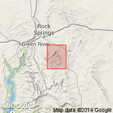
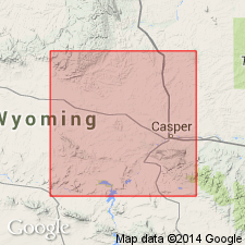
- Green River basin
Summary:
Pg. 721, in a paper on Uinta County, southwestern Wyoming. Frontier formation. A coal-bearing sandstone formation, 2,000+/- feet thick, in which there is a thick stratum of evenly bedded light-brown sandstone, above and below which are beds of clay and shale. Extends north from Kemmerer an unknown distance and south to Diamondville, Cumberland, Spring Valley, and old RR cut just east of Hilliard. Well developed near town of Frontier. Underlies Hilliard formation and overlies Cretaceous beds of Benton age. Age is Late Cretaceous.
Source: US geologic names lexicon (USGS Bull. 896, p. 784).
- Usage in publication:
-
- Frontier formation
- Modifications:
-
- Areal extent
- AAPG geologic province:
-
- Green River basin
Summary:
Pg. 542-544. Frontier formation. Has in past been called Fox Hills, but I could not find in it a Fox Hills fauna such as is common to Fox Hills of eastern Wyoming; therefore have named the beds Frontier formation. Is characterized by OSTREA SOLEMISCUS. Underlies Hilliard formation.
Source: US geologic names lexicon (USGS Bull. 896, p. 784).
- Usage in publication:
-
- Frontier formation*
- Modifications:
-
- Revised
- Biostratigraphic dating
- AAPG geologic province:
-
- Green River basin
Summary:
(On southwestern Wyoming.) Frontier formation. Alternating beds of yellow and gray sandstone and yellow, gray, and black carbonaceous clays with numerous coal beds. Distinctive Benton fossils [identified by T.W. Stanton, USGS, listed on p. 67-68]. Thickness 2,200 to 2,600 feet. In upper part of formation is Oyster Ridge sandstone member. Underlies Hilliard formation and overlies Aspen formation. Age is Late Cretaceous (late Benton to middle Colorado).
[GNC remark (ca. 1938, US geologic names lexicon, USGS Bull. 896, p. 784): In Rock Springs uplift is overlain by Baxter shale and underlain by Aspen shale. In Hanna basin and elsewhere in Wyoming it underlies Carlile shale and overlies Mowry shale.]
Source: US geologic names lexicon (USGS Bull. 896, p. 786); supplemental information from GNU records (USGS DDS-6; Denver GNULEX).
- Usage in publication:
-
- Frontier formation*
- Modifications:
-
- Revised
- Areal extent
- AAPG geologic province:
-
- Bighorn basin
Summary:
Pg. 167, 169, 171. Frontier formation of Colorado group (revised). Recognized in Basin oil field, central Bighorn basin, Wyoming. Rocks formerly part of Colorado shale. Described from composite section (of well records and measured section at Torchlight dome); consists of blue and gray hard shale, white poorly consolidated sandstone, bentonite, and pebble conglomerate. Includes (ascending) Peay sandstone member 45+ feet thick, lies 138 feet above base of formation; Torchlight sandstone member 83 feet thick, lies beneath conglomerate 7 feet thick, consisting of dark chert pebbles up to 4 inches diameter, at top of formation. Total thickness about 565 feet. Overlies Mowry shale (revised); underlies Cody shale (new), both of Colorado group. Age is Cretaceous. Report includes geologic map, history of nomenclature chart, fossil list.
Source: US geologic names lexicon (USGS Bull. 1200, p. 1436-1439); supplemental information from GNU records (USGS DDS-6; Denver GNULEX).
- Usage in publication:
-
- Frontier formation*
- Modifications:
-
- Areal extent
- AAPG geologic province:
-
- Green River basin
Summary:
Pg. 16 (table), 18, 19. Frontier formation. In Rock Springs uplift, Sweetwater County, Wyoming, Frontier formation is 70 to 160 feet thick. Overlies Aspen shale; underlies Baxter shale. Age is Cretaceous.
Source: US geologic names lexicon (USGS Bull. 1200, p. 1436-1439).
- Usage in publication:
-
- Frontier formation*
- Modifications:
-
- Revised
- Areal extent
- AAPG geologic province:
-
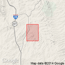
- Wind River basin
Summary:
Frontier formation. In Salt Creek oil field, U.S. Naval Petroleum Reserve No. 3, Natrona County, Wyoming, name applied to rocks previously called Benton shale by Wegemann (USGS Bull. 670, 1918), between Mowry shale above and Carlile shale below. Consists of (ascending): (1) dark-gray shale, sandy shale, and hard sandstone lenses, about 300 feet; (2) "Third Wall Creek sand" of drillers, fine-grained sandstone, 0-30 feet; (3) gray shale and irregular lenses of sandstone, about 240 feet; (4) "Second Wall Creek sand" of drillers, gray to white sandstone with bentonite partings, 20 to 90 feet; (5) gray shale, sandy shale, and thin sandstone, up to 275 feet; (6) Wall Creek sandstone member ("First Wall Creek sand" of drillers), cross-bedded sandstone and sandy shale, 90 to 160 feet. Age is Late Cretaceous.
Source: Modified from GNU records (USGS DDS-6; Denver GNULEX).
- Usage in publication:
-
- Frontier formation*
- Modifications:
-
- Areal extent
- AAPG geologic province:
-
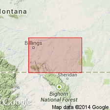
- Powder River basin
Summary:
Pg. 49. Frontier formation of Colorado group. Thickness of formation about 410 feet in Soap Creek field. Consists chiefly of dark shale and beds of bentonite lithologically similar to lower part of overlying Carlile shale. Division between the two formations arbitrarily placed at top of thick bentonite bed exposed east of Soap Creek dome, which lies a short distance above several thin layers of coarse sandstone containing small chert pebbles and shark teeth. These layers are confined to top 100 feet of formation at Soap Creek but apparently become thicker toward northwest. Overlies Mowry shale. Age is Late Cretaceous.
Source: US geologic names lexicon (USGS Bull. 1200, p. 1436-1439).
- Usage in publication:
-
- Frontier formation
- Modifications:
-
- Areal extent
- AAPG geologic province:
-
- Central Western Overthrust
- Wasatch uplift
Summary:
Pg. 839-840. Frontier formation. In north-central Wasatch Mountains, underlies Henefer formation (new) and overlies Aspen formation. Consists of coal-bearing series of hogback-making gray sandstones separated by dark shales and friable sandstones; coarse conglomerate in middle of section. Thickness about 10,000 feet. Age is Late Cretaceous.
Source: US geologic names lexicon (USGS Bull. 1200, p. 1436-1439).
- Usage in publication:
-
- Frontier sandstone member
- Modifications:
-
- Revised
- AAPG geologic province:
-
- Uinta basin
Summary:
Pg. 101, 102, 103. Frontier sandstone member of Mancos shale. Member of Mancos shale in Uinta basin, Utah. Thickness 156 feet at Red Creek; 157 feet at Rim Rock; 163 feet at Colorado border. Overlies Middle shale member; underlies Upper shale member. Stratigraphically above Aspen shale member. Age is Late Cretaceous.
Source: US geologic names lexicon (USGS Bull. 1200, p. 1436-1439).
- Usage in publication:
-
- Frontier formation
- Modifications:
-
- Areal extent
- AAPG geologic province:
-
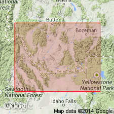
- Yellowstone province
Summary:
Pg. 1588 (table), 1577-1584. Frontier formation in this area [Teton County, Wyoming] is characterized by tan sandstones with some interbedded sandstones, a few thin nodular limestones, many fossiliferous beds. Thickness about 2,750 feet. Overlies Mowry shale; contact placed at base of typical Frontier-type sandstone, above which no bentonite or porcellanite beds were observed. Conformably underlies Cody shale. Age is Late Cretaceous.
Source: US geologic names lexicon (USGS Bull. 1200, p. 1436-1439).
- Usage in publication:
-
- Frontier member*
- Modifications:
-
- Revised
- Areal extent
- AAPG geologic province:
-
- Uinta basin
Summary:
Frontier member of Mancos shale. Member of Mancos shale in Whiterocks River-Ashley Creek area, Uintah County, Utah, where it is 80 to 90 feet thick; overlies Mowry member and underlies unnamed member. Member, in Duchesne and Uintah Counties, Utah, is 210 to 250 feet thick; overlies Mowry member and underlies unnamed member. Age is Late Cretaceous.
See also D.M. Kinney, 1951, USGS Oil and Gas Inv. Map OM-123.
Source: US geologic names lexicon (USGS Bull. 1200, p. 1436-1439).
- Usage in publication:
-
- Frontier formation
- Modifications:
-
- Areal extent
- AAPG geologic province:
-
- Wind River basin
Summary:
Pg. 108-109, [pl. (fig. 4)]. Frontier formation. Frontier, as defined in central Wyoming, consists of sandstone and shale sequence overlying Mowry and underlying Cody shale. Frontier, as defined in type area and other parts of western Wyoming, comprises quite different set of beds. Correlation from southwest corner of Wind River basin southwestward through Bison basin. Rock Springs uplift and Church Buttes to type area indicates that Cody shale and probably at least part of Mesaverde formation of central Wyoming are age equivalent of type Frontier and that part of Frontier formation of central Wyoming is age equivalent of Aspen shale of western Wyoming. Name Frontier is applied in this report [Wind River basin] to the sandstone and shale above the Mowry shale and below the Cody shale, to conformity with long-accepted usage, but not with the implication that formation is the same age as in type area. Thickness 650 to 1,080 feet. Age is Late Cretaceous.
Source: US geologic names lexicon (USGS Bull. 1200, p. 1436-1439).
- Usage in publication:
-
- Frontier formation
- Modifications:
-
- Revised
- AAPG geologic province:
-
- Green River basin
- Uinta basin
Summary:
Pg. 688-689 (table 1). Frontier formation of Mancos group. Shown on generalized columnar section as formation in Mancos group in Green River and Yampa River Canyons [Moffat County, Colorado, and Uintah County, Utah]. Buff marine and continental calcareous sandstone containing pelecypods, shark teeth, plant remains. Carbonaceous shale and sub-bituminous coal beds. Siliceous sandy shale at base. Thickness 200 feet. Overlies Mowry formation; underlies an upper Mancos shale. Age is Late Cretaceous.
Source: US geologic names lexicon (USGS Bull. 1200, p. 1436-1439).
- Usage in publication:
-
- Frontier formation
- Modifications:
-
- Revised
- Areal extent
- AAPG geologic province:
-
- Central Western Overthrust
Summary:
Pg. 14-17. Frontier formation. Extent and thickness of Frontier formation in Horseshoe area has long been subject of conjecture. Schultz (1918, USGS Bull. 543) mentioned its occurrence and noted that it contained producing coals in Lincoln County. Kirkham (1922, Idaho Bur. Mines Bull., no. 4) and Stalder (1928, unpub. report, Teton County) mentioned that formation covers large parts of the district. In present report [Horseshoe Creek], term Frontier is restricted to those Upper Creteceous sediments, essentially gray to buff sandstones, shales, and beds of coal, which overlie basal conglomerate separating Aspen and Frontier formations. Thickness 3,905 feet. Formation occupies most of Horseshoe Creek basin. It is bounded on west by Jackson fault and is underlain to south and east by Aspen formation. Northward, it passes beneath Tertiary volcanics. Age is Late Cretaceous.
Source: US geologic names lexicon (USGS Bull. 1200, p. 1436-1439).
- Usage in publication:
-
- Frontier formation*
- Modifications:
-
- Revised
- AAPG geologic province:
-
- Powder River basin
- Bighorn basin
Summary:
Sheet 2. Frontier formation. In Hardin area, Montana and Wyoming, includes Soap Creek bentonite bed (new) [not separately mapped] at top. Overlies Mowry shale; underlies Cody shale. Age is Late Cretaceous.
Source: US geologic names lexicon (USGS Bull. 1200, p. 1436-1439); supplemental information from GNU records (USGS DDS-6; Denver GNULEX).
- Usage in publication:
-
- Frontier formation
- Modifications:
-
- Revised
- Biostratigraphic dating
- AAPG geologic province:
-
- Powder River basin
- Central Montana uplift
Summary:
Frontier formation of Colorado group. Frontier formation in southern Montana, Big Horn and Yellowstone Counties, is divided into seven stratigraphic units (unnamed). Faunas obtained from units of formation of southern Montana are compared with faunas from Frontier formation and Carlile shale of other areas. Suggested that term Carlile shale be discontinued as rock name in southern Montana and that Frontier be redefined to include all rocks between top of Mowry shale and base of Niobrara formation; this suggestion is based on paleontological evidence. Frontier section (Thom and others, 1935) east of Soap Creek oil field was used as section of reference. Unit 3, in upper part of formation, includes "Vascoceras fauna" of Reeside (1923). Age is Late Cretaceous.
Source: Publication; US geologic names lexicon (USGS Bull. 1200, p. 1436-1439).
- Usage in publication:
-
- Frontier formation*
- Modifications:
-
- Overview
- AAPG geologic province:
-
- Green River basin
- Central Western Overthrust
Summary:
Frontier formation. Formation in its type area, consists of about 2,000 feet of sandstone, coal, bentonite, and porcellanite. At Cumberland Gap, Wyoming, 15 miles south of Frontier, lower half of formation consists of nonmarine sandstone, siltstone, mudstone, and water-laid volcanic rocks with some coal, carbonaceous shale, and limestone. Upper half consists of sandstone, mudstone, and some coal. Underlain by marine Aspen shale of Early Cretaceous age; overlain by 6,000 feet of marine Hilliard shale of middle Late Cretaceous age, which in turn is overlain by 4,000 feet of largely nonmarine Adaville formation. Nonmarine lower half cannot be precisely dated, but is probably Cenomanian. Marine beds in upper half are dated as of late Greenhorn (Turonian), early Carlile (Turonian), and early Niobrara (Coniacian) ages. Nonmarine unit near top believed to be of late Carlile age (Turonian). Northward from type area, formation does not appear to change greatly as far as Fontenelle basin, but upper half of overlying Hilliard shale changes to sandstone and shales of Adaville aspect. Farther north in Snider basin, a thin equivalent of typical Frontier can be identified, but it is overlain by great thickness of sandstone and shale that is not greatly different from the Frontier. Surface measurements suggest as much as 13,000 feet but there may be duplication of beds not readily seen on surface. Uppermost part has not yielded fossils, but main part of these beds contains Niobrara fossils, and the entire sequence above the Aspen has been called Frontier by some authors. Formation passes eastward into dominantly marine rocks with fewer and thinner beds of resistant sandstone. Inasmuch as the sandstone beds that locally form top of Frontier pass eastward into shale, the upper limit of formation changes in age. Ordinarily one of three large units of sandstone forms top of formation. Youngest sandstone unit of early Niobrara age, is tongue shaped, extending from southwest and northwest corners of Wyoming into central part of State. Sandstone beds of about middle Carlile age form top of formation for some distance eastward in Wyoming, northeastern Utah, and northwestern Colorado, beyond the eastern limits of the sandstone beds of early Niobrara age. In much smaller area to north-central Wyoming and south-central Montana, sandstone beds of pre-Carlile age form top of the Frontier. In Cumberland Gap section, formation contains Oyster Ridge sandstone member. Detailed discussion of specific areas. Report includes correlation chart.
Source: US geologic names lexicon (USGS Bull. 1200, p. 1436-1439).
- Usage in publication:
-
- Frontier formation
- Modifications:
-
- Areal extent
- AAPG geologic province:
-
- Wasatch uplift
- Central Western Overthrust
Summary:
Pg. 15, pl. 2. Frontier formation. In Wasatch Mountains, east of Salt Lake City, overlies Kelvin formation and underlies Cretaceous(?) conglomerate. Thickness at least 8,000 feet. Tuffaceous beds similar to porcellanites of Aspen formation crop out near base. Age is Late Cretaceous.
Source: US geologic names lexicon (USGS Bull. 1200, p. 1436-1439).
- Usage in publication:
-
- Frontier formation
- Modifications:
-
- Areal extent
- AAPG geologic province:
-
- Green River basin
- Piceance basin
Summary:
Pg. 33 (columnar section), 34. Frontier formation. In northwestern Colorado (western part), overlies the Mowry and underlies Mancos formation; in eastern part, occurs above Dakota formation and below Niobrara equivalent. Age is Late Cretaceous.
Source: US geologic names lexicon (USGS Bull. 1200, p. 1436-1439).
- Usage in publication:
-
- Frontier formation*
- Modifications:
-
- Overview
- AAPG geologic province:
-
- Powder River basin
Summary:
Pls. 1, 2. Frontier formation, basal formation of Colorado group. Consists of dark-gray, concretionary sandy shale with sandstone lenses; thickness 275 feet. Includes Soap Creek bentonite bed at top. Conformably overlies Mowry shale; conformably underlies Cody shale. Age is Late Cretaceous. Report includes geologic map, columnar section, measured sections.
Source: Publication.
- Usage in publication:
-
- Frontier formation
- Modifications:
-
- Not used
- AAPG geologic province:
-
- Powder River basin
Summary:
Pg. 15-16. Frontier formation. Nomenclature revised locally in Hardin district, Montana and Wyoming. Names Frontier formation and Eagle sandstone, which appear on maps published by Thom and others (1935, USGS Bull. 856), Richards and Rogers (1951, USGS Oil and Gas Inv. Prelim. Map OM-111), and Knechtel and Patterson (1952, USGS Circ. 150; 1955, USGS Mineral Inc. Field Stud. Map MF-36), have been eliminated from nomenclature in present report. Strata that were designated Frontier formation are assigned to Belle Fourche member, basal member of Cody shale of Colorado group; authors believe predominance of shaly material is more typical of the Belle Fourche than to the Frontier [Frontier remains unchanged outside of Hardin district].
Source: US geologic names lexicon (USGS Bull. 1200, p. 1436-1439); supplemental information from GNU records (USGS DDS-6; Denver GNULEX).
- Usage in publication:
-
- Frontier formation
- Modifications:
-
- Areal extent
- AAPG geologic province:
-
- Powder River basin
Summary:
Frontier formation. In Powder River basin, top of Frontier is placed at top of Wall Creek sandstone member. Base of Frontier placed at base of Clay Spur bentonite. Overlies Mowry shale; underlies Carlile shale except in Buffalo-Crazy Woman Creek area where it underlies Cody shale. Thickness varies from almost 1,000 feet in southwest part of basin to 600 feet in subsurface northeast of Kaycee and to 800 feet in southeastern part of basin. Use of name Frontier, with Wall Creek sandstone member at top, can be extended to east and northeast to region where Greenhorn limestone becomes distinct if Greenhorn limestone is distinctly present. Black Hills nomenclature should be used.
Source: US geologic names lexicon (USGS Bull. 1200, p. 1436-1439).
- Usage in publication:
-
- Frontier formation*
- Modifications:
-
- Areal extent
- AAPG geologic province:
-
- Powder River basin
Summary:
Pg. 43-46, pls. 1, 3. Frontier formation. In Buffalo-Lake De Smet area, formation is 500 feet thick and consists of interbedded light-gray sandstone and dark-gray shale with a few beds of bentonite and conglomerate. Overlies Mowry shale; underlies Cody shale. Age is Late Cretaceous.
Source: US geologic names lexicon (USGS Bull. 1200, p. 1436-1439).
- Usage in publication:
-
- Frontier sandstone member
- Modifications:
-
- Revised
- AAPG geologic province:
-
- Uinta basin
Summary:
Pg. 34, 36-37. Frontier sandstone member of Mancos shale. Overlies Mowry shale member and underlies main body of Mancos in Daggett County, Utah. Average thickness about 200 feet. Age is Late Cretaceous.
Source: US geologic names lexicon (USGS Bull. 1200, p. 1436-1439).
- Usage in publication:
-
- Frontier formation
- Modifications:
-
- Revised
- AAPG geologic province:
-
- Central Western Overthrust
Summary:
Pg. 122-123. Frontier formation. In Coalville area, [Summit County], Utah, beds previously assigned to Frontier formation contain a heretofore unnoted major tectonic interruption; hence, the Frontier formation should be divided in recognition of this unconformity. Name Frontier is retained for beds below the angular unconformity, and name Wanship is applied to immediately overlying beds. Thickness of restricted Frontier 2,182 feet.
Source: US geologic names lexicon (USGS Bull. 1200, p. 1436-1439).
- Usage in publication:
-
- Frontier formation
- Modifications:
-
- Revised
- AAPG geologic province:
-
- Central Western Overthrust
Summary:
Pg. 136-146. Frontier formation. Revised in Coalville area, Summit County, Utah. Comprises (ascending) Longwell sandstone, Spring Canyon, Chalk Creek, Coalville, Allan Hollow, Oyster Ridge, Dry Hollow, Grass Creek, Judd shale, and Upton sandstone members. All member names except Oyster Ridge are new. Overlies rocks tentatively assigned to Aspen shale; underlies Henefer formation. Intraformational unconformity recognized, but formation is not divided on basis of this hiatus; hence, Williams and Madsen's (1959) Wanship not used in present report. On correlation chart, column credited to Trexler (1955 unpub. thesis) shows Frontier formation comprises (ascending) Aspen zone, Skunk Point sandstone, Chalk Creek, Grass Valley shale, Oyster Ridge, Coalville conglomerate, Dry Hollow sandstone, Meadow Creek sandstone, Judd shale, and Upton shale members. Between Skunk Point sandstone and Chalk Creek member are about 2,800 feet of sandstone, shale, and conglomeratic sandstone not recognized as Frontier. Most of this interval is Chalk Creek member of present report. [Age is Late Cretaceous.]
Source: US geologic names lexicon (USGS Bull. 1200, p. 1436-1439).
- Usage in publication:
-
- Frontier Formation*
- Modifications:
-
- Revised
- AAPG geologic province:
-
- Montana folded belt
Summary:
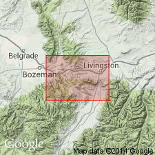
Frontier Formation. In Livingston area, Park County, Montana, revised to include Boulder River Sandstone Member (transferred from Colorado Shale). Age is Late Cretaceous.
Source: Changes in stratigraphic nomenclature, 1964 (USGS Bull. 1224-A, p. A10).
- Usage in publication:
-
- Frontier Formation*
- Modifications:
-
- Biostratigraphic dating
- Revised
- AAPG geologic province:
-
- Green River basin
Summary:
Frontier Formation. In northwestern Carbon County, south-central Wyoming, divided into (ascending): (1) newly assigned Belle Fourche Shale Member (Cenomanian), top placed in zone of DUNVEGANOCERAS CONDITUM and D. ALBERTENSE (zone 7); (2) unnamed middle member (Turonian), a thin sequence of marine sandstone, siltstone, and shale of early Carlile age, zone of SCAPHITES CARLILENSIS (zone 12); and (3) newly redefined Wall Creek Sandstone Member (lateTuronian), zone of INOCERAMUS PERPLEXUS to I. ERECTUS (zones 15 to 19). Members separated by unconformities. Total thickness in outcrop up to 1,000+/- feet; in subsurface is up to 1,230+/- feet. Conformably underlies and interfingers with unnamed noncalcareous shale; contact placed at top of uppermost sandstone or siltstone bed beneath a thick shale unit. Conformably overlies Mowry Shale. Fossils (ammonoids). Age is Late Cretaceous (Cenomanian and Turonian).
Exposed on southern slopes of Ferris and Seminoe Mountains and on flanks of Rawlins uplift and Grenville dome.
Source: Publication; Changes in stratigraphic nomenclature, 1972 (USGS Bull. 1394-A, p. A16-A17).
- Usage in publication:
-
- Frontier Formation*
- Modifications:
-
- Reference
- Dominant lithology:
-
- Sandstone
- Shale
- Siltstone
- AAPG geologic province:
-
- Montana folded belt
- Central Montana uplift
- Powder River basin
Summary:
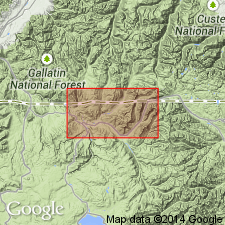
Pg. C6-C7, C24-C27, C67-C68, pls. 1, 2. Frontier Formation. Reference section designated [just southwest of Livingston], Park County, Montana; total thickness 415 feet. Includes (ascending) Boulder River Sandstone Member and an unnamed upper part. Boulder River Sandstone Member, a light- to dark-gray to grayish-green, poorly sorted, very fine-grained to conglomeratic, thin-bedded to massive sandstone that contains abundant heavy minerals, chert, glauconite, and is commonly cemented by calcareous silt or clay; thickness about 120 feet. Unamed upper part consists of about 300 feet of sandstone and shale or siltstone in alternating beds; locally contains thin beds of coal in basal part. Sandstone is gray to greenish-gray, very fine-grained to coarse-grained, thin-bedded to massive; in places is micaceous, calcareous, carbonaceous, and glauconitic. Shale is dark-gray to dark-brown to black, silty, and in places pyritic. Siltstone is dark-gray, thin- to medium-bedded, carbonaceous, feldspathic, and glauconitic. Overlies Mowry Shale, contact placed at lowest well-defined sandstone of the Boulder River Sandstone Member; underlies Cody Shale. Deposited in shallow, brackish water. Age is Late Cretaceous (Cenomanian). Report includes geologic map, correlation chart, fossil list.
Reference section: on north side of Canyon Mountain, [just southwest of Livingston], in secs. 26 and 27, T. 2 S., R. 9 E., [in vicinity of Lat. 45 deg. 37 min. 37 sec. N., Long. 110 deg. 35 min. 30 sec. W., Livingston 7.5-min quadrangle], Park Co., MT (Central Montana uplift).
[Misprint: GNU records (USGS DDS-6; Denver GNULEX, July 30, 1986) state reference section is on south side of Canyon Mountain; it is on the north side.]
Source: Publication.
- Usage in publication:
-
- Frontier Sandstone*
- Modifications:
-
- Redescribed
- Mapped 1:62.5k
- Dominant lithology:
-
- Sandstone
- Shale
- AAPG geologic province:
-
- Yellowstone province
Summary:
Frontier Sandstone. Yellowish- and light-olive-gray to medium-gray, fine-grained, partly calcareous, partly tuffaceous sandstone in beds 1 to 5 feet thick separated by thin interbeds of dark-gray shale. Thickness about 50 to 100 feet. Lies above Lower Cretaceous Mowry Shale and below Upper Cretaceous Cody Shale. Age is Late Cretaceous.
Mapped in northern part of Yellowstone National Park (see pl. 1, west half) east of Mammoth, in Gardner Canyon, northern Park Co., northwestern WY, north side of Lava Creek fault.
Source: Publication; Changes in stratigraphic nomenclature, 1973 (USGS Bull. 1395-A, p. A16-A17).
- Usage in publication:
-
- Frontier Formation*
- Modifications:
-
- Biostratigraphic dating
- Geochronologic dating
- AAPG geologic province:
-
- Green River basin
Summary:
Frontier Formation. Sample collected from a bentonite bed in the Frontier Formation, within the DUNVEGANOCERAS PONDI ammonite zone, in NW/4 NW/4 sec. 21, T. 25 N., R. 78 W., Carbon Co., WY. K-Ar age on biotite 91.3 Ma (weighted mean). Age is Late Cretaceous (Cenomanian).
Source: Modified from GNU records (USGS DDS-6; Denver GNULEX).
- Usage in publication:
-
- Frontier Formation*
- Modifications:
-
- Biostratigraphic dating
- AAPG geologic province:
-
- Powder River basin
Summary:
In study area, Johnson Co, WY, Powder River basin, consists of about 835 ft of interbedded shale, siltstone, sandstone, and bentonite, and the overlying Wall Creek Sandstone Member. In subsurface sandstone units are informally called, (descending) first, second, and third Wall Creek sands. In this report Frontier is informally divided into (ascending) units A, B, C, and D; unit D includes shale and siltstone in lower part and Wall Creek in upper part. Units A through lower part of D correlate with Belle Fourche Shale and all but uppermost part of overlying Greenhorn Formation in northern Black Hills; upper part of unit D (Wall Creek) correlates with part of Turner Sandy Member of Carlile Shale. Interval correlating with uppermost part of Greenhorn and lower part of Carlile is not present in study area, thus upper part of unit D (Wall Creek) lies disconformably on lower part of unit D (see correlation chart, table 1). Fossil mollusks collected from units B through C (unit A is barren) correspond to Western Interior fossil zones CALYCOCERAS GILBERTI (lower Cenomanian) to DUNVEGANOCERAS ALBERTENSE (upper Cenomanian). Lower part of unit D contains fossils of zones WATINOCERAS COLORADOENSE to COLLIGNONICERAS WOOLLGARI (lower Turonian); upper part of unit D (Wall Creek) contains fossils of zone SCAPHITES WHITFIELDI (mid-Turonian). Lithologic and geophysical logs. Conformably overlies Mowry Shale; conformably underlies Cody Shale.
Source: GNU records (USGS DDS-6; Denver GNULEX).
- Usage in publication:
-
- Frontier Formation*
- Modifications:
-
- Age modified
- Overview
- AAPG geologic province:
-
- Central Montana uplift
- Green River basin
Summary:
In Coalville area, Summit Co, UT, Uinta basin, Lower-Upper Cretaceous boundary placed near middle of Chalk Creek Member of Frontier, 1,300-1,700 ft higher than suggested by previous workers. Boundary change based on ammonites and projections of Lower-Upper Cretaceous boundary from Cumberland Gap, Lincoln Co, WY, Greater Green River basin, where boundary is near base of Frontier. Correlation of sections shows westward thickening of Frontier from 1,960 ft at its type at Cumberland Gap to about 7,750 ft at Coalville. Stratigraphic section. Early and Late Cretaceous age.
Source: GNU records (USGS DDS-6; Denver GNULEX).

- Usage in publication:
-
- Frontier Formation*
- Modifications:
-
- Overview
- AAPG geologic province:
-
- Powder River basin
- Wind River basin
- Green River basin
Summary:
Divided into (ascending) Belle Fourche Member (redescribed), unnamed member, and Wall Creek Member (redescribed) in southern and western Powder River and eastern Wind River and Greater Green River basins. Unnamed member lies unconformably between Belle Fourche and Wall Creek. Informal sandstone units I-VIII (ascending) are designated. Frontier consists of interstratified shale, siltstone, sandstone, conglomerate, and bentonite. Correlates with Belle Fourche Shale, Greenhorn Formation and part of Carlile Shale in Black Hills. Isopach maps. In Natrona Co, thickness is up to 265-285 m. Correlation diagram (table 1); representative electric logs; cross section. Conformably overlies Mowry Shale; conformably underlies Cody Shale. Uppermost sandstone of Frontier intertongues with overlying shale and, in general, becomes progressively younger from southeast to northwest WY. Fossils indicate Cenomanian to early Coniacian age (pre-CALYCOCERAS GILBERTI to INOCERAMUS ERECTUS Range Zones).
Source: GNU records (USGS DDS-6; Denver GNULEX).
- Usage in publication:
-
- Frontier Sandstone Member*
- Modifications:
-
- Mapped 1:24k (Moffat Co, CO)
- Dominant lithology:
-
- Sandstone
- Shale
- Siltstone
- AAPG geologic province:
-
- Green River basin
Summary:
Is Upper Cretaceous member of Mancos Shale (Lower and Upper Cretaceous) mapped in southwest Moffat Co, CO (Greater Green River basin). Overlies Mowry Member (Lower Cretaceous) of the Mancos; is the youngest Mesozoic bedrock unit mapped in the quadrangle. Map unit described as upper and lower parts. Upper part is resistant light-brown, light-yellow, or light-greenish-gray (light-gray weathering), mostly thin-bedded fine-grained fossiliferous calcareous locally cross-bedded sandstone and local thin poorly exposed beds of carbonaceous shale. Lower part is mostly dark-gray (light-yellow weathering), fissile shale, silty shale, and siltstone. Lower contact, generally covered, is approximately located. About 40 m (130 ft) thick north of Buckwater Ridge, but the upper part was probably removed by erosion. It is about 80-90 m (260-300 ft) thick south and east of the mapped area (Cullins, 1969; Thomas and others, 1945).
Source: GNU records (USGS DDS-6; Denver GNULEX).
- Usage in publication:
-
- Frontier Formation*
- Modifications:
-
- Age modified
- AAPG geologic province:
-
- Green River basin
Summary:
Lower part or Chalk Creek Member of Hale (1960) interfingers with upper part of Aspen Shale in Cumberland Gap area, Ts19 and 18N, R116W, Lincoln and Uinta Cos, WY. Since upper units of Aspen Shale are dated late Albian at Cumberland Gap (Cobban, Reeside, 1952; Reeside, Cobban, 1960), intercalated beds of Frontier are also considered late Albian. Early Cretaceous-Late Cretaceous boundary may lie within Chalk Creek Member in southwest part of Greater Green River basin. Geologic map. Underlies Hilliard Shale.
Source: GNU records (USGS DDS-6; Denver GNULEX).
- Usage in publication:
-
- Frontier Formation*
- Modifications:
-
- Areal extent
- AAPG geologic province:
-
- Wind River basin
- Green River basin
- Piceance basin
Summary:
Deposited in marine and nonmarine environments in latest Albian, Cenomanian, Turonian to middle Coniacian time. Divided into Belle Fourche Member (base), middle member, and Wall Creek Member in sections shown in Natrona and Fremont Cos, WY, Wind River basin, and Carbon Co, WY in Greater Green River basin. Divided into Chalk Creek (base), Coalville, Allen Hollow, Oyster Ridge, and Dry Hollow Members at Cumberland Gap, Lincoln Co, WY in the overthrust belt. Latest Albian represented only at Cumberland Gap in the Chalk Creek. Only the upper part of Frontier present in Vermilion Creek, Moffat Co, CO in the Piceance basin. Hiatus exist between each of the members east of the overthrust belt. Varies from 164 to 2,000 ft thick. Isopach map. Overlies Mowry Shale everywhere except at Cumberland Gap where it overlies Aspen Shale. Underlies Hilliard Shale at Cumberland Gap, Mancos Shale at Vermilion Creek, CO, Sage Breaks Shale in Carbon Co, and Cody Shale in Fremont and Natrona Cos.
Source: GNU records (USGS DDS-6; Denver GNULEX).
- Usage in publication:
-
- Frontier Formation*
- Modifications:
-
- Overview
- AAPG geologic province:
-
- Wind River basin
- Powder River basin
- Green River basin
Summary:
Within study area (including Fremont and Natrona Cos, Wind River basin, Converse Co, Powder River basin, and Carbon Co, Greater Green River basin) Frontier divided into Belle Fourche Member, member of Emigrant Gap (newly named informal unit), and Wall Creek Member. Member of Emigrant Gap consists of rocks formerly assigned to an unnamed member and the lower part of Wall Creek and is in disconformable contact with both underlying Belle Fourche and overlying Wall Creek. Member of Emigrant Gap occurs in an elongate, west-trending area extending from subsurface in west-central Converse Co through middle of Natrona Co to outcrops in central Fremont Co; also recognized in northwest Carbon Co; ranges up to 140 ft thick. Frontier conformably overlies Mowry Shale; conformably underlies Cody Shale. Stratigraphic chart with molluscan fossil zones (fig. 2); cross sections. Early Cenomanian to late Turonian (Late Cretaceous) age.
Source: GNU records (USGS DDS-6; Denver GNULEX).
- Usage in publication:
-
- Frontier Formation*
- Modifications:
-
- Biostratigraphic dating
- AAPG geologic province:
-
- Bighorn basin
- Wind River basin
- Green River basin
Summary:
Is assigned a late middle to middle late Cenomanian (Late Cretaceous) age based on presence of ammonites from numerous localities in WY. Taxa include PLEISIACANTHOCERAS WYOMINGENSE, EUCALYCOCERAS TEMPLETONENSE, TARRATNOCERAS FLEXICOSTATUM, DUNVEGANOCERAS PROBLEMATICUM, NEOCARDIOCERAS UPTONENSE, N. MINUTUM, and N. sp. Fauna collectively recorded from USGS Mesozoic localities D12630, Big Horn Co, WY in Bighorn basin; D7530, Carbon Co, WY in Greater Green River basin; and D6962, D9337, D9894, and D8918, Natrona Co, WY in Wind River basin.
Source: GNU records (USGS DDS-6; Denver GNULEX).
- Usage in publication:
-
- Frontier Formation*
- Modifications:
-
- Areal extent
- AAPG geologic province:
-
- Montana folded belt
Summary:
Recognized in Madison and Beaverhead Cos, MT in Montana folded belt province as the unit that lies (unconformably, locally) above the Blackleaf Formation. Name Frontier is preferred over Marias River Shale which overlies Blackleaf on the Sweetgrass arch because the rocks look more like Frontier. Base of Frontier placed at base of first thick sandstone, conglomerate, and dark-gray shale above the upper volcaniclastic unit of the Blackleaf. Only lower part studied. Is a fluvial to shallow marine? brackish water unit deposited in Cenomanian to Turonian, or Late Cretaceous time.
Source: GNU records (USGS DDS-6; Denver GNULEX).
- Usage in publication:
-
- Frontier Formation*
- Modifications:
-
- Overview
- AAPG geologic province:
-
- Montana folded belt
Summary:
Only the lower part of Frontier discussed. Overlies the Vaughn Member of the Blackleaf Formation west of the axis of the Ruby River Valley, Madison Co, MT, Montana folded belt province in the Pioneer Mountains, McCartney Mountain, Lima Peaks, and Snowcrest Range. Overlies upper part of Mowry Shale east of the axis of the Ruby River Valley in Madison and Gallatin Cos, MT, Montana folded belt province in the Gravelly, Greenhorn, Madison, and Gallatin Ranges, and Beartooth Mountains. Selection of the geographic boundary change from Blackleaf to Mowry is arbitrary. Base of Frontier placed at base of first sandstone above the dark-gray mudstone of the Mowry, and at base of first sandstone or conglomerate above the Vaughn Member of the Blackleaf Formation. At Lima Peaks, however, the Vaughn-Frontier contact placed at base of a dark-gray nonvolcanic shale below the sandstone of the Frontier. Choice of lower contact at Lima Peaks determined by recognition that the sandstone and conglomerate beds are laterally discontinuous and that a regional unconformity present at base of nonvolcanic shale at that location. Columnar section. Lower part of Frontier is Cenomanian to Turonian age.
Source: GNU records (USGS DDS-6; Denver GNULEX).
- Usage in publication:
-
- Frontier Formation*
- Modifications:
-
- Biostratigraphic dating
- AAPG geologic province:
-
- Wind River basin
Summary:
Within report area of Natrona Co, WY, Wind River basin, Frontier is divided into two or three members, which are, (ascending) Belle Fourche Member of early to late Cenomanian age; the informal member of Emigrant Gap (formerly called the unnamed member) of middle Turonian age; and the Wall Creek Member of late Turonian age (see fig. 2 for ammonite zonation). Member of Emigrant Gap is bounded above and below by disconformities; where it is absent, Wall Creek Member disconformably overlies Belle Fourche. Report describes most of known species of cephalopods (chiefly ammonites) from Frontier in Natrona Co. Frontier in Natrona Co contains molluscan fossils of middle and late Cenomanian age and middle and late Turonian age. Twelve of 23 established ammonite zones from base of middle Cenomanian to top of Turonian in Western Interior of the United States can be recognized in Frontier in Natrona Co. Conformably overlies Mowry Shale; conformably underlies Cody Shale.
Source: GNU records (USGS DDS-6; Denver GNULEX).
- Usage in publication:
-
- Frontier Formation*
- Modifications:
-
- Areal extent
- Overview
- AAPG geologic province:
-
- Montana folded belt
Summary:
Name applied in the Lima Peaks area, Beaverhead Co, MT, Montana folded belt province, to "salt-and-pepper" lithic-rich sandstone, conglomerate, bentonitic mudstone, siltstone, and shale of fluvial and shallow marine origin unconformably above the Vaughn Member of the Blackleaf Formation. The name Frontier is not applied to rocks above the Vaughn in the eastern Pioneer Mountains of Beaverhead Co where the rocks are of different character and of marine origin. Correlation chart. Measured section. Of Cenomanian and Turonian age.
Source: GNU records (USGS DDS-6; Denver GNULEX).
- Usage in publication:
-
- Frontier Formation*
- Modifications:
-
- Revised
- AAPG geologic province:
-
- Uinta basin
- Green River basin
Summary:
Revised in stratigraphic rank, in northeast UT in the Uinta basin and northwest CO in the Greater Green River basin, from Frontier Sandstone Member of Mancos Shale to Frontier Formation of Mancos Group. Divided into six facies: 1) basal transgressive marine sandstone; 2) marine shale, the Tununk Shale Member (reassigned in report area); 3) regressive coastal sandstone; 4) nonmarine sandstone, shale, and coal; 5) upper transgressive coastal sandstone; and 6) off-shore bar sandstone. Is 760 ft thick in western exposures and 140 ft thick in eastern exposures. Overlies unnamed shale unit of Cenomanian? age (of Mancos Group) in southeast part of Uinta Mountains, and unconformably overlies Mowry Shale (raised in rank) of Albian age (of Mancos Group) elsewhere. The unconformity at Mowry-Frontier contact represents a hiatus of as much as 7 Ma or the span from late Albian to late middle Turonian time. Underlies the main body of Mancos Group. Frontier is assigned to early and middle Turonian. On north side of Uintas, the Frontier is of formation rank and the term Mancos isn't used. The sequence is divided into the Mowry Shale, Frontier Formation, and the name Hilliard Shale replaces the term main body of Mancos. Cross sections.
Source: GNU records (USGS DDS-6; Denver GNULEX).
- Usage in publication:
-
- Frontier Formation*
- Modifications:
-
- Biostratigraphic dating
- AAPG geologic province:
-
- Yellowstone province
- Montana folded belt
Summary:
Four measured sections described. At Mount Everts, Yellowstone National Park, WY, Yellowstone province, Frontier: is 185 ft thick; its basal contact placed at base of first ledge-forming sandstone above slope-forming gray muddy siltstone and silty mudstone of Mowry Shale; its upper contact with Cody Shale unconformable, its age is Cenomanian and Turonian; upper part yielded middle Turonian COLLIGNONICERAS WOOLLGARI zone; early to middle Cenomanian pollen found in lower part. In Madison Range, Gallatin Co, MT, Montana folded belt province at Lincoln Mountain, only the lower 336 ft part of Frontier is present; contact with underlying Mowry is conformable; marine ammonite COLLIGNONICERAS WOOLLGARI found near top. At Big Sky in Madison Range, only the upper 377 ft of Frontier is exposed; middle Turonian PRIONCYCLUS HYATTI zone collected near middle; underlies Cody Shale. In Ruby River section, Madison Co, MT, Frontier 2895 ft thick overlies Vaughn Member of Blackleaf Formation unconformably; top part is missing; has palynomorphs and bivalves of Cenomanian-Turonian age. Stratigraphic chart. Deposited in shallow water to marginal marine and nonmarine environments. Faunal lists.
Source: GNU records (USGS DDS-6; Denver GNULEX).
- Usage in publication:
-
- Frontier Formation*
- Modifications:
-
- Overview
- AAPG geologic province:
-
- Snake River basin
- Montana folded belt
Summary:
The Frontier Formation-Beaverhead Group contact is easily placed in the west part of the study area from Knob Mountain, secs 27 and 28, T15S, R9W to Shineberger Creek, sec 29, T15S, R7W, Beaverhead Co, MT in the Montana folded belt province, where the two units are separated by an angular unconformity. This same contact is difficult to locate in the east part of the study area near Humphrey, Clark Co, ID in the Snake River basin where the contact is conformable. Occurrence of distinctive lithologies present in the Frontier but missing from the Beaverhead can be used to separate them in the east part of the area. The Frontier has 1) conglomerates and conglomeratic sandstone derived from Cretaceous and Jurassic formations and 2) green to olive-green porcellanites and tuffaceous and porcellanitic sandstone. The conglomerates of Jurassic and Cretaceous rocks lie below the unconformity separating Frontier from Beaverhead in the western exposures. The authors recommend using the unconformity for the contact where it can be recognized. Elsewhere the contact should be placed at the top of the green porcellanitic unit. This unit is an excellent time marker and is located near the top of the Frontier in the western exposures. Correlation charts.
Source: GNU records (USGS DDS-6; Denver GNULEX).

- Usage in publication:
-
- Frontier Formation*
- Modifications:
-
- Areal extent
- AAPG geologic province:
-
- Powder River basin
Summary:
Name applied in the subsurface of the western Powder River basin of WY (Johnson, Sheridan, western Campbell and Converse Cos) and MT (Big Horn Co) where it overlies Clay Spur Bentonite Bed, top bed of Mowry Shale, and underlies Sage Breaks Shale (rank raised). Name Frontier replaced eastward in the subsurface where the section can be divided into the (ascending): Belle Fourche Shale, Greenhorn Formation, and lower two members--the Pool Creek and Turner Sandy--of the Carlile Shale. Sage Breaks Member of Carlile is the Sage Breaks of the western part of the basin. Late Cretaceous age. [Shown on 22 cross sections in this OC series.]
Source: GNU records (USGS DDS-6; Denver GNULEX).
- Usage in publication:
-
- Frontier Formation*
- Modifications:
-
- Revised
- Biostratigraphic dating
- AAPG geologic province:
-
- Powder River basin
Summary:
In southwest part of Powder River basin, WY, divided into (ascending) Belle Fourche (revised), Emigrant Gap (new), and Wall Creek Members. Emigrant Gap occurs disconformably between Belle Fourche and Wall Creek. In southern Johnson Co, Frontier is composed generally of Belle Fourche and Wall Creek; in northern Johnson Co, Wall Creek grades laterally into lower part of Cody Shale, Belle Fourche is raised to formation rank, and the name Frontier is not used. In northwest part of basin, Frontier is equivalent to Belle Fourche Formation, Greenhorn Formation, and part of Carlile Member of Cody Shale; in southeast part of basin is equivalent to Belle Fourche Shale, Greenhorn, and part of Carlile Shale. Reaches thickness of up to 1000 ft in Natrona Co. Conformably overlies Mowry Shale; conformably underlies Cody Shale. Measured sections; geophysical logs; petrology; cross sections; biozones. Late Cretaceous (early Cenomanian to late Turonian) age.
Source: GNU records (USGS DDS-6; Denver GNULEX).
For more information, please contact Nancy Stamm, Geologic Names Committee Secretary.
Asterisk (*) indicates published by U.S. Geological Survey authors.
"No current usage" (†) implies that a name has been abandoned or has fallen into disuse. Former usage and, if known, replacement name given in parentheses ( ).
Slash (/) indicates name conflicts with nomenclatural guidelines (CSN, 1933; ACSN, 1961, 1970; NACSN, 1983, 2005, 2021). May be explained within brackets ([ ]).