The National Geologic Map Database is migrating to a new infrastructure. We apologize for any service disruptions during this process.
|
|---|


- Usage in publication:
-
- Chinle formation
- Modifications:
-
- Adopted
- AAPG geologic province:
-
- Black Mesa basin
- Paradox basin
Summary:
Pg. 102. Chinle formation. Overlies Shinarump conglomerate and underlies La Plata group in Navajo Indian Reservation, Arizona. Name adopted for forthcoming report. [Not described.]
Source: US geologic names lexicon (USGS Bull. 896, p. 432).
- Usage in publication:
-
- Chinle formation*
- Modifications:
-
- Principal reference
- AAPG geologic province:
-
- Plateau sedimentary province
Summary:
Chinle formation. In Navajo country consists of (descending) : (1) Red shale and shaly sandstone; (2) lenses of limestone conglomerate containing red shale; (3) purple, lavender, green, and light-colored variegated shales with limestone conglomerate lenses; (4) chocolate-colored arenaceous shales, at base. Thickness 400 to 1,000 feet. Overlain, unconformably(?), by Wingate sandstone and underlain, unconformably(?), by Shinarump conglomerate. The Chinle contains the fossil forests. Named for Chinle Valley, northeastern Arizona. Age is Late Triassic.
Source: US geologic names lexicon (USGS Bull. 896, p. 432).

- Usage in publication:
-
- Chinle formation*
- Modifications:
-
- Areal extent
Summary:
Chinle formation. For distribution and further details see USGS Prof. Paper 93 (by H.E. Gregory); USGS Prof. Paper 129, 1922 (by J.B. Reeside, Jr., and H. Bassler); USGS Bull. 726, 1922 (by N.H. Darton); USGS Prof. Paper 132, 1923 (by C.R. Longwell); USGS Bull. 751, 1924 (by H.D. Miser); USGS Prof. Paper 150, 1928 (by J. Gilluly and J.B. Reeside, Jr.); and USGS Prof. Paper 183, 1936 (by A.A. Baker, C.H. Dane, and J.B. Reeside, Jr.). In all of the States (northern Arizona, southern Utah, southeastern Nevada, southwestern Colorado, and northern New Mexico) the formation underlies Wingate sandstone and overlies Shinarump conglomerate. Age is Late Triassic.
Source: US geologic names lexicon (USGS Bull. 896, p. 432).
- Usage in publication:
-
- Chinle formation*
- Modifications:
-
- Revised
- AAPG geologic province:
-
- Palo Duro basin
Summary:
Divided into a lower member 700 to 800 ft thick and the newly named Redonda member. Basal contact not exposed. Unconformably underlies Wingate? sandstone. The lower member is composed of dark-red sandy shale and red and gray sandstone. The Redonda is composed of 25 to 425 ft of variegated and red shale, purple-red and gray argillaceous limestone, and red or buff sandstone and siltstone. Cross sections. Geologic map; both members mapped over extensive area in southern and northern parts of map, mostly in Quay Co, but extending northwestward into adjoining San Miguel Co, and on isolated mesas in central part of area. Basal contact of Chinle is in subsurface with Santa Rosa sandstone. Triassic age.
Source: GNU records (USGS DDS-6; Denver GNULEX).
- Usage in publication:
-
- Chinle formation*
- Modifications:
-
- Revised
- AAPG geologic province:
-
- San Juan basin
Summary:
First published use of Agua Zarca sandstone member, Salitral shale tongue, and Poleo sandstone lentil of the lower part of the Chinle. These three new units mapped in the southern part of the area in southern Rio Arriba and Sandoval Cos, NM, San Juan basin. To north the lower units are mapped as one undifferentiated unit. An upper unnamed part of the Chinle above the Poleo consists of brownish-red, purple-red and green shale, siltstone, sandstone, and occasional conglomerate beds. Total thickness of Chinle not stated. May overlie Cutler, Yeso, and San Andres formations. Underlies Wingate? sandstone. Late Triassic age. Geologic map. Cross sections.
Source: GNU records (USGS DDS-6; Denver GNULEX).
- Usage in publication:
-
- Chinle formation*
- Modifications:
-
- Areal extent
- AAPG geologic province:
-
- Las Vegas-Raton basin
Summary:
Chinle formation. In northwestern Mora County, New Mexico, conformably overlies Santa Rosa sandstone; underlies Naranjo formation (new). Thickness 640 feet. [Age is Late Triassic.]
Source: US geologic names lexicon (USGS Bull. 1200, p. 775-777).
- Usage in publication:
-
- Chinle formation*
- Modifications:
-
- Revised
- AAPG geologic province:
-
- Paradox basin
Summary:
Revised in that the basal member in the San Rafael Swell, Emery Co, UT, Paradox basin, named Temple Mountain Member of Chinle. The new member was designated purple and white unit, mottled unit, and pinto bed in earlier reports. Temple Mountain forms a purple ledge or slope, and lies unconformably above brown-red, slope- and ledge-forming Moenkopi formation and unconformably beneath massive cliff-forming Moss Back member of the Chinle. New member is a stream deposit that picked up Moenkopi material and redeposited it as part of the member. Late Triassic age. Geologic map.
Source: GNU records (USGS DDS-6; Denver GNULEX).
- Usage in publication:
-
- Chinle formation*
- Modifications:
-
- Revised
- AAPG geologic province:
-
- Plateau sedimentary province
Summary:
Pg. 3 (fig. 2), 5-7. Chinle formation. Contact between Chinle formation and Glen Canyon group in Navajo country lies between Gregory's "A" and "B" (USGS Prof. Paper 93, 1917) divisions of the Chinle. Rocks long assigned to Chinle formation are therefore included in Glen Canyon group. The Chinle "A" division has been reassigned to Wingate sandstone and is herein named Rock Point member of Wingate. This reassignment of the Chinle "A" was based upon intertonguing between the Wingate sandstone and the Chinle "A" in several areas. [Age is Late Triassic.]
Source: Publication; US geologic names lexicon (USGS Bull. 1200, p. 775-777).
- Usage in publication:
-
- Chinle formation*
- Modifications:
-
- Revised
- AAPG geologic province:
-
- Paradox basin
Summary:
Divided in southeast UT, Paradox basin, into (ascending): Temple Mountain, Shinarump (reduced in stratigraphic rank from formation to member of Chinle and restricted to the lower sandstone and conglomerate of the former Shinarump), Monitor Butte, Moss Back (new name), Petrified Forest, Owl Rock, and Church Rock members. The overlying middle claystone and clayey sandstone unit of the Shinarump is called Monitor Butte member. The upper sandstone and conglomerate is named Moss Back member of the Chinle in this report. Is about 1,200 ft thick in the Monument Valley area. Thins north to about 300 ft in central UT. Thinning due to pinch-out northward of the Shinarump, Monitor Butte, Moss Back, and Petrified Forest. The Owl Rock and Church Rock thicknesses remain constant in southeast UT. Cross sections. Measured section of Moss Back at its type. Of Late Triassic age.
Source: GNU records (USGS DDS-6; Denver GNULEX).
- Usage in publication:
-
- Chinle formation*
- Modifications:
-
- Revised
- AAPG geologic province:
-
- Black Mesa basin
- Plateau sedimentary province
Summary:
Thickens southeastward from 848 ft, Coconino Co, AZ in the Plateau sedimentary province at Lees Ferry across the Black Mesa basin of northeast AZ, to 1,500 ft at Zuni, McKinley Co, NM in the San Juan basin. Divided into Shinarump, lower red (at Fort Defiance, AZ; Mesa Redondo at St. Johns, AZ), Petrified Forest, and Owl Rock (at Fort Defiance) members. Petrified Forest includes a lower part, the newly named Sonsela bed, and an upper part. Isopach map; fence diagram; nomenclature chart. Triassic age.
Source: GNU records (USGS DDS-6; Denver GNULEX).
- Usage in publication:
-
- Chinle formation
- Modifications:
-
- Revised
- AAPG geologic province:
-
- Black Mesa basin
Summary:
A 95 to 160 ft thick unit stratigraphically above Shinarump member of Upper Triassic Chinle and beneath Petrified Forest member of Chinle between Holbrook, Navajo Co, AZ and the Petrified Forest National Monument, Apache Co, AZ, between Holbrook and St. Johns (Apache Co), and between Holbrook and Concho (Apache Co), named Mesa Redondo member of Chinle. At its type measured section: Mesa Redondo unconformably overlies the Holbrook member of Moenkopi formation; the unconformable contact is marked by an erosional bleached zone with local erosional relief of 1 to 15 ft; the contact is placed at a change from red, thin to flat and lenticular bedded mudstone and siltstone (Holbrook) with gray, very fine grained, irregular bedded, well-cemented, siliceous, subround to subangular clear quartz sandstone that has black accessory minerals (Mesa Redondo).
Source: GNU records (USGS DDS-6; Denver GNULEX).
- Usage in publication:
-
- Chinle formation*
- Modifications:
-
- Revised
- AAPG geologic province:
-
- Sierra Grande uplift
- Palo Duro basin
Summary:
Redonda Member, upper member of Chinle formation, removed from Chinle and assigned formation rank in the Palo Duro basin and on the Sierra Grande uplift. Redonda is different in character (the beds do not pinch and swell within short distances as they do in the Chinle) and is correlated with the Wingate sandstone of the Colorado Plateau. Also, the overlying sandstone, previously thought to be Wingate which overlies the Chinle on the plateau, is known to be correlative with the Upper Jurassic Entrada sandstone.
Source: GNU records (USGS DDS-6; Denver GNULEX).
- Usage in publication:
-
- Chinle formation*
- Modifications:
-
- Areal extent
- AAPG geologic province:
-
- Piceance basin
- Uinta basin
Summary:
Pg. 1838, 1841, 1845. Chinle formation. In salt anticline region [Mesa County, Colorado, and Grand County, Utah], overlies Pariott member (new) of Moenkopi formation. [Age is Late Triassic.]
Source: US geologic names lexicon (USGS Bull. 1200, p. 775-777).
- Usage in publication:
-
- Chinle Formation*
- Modifications:
-
- Overview
- AAPG geologic province:
-
- Green River basin
- Piceance basin
Summary:
Divided into six units: Gartra Member (formerly of Gartra Grit Member of Stanaker Formation), at base; mottled member; ocher siltstone member; local sandstone and conglomerate member; red siltstone member; and upper member on Uinta uplift, UT, in Greater Green River and Piceance basins, CO. Term Stanaker not used; term grit not retained as part of designation for Gartra. Ocher siltstone member is correlated with Popo Agie Member of Chugwater Formation of WY. Red siltstone member is correlated with Church Rock Member of Chinle of southeast UT. Assigned a Late Triassic age. Gartra is a stream deposit; the mottled member is thought to be a reworked stream deposit; the ocher member is thought to be a shallow water, probably marsh, deposit; the sandstone and conglomerate, red siltstone, and upper members are thought to be floodplain deposits.
Source: GNU records (USGS DDS-6; Denver GNULEX).

- Usage in publication:
-
- Chinle Formation
- Modifications:
-
- Revised
- AAPG geologic province:
-
- Uinta basin
- Uinta uplift
Summary:
Revised in that Chinle Formation in the eastern Uinta Mountain area, UT in the Uinta basin and Uinta uplift is divided into the Gartra Member, at base, and the Stanaker Member, at the top. Stanaker was the name applied to this entire sequence by Thomas and Krueger (1946). Stanaker restricted in this report to the steep, slope-forming redbeds of the Chinle that are 196 to 279 ft thick and lie above the poorly sorted, fine-grained to granular basal sandstone called Gartra. Detailed discussion of lithologies of both members. Ranges from 206 to 389 ft thick. Assigned to the Late Triassic. Nomenclature chart. Overlies Moenkopi Formation. Underlies Nugget [Sandstone].
Source: GNU records (USGS DDS-6; Denver GNULEX).
- Usage in publication:
-
- Chinle Formation*
- Modifications:
-
- Areal extent
- AAPG geologic province:
-
- Great Basin province
Summary:
The part of the stratigraphic section in the Great Basin province of southwest UT and southern NV formerly considered to be part of the Chinle Formation includes rocks correlated with and assigned to the Chinle, Moenave and Kayenta Formations of the Glen Canyon Group. The Chinle-Glen Canyon contact is an erosion surface that marks a hiatus in southern NV and southwestern UT that is occupied to the east by the Owl Rock and Church Rock Members of the Chinle. Of Late Triassic age.
Source: GNU records (USGS DDS-6; Denver GNULEX).
- Usage in publication:
-
- Chinle Formation*
- Modifications:
-
- Revised
- AAPG geologic province:
-
- Plateau sedimentary province
- San Juan basin
- Black Mesa basin
- Paradox basin
Summary:
Chinle Formation is revised to include the Mesa Redondo Member and Sonsela Sandstone Bed. Age is Late Triassic.
Source: GNU records (USGS DDS-6; Menlo GNULEX).
- Usage in publication:
-
- Chinle Shale
- Modifications:
-
- Revised
- AAPG geologic province:
-
- Palo Duro basin
Summary:
Revised in that Chinle can be divided into a lower shale member, the newly named Cuervo Sandstone Member, and an upper shale member. Stratigraphic table. Geologic map; mapped in eastern and north-central part of east sheet. Chinle ranges between 700 and 1,300 ft thick in Fort Sumner area. Lower member is 150 to 200 ft thick; Cuervo is 155 to 224 ft thick; upper member is about 350 ft thick. Overlies Santa Rosa Sandstone; underlies Redonda Formation. Triassic age.
Source: GNU records (USGS DDS-6; Denver GNULEX).
- Usage in publication:
-
- Chinle Formation*
- Modifications:
-
- Overview
- Areal extent
- Revised
- AAPG geologic province:
-
- Great Basin province
- Plateau sedimentary province
- Black Mesa basin
- Paradox basin
- Uinta basin
- San Juan basin
- Green River basin
- Wasatch uplift
- Uinta uplift
Summary:
Formation can be mapped in Colorado Plateau areas of NV, AZ, NM, UT, and CO in the Great Basin and Plateau sedimentary provinces; Black Mesa, Paradox, Uinta, Piceance, San Juan, and Greater Green River basins; Wasatch and Uinta uplifts. Rests unconformably on Moenkopi Formation throughout most of its extent, on Permian, older Paleozoic, and Precambrian along east margin. Unconformably overlain by Glen Canyon Group, except for areas near its east margins where it is overlain by Jurassic or Cretaceous rocks. Overlain by Rock Point Member of Wingate Sandstone (equivalent to Church Rock Member of Chinle) north of Laguna Creek, AZ. Ranges from 0 to 1,700 ft thick. Thins north. Divided into many formal and informal members that can be combined into two groupings, based on depositional environment --1) lower bentonitic part that ranges in origin from stream deposits, soil zones, ash-fall or ash and pumice carried by streams, and 2) upper redbeds part that ranges from quiet water, lake, to stream deposits. Source areas were the Uncompahgre, Front Range, and Mogollon highlands. Correo reduced to bed rank. Is of Keuper, Late Triassic age, and equivalent to part of Newark and Dockum Groups. Fossils--freshwater pelecypods, gastropods, and arthropods, fish, amphibians, reptiles, plants. Isopach map. Paleogeographic map. Nomenclature chart. Cross section. Block diagram. Measured sections.
Source: GNU records (USGS DDS-6; Denver GNULEX).
- Usage in publication:
-
- Chinle Formation
- Modifications:
-
- Revised
- AAPG geologic province:
-
- Paradox basin
Summary:
Overlies unconformably the newly named Moody Canyon Member of the Moenkopi Formation in the Paradox basin, southeast UT.
Source: GNU records (USGS DDS-6; Denver GNULEX).
- Usage in publication:
-
- Chinle Formation*
- Modifications:
-
- Revised
- AAPG geologic province:
-
- San Juan basin
Summary:
Is overlain in Gallup-Grants area, McKinley Co, NM in San Juan basin by an eolian sandstone assigned to Entrada Sandstone of Glen Canyon Group, named Iyanbito Member. Previous assignment of these beds to Lukachukai Member of Wingate Sandstone of Glen Canyon Group is incorrect and therefore discontinued. Is of Late Triassic age.
Source: GNU records (USGS DDS-6; Denver GNULEX).
- Usage in publication:
-
- Chinle Formation
- Modifications:
-
- Mapped 1:250k
- Dominant lithology:
-
- Claystone
- Sandstone
- AAPG geologic province:
-
- Permian basin
Summary:
Pamphlet [p. 4]. Chinle Formation [of Dockum Group]. Claystone, micaceous, greenish, red with reduction spots, interbedded with sandstone, fine-grained, in thin beds. Thickness up to 300 feet. Lies above Santa Rosa Sandstone [of Dockum Group]. Age is Triassic.
[Isolated exposures mapped in Custer Mountain, Eunice, San Simon Swale areas, Lea Co., NM.]
Source: Publication.
- Usage in publication:
-
- Chinle Formation*
- Modifications:
-
- Mapped 1:24k (Moffat Co, CO)
- Dominant lithology:
-
- Siltstone
- Sandstone
- Claystone
- Shale
- AAPG geologic province:
-
- Green River basin
Summary:
Is Upper Triassic formation mapped in southwest Moffat Co, CO (Greater Green River basin). Is oldest bedrock unit mapped in the quadrangle, but is shown on cross section to unconformably overlie Moenkopi Formation (Lower Triassic) in the subsurface; unconformably underlies Glen Canyon Sandstone (Upper Triassic and Lower Jurassic). Map unit described as soft to moderately resistant medium-red and pink, or subordinate light-gray and light-green, thin- to medium-bedded ripple-marked cross-bedded siltstone, fine-grained sandstone, claystone, and shale. Only a partial section, about 40 m (130 ft) thick, is exposed. It belongs to the upper member and the upper siltstone member of Poole and Stewart (1964). High and others (1969) and Picard (1975), however, included the upper and red siltstone members of Poole and Stewart in the Nugget Sandstone. Map unit about 65-80 m (215-260 ft) thick in nearby areas (Poole and Stewart, 1964), and generally thickens southward in the Colorado Plateaus province (Stewart and others, 1972).
Source: GNU records (USGS DDS-6; Denver GNULEX).
- Usage in publication:
-
- Chinle Formation
- Modifications:
-
- Areal extent
- Overview
- Dominant lithology:
-
- Shale
- Siltstone
- Sandstone
- Limestone
- AAPG geologic province:
-
- Sierra Grande uplift
- Palo Duro basin
Summary:
Is Upper Triassic formation in Dockum Group, mapped in southern Harding Co, NM (Sierra Grande uplift) and in eastern San Miguel and Quay Cos, NM and southwestern Oldham and northwestern Deaf Smith Cos, TX (Palo Duro basin). Is not mapped east 102 deg 45' W in Oldham Co, TX. Overlies Trujillo Formation (Upper Triassic) of Dockum Group; overlain by Exeter Sandstone (Upper Jurassic). Map unit described as shale, siltstone, sandstone, thin limestone lentils, and mudstone; mostly dusky-red with thin greenish shales; thickness up to 1,200 ft.
Source: GNU records (USGS DDS-6; Denver GNULEX).
- Usage in publication:
-
- Chinle Formation
- Modifications:
-
- Not used
Summary:
Not used in Garza and Crosby Cos, TX, Permian basin, for rocks in upper part of Dockum Group above Trujillo Formation. Chinle thought to be equivalent to the entire Dockum sequence and therefore not a suitable term for a part of Dockum. Dockum assigned formation rank in Garza and Crosby Cos, and divided into (ascending) Tecovas, Trujillo, and Cooper (new name) Members.
Source: GNU records (USGS DDS-6; Denver GNULEX).
- Usage in publication:
-
- Chinle Formation*
- Modifications:
-
- Overview
- AAPG geologic province:
-
- Paradox basin
Summary:
Was deposited in a complex fluvial-deltaic-lacustrine system. Paleovalleys eroded into underlying Moenkopi Formation by degradational fluvial system in Chinle time. Contains numerous fossils--fish scales and bones, lungfish burrows, SCOYENIA (worm burrow), coprolites, conchostracans, ostracods, vertebrates, gastropods, and pelecypods. Subsequent rise in baselevel in Chinle time resulted in infilling of the paleovalleys. First, paleovalleys filled in Shinarump time; second, headward deposition proceeded up paleovalleys, the water table rose, seasonal flooding, and increased volcanic activity occurred in Monitor Butte and Moss Back times; third, sinuous, ash-laden channels, splays, and floodplains prograded over marshy areas in Petrified Forest time; fourth, lakes, ponds, and streams existed in Owl Rock time; and fifth, as a result of a lower water table, playa mudflat and ephemeral channel sandstones deposited in Church Rock time.
Source: GNU records (USGS DDS-6; Denver GNULEX).
- Usage in publication:
-
- Chinle Formation
- Modifications:
-
- Contact revised
- AAPG geologic province:
-
- Palo Duro basin
Summary:
Lower contact revised in Palo Duro basin in that lower shale member of the Upper Triassic Chinle Formation overlies the newly named Tres Lagunas Member of Santa Rosa Formation. Correlation chart.
Source: GNU records (USGS DDS-6; Denver GNULEX).
- Usage in publication:
-
- Chinle Formation*
- Modifications:
-
- Revised
- AAPG geologic province:
-
- Black Mesa basin
- San Juan basin
Summary:
Upper contact of Upper Triassic Chinle revised in area south of Laguna Creek around the Defiance uplift in northeast AZ in the Black Mesa basin and in northwest NM in the San Juan basin. Rock Point Member, formerly assigned as the basal member of the Wingate in area, is reassigned to the Chinle. Rock Point has geographic distribution, depositional environment, lithology, bedding, and sedimentary characteristics similar to Chinle, but dissimilar from cliff-forming sandstone of the eolian erg of the restricted Wingate. In earlier reports, redbeds above Owl Rock Member of Chinle were arbitrarily assigned to Rock Point south of Laguna Creek and to Church Rock Member of Chinle north of Laguna Creek. No one has disputed the correlation of these two members with each other, and with the Dolores Formation. Lukachukai Member of Wingate abandoned. Sandstone formerly assigned to the Lukachukai are assigned to the Wingate Sandstone. Cross section.
Source: GNU records (USGS DDS-6; Denver GNULEX).

- Usage in publication:
-
- Chinle Formation
- Modifications:
-
- Not used
Summary:
Not used in east-central NM. Upper Triassic rocks of east-central NM were deposited in a basin separated from the one in which Chinle of the Colorado Plateau was deposited. Name Dockum Group or Formation not used because Dockum was not defined precisely. Upper Triassic rocks formerly assigned to Chinle in east-central NM are renamed. The lower shale member of Chinle is named Garita Creek Formation. The Cuervo Member of Chinle is reassigned as Trujillo Formation; Cuervo not used. The upper shale member is named Bull Canyon Formation. Redonda Member of Chinle is redesignated Redonda Formation. Nomenclature chart.
Source: GNU records (USGS DDS-6; Denver GNULEX).
- Usage in publication:
-
- Chinle Formation
- Modifications:
-
- Revised
- AAPG geologic province:
-
- San Juan basin
Summary:
Divided in west-central NM, San Juan basin, into (ascending): Shinarump Member, mottled strata, Bluewater Creek Member (new name), Petrified Forest, Owl Rock, and Rock Point Members. Overlies Moenkopi Formation disconformably. Underlies Iyanbito Member of Entrada Sandstone disconformably. Bluewater Creek replaces use of Monitor Butte in this area. Authors restrict Monitor Butte to the dominantly green-gray bentonitic claystone and sandstone at Monitor Butte, San Juan Co, UT, Paradox basin. Strata in the Bluewater Creek equivalent to Monitor Butte in west-central NM are gray-red and red-brown sandstone. Petrified Forest divided into a lower part, Sonsela Sandstone Bed, and an upper part. Cross sections. History of nomenclature chart. Measured sections. Late Triassic age.
Source: GNU records (USGS DDS-6; Denver GNULEX).
- Usage in publication:
-
- Chinle Group
- Modifications:
-
- Revised
- AAPG geologic province:
-
- Orogrande basin
- San Juan basin
Summary:
Divided in Valencia, Socorro, and Lincoln Cos., NM in the San Juan and Orogrande basins into the Shinarump or Santa Rosa Formations and the overlying newly named San Pedro Arroyo Formation. The Shinarump is used in NM along the Colorado Plateau edge in Carrizo Arroyo, Valencia Co. to Carthage, Socorro Co. along the east edge of the Rio Grande rift. Santa Rosa Formation is used to the east in Lincoln Co. in part of south-central, in east-central and southeast NM, Orogrande basin. Chinle overlies Moenkopi Formation and underlies Morrison Formation locally or Mesa Rica Sandstone locally. Cross section. Correlation chart.
Source: GNU records (USGS DDS-6; Denver GNULEX).
- Usage in publication:
-
- Chinle Formation*
- Modifications:
-
- Overview
- AAPG geologic province:
-
- Eagle basin
Summary:
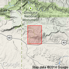
The red-brown conglomerate, sandstone, siltstone, and mudstone of the Upper Triassic Chinle Formation in the Eagle basin is a succession of fluvial channel, floodplain, lacustrine-deltaic, lacustrine, and eolian deposits. The conglomerate was deposited in paleovalleys cut into the underlying State Bridge Formation. Sediment transport directions were from the ancestral Uncompahgre and the ancestral Front Range. Upper part thins due to erosion prior to deposition of the overlying Entrada Sandstone. A tropical monsoonal climate suggested for early Chinle time. Eolian deposits in the upper part are due to drier climatic conditions caused by the northward migration of Pangea moving CO out of the monsoonal climes. Correlation chart and cross sections showing detailed relationships of parts of Chinle. The eolian sandstone that unconformably overlies Chinle in the Uinta Mountains, UT-CO on the Uinta uplift, and at Dinosaur National Monument, UT-CO on the Uinta uplift and in the Greater Green River basin can be divided into two units. These sandstones are older than the eolian sandstone above the Chinle in the Eagle basin. The lower unit, 10-30 ft-thick, is probably equivalent to the Lower Jurassic Wingate Sandstone farther south in UT. The upper unit is lighter in color than the lower unit, and is probably a correlative of the Lower Jurassic Navajo Sandstone to the south in UT. Cross section and correlation chart show divisions of Chinle in northern UT and adjoining northern CO.
Source: GNU records (USGS DDS-6; Denver GNULEX).
- Usage in publication:
-
- Chinle Formation*
- Modifications:
-
- Overview
- AAPG geologic province:
-
- Great Basin province
Summary:
Shinarump and Petrified Forest Members mapped along west edge of quad, Lincoln Co, NV, Great Basin province. Conformably overlies Moenkopi Formation; conformably underlies Moenave Formation. Combined thickness of members is up to 180 m. Late Triassic age.
Source: GNU records (USGS DDS-6; Denver GNULEX).
For more information, please contact Nancy Stamm, Geologic Names Committee Secretary.
Asterisk (*) indicates published by U.S. Geological Survey authors.
"No current usage" (†) implies that a name has been abandoned or has fallen into disuse. Former usage and, if known, replacement name given in parentheses ( ).
Slash (/) indicates name conflicts with nomenclatural guidelines (CSN, 1933; ACSN, 1961, 1970; NACSN, 1983, 2005, 2021). May be explained within brackets ([ ]).