

- Usage in publication:
-
- Belt formation*
- Modifications:
-
- Original reference
- Dominant lithology:
-
- Sandstone
- Conglomerate
- Limestone
- Shale
- AAPG geologic province:
-
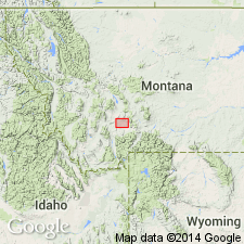
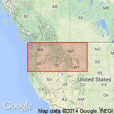
- Northern Rocky Mountain region
Summary:
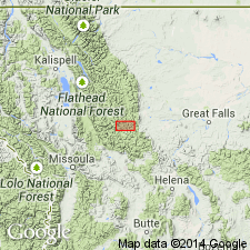
Pg. 16-20, pl. 4. Belt formation. Nonfossiliferous clastic beds, sometimes slightly metamorphosed, which lie between the Archean gneisses and a belt of quartzite, above which are beds with Middle Cambrian fossils. From its stratigraphic position this group could be only of Lower Cambrian or of Algonkian age; probably Algonkian. In vicinity of Three Forks was provisionally called †East Gallatin group (USGS 6th Ann. Rpt., p. 50, 1884), from a 2,300-foot-thick measured section along north side of East Gallatin River near its junction with West Gallatin. In Bridger Range the section is carried lower than on the East Gallatin. In Big Belt Range the formation is 10,000 to 12,000 feet thick.
Source: USGS geologic time classification (USGS Bull. 769, p. 108-111); US geologic names lexicon (USGS Bull. 896, East Gallatin entry p. 653).
- Usage in publication:
-
- Belt terrane
- Modifications:
-
- Revised
- AAPG geologic province:
-
- Northern Rocky Mountain region
Summary:
Pg. 199-215, 235. Belt terrane. Subdivided into (ascending): Neihart quartzite and sandstone, Chamberlain shales, Newland limestone, Greyson shales, Spokane shales, Empire shales, Helena limestone, Marsh shales. Rocks are widely distributed in central Montana, the best sections being exposed in the Big Belt and Little Belt Mountains, in Meagher and Broadwater Counties. They extend to the north in Cascade, to the west in Lewis and Clarke and Jefferson Counties, and to the north in Gallatin, Park, and Sweetwater Counties, in all covering an area of 6,000+ sq mi. Throughout this area Cambrian rocks rest unconformably on different members composing the Belt terrane. This unconformity is sufficient to explain the absence of Lower Cambrian rocks and fossils and to warrant our placing the Belt terrane in the pre-Cambrian Algonkian system of formations.
Source: USGS geologic time classification (USGS Bull. 769, p. 111); GNC MT Corr. Chart, sheet 1, July 1932.
- Usage in publication:
-
- Belt series*
- Modifications:
-
- Areal extent
- AAPG geologic province:
-
- Northern Rocky Mountain region*
Summary:
Pg. 32-33, 39, 41, 46, 350. Belt series. The largest area of Algonkian known is that of the Belt series of northern Montana, Idaho, and southern British Columbia. The Belt series is subdivided lithologically into a number of formations, but represents practically continuous deposition. To the south in Montana the Cherry Creek sedimentary rocks are assigned to the Algonkian. While their relations to the Belt series are not shown by direct contact, the relatively greater metamorphism and deformation of the Cherry Creek group indicate its earlier age and probable separation by unconformity. The quartzites of the Uinta and Wasatch mountains, correlated with the Belt series, are essentially structural units. The same is true of the quartzites and slates of Needle Mountains, Colorado. In the Grand Canyon of the Colorado there are two groups classed in the Algonkian, separated from each other by a minor unconformity. [Pages 32-33.]
The Belt series of Montana also is unconformable upon the Archean with marked discordance. [Page 39.]
The Belt series in its now known extent constitutes the greatest area of Algonkian on the continent, and it may be that this area should be extended to include Utah, Colorado, and Arizona quartzites. [Page 41.]
If the Animikie group is ever found to be the equivalent of the Belt series of British Columbia, as is thought possible, this would make more probable the Cambrian age of the Keweenawan lying above the Animikie, in view of the fact that in British Columbia the Belt series apparently grades up into the Cambrian. Against this evidence of possible conformity and favoring the view here held that the Cambrian lies unconformably above the upper Keweenawan are the following facts: * * * [Page 350.]
Source: USGS geologic time classification (USGS Bull. 769, p. 111-112); GNC MT Corr. Chart, sheet 1, July 1932.
- Usage in publication:
-
- Belt series*
- Modifications:
-
- Overview
- Dominant lithology:
-
- Clastics
Summary:
Pg. 108-112. Belt series. Pre-Cambrian metamorphosed sedimentary rocks widely developed in Montana, Idaho, eastern Washington, and British Columbia. In early reports called "Belt formation," "Belt terrane," "Belt beds," and "Belt group." The USGS classifies the Belt as a provincial series belonging to the Algonkian system. The name is derived from the extensive development of the rocks in the Big Belt and Little Belt Mountains of central Montana.
Source: Publication; US geologic names lexicon (USGS Bull. 896, p. 157).

- Usage in publication:
-
- Belt series
- Modifications:
-
- Revised
- AAPG geologic province:
-
- Northern Rocky Mountain region
Summary:
Pg. 1873-1970. Belt series, within its northern basin, is divisible into facies that differ in lithology, stratigraphic sequence, thickness, recorded conditions of deposition, fauna, and flora. Of these facies, following are herein defined: Meagher, Blackfoot Canyon, Glacier Park, Galton, Purcell, and Coeur d'Alene. Comprises (ascending) Ravalli, Piegan (new), and Missoula groups. Following formations described: Altyn, Appekunny, Grinnell, Siyeh, Spokane, and Miller Peak. [Age is Precambrian.]
Source: US geologic names lexicon (USGS Bull. 1200, p. 294-295).
- Usage in publication:
-
- Belt series*
- Modifications:
-
- Revised
- AAPG geologic province:
-
- Northern Rocky Mountain region
Summary:
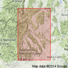
Pg. 211-218. Belt series. In Saypo quadrangle, Montana, only upper Belt rocks are exposed. Series divided into (ascending) Miller Peak argillite, Cayuse formation (new), Hoadley formation (new), and Ahorn quartzite (new). Formations are equivalent in age to lower and middle part of Missoula group of Clapp and Deiss ( 1931). [Age is Precambrian.]
Source: US geologic names lexicon (USGS Bull. 1200, p. 294-295).
- Usage in publication:
-
- Belt series*
- Modifications:
-
- Revised
- AAPG geologic province:
-
- Northern Rocky Mountain region
Summary:
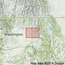
Pg. 1096-1099. Belt series. In Borah Peak quadrangle, Idaho, Belt series subdivided into
(ascending) Lemhi and Swauger quartzites (both new). [Age is Precambrian.]
Source: US geologic names lexicon (USGS Bull. 1200, p. 294-295).
- Usage in publication:
-
- Belt series*
- Modifications:
-
- Revised
- AAPG geologic province:
-
- Northern Rocky Mountain region
Summary:
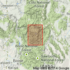
Pg. 8-19, pl. 1. Belt series. Thickness 40,000 feet in Libby quadrangle, Montana. Comprises five formations (ascending): Prichard, Ravalli, Wallace, Striped Peak, and Libby (new). Prichard, Wallace, and Striped Peak correlated with formations of same name in Coeur d'Alene district; the Ravalli correlated with Burke formation, Revett quartzite, and St. Regis formation of that district. [Age is Precambrian.]
Source: US geologic names lexicon (USGS Bull. 1200, p. 294-295).
- Usage in publication:
-
- Belt series*
- Modifications:
-
- Revised
- AAPG geologic province:
-
- Northern Rocky Mountain region
Summary:
Belt series. Proposed to include lower part of Belt series in Ravalli group with exception of Prichard formation and Neihart quartzite, the middle part in the Piegan group, and upper part in Missoula group. Name North Boulder group proposed for hitherto unnamed components of Belt series in isolated exposures near Jefferson River, southeast of Butte. Relations between North Boulder group and units farther north are not clear. The North Boulder may be equivalent in age to some part of Missoula group or to part of that group and part of Piegan group. Age is pre-Cambrian.
Source: US geologic names lexicon (USGS Bull. 1200, p. 294-295).
- Usage in publication:
-
- Belt series*
- Modifications:
-
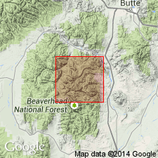
- Areal extent
- AAPG geologic province:
-
- Northern Rocky Mountain region
Summary:
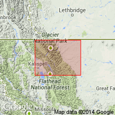
Pg. 16-57, pls. 1, 2. Discussion of Belt series in Glacier National Park and Flathead region, Montana. Terms Ravalli, Piegan, and Missoula groups are used but their limits are redefined. Table compares present terminology with that used by Fenton and Fenton (1937).
Source: US geologic names lexicon (USGS Bull. 1200, p. 294-295).
- Usage in publication:
-
- Belt series*
- Modifications:
-
- Revised
- AAPG geologic province:
-
- Northern Rocky Mountain region
Summary:
Pg. 551-569, pl. 28. Belt series. St. Regis-Superior area, Mineral County, Montana, is underlain by about 50,000 feet of metasedimentary rocks of Belt series. Lower part of Belt series is divided into (ascending) Prichard, Burke, Revett, St. Regis, and Wallace formations; upper part, or Missoula group, is divided into (ascending) Spruce, Lupine, Sloway, and Bourchard formations (all new), and an unnamed feldspatbic quartzite. [Age is Precambrian.]
Source: US geologic names lexicon (USGS Bull. 1200, p. 294-295).
- Usage in publication:
-
- Belt Series
- Modifications:
-
- Revised
- AAPG geologic province:
-
- Northern Rocky Mountain region
Summary:
Revised in that Belt Series includes the newly named Apple Creek Phyllite, the Lemhi Quartzite and Swauger Quartzite in Lemhi Co, ID in the Northern Rocky Mountain region. Precambrian age. Geologic map and cross sections.
Source: GNU records (USGS DDS-6; Denver GNULEX).
- Usage in publication:
-
- Belt series*
- Modifications:
-
- Revised
- AAPG geologic province:
-
- Northern Rocky Mountain region
Summary:
Pg. F189-F235; USGS Misc. Inv. Ser. Map I-296, 1959. Belt series, in Bonner quadrangle, western Montana, comprises (ascending) Piegan group with Newland limestone, and Missoula group consisting of (ascending) Miller Peak argillite, Bonner quartzite (new), McNamara argillite, Garnet Range quartzite, and Pilcher quartzite (new). Age is Precambrian.
Source: Publication; US geologic names lexicon (USGS Bull. 1200, p. 294-295).
- Usage in publication:
-
- Belt Supergroup
- Modifications:
-
- Revised
- AAPG geologic province:
-
- Northern Rocky Mountain region
Summary:
Divided into 9 named units in southwest Marias Pass area, Flathead Co, MT in the Northern Rocky Mountain region. These units are Appekunny (base), Grinnell, Siyeh, Snowslip (new name), and Shepard Formations, Kintla Group (raised in stratigraphic rank and divided into newly named Shields Formation and Red Plume Quartzite), and an unnamed green argillite and green and white quartzite (top). Assigned to the Precambrian.
Source: GNU records (USGS DDS-6; Denver GNULEX).
- Usage in publication:
-
- Belt Series
- Modifications:
-
- Areal extent
- AAPG geologic province:
-
- Northern Rocky Mountain region
Summary:
Coarse-grained arkose and conglomerate of the LaHood Formation crop out in a narrow zone from the northern half of the Bridger Range to and across the Highland Mountains, in Northern Rocky Mountain region, Jefferson Co, MT. Grades northward into fine-grained carbonate, argillite, siltite, and quartzite of Belt Series (Neihart Quartzite, Chamberlain Shale, Prichard Formation, Newland Limestone, and lower part of Greyson Shale). Is of Precambrian age.
Source: GNU records (USGS DDS-6; Denver GNULEX).
- Usage in publication:
-
- Belt series*
- Modifications:
-
- Revised
- AAPG geologic province:
-
- Northern Rocky Mountain region
Summary:
North Boulder formation of Belt series mapped as the only unit of the Belt, younger than an amphibolite and gneiss unit and older than the Flathead sandstone. Described as mostly thick-bedded, yellowish-brown and reddish-brown, coarse, micaceous, feldspathic sandstone of more than 4,000 ft thick. Some lenses of subround cobble conglomerate of quartzite, granite pegmatite, diorite, gneiss, amphibolite, and diabase near base. May correlate with the LaHood formation. Assigned a late Precambrian age. Mapped in 3-sq-mi area in central part of quad, Gallatin Co, MT, Northern Rocky Mountain region. Thought to be upper Belt, though rocks in this quad are not typical of the Belt elsewhere. Geologic map. [Compare with Peale, 1893 and 1896].
Source: GNU records (USGS DDS-6; Denver GNULEX).
- Usage in publication:
-
- Belt Supergroup*
- Modifications:
-
- Revised
- AAPG geologic province:
-
- Northern Rocky Mountain region
Summary:
North Boulder Group of Belt Supergroup abandoned and replaced in Northern Rocky Mountain region by LaHood Formation of Precambrian Belt Supergroup (adopted).
Source: GNU records (USGS DDS-6; Denver GNULEX).
- Usage in publication:
-
- Belt Supergroup
- Modifications:
-
- Overview
- AAPG geologic province:
-
- Northern Rocky Mountain region
Summary:
Name Missoula Group has been applied to all rocks in the Precambrian Belt Supergroup above the carbonate (Siyeh Formation of Glacier National Park or Helena Formation of Helena area). These same rocks were designated Camp Creek Series by Walcott in 1906, but that name has been little used and is abandoned in favor of Missoula in this report. The Camp Creek section is designated a reference section [but section not described] for the Missoula. The reference section is located along the crest of the ridge parallel to and northwest of Camp Creek in secs 22, 28, and 33, T20N, R12W, Lewis and Clark Range, Powell Co, MT in Northern Rocky Mountain region where the following formations of the Missoula are exposed (ascending order): Snowslip, Shepard, and Shields Formations, Bonner Quartzite, McNamara and Garnet Range Formations, Helena Formation of Helena area; Siyeh Formation of Glacier National Park; and the Newland Limestone of Bonner area. These are thought to be lateral equivalents. Geologic map.
Source: GNU records (USGS DDS-6; Denver GNULEX).

- Usage in publication:
-
- Belt Supergroup*
- Modifications:
-
- Revised
- AAPG geologic province:
-
- Northern Rocky Mountain region
Summary:
Belt Supergroup. Divided into (ascending): pre-Ravalli or lower Belt (formation(s) only, not group); Ravalli Group; middle Belt carbonate rock (formation(s) only, not group); and Missoula Group. Recognized in northwestern and central western Montana, northern Idaho, and northeastern Washington. Age is Precambrian Y.
Source: Changes in stratigraphic nomenclature, 1972 (USGS Bull. 1394-A, p. A4-A5).
- Usage in publication:
-
- Belt Supergroup*
- Modifications:
-
- Areal extent
- AAPG geologic province:
-
- Northern Rocky Mountain region
Summary:
Divided into Yellowjacket Formation (base) and Hoodoo Quartzite (top) which are extended westward into Lemhi, Valley, and Idaho Cos, ID in Northern Rocky Mountain region.
Source: GNU records (USGS DDS-6; Denver GNULEX).
- Usage in publication:
-
- Belt Supergroup*
- Modifications:
-
- Overview
- Areal extent
- AAPG geologic province:
-
- Northern Rocky Mountain region
Summary:
Divided in report area in the Northern Rocky Mountain region, ID and WA into (ascending): Prichard, Burke, Revett, St. Regis, Wallace, Striped Peak, and Libby Formations. Base and top eroded. Underlies the Gold Creek Quartzite. Highly metamorphosed rocks at the southeast edge of the map and in the Coeur d'Alene district, ID and near Spokane, WA mapped as part of Prichard. Some of the metamorphic rocks had been called Newman Lake and Hauser Lake Gneisses. [No explanation given for non-use of names Newman Lake or Hauser Lake, nor of their status as formal names.] Precambrian age.
Source: GNU records (USGS DDS-6; Denver GNULEX).
- Usage in publication:
-
- Belt Supergroup*
- Modifications:
-
- Revised
- Areal extent
- AAPG geologic province:
-
- Northern Rocky Mountain region
Summary:
Precambrian sedimentary rocks in the Lemhi Range, Lemhi Co, ID in Northern Rocky Mountain region dominantly fine- to medium-grained feldspathic or micaceous quartzites of immense thickness. They have little in common with the partly equivalent Belt Supergroup rocks. Most of the Belt rocks are medium silt or finer. Shallow water features--mudcracks, ripple marks, salt casts are rare in the Lemhi Range rocks. Stromatolites common in the Belt have been found at only two localities in the Lemhis. Terms Yellowjacket Formation and Hoodoo Quartzite considered to be east-central ID units of the miogeocline and not of the Belt basin. Term Lemhi removed from supergroup, and raised to group status. Term Swauger Quartzite removed from supergroup and redefined as Swauger Formation.
Source: GNU records (USGS DDS-6; Denver GNULEX).
- Usage in publication:
-
- Belt Supergroup*
- Modifications:
-
- Revised
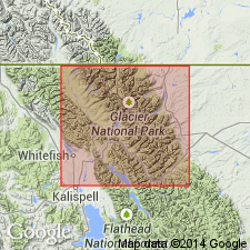
- AAPG geologic province:
-
- Northern Rocky Mountain region
Summary:
Precambrian Y Belt Supergroup ranges in age from 1,325 to 900 m.y. and in thickness from 26,000 to 36,000 ft in the Park. The Altyn Limestone is redefined as Altyn Formation. The Appekunny [of Ravalli Group] and Greyson [of Missoula Group] Formations are thought to be two names for the same rocks. Name Altyn Limestone redefined as Altyn Formation. Greyson is the older name so Appekunny is abandoned. Correlation chart shows relationship of Belt units in Glacier National Park, Glacier Co, MT, Northern Rocky Mountain region with other Belt units at Missoula, Bonner and Canyon Ferry areas and with units used by Willis (1902) and Childers (1963).
Source: GNU records (USGS DDS-6; Denver GNULEX).
- Usage in publication:
-
- Belt Supergroup*
- Modifications:
-
- Overview
- AAPG geologic province:
-
- Northern Rocky Mountain region
Summary:
Middle Proterozoic rocks designated as informal units or sequences at Swamp Creek, Boner Knob, Big Point, and Maurice Mountain in report area in the Northern Rocky Mountain region in preference to assignment to formations of Belt Supergroup. These informal sequences may correlate with Mount Shields Formation and Bonner Quartzite of Missoula Group.
Source: GNU records (USGS DDS-6; Denver GNULEX).
- Usage in publication:
-
- Belt Supergroup*
- Modifications:
-
- Paleomagnetics
- AAPG geologic province:
-
- Northern Rocky Mountain region
Summary:
Paleomagnetic data shows that the Grand Canyon Supergroup almost entirely postdates the Belt Supergroup of WA, ID, MT, BC, and AT. The only permissible paleomagnetic correlation and temporal overlap is between the uppermost normal polarity part of Pilcher Quartzite at top of Belt and the upper part of Bass Limestone at base of Unkar Group of Grand Canyon Supergroup. Belt Supergroup mapped in the Northern Rocky Mountain region. Middle Proterozoic age.
Source: GNU records (USGS DDS-6; Denver GNULEX).
- Usage in publication:
-
- Belt Supergroup*
- Modifications:
-
- Mapped
- AAPG geologic province:
-
- Northern Rocky Mountain region
Summary:
Belt Supergroup. In Glacier National Park, Glacier and Flathead Counties, northwestern Montana, includes the following formations (ascending): Prichard (west side of park, not separately mapped); Waterton, 170 to 229 m (east side of park); Altyn, 238 to 255 m (east side of park); Appekunny, 530 to 690 m (east side of park; not separately mapped on west side); Grinnell, 530 to 790 m; Empire, 122 to 158 m; Helena, 750 to 1,030 m; Snowslip, 360 to 635 m (includes Purcell Lava, 19 to 92 m, in upper part); Shepard, 165 to 400 m; Mount Shields, about 850 m; Bonner Quartzite, 250 to 280 m; and McNamara, 450 to 600 m. Age is Middle Proterozoic.
Source: Publication.
- Usage in publication:
-
- Belt Supergroup*
- Modifications:
-
- Revised
- AAPG geologic province:
-
- Northern Rocky Mountain region
Summary:
Revised in that newly named Moose Formation and Table Mountain Quartzite assigned to lower Belt. Study area is in Highland Mountains, Silver Bow Co, MT, Northern Rocky Mountain region. Lower Belt in Highland Mountains area now consists of (ascending) La Hood and Moose Formations, Table Mountain Quartzite, and Newland Formation. Schematic cross section (fig. 2); correlation diagram (fig. 3). Lower Belt overlies Early Proterozoic crystalline basement rocks; upper contact of lower Belt is interlayered with Greyson Shale of Ravalli Group of Belt Supergroup. Middle Proterozoic age.
Source: GNU records (USGS DDS-6; Denver GNULEX).
For more information, please contact Nancy Stamm, Geologic Names Committee Secretary.
Asterisk (*) indicates published by U.S. Geological Survey authors.
"No current usage" (†) implies that a name has been abandoned or has fallen into disuse. Former usage and, if known, replacement name given in parentheses ( ).
Slash (/) indicates name conflicts with nomenclatural guidelines (CSN, 1933; ACSN, 1961, 1970; NACSN, 1983, 2005, 2021). May be explained within brackets ([ ]).