

- Usage in publication:
-
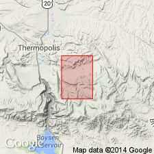
- Thermopolis shale*
- Modifications:
-
- Named
- Dominant lithology:
-
- Shale
- Sandstone
- AAPG geologic province:
-
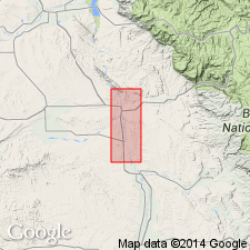
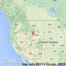
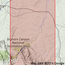
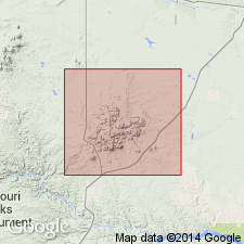
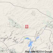
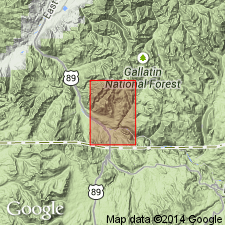
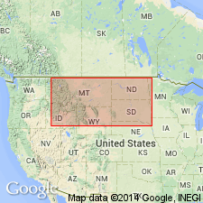
- Bighorn basin
Summary:
Named as the basal formation of four formations of Colorado group for town of Thermopolis, Hot Springs Co, WY in the Bighorn basin near which it is well exposed. No type locality designated. Overlies the "Greybull sand," the upper sandstone of the Cloverly formation. Conformably underlies Mowry shale; Mowry considered to be a formation rank unit in the Colorado group. Consists mostly of dark shale but also includes one or more lenticular sandstones. "Muddy sand" the most persistent of these sandstones lies 210 to 330 ft above top of "Greybull sand" of the Cloverly. The Muddy is 15 to 55 ft thick. A generalized section of Mowry in the Basin oil field given; Mowry has 4 described units (ascending order): 1.) soft dark shale 275 +/-ft thick, 2.) Muddy sand 35 +/-ft thick, 3.) soft dark shale 170 +/-ft thick, 4.) hard shale and lenses of sandstone 230 ft thick. Rocks assigned to Thermopolis were formerly an unnamed part of the Colorado shale. History of nomenclature chart. Of Late Cretaceous age.
Source: GNU records (USGS DDS-6; Denver GNULEX).
- Usage in publication:
-
- Thermopolis shale*
- Modifications:
-
- Areal extent
- Overview
- AAPG geologic province:
-
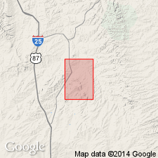
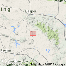
- Wind River basin
Summary:
Name applied to rocks in the Salt Creek oil field, U. S. Naval Petroleum Reserve No. 3, Natrona Co., WY in the Wind River basin formerly mapped as unnamed basal part of Benton shale by Wegemann (USGS Bulletin 670, 1918). Term Benton shale not used. Consists of black shale containing plant remains. Includes a thin sandstone near top that is thought of as equivalent to "Muddy sand" of the Bighorn basin. The sand is about 6 ft thick or less, and lies about 20 ft below top of overlying Mowry shale. Divisible, therefore, into a lower black shale with shark teeth about 200 ft thick, a middle fine grained sandstone with some coal and wood fragments 0 to 11 ft thick called "Muddy", and a upper dark soft shale about 20 ft thick. Overlies Cloverly formation. Underlies Mowry shale (formerly designated Mowry shale member of Benton shale). Stratigraphic chart. Columnar section. Of Late Cretaceous age.
Source: GNU records (USGS DDS-6; Denver GNULEX).
- Usage in publication:
-
- Thermopolis shale*
- Modifications:
-
- Revised
- AAPG geologic province:
-
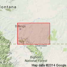
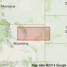
- Powder River basin
- Central Montana uplift
Summary:
Thermopolis shale of Colorado group. Divided into lower member, middle member, Birdhead sandstone member (new), and upper member. Thickness 525 to 800 feet. Overlies Cloverly formation. Underlies siliceous Mowry shale. In the east, the Thermopolis-Mowry contact placed at base of lowest fish-scale. In the west, contact placed between yellow sandstone of Mowry and dark, gray shale of Thermopolis. Mapped area from T. 9 S. to T. 2 S., R. 33 E. to R. 26 E., Big Horn and Yellowstone Counties, Montana. Age is Late Cretaceous. Report includes stratigraphic table. Fossils identified (listed).
Source: Modified from GNU records (USGS DDS-6; Denver GNULEX).
- Usage in publication:
-
- Thermopolis shale member
- Modifications:
-
- Areal extent
- AAPG geologic province:
-
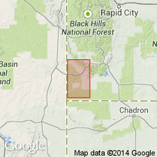
- Chadron arch
Summary:
Name used interchangeably with Skull Creek shale member for lowest part of the Graneros shale in Fall River Co, SD on the Chadron arch. Overlain by the Newcastle sandstone member; underlain by the Dakota formation.
Source: GNU records (USGS DDS-6; Denver GNULEX).
- Usage in publication:
-
- Thermopolis shale*
- Modifications:
-
- Revised
- AAPG geologic province:
-
- Yellowstone province
Summary:
As defined in this report, Thermopolis shale is divided into a lower black shale member 155 to 220 ft thick and the Muddy sandstone member 45 to 92 ft thick. The lower member includes thin partings of gray siltstone, many partings of brown marlstone and gray limestone. The lower member can be recognized in MT and in ID. No fossils found in lower member in Jackson Hole area, though forams have been found to east. The overlying Muddy consists of gray, very fine to medium-grained sandstone with lesser amounts of black shale and thin layers of bentonite. The sandstone has a salt-and-pepper appearance. Some outcrops of the Muddy are cliffs; other form slopes. Locally member composed of quartzite. Muddy is recognized over a large area and is consistent. Muddy overlies "rusty beds" of the undivided Morrison? and Cloverly formations. Muddy underlies Mowry shale. Mowry may include in its lower part black shale equivalent to the upper part of the Thermopolis as mapped in other areas. The Lower Cretaceous Mowry is identified at Lower Slide Lake and at Bacon Ridge, Teton Co., WY in the Yellowstone province on the cross section. Mowry underlies Frontier formation.
Source: GNU records (USGS DDS-6; Denver GNULEX).
- Usage in publication:
-
- Thermopolis shale*
- Modifications:
-
- Revised
- AAPG geologic province:
-
- Powder River basin
Summary:
Pg. 45-47. Thermopolis shale. Described in Hardin area, Montana-Wyoming, where it is 425 feet thick; overlies Cloverly formation and underlies Mowry shale. Restricted to exclude [Birdhead] sandstone which is reallocated to member status in Cloverly. Age is Early Cretaceous. Report includes geologic map, columnar section, measured sections.
Source: US geologic names lexicon (USGS Bull. 1200, p. 3866-3867).
- Usage in publication:
-
- Thermopolis shale*
- Modifications:
-
- Overview
- AAPG geologic province:
-
- Denver basin
Summary:
Area of report is Front Range of Rocky Mountains. Correlation with other Cretaceous units in Powder River basin of northeast WY, Wind River basin of central WY, and Denver basin of southeast WY, northeast and south-central CO shown on fig. 19.
Source: GNU records (USGS DDS-6; Denver GNULEX).
- Usage in publication:
-
- Thermopolis shale
- Modifications:
-
- Overview
- AAPG geologic province:
-
- Bighorn basin
Summary:
Author follows the definition of Thermopolis shale used by Lupton (1916)--or the interval in the Bighorn basin from the base of the rusty beds of Thermopolis which lie on Cloverly Formation up to base of siliceous shale of Mowry shale, a very sharp contact. Some have restricted Thermopolis to shale and siltstone below Muddy sandstone and above Cloverly. Others have excluded the "Rusty beds" from Thermopolis and have assigned them to the underlying Cloverly. This author divides Thermopolis into (ascending): lower Thermopolis, Muddy sandstone, upper Thermopolis (formerly called Nefsy shale). The lower Thermopolis is further divided into (ascending): "Rusty beds", 120 ft thick; lower shale, 90 ft thick; middle silty shale, 30 ft thick; upper shale, 75-110 ft thick. The "Rusty beds"-Cloverly contact difficult to select. The middle silty shale has been called "Dakota silt" in MT. The Muddy sandstone [unranked] is about 35 ft thick at type, but varies locally. The Muddy has variable amounts of sandstone, siltstone, some shale and bentonite, and locally chert-pebble conglomerate and peat. Upper Thermopolis is 200-300 ft thick, gray to black shale with ironstone and a few white bentonite beds. Fossils (forams) in lower and upper Thermopolis listed. Cross sections. Deposited in bays, lagoons, river mouths, and estuaries in Cretaceous time.
Source: GNU records (USGS DDS-6; Denver GNULEX).
- Usage in publication:
-
- Thermopolis shale*
- Modifications:
-
- Revised
- AAPG geologic province:
-
- Williston basin
Summary:
Revised in Phillips Co, MT in the Williston basin, in that the 25 ft thick coarse-grained, massively bedded, ridge-forming sandstone that occurs near the middle of the Thermopolis shale is named Cyprian sandstone member of the Thermopolis. This sandstone was called Muddy sand in some earlier reports. The formation is mostly a blue-gray shale with numerous thin bentonite beds. Thermopolis overlies the First Cat Creek sand of drillers and underlies the Mowry shale. Is about 600 ft thick. Geologic map. Columnar section. Cretaceous age.
Source: GNU records (USGS DDS-6; Denver GNULEX).

- Usage in publication:
-
- Thermopolis shale
- Modifications:
-
- Revised
- AAPG geologic province:
-
- Bighorn basin
Summary:
Overlies the newly named Sykes Mountain formation, a replacement name for the Greybull member of the Cloverly formation in Big Horn Co, WY in Bighorn basin. Lower contact placed where black or gray shale predominates over brown, gray to black sandstone, siltstone and ironstone. Nomenclature chart. Cross section. Of Early Cretaceous age.
Source: GNU records (USGS DDS-6; Denver GNULEX).
- Usage in publication:
-
- Thermopolis shale
- Modifications:
-
- Revised
- AAPG geologic province:
-
- Wind River basin
Summary:
Identified in subsurface in Grieve field, Natrona Co, WY in the Wind River basin. Divided into a lower shale 142 ft thick, Muddy Sandstone Member 45 ft thick, upper shale 42 ft thick. [Informal?] unit-a sandstone lens-newly named Grieve sand of upper part of Muddy Member defined. Thermopolis overlies the Cloverly Formation and underlies the Mowry [Shale]. Cretaceous age.
Source: GNU records (USGS DDS-6; Denver GNULEX).
- Usage in publication:
-
- Thermopolis Shale
- Modifications:
-
- Revised
- AAPG geologic province:
-
- Bighorn basin
Summary:
"Rusty Beds Member" designated a formal member of Thermopolis Shale. Is the only part of Thermopolis in Bighorn basin discussed in this report. Some workers have placed the member in the underlying Cloverly Formation. Correlation chart. Of Early Cretaceous age.
Source: GNU records (USGS DDS-6; Denver GNULEX).
- Usage in publication:
-
- Thermopolis Shale
- Modifications:
-
- Contact revised
- AAPG geologic province:
-
- Williston basin
Summary:
Lower contact revised in that Thermopolis overlies the newly named Coyote Creek Member upper member of Fall River Formation of Inyan Kara Group in western SD in the Williston basin. Of Late Cretaceous age. Cross sections.
Source: GNU records (USGS DDS-6; Denver GNULEX).
- Usage in publication:
-
- Thermopolis Shale*
- Modifications:
-
- Revised
- AAPG geologic province:
-
- Montana folded belt
Summary:
Thermopolis Shale as mapped in this report area, Park Co., MT in the Montana folded belt province is divisible into two members (not shown separately on the geologic map). The lower or shale member about 280 ft thick is dark gray or black fissile or platy, interbedded with thin-bedded fine-grained rusty-weathered sandstone or siltstone. The shale and the siltstone have worm trails and carbonaceous flecks. The basal contact with the Cloverly is a topographic break and a lithologic (from sandstone to shale) break. The Muddy is divisible into a lower sandstone 27 ft thick, a 34 ft thick shale, and an upper gray medium grained, locally fine grained, locally coarse grained, conglomeratic near top 21 ft thick sandstone. Most of Muddy has salt-and-pepper appearance. Upper contact of Thermopolis is controversial. Some places the soft black shales above the Muddy in the Thermopolis rather than with the overlying siliceous Mowry Shale. However, in many parts of WY and in the Gardiner area, the only mappable contact is the top of the Muddy. Of Early Cretaceous age. Measured section on Cinnabar Mountain, lower member is 280 ft thick, Muddy is 115 ft thick; Thermopolis overlies upper sandstone member [term rusty beds not used] of Cloverly and underlies Mowry shale; upper contact is a 324 ft thick covered interval.
Source: GNU records (USGS DDS-6; Denver GNULEX).
- Usage in publication:
-
- Thermopolis Shale*
- Modifications:
-
- Overview
- AAPG geologic province:
-
- Denver basin
- Green River basin
Summary:
Thermopolis and Mowry Shales mapped as a single unit in the southeast part of the Shirley basin, western Albany Co (Denver basin) and eastern Carbon Co (Greater Green River basin), WY. Basal Thermopolis lies conformably above the Cloverly Formation. The upper Mowry underlies the Frontier Formation. Rocks of the Thermopolis consist of: 1.) basal gray to black carbonaceous shale about 60 ft thick of marine origin, 2.) the Muddy Sandstone Member about 14 ft thick, 3.) a brown-gray, thin-bedded, fine grained, silty sandstone interbedded with thin-bedded siltstone and shale 50 ft thick that has a 2 ft thick lignite bed at top, and 4.) a 60 ft thick interval of sandy siltstone and shale interbedded with "typical" Mowry siliceous shale. Unit 4 is arbitrarily considered to be upper Thermopolis. Unit 3 is poorly indurated and makes poor outcrops; it is of paladal origin. Some of the buff to gray thin bedded sandstone beds of the Muddy are ripple marked. The 110 ft of gray, dense or siliceous, laminated shale with fish scales and interbedded 2-3 ft thick bentonite beds are the Mowry; this sequence very resistant to erosion forms long narrow ridges. Stratigraphic chart. Cretaceous age.
Source: GNU records (USGS DDS-6; Denver GNULEX).
- Usage in publication:
-
- Thermopolis Shale*
- Modifications:
-
- Revised
- AAPG geologic province:
-
- Bighorn basin
Summary:
Revised in that Muddy Sandstone Member used as the upper [rather than as the middle] member of the Thermopolis. The overlying lower very dark gray claystone is designated lower part of the Mowry Shale. [This lower claystone of the Mowry has been assigned as the upper member of Thermopolis Shale by some and as the Shell Creek Shale by others.] The Muddy is 40 to 60 ft thick, ledge-forming, fine-to-coarse grained, mostly quartzitic, locally soft, friable, sandstone; it has some interbedded siltstone and claystone. The underlying 230 ft thick main body is dark gray to black claystone interbedded with phacoidal siltstone and very fine grained sandstone in lower 25 ft. Main body overlies Coverly Formation. Mapped as one unit -Muddy and main body--in north-central part of quad, southeast of Thermopolis in Hot Springs Co., WY in the Bighorn basin. Of Early Cretaceous age.
Source: GNU records (USGS DDS-6; Denver GNULEX).
- Usage in publication:
-
- Thermopolis Shale*
- Modifications:
-
- Reference
- Overview
- Dominant lithology:
-
- Claystone
- Sandstone
- Mudstone
- Shale
- AAPG geologic province:
-
- Montana folded belt
Summary:
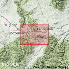
Divided into lower sandstone, middle shale, and upper sandstone members. Lower sandstone member correlates with "Rusty beds" and Greybull Sandstone Member of north-central WY. Middle shale member correlates with Skull Creek Shale of northeast WY. Upper sandstone member correlates with Muddy Sandstone Member in central WY. Reference section designated and measured in SW1/4 sec 20, T2S, R7E, Gallatin Co, MT, Montana folded belt province, where 493 ft of Thermopolis lies between Kootenai Formation (below) and Mowry Shale (above). Consists of: 1) sandstone that may be yellow brown to gray, very fine to medium grained, very thin bedded to massive, poorly to well sorted, calcareous, silty, micaceous, indurated; 2) olive-black mudstone that may be massive, carbonaceous; 3) olive- to brown-black, and dark gray carbonaceous, tuffaceous shale that has calcareous lenses and lenses of very fine grained sandstone; and 4) a minor amount of olive-gray thin-bedded to massive claystone. Another measured section 530 ft thick described in sec 35, T2S, R9E. Some bentonite also present. Of Early Cretaceous age, middle to late Albian. Geologic map. Correlation chart. Fossil lists.
Source: GNU records (USGS DDS-6; Denver GNULEX).
- Usage in publication:
-
- Thermopolis Shale*
- Modifications:
-
- Areal extent
- AAPG geologic province:
-
- Williston basin
Summary:
Thermopolis Shale. Geographically restricted from Montana because it is used to include different strata, and it correlates with formations that have been mapped over the area. The Thermopolis Shale, as used by Knechtel (1959, USGS Bull. 1072-N, p. 739-740) in Little Rocky Mountains area, north-central Montana, and by Richards (1955, USGS Bull. 1026, p. 45-47) in Bighorn Canyon-Hardin area, south-central Montana, is replaced with the Skull Creek Shale, Muddy Sandstone (revised), and the basal part of the Mowry Shale. The Thermopolis Shale, as used by Roberts (1972, USGS Prof. Paper 526-C, p. 16-17) in the Livingston area, southwestern Montana, is replaced with the Fall River Sandstone, Skull Creek Shale, and Muddy Sandstone. Thermopolis Shale remains in good usage in Wyoming.
Source: Changes in stratigraphic nomenclature, 1975 (USGS Bull. 1422-A, p. A40-A41, A66-A67).
- Usage in publication:
-
- Thermopolis? shale*
- Modifications:
-
- Areal extent
- AAPG geologic province:
-
- Montana folded belt
- Snake River basin
Summary:
Two members mapped in southeast corner of report area, Beaverhead Co, MT, Montana folded belt province, and Clark Co, ID in the Snake River basin. The lower sandstone member overlies the Lower Cretaceous Kootenai Formation and consists of brown, thin- to medium-bedded, cross-bedded, fine- to medium-grained, quartzose, friable sandstone 7.5 to 15 m thick. The upper shale member is stratigraphically older than the Paleocene and Cretaceous Beaverhead? Formation and consists of a dark-gray to black shale and shaly siltstone whose thickness is unknown. The upper shale member was assigned to Colorado Shale and to Bear River? Formation by earlier workers. Contains pollen that strongly suggests Albian or pre-Cenomanian age. Assigned to Early Cretaceous.
Source: GNU records (USGS DDS-6; Denver GNULEX).
- Usage in publication:
-
- Thermopolis Shale*
- Modifications:
-
- Overview
- AAPG geologic province:
-
- Montana folded belt
Summary:
Name used in the east part of the report area, Beaverhead and Madison Cos, MT on the east side of the axis of the Ruby River, Montana folded belt province. Basal contact placed at the top of the gastropod limestone of the Kootenai Formation. The lower sandstone member consists of pale-brown to rusty color, fine-grained, cross-bedded quartz arenite with abundant oscillatory ripple marks of marine shoreface origin 50 to 220 ft thick. The lower member has been variously assigned to the Bear River? Formation, Kootenai Formation, Colorado Shale, or Thermopolis Shale by previous mappers. Late Albian ammonites and lacustrine ostracods present in lower member. The upper shale member consists of black shale 30 to 300 ft thick of marine origin and has Albian palynomorphs and ammonites. The shale member of Thermopolis has been variously assigned to the Bear River? Formation, Thermopolis Shale, Colorado Formation, Colorado Shale, Muddy Sandstone, and upper sandstone of Flood Member of Blackhawk Formation by previous mappers. Thermopolis is of Albian, Early Cretaceous age. Columnar sections.
Source: GNU records (USGS DDS-6; Denver GNULEX).
- Usage in publication:
-
- Thermopolis Shale*
- Modifications:
-
- Areal extent
- AAPG geologic province:
-
- Montana folded belt
Summary:
Recognized as far west as the Beartooth Mountains, Gallatin, Madison, Gravelly, and Greenhorn Ranges, MT, Montana folded belt province, and in the Centennial Mountains of MT. These ranges represent the west limit of the use of the name Thermopolis. The axis of the Ruby River valley which separates the Snowcrest Range from the Greenhorn and Gravelly Ranges is the arbitrary location of the nomenclature change. Is equivalent to the lower part of the Flood Member of the Blackleaf west of the Ruby River valley. Is divided into a basal sandstone and an upper shale member. Unconformably overlies Kootenai Formation. Underlies Muddy Sandstone. Stratigraphic chart. Of Albian, Early Cretaceous age.
Source: GNU records (USGS DDS-6; Denver GNULEX).
- Usage in publication:
-
- Thermopolis Formation
- Modifications:
-
- Overview
- AAPG geologic province:
-
- Wind River basin
Summary:
As shown in figs. 3 and 4 and discussed in text, author divides Thermopolis Formation into lower Rusty Beds (or "rusty beds"), medial shales ("Thermopolis Shale"), and upper Muddy Sandstone [Member]. [Author follows Mirsky (1962) in assignment of "rusty beds" to Thermopolis, however, author apparently does not consider unit to be a formal member of Thermopolis.] Lower "rusty beds" interval consists of about 115 feet of interbedded shale, bioturbated siltstones, and fine-grained quartz arenites. Rusty beds represent initial Cretaceous transgression into Rocky Mountain region and are continuous throughout Wind River basin. Rusty beds are assigned Aptian and Albian (Early Cretaceous) age and remainder of Thermopolis is Albian.
Source: GNU records (USGS DDS-6; Denver GNULEX).
For more information, please contact Nancy Stamm, Geologic Names Committee Secretary.
Asterisk (*) indicates published by U.S. Geological Survey authors.
"No current usage" (†) implies that a name has been abandoned or has fallen into disuse. Former usage and, if known, replacement name given in parentheses ( ).
Slash (/) indicates name conflicts with nomenclatural guidelines (CSN, 1933; ACSN, 1961, 1970; NACSN, 1983, 2005, 2021). May be explained within brackets ([ ]).