The National Geologic Map Database is migrating to a new infrastructure. We apologize for any service disruptions during this process.
|
|---|


- Usage in publication:
-
- Mowrie beds*
- Modifications:
-
- Named
- Dominant lithology:
-
- Shale
- Sandstone
- AAPG geologic province:
-
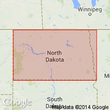
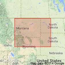
- Powder River basin
Summary:
Named as a member of the Benton formation for Mowrie Creek northwest of Buffalo, Johnson Co, WY in the Powder River basin. No type locality designated. Consists of about 150 ft of hard gray shale and thin-bedded, ridge-forming sandstone that weather light gray. Most of the beds contain a large number of fish scales, occasional fish teeth and bones. Overlies the lower member of the Benton; underlies upper member of Benton. Cross section. Its stratigraphic position is equivalent to the middle Graneros division in Black Hills, to the upper Graneros division in Bighorn Mountains and north end of Laramie Range, and to the lower Graneros division in Laramie Range. Of Cretaceous age.
Source: GNU records (USGS DDS-6; Denver GNULEX).
- Usage in publication:
-
- Mowry member*
- Modifications:
-
- Areal extent
- AAPG geologic province:
-
- Powder River basin
- Williston basin
Summary:
Extends name to Black Hills region [in Powder River and Williston basins] for a member of the Graneros shale. Within about 200 ft of its base the [Graneros] shale contains a conspicuous series of harder shales and thin-bedded, fine-grained sandstones which weather to a light-gray color and, owing to their hardness, form a line of knobs and ridges that rise slightly above the main slope. This member is an extension of Mowry beds of Bighorn Mountains and adjoining region. Late Cretaceous in age.
Source: GNU records (USGS DDS-6; Denver GNULEX).
- Usage in publication:
-
- Mowry shale member*
- Modifications:
-
- Overview
- AAPG geologic province:
-
- Wind River basin
Summary:
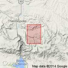
Salt Creek oil field lies in Ts38 to 41N, Rs78 and 79W, Natrona Co, WY in Wind River basin. Is assigned as a member of Benton shale. Is 300 ft thick. Consists of firm slaty shale. Forms a prominent ridge. The shale weathers white. Has a great number of fish scales. A 5 ft bentonite bed at top. Overlies and underlies unnamed dark shales of the Benton. Lies 270 ft above base of Benton. Assigned to the Late Cretaceous.
Source: GNU records (USGS DDS-6; Denver GNULEX).
- Usage in publication:
-
- Mowry shale*
- Modifications:
-
- Revised
- Areal extent
- AAPG geologic province:
-
- Bighorn basin
Summary:
Introduced as a name for some hard platy shale in the central part of the Bighorn basin where it is raised in stratigraphic rank from Mowry member of Colorado shale to Mowry shale of Colorado group. Is one of four formations of the Colorado group. History of nomenclature chart. Overlies the newly named Thermopolis shale of the Colorado group and underlies the Frontier formation of the Colorado. Is about 160 ft thick. Noted for presence of large number of fish scales. Divisible into four parts by two sandstones. Basal sandstone called Octh sand of drillers is about 25 ft thick. The younger sandstone called the Kimball sand of drillers is 50 ft thick and it lies 70 ft above base of formation. Cretaceous age.
Source: GNU records (USGS DDS-6; Denver GNULEX).

- Usage in publication:
-
- Mowry shale member*
- Modifications:
-
- Overview
- AAPG geologic province:
-
- Powder River basin
Summary:
Member of Graneros shale. Includes about 150 ft of hard, light-gray sandy shale that contains numerous fish scales in Upton-Thornton area, Crook and Weston Cos, WY in Powder River basin. Excludes an underlying unnamed member of dark sandy shale 50 ft thick that intervenes between the member and an unnamed sandstone member. Overlain by an unnamed part of Graneros shale. Late Cretaceous in age. Geologic map. Stratigraphic table.
Source: GNU records (USGS DDS-6; Denver GNULEX).
- Usage in publication:
-
- Mowry shale member*
- Modifications:
-
- Overview
- AAPG geologic province:
-
- Powder River basin
- Williston basin
- Chadron arch
Summary:
Member of the Graneros shale in the Black Hills region [in the Powder River and Williston basins and on the Chadron arch]. Gradationally overlies the Nefsy shale member; underlies the Belle Fourche shale member. Contact with Belle Fourche shale member is the top of a bentonite bed 1-4 ft thick that was traced 175 miles along its outcrop in northeastern WY and that can be recognized with reasonable certainty in SD beyond the limits of mapping. Field, chemical, and microscopic evidence indicates almost certainly the silica in the Mowry shale was in some way derived from the alteration of volcanic ash. As a probable method of this derivation, it is suggested that the original ash was unusually siliceous, that it was decomposed by long exposure to sea water, and that silica dissolved from it was precipitate by decaying organic matter. A minor amount of secondary silicification may have occurred during consolidation and weathering. The few siliceous tests of organisms found fossilized in the shale are considered merely incidental constituents of the shale. The small amounts of clay, silt, and sand in the shale may be in part more or less altered volcanic products and in part normal clastic sediments. Late Cretaceous in age.
Source: GNU records (USGS DDS-6; Denver GNULEX).
- Usage in publication:
-
- Mowry siliceous shale*
- Modifications:
-
- Redescribed
- Revised
- Overview
- Dominant lithology:
-
- Shale
- AAPG geologic province:
-
- Powder River basin
- Williston basin
Summary:
A member of the Graneros shale on the west side of the Black Hills, northeastern WY and southeastern MT in the Powder River and Williston basins. Redescribed by addition of term siliceous to name. Lower contact revised downward to top of the Newcastle sandstone member, thereby including in the basal part rocks formerly in the Nefsy shale member (abandoned). Clay Spur bentonite bed (new) at the top over entire area. Underlain by the Newcastle sandstone member; overlain by the Belle Fourche shale member. Compares a sample of shale from uppermost part with samples of shale from other Upper Cretaceous rocks in the Black Hills for their mineralogy, chemical composition, grain size, density, porosity, fissility, and bedding laminations. Late Cretaceous in age.
Source: GNU records (USGS DDS-6; Denver GNULEX).
- Usage in publication:
-
- Mowry shale*
- Modifications:
-
- Revised
- AAPG geologic province:
-
- Wind River basin
Summary:
Revised in stratigraphic rank in the Salt Creek oil field, U. S. Naval Petroleum Reserve No. 3, Natrona Co., WY in the Wind River basin from Mowry shale member of Benton shale (Wegemann, 1918, USGS Bulletin 670) to Mowry shale. Term Benton not used. Overlies Thermopolis shale; rocks assigned to Thermopolis were formerly a lower unnamed part of Benton (Wegemann, cited above). Underlies Frontier formation; rocks assigned to Frontier were formerly designated an unnamed part and Wall Creek sandstone member of Benton. Mowry: forms conspicuous scarps on outcrop; consists of about 230 ft of hard, fissile shale that weathers light gray; contains abundant fish scales; has numerous bentonite layers. One layer of bentonite rests on the top layer of the "fish scale" shale. [See description of Thermopolis for placement of "Muddy sand"] Stratigraphic chart. Columnar section. Of Late Cretaceous age.
Source: GNU records (USGS DDS-6; Denver GNULEX).
- Usage in publication:
-
- Mowry shale*
- Modifications:
-
- Revised
- Age modified
- AAPG geologic province:
-
- Powder River basin
- Chadron arch
- Williston basin
Summary:
Raised to formational rank in a chart showing representative Cretaceous sequence in northern Great Plains [Black Hills region in Powder River and Williston basins and on Chadron arch]. Overlain conformably by Belle Fourche shale; underlain conformably by Newcastle sandstone. Late Cretaceous (Cenomanian) in age.
Source: GNU records (USGS DDS-6; Denver GNULEX).
- Usage in publication:
-
- Mowry shale*
- Modifications:
-
- Overview
- AAPG geologic province:
-
- Powder River basin
- Williston basin
Summary:
Assigned an Early Cretaceous (Albian) age on north flank of Black Hills [WY and SD in Powder River and Williston basins]. Boundary between Lower and Upper Cretaceous rocks placed at top of formation. Overlain conformably by Belle Fourche shale; underlain conformably by Newcastle sandstone.
Source: GNU records (USGS DDS-6; Denver GNULEX).
- Usage in publication:
-
- Mowry shale*
- Modifications:
-
- Biostratigraphic dating
- Age modified
- AAPG geologic province:
-
- Powder River basin
Summary:
Uncrushed ammonites have been collected from Mowry shale and equivalent rocks at several localities in CO, WY, and MT. These collections show that impressions and crushed interval molds of ammonites previously assigned to the Upper Cretaceous genera METOICOCERAS, ACOMPSOCERAS, and NEOCARDIOCERAS (as KANABICERAS) belong to the Lower Cretaceous genera GASTROPLITES and NEOGASTROPLITES. [Localities mentioned include Mowry shale on west flank of Black Hills, WY in Powder River basin]. Early Cretaceous (Albian) in age.
Source: GNU records (USGS DDS-6; Denver GNULEX).
- Usage in publication:
-
- Mowry shale
- Modifications:
-
- Overview
- AAPG geologic province:
-
- Williston basin
- Powder River basin
- Chadron arch
Summary:
Made lower of two formations in Graneros shale group in Black Hills region in Williston and Powder River basins and on Chadron arch. Overlain by Belle Fourche shale; underlain by Newcastle sandstone. Late Cretaceous in age.
Source: GNU records (USGS DDS-6; Denver GNULEX).
- Usage in publication:
-
- Mowry shale*
- Modifications:
-
- Revised
- AAPG geologic province:
-
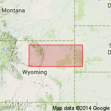
- Yellowstone province
Summary:
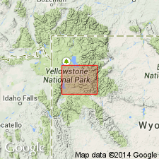
As defined in this report, Mowry includes black shale above Muddy sandstone member of Thermopolis shale and below the Frontier formation. The shale is of 635 to about 700 ft thick, black, hard, siliceous, gray-weathering, and interbedded with soft shale, bentonite, silicified tuff, and sandstone. Mowry may include, in its lower part, some [nonsiliceous] black shale equivalent to the upper part of the Thermopolis shale as the upper contact of that formation has been placed by other authors in other areas. Cross section shows the Lower Cretaceous Mowry at Lower Slide Lake and Bacon Ridge, Teton Co., WY, Yellowstone province.
Source: GNU records (USGS DDS-6; Denver GNULEX).
- Usage in publication:
-
- Mowry formation
- Modifications:
-
- Areal extent
- Overview
- AAPG geologic province:
-
- Williston basin
Summary:
Extends name into subsurface of Williston basin in ND in a series of correlation diagrams. A formation in Dakota group. Overlain by Belle Fourche formation; underlain by Newcastle formation. Early Cretaceous in age.
Source: GNU records (USGS DDS-6; Denver GNULEX).
- Usage in publication:
-
- Mowry shale*
- Modifications:
-
- Overview
- AAPG geologic province:
-
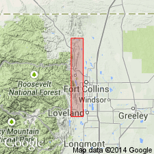
- Denver basin
Summary:
Report area is Front Range of Rocky Mountains, Denver basin. Correlation with other Cretaceous units in Powder River basin of northeast WY, Wind River basin of central WY and Denver basin, southeast WY, northeast and south-central CO shown on fig 19.
Source: GNU records (USGS DDS-6; Denver GNULEX).
- Usage in publication:
-
- Mowry shale
- Modifications:
-
- Overview
- AAPG geologic province:
-
- Chadron arch
- Powder River basin
Summary:
Lists and discusses distribution of microfaunas collected from the Thermopolis shale in the Bighorn, Wind River, and western part of Powder River basins, and from basal part of Mowry shale in outcrops in the Black Hills on the east side of the Powder River basin and on Chadron arch. Faunas collected from the upper part of Thermopolis shale [above the Muddy sandstone member] are common to the basal part of Mowry shale in a unit once distinguished separately as the Nefsy shale (Collier, 1922). Early Cretaceous in age.
Source: GNU records (USGS DDS-6; Denver GNULEX).
- Usage in publication:
-
- Mowry shale*, shale member*
- Modifications:
-
- Revised
- Overview
- Biostratigraphic dating
- AAPG geologic province:
-
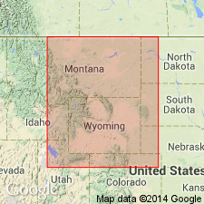
- Central Montana uplift
- Williston basin
- Sweetgrass arch
Summary:
Accepted as member of the Colorado shale in Stillwater and Fergus Cos on the Central Montana uplift, Petroleum Co in the Williston basin, and Cascade Co on the Sweetgrass arch. Accepted as a formation in Natrona Co in the Wind River basin, Park Co, Yellowstone province, and Weston and Crook Cos., Powder River basin. Is 100 ft thick in Laramie basin; 155 ft thick in northwest CO; 200 -700 ft thick in the Wind River basin (thickest in western part of basin); 160 to 450 ft thick in Bighorn basin. Is correlative with the Aspen shale of Lincoln and Uinta Cos, WY in the Greater Green River basin. Is the first marine Cretaceous deposit in area. Contains flora, freshwater invertebrates, marine invertebrates, fish remains, and reptile bones. Assigned a late Albian, Early Cretaceous age with the reservation that it may belong to the earliest Cenomanian or earliest Late Cretaceous. Contains NEOGASTROPLITES assemblages.
Source: GNU records (USGS DDS-6; Denver GNULEX).
- Usage in publication:
-
- Mowry Shale
- Modifications:
-
- Revised
- Overview
- AAPG geologic province:
-
- Williston basin
- Central Montana uplift
- Sweetgrass arch
Summary:
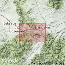
Name applied to all shale between Skull Creek and Belle Fourche Shales. Divisible into a lower Mowry and upper Mowry. Lower part called informally Dynneson unit. Dynneson includes three laterally equivalent facies: 1) lower Mowry lithofacies, a soft shale nearly 300 ft thick; 2) Dynneson Sandstone Member (named) or Dynneson lithofacies, a blanket-type sandstone that covers about 30,000 sq mi in eastern MT and western ND; 3) Bow Island Sandstone Member or Bow Island lithofacies, a silty sandstone about 140 ft thick. Isopach and lithofacies map of Dynneson unit. Lower Mowry is 300+ ft thick (maximum). Fossils (listed) in lower Mowry. Upper Mowry lithofacies consists mostly of gray siliceous shale; also has many bentonite beds. Upper Mowry ranges from less than 50 ft thick (central ND) to 400 ft thick (south-central MT). Big Elk Sandstone Member, a gray to brown, fine- to medium-grained, subangular to subround, poorly sorted, silty to clayey sandstone assigned as upper member in central MT and in Livingston area. In central MT, a ridge-forming sandstone identified below Big Elk is called Boulder River Sandstone Member. Fossils in upper Mowry (listed): fish scales, ammonites, etc. Cross sections. Isopach map. Of late Albian, Early Cretaceous age.
Source: GNU records (USGS DDS-6; Denver GNULEX).
- Usage in publication:
-
- Mowry Shale
- Modifications:
-
- Areal extent
- AAPG geologic province:
-
- Denver basin
Summary:
Name applied to the Lower Cretaceous dark-gray siliceous shale and siltstone above the Dakota Group and below Graneros Shale in area between Loveland and Boxelder Creek (sec 9, T10N, R69W), Larimer Co, CO, Denver basin. These rocks were assigned formerly to lower part of the Benton Group by Waage (1955, 1961) and are equivalent to what Waage (1953) assigned to the Graneros in south central CO. Correlation chart.
Source: GNU records (USGS DDS-6; Denver GNULEX).
- Usage in publication:
-
- Mowry shale*
- Modifications:
-
- Revised
- AAPG geologic province:
-
- Montana folded belt
Summary:
Thermopolis Shale as mapped in report area, Park Co., MT in the Montana folded belt province is divisible into two members (not shown separately on the geologic map). The lower or shale member about 280 ft thick is dark gray or black, fissile or platy, interbedded with thin-bedded fine-grained, rusty-weathered sandstone or siltstone. The shale and the siltstone have worm trails and carbonaceous flecks. The basal contact with the Cloverly is a topographic break and a lithologic (from sandstone to shale) break. The Muddy is divisible into a lower sandstone 27 ft thick, a 34 ft thick shale, and an upper gray medium grained, locally fine grained, locally coarse grained, conglomerate near top 21 ft thick sandstone. Most of Muddy has salt-and-pepper appearance. Upper contact of Thermopolis is controversial. Some places the soft black shales above the Muddy in the Thermopolis rather than with the overlying siliceous Mowry Shale. However, in many parts of WY and in the Gardiner area, the only mappable contact is the top of the Muddy. Of Early Cretaceous age. Measured section on Cinnabar Mountain, lower member is 280 ft thick, Muddy is 115 ft thick; Thermopolis overlies upper sandstone member of Cloverly [term rusty beds not used] and underlies Mowry shale; upper contact is a 324 ft thick covered interval.
Source: GNU records (USGS DDS-6; Denver GNULEX).
- Usage in publication:
-
- Mowry Shale*
- Modifications:
-
- Overview
- AAPG geologic province:
-
- Denver basin
- Green River basin
Summary:
Thermopolis and Mowry Shales mapped as a single unit in the southeast part of the Shirley basin, western Albany Co (Denver basin) and eastern Carbon Co (Greater Green River basin), WY. Basal Thermopolis lies conformably above the Cloverly Formation. The upper Mowry underlies the Frontier Formation. Rocks of the Thermopolis consist of: 1.) basal gray to black carbonaceous shale about 60 ft thick of marine origin, 2.) the Muddy Sandstone Member about 14 ft thick, 3.) a brown-gray, thin bedded, fine grained, silty sandstone interbedded with thin bedded siltstone and shale 50 ft thick, that has a 2 ft thick lignite bed at top, and 4.) a 60 ft thick interval of sandy siltstone and shale interbedded with "typical" Mowry siliceous shale. Unit 4 is arbitrarily considered to be upper Thermopolis. Unit 3 is poorly indurated and makes poor outcrops; it is of paladal origin. Some of the buff to gray thin-bedded sandstone beds of the Muddy are ripple marked. The 110 ft of gray dense or siliceous, laminated shale with fish scales and interbedded 2-3 ft thick bentonite beds are the Mowry, this sequence very resistant to erosion forms long narrow ridges. Stratigraphic chart. Cretaceous age.
Source: GNU records (USGS DDS-6; Denver GNULEX).
- Usage in publication:
-
- Mowry Shale*
- Modifications:
-
- Revised
- AAPG geologic province:
-
- Bighorn basin
Summary:
Revised usage in that Mowry overlies Muddy Sandstone Member of Thermopolis Shale. Includes a lower part of very dark gray claystone and an upper part of dark gray, light gray-weathering fissile claystone with abundant fish scales. [Lower part of Mowry of this report was included in the Thermopolis Shale by some and in the Shell Creek Shale by others.] Upper part forms more resistant, steeper slopes than does the lower part. About 300 ft exposed. Early Cretaceous age. Mapped in north-central part of quad which is southeast of town of Thermopolis, Hot Springs Co., WY in the Bighorn basin.
Source: GNU records (USGS DDS-6; Denver GNULEX).
- Usage in publication:
-
- Mowry Shale*
- Modifications:
-
- Reference
- Dominant lithology:
-
- Shale
- Sandstone
- Siltstone
- Claystone
- Bentonite
- AAPG geologic province:
-
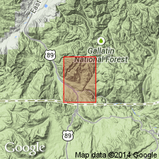
- Montana folded belt
Summary:
Reference section designated on north side, Rocky Creek Canyon SW1/4 sec 20, T2S, R7E, Gallatin Co, MT, Montana folded belt province where 497 ft of Mowry lie between Thermopolis Shale (below) and Frontier Formation (above). Extends eastward into Central Montana uplift and Powder River basin. Composed of: 1) brown-gray, tuffaceous, arenaceous shale; 2) olive-gray to light-gray sandstone that ranges from thin to thick bedded, very fine grained to coarse grained, and that may be calcareous or friable; 3) gray thin-bedded calcareous, indurated, carbonaceous siltstone; 4) brown-gray tuffaceous shale; 5) olive-gray to brown-black, arenaceous, tuffaceous claystone; and 6) bentonite at reference section. Of late Albian, Early Cretaceous age. Fossil lists. Correlation chart. Geologic map.
Source: GNU records (USGS DDS-6; Denver GNULEX).

- Usage in publication:
-
- Mowry Formation*
- Modifications:
-
- Geochronologic dating
- AAPG geologic province:
-
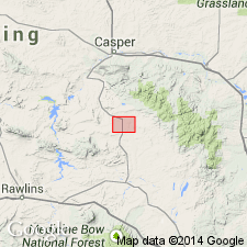
- Wind River basin
Summary:
Pg. 30, geologic time scale (inside front cover). Mowry Formation. Two samples from bentonite bed, in Emigrant Gap, approx. Lat. 42 deg. 43 min. N., Long. 106 deg. 28 min. W., Freeland quadrangle, Natrona County, Wyoming, yielded Pb-alpha ages of 140 +/-20 Ma and 130 +/-20 Ma (zircon); ages too old, possibly due to presence of detrital zircon. Ages calculated using decay constants of Steiger and Jager, 1977 (Earth Planet. Sci. Letters, v. 36, p. 359-362). K-Ar ages (biotite and sanidine) average 96 to 90 Ma (Folinsbee and others, 1963, GSA Spec. Paper 73, p. 84) [Cretaceous].
Source: Publication.
- Usage in publication:
-
- Mowry Member*
- Modifications:
-
- Mapped 1:24k (Moffat Co, CO)
- Dominant lithology:
-
- Shale
- Bentonite
- AAPG geologic province:
-
- Green River basin
Summary:
Is Lower Cretaceous member of Mancos Shale (Lower and Upper Cretaceous) mapped in southwest Moffat Co, CO (Greater Green River basin). Overlies Dakota Sandstone (Lower Cretaceous); underlies Frontier Sandstone Member (Upper Cretaceous) of the Mancos. Map unit described as distinctive soft silver-gray or bluish-gray fissile siliceous shale and bentonite. Contains abundant fish scales. Covered in most places by debris from the overlying Frontier Sandstone Member, but the presence of the Mowry is indicated by chips of silver-gray shale in the soil. At least 15 m (50 ft) thick north of Buckwater Ridge.
Source: GNU records (USGS DDS-6; Denver GNULEX).
- Usage in publication:
-
- Mowry Shale Member*
- Modifications:
-
- Mapped 1:24k (Garfield Co, CO)
- Dominant lithology:
-
- Shale
- AAPG geologic province:
-
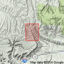
- Piceance basin
Summary:
Mapped as lowermost member of Mancos Shale. Outcrops in northeast part of quad, Garfield Co, CO, Piceance basin. Consists of gray to black thinly bedded, siliceous, fissile marine shale; about 200 ft thick. Conformably overlies Dakota Sandstone; conformably underlies Frontier Sandstone Member of Mancos. Assigned Early Cretaceous age.
Source: GNU records (USGS DDS-6; Denver GNULEX).
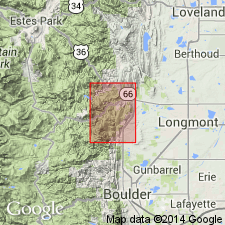
- Usage in publication:
-
- Mowry Shale*
- Modifications:
-
- Areal extent
- AAPG geologic province:
-
- Denver basin
Summary:
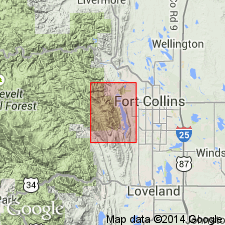
Is mapped with Carlile Shale, Greehorn Limestone, and Graneros Shale, undivided, because it cannot be separately mapped due to poor exposure. Is extended into the LaPorte quadrangle, Larimer Co, CO in the Denver basin. Thickness is reported to be about 20 ft. Is assigned to the Lower Cretaceous. Overlies the South Platte Formation of Dakota Group; underlies Graneros Shale.
Source: GNU records (USGS DDS-6; Denver GNULEX).
- Usage in publication:
-
- Mowry Shale*
- Modifications:
-
- Areal extent
- AAPG geologic province:
-
- Denver basin
Summary:
Is mapped with Carlile Shale, Greehorn Limestone, and Graneros Shale, undivided, because it cannot be separately mapped due to poor exposure. Is extended into the Lyons quadrangle, Boulder Co, CO in the Denver basin. Thickness is reported to be about 10 ft. Is assigned to the Lower Cretaceous. Overlies the South Platte Formation of Dakota Group; underlies Graneros Shale.
Source: GNU records (USGS DDS-6; Denver GNULEX).
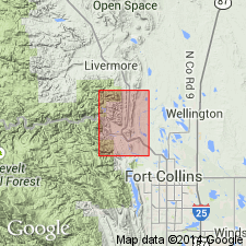
- Usage in publication:
-
- Mowry Shale*
- Modifications:
-
- Areal extent
- AAPG geologic province:
-
- Denver basin
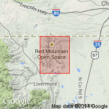
Summary:
Is mapped with Carlile Shale, Greenhorn Limestone, and Graneros Shale, undivided, because it cannot be separately mapped due to poor exposure. Is extended into the Livermore quadrangle, Larimer Co, CO in the Denver basin. Thickness is reported to be about 45 ft. Is assigned to the Lower Cretaceous. Overlies South Platte Formation of Dakota Group underlies Graneros Shale.
Source: GNU records (USGS DDS-6; Denver GNULEX).
- Usage in publication:
-
- Mowry Shale*
- Modifications:
-
- Areal extent
- AAPG geologic province:
-
- Denver basin
Summary:
Is mapped with Carlile Shale, Greenhorn Limestone, and Graneros Shale, undivided, because it cannot be separately mapped due to poor exposure. Is extended into the Carter Lake Reservoir quadrangle, Boulder and Larimer Cos, CO in the Denver basin. Thickness is reported to be as much as 10 ft. Is assigned to the Lower Cretaceous. Overlies the South Platte Formation of Dakota Group; underlies Graneros Shale.
Source: GNU records (USGS DDS-6; Denver GNULEX).

- Usage in publication:
-
- Mowry Shale, Formation
- Modifications:
-
- Revised
- AAPG geologic province:
-
- Montana folded belt
Summary:
First published use of Albino Member, basal member of Mowry Shale or Mowry Formation. Term Albino was used informally in two theses--as "Albino Formation" (Hall, 1961) and as "Albino Member of Mowry Formation" (Wilson, 1970). Albino overlies Albian Muddy Sandstone and underlies upper part of Mowry. Eight fossil fern flora found in Albino; 7 new species described. Two species of spores identified in Albino. Of Albian, Early Cretaceous age. Stratigraphic chart.
Source: GNU records (USGS DDS-6; Denver GNULEX).
- Usage in publication:
-
- Mowry Shale*
- Modifications:
-
- Geochronologic dating
- AAPG geologic province:
-
- Yellowstone province
Summary:
A K-Ar age of 99.7 +/-1.0 m.y. obtained from a biotite-rich tuff 37 ft above base in Teton Co, WY in report area in the Yellowstone province. Age is Early Cretaceous.
Source: GNU records (USGS DDS-6; Denver GNULEX).
- Usage in publication:
-
- Mowry Shale*
- Modifications:
-
- Biostratigraphic dating
- Age modified
- AAPG geologic province:
-
- Denver basin
Summary:
Earliest Cenomanian palynomorph suites typified by NYSSAPOLLENITES ALBERTENSIS and small angiospermous obligate tetrads, occur in beds of both Mowry that immediately overlies Muddy Sandstone in central CO, Denver basin and in Encinal Canyon Member of Muddy in plateau region (R. H. Tschudy, 1985, oral commun.; D. J. Nichols and F. H. Wingate, 1988, written commun.). Foraminifera reported by other workers indicate a latest Albian to early Cenomanian age for Mowry. Correlation chart shows Mowry as early Cenomanian (Late Cretaceous) age.
Source: GNU records (USGS DDS-6; Denver GNULEX).
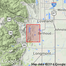
- Usage in publication:
-
- Mowry Shale*
- Modifications:
-
- Areal extent
- AAPG geologic province:
-
- Denver basin
Summary:
Is mapped with Carlile Shale, Greenhorn Limestone, and Graneros Shale, undivided, because it cannot be separately mapped due to poor exposure. Is extended into the Horsetooth Reservoir quadrangle, Larimer Co, CO in the Denver basin. Thickness is reported to be about 10 ft. Is assigned to the Lower Cretaceous. Overlies the South Platte Formation of Dakota Group; underlies Graneros Shale.
Source: GNU records (USGS DDS-6; Denver GNULEX).
- Usage in publication:
-
- Mowry Shale*, Member*
- Modifications:
-
- Age modified
- Biostratigraphic dating
- AAPG geologic province:
-
- Many basins
Summary:
Age modified [from Early Cretaceous (Albian) to Late Cretaceous (early Cenomanian)] on basis of biostratigraphic dating. Pseudoceratitic ammonites identified from the Mowry Shale in Park, Crook, Hot Springs, and Natrona Cos, WY and from the Mowry Member of the Colorado Shale in Cascade, Fergus, Petroleum, and Meagher Cos, MT, are believed to be of early Cenomanian age.
Denver GNU: "...Present investigation revises the NEOGASTROPLITES zonation of Reeside and Cobban (1960): first, by suggesting that the zones of N. MUELLERI and N. AMERICANUS should be reversed in their order [Note: the original stratigraphic order of Reeside and Cobban (1960) has been found to be correct according to discussion with Cobban this date (12/16/93)];…"
NO. Pretty obvious authors merely SUGGEST reversing order of muelleri and americanus zones. They note a few dissimilarities Metengonoceras teigenense, n. sp. and M. aspenanum have with other species in same zones (p. 19)
"...and second, by considering that the zones (descending) of N. MACLEARNI, N. MUELLERI, and N. AMERICANUS are early Cenomanian, and that the zone of N. CORNUTUS may well be early Cenomanian age."
YES.
Source: GNU records (USGS DDS-6; Denver GNULEX).
- Usage in publication:
-
- Mowry Shale*
- Modifications:
-
- Areal extent
- AAPG geologic province:
-
- Denver basin
Summary:
Is mapped with Carlile Shale, Greenhorn Limestone, and Graneros Shale, undivided, because it cannot be separately mapped due to poor exposure. Is extended into the Table Mountain quadrangle and adjacent parts of the Round Butte and Buckeye quadrangles, Larimer Co, CO in the Denver basin. Thickness is reported to be about 45 ft. Is assigned to the Lower Cretaceous. Overlies the South Platte Formation of the Dakota Group; underlies the Graneros Shale.
Source: GNU records (USGS DDS-6; Denver GNULEX).
- Usage in publication:
-
- Mowry Shale*
- Modifications:
-
- Overview
- AAPG geologic province:
-
- Montana folded belt
Summary:
Name used east of the Ruby River, Beaverhead and Madison Cos, MT in the Montana folded belt province. The lower pastel-colored bentonitic strata assigned to the Vaughn Member which can be as much as 269 ft thick. The upper part is present only in the Madison Range, though it may have been deposited farther west and subsequently eroded. The top of the Mowry in the Madison Range was chosen at the base of some cherty sandstone beds about 50 ft thick that are placed in the overlying Frontier Formation. Fish fragments and pelecypod fossils identified. Strata assigned to the Mowry in this report were called Aspen? Formation, Frontier Formation, part of Muddy Sandstone, Colorado Formation, Colorado Group, Mesaverde Formation, undivided unit of the Colorado and Montana Groups, or just undifferentiated. Of Albian, Early Cretaceous age. Columnar section.
Source: GNU records (USGS DDS-6; Denver GNULEX).
- Usage in publication:
-
- Mowry Shale*
- Modifications:
-
- Revised
- Areal extent
- AAPG geologic province:
-
- Montana folded belt
Summary:
Mowry Shale recognized in southwest MT in the Greenhorn, Madison, Gallatin, and Gravelly Ranges, Beartooth and Centennial Mountains, Montana folded belt province. These ranges are the west limit of the use of the term Mowry. The axis of the Ruby River valley which separates the Snowcrest Range from the Greenhorn and Gravelly Ranges is the arbitrary location of nomenclature change. The Mowry equivalent west and north of these ranges is the Vaughn and Bootlegger Members of the Blackleaf Formation. Mowry is divided into a lower or Vaughn Member and an overlying upper part. The Vaughn is a floodplain and marsh deposit composed of a predominantly nonresistant bentonitic pastel (gray, green, pink, orange, brown) mudstone with some tuff, volcaniclastic sandstone and siltstone, and porcellanitic mudstone, 82 m thick at its principal reference section (designated in this report). Vaughn is overlain by the upper part of the Mowry, a dark-gray mudstone and siltstone 84 m thick at the principal reference section of the Vaughn. Upper part of Mowry is marine and marginal marine--marsh, stream channel, overbank deposit. Assigned an Albian, Early Cretaceous age. Nomenclature chart.
Source: GNU records (USGS DDS-6; Denver GNULEX).
- Usage in publication:
-
- Mowry Shale*
- Modifications:
-
- Revised
- AAPG geologic province:
-
- Uinta basin
- Green River basin
- Uinta uplift
Summary:
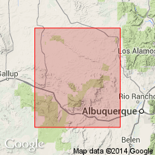
Raised in rank from Mowry Member of Mancos Shale to Mowry Shale of Mancos Group along the south side of Uinta Mountains from Current Creek, NE1/4 sec 36, T1S, R11W, Wasatch Co, UT in the Uinta basin to Vermilion Creek, T10N, R101W, Moffat Co, CO in the Greater Green River basin. Albian age assignment of Mowry based on use of ammonite fossils [rather than palynomorphs]. --NO.
Pg. 9. Authors state "...The Mowry Shale of early Cenomanian age sharply but conformably overlies the Dakota Sandstone. The Mowry formerly was considered late Albian (Early Cretaceous) in age on the basis of Neogastroplites fauna; however, Cobban and Kennedy (1989) now consider that Neogastroplites americanus, which occurs in the middle of the Mowry Shale in the report area (plate 1, A-A', D-D'), and possibly N. cornutus, which occurs in the lower part of the Mowry (plate 1, D-D '), are probably early Cenomanian in age. In addition, Eicher (1965) reported calcareous planktonic foraminifers from the upper 26 ft (8 m) of the Mowry Shale along the Front Range in northern Colorado that also indicate a Cenomainan age for at least part of the Mowry. Hence, the Mowry Shale in this report is considered early Cenomanian in age. Regardless of where the Albian-Cenomanian boundary lies, the absolute age at the top of the Mowry is about 96 Ma inasmuch as the radiometric ages assigned to the Mowry are from bentonite beds in the Mowry (Obradovich and Cobban, 1975). "
As the basal formation of the Mancos Group, Mowry rests on Dakota Sandstone. Mowry lies unconformably beneath the unnamed shale unit of the Mancos Group on the south side of the Uintas. Where the shale unit has pinched out, Mowry lies beneath the basal sandstone of the Frontier on south side of western Uintas, or where the basal sandstone is missing, it underlies the Tununk Shale Member of (new affiliation) the Frontier Formation of the Mancos Group. The unconformity at the Mowry-Frontier contact represents a hiatus of as much as 7 Ma or the span from late Albian to late middle Turonian time. --NO.
Pg. 17. Authors state "...The unconformity at the contact of the Frontier Formation and the Mowry Shale represents a hiatus of as much as 6-7 m.y. (early Cenomanian to late middle Turonian.)…"
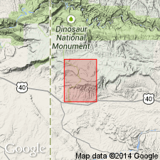
Mowry on north side of Uintas in UT on the Uinta uplift overlies the Dakota and underlies the Frontier, and is retained as of formation rank, but not as part of Mancos Group. Mowry is 285 ft thick at Bridger Lake on north side of Uintas, 80-90 ft thick near UT-CO boundary southeast of Vernal. Farther south on Douglas Creek arch, it thins to 0 by depositional thinning and by gradation into the Dakota. Cross sections.
Source: GNU records (USGS DDS-6; Denver GNULEX).

- Usage in publication:
-
- Mowry Shale*
- Modifications:
-
- Areal extent
- AAPG geologic province:
-
- Powder River basin
Summary:
Identified throughout the subsurface of the Powder River basin in MT and WY where it overlies Muddy Sandstone and underlies Frontier Formation on west side of basin and Belle Fourche Shale on the east side of basin. Clay Spur Bentonite Beds is the top bed in the Mowry throughout the extent of the Mowry. Of Late Cretaceous age. [This nomenclature shown on 22 cross sections in this OC series.]
Source: GNU records (USGS DDS-6; Denver GNULEX).
- Usage in publication:
-
- Mowry Shale*
- Modifications:
-
- Geochronologic dating
- AAPG geologic province:
-
- Wind River basin
Summary:
The Clay Spur Bentonite Bed at the top of the Mowry Shale (Upper Cretaceous) was sampled about 12.9 km west of Casper, Natrona Co, WY (Wind River basin). The 40Ar/39Ar laser fusion approach using sanidine from bentonite yields an age of 97.17 +/-0.69 Ma for the Clay Spur and thus for the top of the Mowry as well. The Albian-Cenomanian boundary is assigned an age 98.5 +/-0.5 Ma and the Cenomanian-Turonian boundary is assigned an age of 93.3 +/-0.2 Ma.
Source: GNU records (USGS DDS-6; Denver GNULEX).
For more information, please contact Nancy Stamm, Geologic Names Committee Secretary.
Asterisk (*) indicates published by U.S. Geological Survey authors.
"No current usage" (†) implies that a name has been abandoned or has fallen into disuse. Former usage and, if known, replacement name given in parentheses ( ).
Slash (/) indicates name conflicts with nomenclatural guidelines (CSN, 1933; ACSN, 1961, 1970; NACSN, 1983, 2005, 2021). May be explained within brackets ([ ]).