The National Geologic Map Database is migrating to a new infrastructure. We apologize for any service disruptions during this process.
|
|---|


- Usage in publication:
-
- Dark Ridge Member*
- Modifications:
-
- Original reference
- Dominant lithology:
-
- Sandstone
- Shale
- AAPG geologic province:
-
- Appalachian basin
Summary:
B30-B38. Dark Ridge Member of Lee Formation. Name applied to a section of thin-bedded sandstone and shale, previously referred to as sandstone and shale member B (Englund and others, 1963). At type locality, consists of 60 feet of medium-dark-gray shale with a few thin beds of very fine to fine-grained sandstone and includes Cumberland Gap coal bed at top. An argillaceous very fine grained partly ripple-bedded sandstone in upper part of member thickens northeastward to about 100 feet in vicinity of White Rocks, where it overlies 40 feet of medium-dark-gray shale in lower part of member. There basal contact with underlying White Rocks Sandstone is gradational; where the White Rocks wedges out, the base is gradational with Chadwell Member (new). Underlies Middlesboro Member (new). Age is Pennsylvanian.
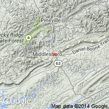
Type locality [section]: on Skyland Road, near south end of Dark Ridge on north side of Cumberland Gap, where member occupies poorly exposed interval between massive sandstones of underlying and overlying members. Named from Dark Ridge, a northward-trending ridge on north side of Cumberland Gap, Bell Co., southeastern KY, and Lee Co., southwestern VA.
Source: US geologic names lexicon (USGS Bull. 1350, p. 193); supplemental information from GNU records (USGS DDS-6; Reston GNULEX).
- Usage in publication:
-
- Dark Ridge Member*
- Modifications:
-
- Age modified
- Biostratigraphic dating
- AAPG geologic province:
-
- Appalachian basin
Summary:
Pocahontas Formation thins southwestward and may be partly equivalent to Dark Ridge Member of Lee Formation in southwestern VA. Pocahontas contains Lower Pennsylvanian flora, including NEUROPTERIS POCAHONTAS from two locations in Russell Co. Correlative relationship shown in fig. 2 of report.
Source: GNU records (USGS DDS-6; Reston GNULEX).
- Usage in publication:
-
- Dark Ridge Member*
- Modifications:
-
- Age modified
- AAPG geologic province:
-
- Appalachian basin
Summary:
Age refined to Early Pennsylvanian as shown on columnar section.
Source: GNU records (USGS DDS-6; Reston GNULEX).

- Usage in publication:
-
- Dark Ridge Member
- Modifications:
-
- Revised
- AAPG geologic province:
-
- Appalachian basin
Summary:
Breathitt Formation is informally elevated to group rank and subdivided into the following eight informal formations: Pocahontas, Bottom Creek, Alvy Creek, Grundy, Pikeville, Hyden, Four Corners, and Princess formations. Dark Ridge Member is removed from the Lee Formation and reassigned to the Bottom Creek formation. Unit occurs between the underlying Warren Point Sandstone Member and the overlying Sewanee Sandstone Member of the Lee Formation, which are equivalent to the Middlesboro Member of the Lee in the Cumberland Thrust Sheet and the lower part of the New River Formation in WV. Dark Ridge contains the Cumberland Gap coal bed and several thin, unnamed coals. [Revisions made in this paper are strongly contested by C. Rice and other USGS scientists who work in this area (oral commun., 9/3/93).]
Source: GNU records (USGS DDS-6; Reston GNULEX).

- Usage in publication:
-
- Dark Ridge Member
- Modifications:
-
- Revised
- AAPG geologic province:
-
- Appalachian basin
Summary:
The Dark Ridge Member is herein formally removed from the Lee Formation and placed in the Breathitt Group, as a member of the informal Bottom Creek formation. Breathitt is formally raised to Group rank in this report and the Lee Formation is dropped from usage. The Bottom Creek occurs mainly in WV and VA and is represented in eastern KY only by the Dark Ridge Member, which separates the Warren Point Sandstone from the overlying Sewanee Sandstone. Breathitt is now subdivided into ten formal formations and two informal formations. According to the author, formal nomenclature presented in this report for units occurring in KY has been accepted by the Kentucky Stratigraphic Nomenclature Committee. Units that occur largely outside KY are considered informal. Report includes correlation charts, cross sections, and measured sections.
Source: GNU records (USGS DDS-6; Reston GNULEX).
- Usage in publication:
-
- Dark Ridge Member*
- Modifications:
-
- Revised
- AAPG geologic province:
-
- Appalachian basin
Summary:
In pilot bore section, rocks identified as Dark Ridge Member of Lee Formation by Vanover and others (1989, Itinerary, Day 2-Pilot bore traverse, IN Dean, C.S., and Moshier, S.O., eds., Cumberland Mountain: the inside story: Geological Survey of Kentucky Field Trip Guidebook, p. 24-30) and by Vanover (1989, Pilot tunnel stratigraphy, IN Dean, C.S., and Moshier, S.O., eds., Cumberland Mountain: the inside story: Geological Survey of Kentucky Field Trip Guidebook, p. 39-43) are here reidentified as upper part of upper member of Pennington Formation. Approximately equivalent to Pride Shale Member of Bluestone Formation; a fossil bed is common to both units.
Source: GNU records (USGS DDS-6; Reston GNULEX).

- Usage in publication:
-
- Dark Ridge Member
- Modifications:
-
- Areal extent
- AAPG geologic province:
-
- Appalachian basin
Summary:
Dark Ridge Member of Lee Formation crops out from Cumberland Gap northeastward to Big Stone Gap where it interfingers with the Pocahontas Formation. Member is about 60 ft thick at its type locality and reaches 300 ft along Cumberland Mountain. Consists of medium-dark-gray shale and siltstone with a few thin beds of very fine grained sandstone and includes the Cumberland Gap coal bed at the top. The coal is 36 to 48 in. thick. Lower contact with the Late Mississippian White Rocks Sandstone Member or with the Chadwell Member is gradational. Upper contact with the Middlesboro Member is unconformable. Age is Early Pennsylvanian (Morrowan).
Source: GNU records (USGS DDS-6; Reston GNULEX).

- Usage in publication:
-
- Dark Ridge Member*
- Modifications:
-
- Areal extent
- AAPG geologic province:
-
- Appalachian basin
Summary:
Dark Ridge Member of Lee Formation. [Thin-bedded sandstone and shale up to 300 feet thick], in lower part of Lee Formation below Middlesboro Member, and above Chadwell or White Rocks Member. Includes Cumberland Gap coal bed. Age is Mississippian. [In footnote 30, authors state the Chadwell was placed in Mississippian by Englund, 1964 (Englund considered the Chadwell to be Mississippian and Pennsylvanian, see fig. 1), but is here considered Pennsylvanian based on fossils (miospores; oral commun., C.F. Eble, Kentucky Geological Survey, 1993, 1994).]
Recognized in Upper Cumberland River district, southeastern KY.
[See also Rice and others, 1994, GSA Spec. Paper 294, p. 124.]
Source: Publication.

- Usage in publication:
-
- Dark Ridge Member
- Modifications:
-
- Areal extent
- AAPG geologic province:
-
- Appalachian basin
Summary:
Corr. chart. Dark Ridge Member of Lee Formation (VA); Dark Ridge Member of Bottom Creek Formation (informal) of Breathitt Group (KY). Sandstone, siltstone, shale, and/or mudstone. Age is Early Pennsylvanian (late Namurian to Westphalian; Morrowan).
In southwestern Virginia is basal member of Lee Formation. Maximum thickness 300 feet. Includes (ascending) Squire Jim, C, and Pocahontas No. 1 through No. 5 coal beds. Underlies Middlesboro Member of Lee Formation. Interbedded with Pocahontas Formation. Age is Early Pennsylvanian (late Namurian to Westphalian; Morrowan). [Peppers (1996, GSA Memoir 188, pl.) placed the Pocahontas No. 2 coal in Namurian B, CRASSISPORA KOSANKEI-GRUMOSISPORITES VARIORETICULATUS (KV) miospore assemblage zone of western Europe; the overlying Pocahontas No. 7 coal marks the base of Namurian C.]
In eastern and southeastern Kentucky, the Dark Ridge makes up entire Bottom Creek Formation. Underlies Sewanee Sandstone and overlies White Rocks Sandstone Member of Warren Point Sandstone; all of Breathitt Group. Includes Cumberland Gap coal bed in [Upper Cumberland River district] southeastern Kentucky. Age is Early Pennsylvanian (Westphalian; Morrowan). [Is younger than the Dark Ridge of southwestern Virginia. Base of member in Kentucky = Pocahontas No. 8 coal bed at base of New River Formation in southwestern Virginia and West Virginia. Eble and others (2009, Kentucky Geol. Survey, Spec. Pub. no. 10, ser. XII, figs. 5.1, 5.2, 5.3) placed the Pocahontas No. 8 coal in lower part of Langsettian (lower part of Westphalian A), TRIQUITRITES SINANI-CIRRATRIRADITES SATURNI (SS) miospore assemblage zone of western Europe. Peppers (1996, GSA Memoir 188, pl.) placed this bed in underlying Namurian C, RAISTRICKIA FULVA-RETICULATISPORITES RETICULATUS (FR) miospore assemblage zone of western Europe.]
[See also geologic descriptions of stratigraphic units in the Kentucky Geological Survey database (http://kgs.uky.edu/kgsmap/KGSLitho/lithoSearch.asp#).]
Source: Publication.
For more information, please contact Nancy Stamm, Geologic Names Committee Secretary.
Asterisk (*) indicates published by U.S. Geological Survey authors.
"No current usage" (†) implies that a name has been abandoned or has fallen into disuse. Former usage and, if known, replacement name given in parentheses ( ).
Slash (/) indicates name conflicts with nomenclatural guidelines (CSN, 1933; ACSN, 1961, 1970; NACSN, 1983, 2005, 2021). May be explained within brackets ([ ]).