- Usage in publication:
-
- Madison limestone*
- Modifications:
-
- Original reference
- Dominant lithology:
-
- Limestone
- AAPG geologic province:
-
- Montana folded belt
Summary:
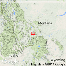
Madison limestone. Consists of (descending): massive jaspery limestones, 575 feet; light bluish gray massive limestones, 350 feet; dark-colored compact laminated limestones, 325 feet. Fossils listed. Rests on Devonian Threeforks [Three Forks] shale and is overlain by Quadrant formation. Age is Early Mississippian. Recognized in Montana, Wyoming, Idaho, and northern Utah.
Named from Madison Range, central part of Threeforks [Three Forks] quadrangle, MT, where it is conspicuously developed.
Source: US geologic names lexicon (USGS Bull. 896, p. 1264).
- Usage in publication:
-
- Madison limestone*
- Modifications:
-
- Revised
- AAPG geologic province:
-
- Sweetgrass arch
Summary:
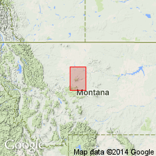
Madison limestone subdivided into (ascending) Paine shale, Woodhurst limestone, and Castle limestone. Overlies Monarch formation; underlies Quadrant formation. Thickness 1,300 feet. Age is Carboniferous.
Source: US geologic names lexicon (USGS Bull. 1200, p. 2317-2321).
- Usage in publication:
-
- Madison group*
- Modifications:
-
- Revised
- AAPG geologic province:
-
- Williston basin
Summary:
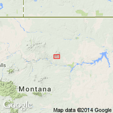
Madison group. In this part of Montana (Little Rocky Mountain region) the Madison limestone becomes a group, divisible into two distinct formations, here named Lodgepole limestone (the lower one) and Mission Canyon limestone (the upper one). Unconformably underlies Ellis formation; overlies Jefferson limestone. Age is Mississippian.
Source: US geologic names lexicon (USGS Bull. 896, Lodgepole entry p. 1206); supplemental information from GNU records (USGS DDS-6; Denver GNULEX).
- Usage in publication:
-
- Madison formation
- Modifications:
-
- Revised
- AAPG geologic province:
-
- Montana folded belt
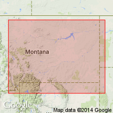
Summary:
Pg. 45-48. Madison formation. In northwestern Montana subdivided into (ascending) Silvertip conglomerate, Saypo limestone, Dean Lake chert, Rooney chert, and Monitor Mountain limestone members (all new). Thickness 420 to 841 feet. Unconformably overlies Jefferson limestones. Age is Early Mississippian (probably Kinderhook and Osage) age based on typical Madison fauna.
Notable exposures on Lone Butte, Spotted Bear Mountain, and Pentagon Mountain in Flathead Co., and on Monitor Mountain in Lewis and Clark Co., MT.
[Misprint (USGS Bull. 1200, p. 2317): omission of Rooney chert member of Madison; lies above Dean Lake and below Monitor.]
Source: US geologic names lexicon (USGS Bull. 1200, p. 2317-2321); supplemental information from GNU records (USGS DDS-6; Denver GNULEX).
- Usage in publication:
-
- Madison group
- Modifications:
-
- Principal reference
- AAPG geologic province:
-
- Williston basin
- Powder River basin
- Central Montana uplift
- Montana folded belt
- Sweetgrass arch
- Yellowstone province
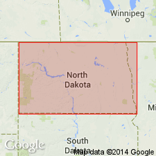
Summary:
Madison group. In Montana comprises (ascending) Lodgepole limestone with Paine and Woodhurst members and Mission Canyon limestone. Overlies Three Forks formation; underlies Kibbey sandstone, Ellis formation, or Amsden formation. Age is Early Mississippian. Type section suggested.
Type section: along Gallatin River at Logan, MT.
Source: US geologic names lexicon (USGS Bull. 1200, p. 2317-2321).
- Usage in publication:
-
- Madison group
- Modifications:
-
- Revised
- AAPG geologic province:
-
- Williston basin
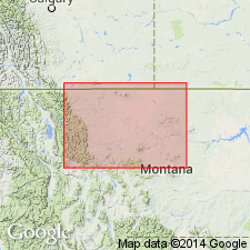
Summary:
Madison group. In subsurface of North Dakota, consists of (ascending): (1) Lodgepole limestone, limestone, shaly limestone, and shale, 0 to 880 feet, age probably Kinderhook and Osage; (2) Mission Canyon limestone, limestone, 0 to 530 feet, age probably Osage and Meramec, oil-producing; and (3) Charles formation, dolomite, limestone, varicolored shale, and anhydrite, 0 to 890 feet, age is Meramec and Chester, oil-producing. Underlies Kibbey formation of Big Snowy group; overlies Englewood formation (="Bakken formation" of AAPG Williston Basin Committee). Age is Mississippian.
Source: Publication.
- Usage in publication:
-
- Madison group
- Modifications:
-
- Revised
- AAPG geologic province:
-
- Sweetgrass arch
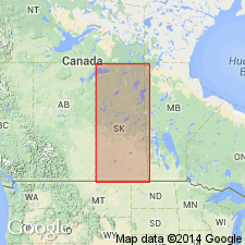
Summary:
Pg. 78, 79. Madison group. As used in this report [Sweetgrass arch area], comprises (ascending) Exshaw-Bakken formation, Lodgepole formation, Mission Canyon formation, and Sun River dolomite (new). Sun River is considered equivalent to Charles formation. Age is Mississippian (Kinderhook-Osage).
Source: US geologic names lexicon (USGS Bull. 1200, p. 2317-2321); supplemental information from GNU records (USGS DDS-6; Denver GNULEX).
- Usage in publication:
-
- Madison limestone
- Modifications:
-
- Revised
- AAPG geologic province:
-
- Williston basin
Summary:
Pg. 15 (fig. 2), 26-36. Along northeastern rim of Williston basin, southeastern and south-central Sasketchewan, southwestern Manitoba, and north-central North Dakota, Mississippian rocks in the subsurface (Madison group) are divided into (descending) "Charles" evaporites, Madison limestone, and Bakken formation. The Madison limestone is divided into upper and lower parts.
Upper part includes "clastic" marker beds, descending:
Ratcliffe beds, 75 feet
Midale evaporite, 25 feet
Midale beds, 80 feet (=M.C.5 of Thomas, 1954)
Frosbisher evaporite, 25 feet
Hastings-Frobisher beds, 200 feet (=M.C.5 of Thomas)
Kisbey sandstone, 50 feet (=M.C.4 of Thomas)
Forget-Nottingham limestone, 175 feet (=M.C.3 of Thomas)
M.C.2 beds, 10 feet (=M.C.2 of Thomas)
M.C.1 limestone, 200 feet (=M.C.1 of Thomas)
Thomas' M.C.1 to M.C.5 = Mission Canyon formation. [On fig. 11 and in Appendix of core descriptions from selected wells, author includes beds above Hastings-Frobisher beds in his "Charles" evaporites (=Charles formation of some geologists).] Lower part of Madison limestone (=Lodgepole formation) consists of, descending: main limestone, 450+ feet; "Marker" shale, 1 to 3 feet; basal limestone, 10+ feet.
See also G.E. Thomas, 1954, Mississippian of northeastern Williston basin, Can. Inst. Min. and Met. Trans., v. 57, p. 68-74 (Bull. 503, p. 136-142).
Source: Publication.
- Usage in publication:
-
- Madison group
- Modifications:
-
- Revised
- AAPG geologic province:
-
- Williston basin
Summary:
Pg. 1-4. Madison group. "Beds" were chosen for subdivisions of limestone sequence of the Madison because no adequate correlation exists between rocks of northeastern Williston basin and Mission Canyon or Lodgepole Limestone of Montana. "Beds" may include several contrasting lithologies and have lateral and vertical facies changes. "Beds" named Poplar, Ratcliffe, Midale, Frobisher-Alida, Tilston, and Souris Valley from oil fields of southeastern Saskatchewan. Age is Mississippian.
Source: Excerpted from North Dakota lexicon (North Dakota Geol. Survey Rept. Inv. 71, p. 64-65).
- Usage in publication:
-
- Madison limestone*
- Modifications:
-
- Areal extent
- AAPG geologic province:
-
- Great Basin province
- South Western Overthrust
Summary:
Pg. 14-17. Name Madison limestone is preferred to name Gardner dolomite for rocks of [Early] Mississippian age in East Tintic Mountains inasmuch as Gardner dolomite, as originally defined by Loughlin (1919), erroneously included some beds of Late Devonian age, and name was essentially restricted in its usage to East Tintic Mountains. Subdivided into two unnamed members. Lower member, 250 to about 350 feet thick, consists of eight distinctive lithologic units that are persistent throughout area; upper member, 450 to 550 feet thick, consists of two units. Overlies Pinyon Peak limestone; underlies Deseret limestone. Term Madison will be used as group name to include two new formations in report currently being prepared. Names have not been officially adopted by the USGS, hence are not used in present report.
Source: US geologic names lexicon (USGS Bull. 1200, p. 2317-2321).
- Usage in publication:
-
- Madison group
- Modifications:
-
- Revised
- AAPG geologic province:
-
- Williston basin
Summary:
Madison group. In subsurface of Renville, Bottineau, and McHenry Counties, north-central North Dakota, Madison group subdivided into into radioactivity- and electric log- units, or combinations of units (previously established for the Williston basin by Harrison and Flood, 1956, and the Saskatchewan Geological Society, 1956). These subdivisions are (ascending): Lodgepole formation; M.C.1 beds; M.C.2 beds; M.C.3 beds; M.C.4 and M.C.5 beds combined (including C bed of Harrison and Flood); Midale beds; Ratcliffe beds; and Poplar beds. Mechanical-log characteristics of these subdivisions are shown for the Carter-Phillips, G, Blower No. 1 well, in SE/4 SW/4 sec. 20, T. 160 N. [T. 161 N.], R. 83 W., Bottineau Co., ND. Overlain unconformably by Spearfish formation; underlying rocks not described. Age is Mississippian.
Source: Modified from GNU records (USGS DDS-6; Denver GNULEX).
- Usage in publication:
-
- Madison group
- Modifications:
-
- Not used
- AAPG geologic province:
-
- Great Basin province
Rigby, J.K., 1958, Geology of the Stansbury Mountains, [Utah]: Utah Geological Society, Guidebook to the geology of Utah, no. 13, p. 1-134.
Summary:
Pg. 40. [Madison limestone.] Discussion of geology of Stansbury Mountains, Tooele County, central northern Utah. Mississippian nomenclature is currentiy in state of flux. Recent work by the USGS in Tintic disctrict has revised nomenclature there, but names have not been officially proposed. Because of this situation, nomenclature used in present report follows that established earlier, modified by Lovering and others (1949, Econ. Geol. Mon. 1), for some units recognized within Stansbury Mountains are named only in Tintic district, even though some of these names are now being modified. In present report, term Gardner dolomite is used with two member subdivisions, in practically the same sense as applied by Lovering and others (1949) and includes all of Madison group of Morris (1957) except the upper cherty beds, herein separately mapped as basal unit of Pine Canyon formation.
Source: US geologic names lexicon (USGS Bull. 1200, p. 2317-2321).
- Usage in publication:
-
- Madison limestone
- Madison group
- AAPG geologic province:
-
- Great Basin province
- South Western Overthrust
Summary:
Pg. 37-38, 41, 43, 45. Madison limestone; Madison group. Discussion of geology of southern Oquirrh Mountains and Fivemile Pass-Northern Boulter Mountain area, Tooele and Utah Counties, Utah. Gilluly (1932, USGS Prof. Paper 173) used name Madison limestone for Lower Mississippian strata of Oquirrh Mountains. Total thickness of 462 feet of gray fossiliferous and to part cherty limestone was assigned to the Madison; an extensive faunal list provided by Girty evidently provided part of basis for using name Madison limestone. In Stansbury Mountains to west of Oquirrh Mountains, Rigby (1958) used name Madison group and referred Gardner dolomite to the lower formation and the overlying cherty unit of the Pine Canyon to upper part of group. Madison group at type locality and in many areas of outcrop to Montana contains distinct mappable lithologic formations. There the group consists of Lodgepole limestone, Mission Canyon limestone, and Charles formation. It seems unwise, however, to attempt to apply name Madison limestone to quite dissimilar lithic units in central Utah just because some faunal elements are common in both regions. Only a few beds of upper Gardner bear superficial resemblance to some strata of Lodgepole formation. It is believed that name Madison group (or formation) should be restricted to areal extent of typical Madison lithology. In present report, lower half of Gilluly's Madison is allocated to upper member of Gardner formation, and some upper strata of what Gilluly mapped as Madison are included in lower part of Pine Canyon limestone and, in reality, comprise its lower member.
Source: US geologic names lexicon (USGS Bull. 1200, p. 2317-2321).
- Usage in publication:
-
- Madison group
- Modifications:
-
- Revised
- AAPG geologic province:
-
- Williston basin
Summary:
Madison group. In subsurface of Williston basin, north-central North Dakota and southeastern Saskatchewan, divided into (ascending) Lodgepole, Mission Canyon, and Charles facies. The North Dakota Geol. Soc., in cooperation with the Saskatchewan Geol. Soc., proposed sequence of electric-log units (ascending): an unnamed unit; Tilston member; Frobisher-Alida member; Ratcliffe member, including the Midvale tongue at base; and Poplar member. Emphasizes that criteria for identification of the above-mentioned members are based on [mechanical]-log deflections, not on lithology. Marker-determined units may, and frequently do, occur in more than one facies. [Sample logs showing criteria for identifying the marker-determined units not shown.] Age is Mississippian.
Source: Modified from GNU records (USGS DDS-6; Denver GNULEX).
- Usage in publication:
-
- Madison group
- Modifications:
-
- Revised
- AAPG geologic province:
-
- Williston basin
Summary:
Madison group. Introduces nomenclature based on mechanical-log correlations [as proposed by Smith, 1960 (abs.), Prog. 10th Ann. Mtg., Rocky Mountain Section, AAPG, Billings, MT, p. 19] for the upper part of Madison group in subsurface of Williston basin, northwestern North Dakota. Upper Madison is subdivided into (ascending): Frobisher-Alida interval, including the Rivil subinterval at top; Ratcliffe interval, including the Midale subinterval at base; and the Poplar interval. Revised boundaries and names are compared with those proposed by Saskatchewan Geol. Soc. (1956). Age is Mississippian.
Source: Modified from GNU records (USGS DDS-6; Denver GNULEX).
- Usage in publication:
-
- Madison group*
- Modifications:
-
- Biostratigraphic dating
- AAPG geologic province:
-
- Montana folded belt
- Williston basin
Summary:
Shows distribution of coral zones in 8 stratigraphic sections--1 in UT, 2 in WY, and 5 in MT, in Montana folded belt province and Williston basin. Coral zones are (ascending): Zone A comprises lower 10-50 ft of Lodgepole in sections 4 and 5. Zone B includes beds in lower part of Lodgepole in sections 4 and 5, and is shown as lowest zone in sections 7 and 8. Zone C1 includes upper part Lodgepole in all four sections. Zone C2 is lowest zone in overlying Mission Canyon limestone. Boundary between C1 and C2 arbitrarily placed at top of Lodgepole, due to lack of data. Zone D includes upper part Mission Canyon and overlying Charles formation. The coral faunas do not provide satisfactory basis for detailed correlation with type Mississippian of Midcontinent region, because their sensitivity to depositional conditions appears to have given rise to different assemblages and distribution patterns in rocks believed to be nearly contemporaneous. Brachiopods associated with coral suggests tentative correlations with type Mississippian: Zone A entirely Kinderhook age. Beds equivalent to part of Kinderhook may be present in Zone B, and may extend into C1. Osage equivalents found in C1, C2, and D. Part of Zone D Meramec age. These correlations confirmed by distribution patterns of coral genera common to Madison and type Mississippian sequences.
Source: GNU records (USGS DDS-6; Denver GNULEX).
- Usage in publication:
-
- Madison group
- Modifications:
-
- Revised
- Overview
- AAPG geologic province:
-
- Williston basin
Summary:
Shows correlations of the (ascending) Tilston, Frobisher-Alida, and Ratcliffe [mechanical-log] intervals in the middle part of Madison group in central part of Williston basin, ND in a detailed electric- and radioactivity-log correlation diagram extending from Renville Co, ND southward to Sioux Co, ND. Discusses lithologies and thicknesses with emphasis on the Frobisher-Alida interval. Electric-log characteristics of the intervals, and their subdivisions, including the Rivil subinterval at top of Frobisher-Alida interval and the Midale subinterval at base of Ratcliffe interval, are shown on a log of the Carter-Phillips, G. Blower no. 1 well, SE1/4, SW1/4 sec 20, T160N, R83W, Bottineau Co, ND. Mississippian in age.
Source: GNU records (USGS DDS-6; Denver GNULEX).
- Usage in publication:
-
- Madison Group*
- Modifications:
-
- Revised
- Reference
- AAPG geologic province:
-
- Sweetgrass arch
- Montana folded belt
Summary:
Name Madison Group applied to Mississippian rocks in Sun River Canyon area, Teton Co, MT on the Sweetgrass arch and Lewis and Clark Co, MT in the Montana folded belt province, that lie above Devonian limestone and unconformably below Jurassic Ellis Group. These Mississippian rocks previously called Madison Limestone, Madison Group, and Hannan Limestone. Named Hannan abandoned. Madison Group divided into Allan Mountain Limestone (base) of Kinderhook and Osage age, and Castle Reef Dolomite (top) of Meramec age. Sun River is reduced in stratigraphic rank from formation (Chamberlain, 1955) to member as the upper member of Castle Reef. These local formations named because correlation of units in Sun River Canyon with units elsewhere uncertain. Reference section for Madison designated on north side of Gibson Reservoir in SE1/4 sec 36, T22N, R10W, Patricks Basin quad, Teton Co, MT. Is fossiliferous: corals, brachiopods, crinoids, and pelecypods. Assigned to Early and Late Mississippian.
Source: GNU records (USGS DDS-6; Denver GNULEX).
- Usage in publication:
-
- Madison Group
- Modifications:
-
- Overview
- AAPG geologic province:
-
- Williston basin
Summary:
Subdivided into five time-stratigraphic intervals in central part of Williston basin, ND as follows (ascending): Bottineau interval, including the Carrington shale facies at base (new); Tilston interval; Frobisher-Alida interval, including the Rivil subinterval at top; Ratcliff interval, including Midale subinterval at base; and Poplar interval. Describes lithologies and facies relations for each of the intervals in eastern ND. Shows relations to Lodgepole, Mission Canyon, and Charles facies [Formations]. Shows the electric-log markers that define the intervals and subintervals in the Carter Oil Co, E. L. Semling no. 1 well, sec 18, T141N, R81W, Oliver Co, in central ND. Compares nomenclature with that of some previous authors in Williston basin. Overlain unconformably by Kibbey Formation or younger rocks; underlain conformably by Bakken Formation, or where Bakken is missing, unconformably by older rocks. Mississippian (Kinderhook, Osage, and Meramec) in age, based on correlations with equivalent beds assigned these ages in Canada.
Source: GNU records (USGS DDS-6; Denver GNULEX).
- Usage in publication:
-
- Madison Limestone*
- Modifications:
-
- Areal extent
- Overview
- AAPG geologic province:
-
- Green River basin
- Powder River basin
- Wind River basin
Summary:
Equivalent to Mississippian rocks in Laramie Range and vicinity in Greater Green River, Powder River, and Wind River basins. Mississippian rocks in study area consist of basal arkosic conglomeratic sandstone unit, middle limestone unit, and an upper fossiliferous cherty or limestone unit. Basal sandstone is gradational with overlying limestone unit. Agatston (1954, AAPG Bull, v. 38, p. 508-583) found Kinderhook fossils in basal clastic unit near Farthing, WY, thus because of fossils and intertonguing with overlying typical Madison, basal clastic unit is assigned Mississippian (Kinderhook) age. Basal clastic unit correlates with a similar basal Mississippian unit in Rawlins, WY, area, Gilman Sandstone Member of Leadville Dolomite of central CO, Englewood Limestone of Black Hills, Bakken Formation of northern MT, and possibly Sappington Sandstone Member of Three Forks Shale in south-central MT. Basal clastic unit can be traced in the subsurface northeastward from Laramie Range into Hartville uplift area in east-central WY where it is probably represented by a clastic sequence beneath limestone of Guernsey Formation. Love and others (1953, USGS Oil and Gas Inv. Chart OC-44) date limestone near base of Guernsey as Late Devonian; thus basal clastic unit may transgress Devonian-Mississippian boundary between Hartville area and Laramie Range. Isopach map; cross section.
Source: GNU records (USGS DDS-6; Denver GNULEX).
- Usage in publication:
-
- Madison group*
- Modifications:
-
- Overview
- AAPG geologic province:
-
- Montana folded belt
Summary:
Was recognized by Peale (1893) as a formation solely of limestone and 1,250 ft thick. Used as a group in same area. Divided into Lodgepole and Mission Canyon limestones in Gallatin, Broadwater, and Jefferson Cos, MT, Montana folded belt province. Section measured and described on Milligan Creek, sec 10, T1N, R1W where 600 +/-ft of Lodgepole and 900 +/-ft of Mission Canyon measured. Section measured in sec 4, T1S, R1W where 450 ft of Lodgepole limestone and about 150 ft of Mission Canyon measured. Lies between Three Forks shale above and Big Snowy formation below. Lodgepole is a marine, shallow-water, sublittoral to shallow neritic deposit. Fauna (brachiopods, corals, crinoids) assure assignment to Early Mississippian. Mission Canyon deposited under deep neritic conditions. Has fragments of brachiopods, corals, and crinoids. Assigned an Early Mississippian age. Geologic map.
Source: GNU records (USGS DDS-6; Denver GNULEX).
- Usage in publication:
-
- Madison Group
- Modifications:
-
- Overview
- AAPG geologic province:
-
- Williston basin
Summary:
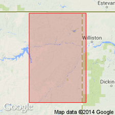
Expanded in eastern MT in the Williston basin to include Bakken Formation at base, overlain by (ascending) Lodgepole, Mission Canyon, and Charles Formations. Mississippian in age.
Source: GNU records (USGS DDS-6; Denver GNULEX).
- Usage in publication:
-
- Madison Group
- Modifications:
-
- Overview
- AAPG geologic province:
-
- Williston basin
- Chadron arch
Summary:
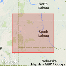
Divides Madison Group in western SD in Williston basin and on Chadron arch into three operational units, following the informal subdivisions of Andrichuk (1975). These are a lower unit that is essentially the Lodgepole Limestone as that term is traditionally used; a middle unit that is Mission Canyon Limestone plus the deposits of the lowest evaporite cycle of the Charles Formation as defined by Seager (1942); and an upper unit that is the remainder of the Charles Formation. Shows correlation diagram, and thickness and facies maps for the three units in western SD, northwesternmost NE, and immediately adjacent parts of WY and ND. Mississippian in age.
Source: GNU records (USGS DDS-6; Denver GNULEX).
- Usage in publication:
-
- Madison limestone equivalent*
- Modifications:
-
- Areal extent
- AAPG geologic province:
-
- Great Basin province
Summary:
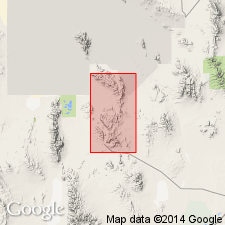
Name Madison limestone equivalent, applied to some Lower Mississippian medium-gray limestone with chert in upper part, mapped in northern part of Dugway Range, Tooele Co, UT in the Great Basin province. Base of map unit placed at top of massive cliff-forming quartzite named Hanauer formation in this report. Top of map unit placed at base of gray, calcareous, thin-bedded siltstone of Woodman formation. Section 315 ft thick measured three-quarters of a mi north of Four Metals mine, northern Dugway Range, where the unit consists of white to medium-gray, fine-grained limestone. Upper bed at section is fossiliferous (brachiopods, cup corals, crinoid stems). Fossil collection from upper 10 ft thick quartzite bed (listed) is of Early Mississippian age. Age of lower part of Madison equivalent is unknown.
Source: GNU records (USGS DDS-6; Denver GNULEX).
- Usage in publication:
-
- Madison Formation
- Modifications:
-
- Overview
- Revised
- AAPG geologic province:
-
- Williston basin
Summary:
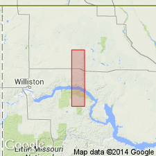
Referred to as a formation and subdivided into upper, middle and lower parts in northwestern ND in Williston basin. Upper part includes the Poplar and underlying Ratcliffe intervals. Middle and lower parts include the undivided Frobisher-Alida, Tilston, and Bottineau intervals; five subintervals are recognized in the undivided interval. These are designated (descending): M2, M1, L3, L2, and L1. The middle part of Madison consists of subintervals M2 and M1 and the lower part of Madison consists of subintervals L3, L2, and L1. The intervals and subintervals are all informal marker-defined mechanical-log subdivisions. Shows marker horizons of the intervals and subintervals on a log of the Hunt Oil, C. Overlie no. 3 well, SW1/4, SW1/4 sec 30, T160N, R94W, Burke Co, ND. Describes the subintervals in the middle and lower parts of the formation and shows their correlation in lines of section in Divide, Burke, and Williams Cos, ND. Mississippian in age.
Source: GNU records (USGS DDS-6; Denver GNULEX).
- Usage in publication:
-
- Madison Limestone*
- Modifications:
-
- Revised
- AAPG geologic province:
-
- Bighorn basin
- Powder River basin
- Wind River basin
- Green River basin
- Yellowstone province
Summary:
Amsden Formation or depending on location, its correlative, the lower part of Casper Formation, unconformably overlies Mississippian Madison Limestone. The hiatus between the Madison and the younger rocks is greater in the east part that in the west. Revised in that Madison underlies Horseshoe Shale Member (new name) of Amsden at the type Amsden at Amsden Creek, Sheridan Co, WY in Powder River basin, and Darwin Sandstone Member of Amsden at the reference section of Amsden in Tensleep Canyon, Washakie Co, WY in Wind River and Greater Green River basins, and in Yellowstone province.
Source: GNU records (USGS DDS-6; Denver GNULEX).
- Usage in publication:
-
- Madison Limestone*
- Modifications:
-
- Age modified
- Revised
- AAPG geologic province:
-
- Yellowstone province
- Bighorn basin
- Powder River basin
Summary:
Age modified locally where the newly named Cottonwood Canyon Member is assigned to the Madison Limestone, as its basal member in northern and south-central WY (Yellowstone province, Bighorn and Powder River basins). The Cottonwood Canyon is divisible into the lower tongue of Devonian age and the upper tongue of Early Mississippian age. Madison is of Late Devonian and Mississippian age.
Source: GNU records (USGS DDS-6; Denver GNULEX).
- Usage in publication:
-
- Madison Group
- Modifications:
-
- Overview
- AAPG geologic province:
-
- Williston basin
- Central Montana uplift
- Sweetgrass arch
- Powder River basin
- Yellowstone province
- Bighorn basin
Summary:
Used as Madison Group in SD, ND, and MT, Williston basin, Montana folded belt province, and Sweetgrass arch; includes (ascending): Lodgepole Limestone, Mission Canyon Limestone, and Charles Formation. Conformably overlies the Englewood Limestone, Bakken Formation, or older rocks; overlain unconformably by Kibbey Formation or younger rocks. Used as Madison Formation in northwestern, central, and part of southeastern WY (Laramie Range). In these areas, underlain by Devonian or older rocks; overlain unconformably by Amsden Formation or younger rocks. Mississippian (Kinderhook, Osage, and Meramec) in age. Shows correlations in Rocky Mountain region. Maps show the thickness and lithofacies of subunits of approximately Kinderhook, Osage, and Meramec ages, respectively.
Source: GNU records (USGS DDS-6; Denver GNULEX).
- Usage in publication:
-
- Madison Limestone*
- Modifications:
-
- Revised
- AAPG geologic province:
-
- Yellowstone province
Summary:
Madison Limestone crops out in eastern and northern parts in report area, Yellowstone province where it is divisible into a main part as much as 1,500 ft thick of Early and Late Mississippian age, and the Bull Ridge Member, 50-100 ft thick of Late Mississippian age. Rocks assigned to Bull Ridge in this report were variously called upper part of Mission Canyon Limestone, upper member of Madison Limestone, all or part of Brazer Limestone, Sacajawea Formation, strawberry beds, or basal part of Amsden Formation. Overlies Darby Formation. Underlies Darwin Sandstone Member of Amsden Formation.
Source: GNU records (USGS DDS-6; Denver GNULEX).
- Usage in publication:
-
- Madison Group*
- Modifications:
-
- Revised
- AAPG geologic province:
-
- Bighorn basin
Summary:
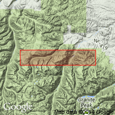
Bull Ridge Member can be recognized in the Beartooth Mountains of Park Co, WY and adjoining Carbon Co, MT in the Bighorn basin, as a member of Mission Canyon Limestone of Madison Group. Member can also be recognized in the Wind River, Owl Creek and Bighorn Mountains of the Wind River and Bighorn basins, where it is a member of the Madison Limestone. Bull Ridge ranges in Beartooths from 10 to 120 ft thick, and has the same lithic sequence and early Meramecian fauna as its type.
Source: GNU records (USGS DDS-6; Denver GNULEX).
- Usage in publication:
-
- Madison Group*
- Modifications:
-
- Revised
- AAPG geologic province:
-
- Sweetgrass arch
- Montana folded belt
Summary:
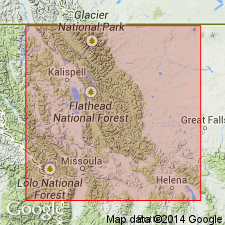
Contact between Allan Mountain Formation (previously called Allan Mountain Limestone) and Castle Reef Formation (previously called Castle Reef Dolomite) of the Mississippian Madison Group, modified. Unit 23 of Mudge, 1972 (USGS Professional Paper 663-A, p. A93-A94) removed from lower member of Castle Rock and assigned to upper member of Allan Mountain. Terms lower member and Sun River Member of Castle Reef not used; Castle Reef divided into two informal units--Gateway Pass (base) and Dupuyer Creek (top). Principal reference section designated for Castle Reef on North Fork of Dupuyer Creek in NW1/4 NW1/4 SW1/4 sec 21, T27N, R9W, Walling Reef quad, MT. Is present throughout the Sawtooth Range, which is in the Montana folded belt province and Sweetgrass arch.
Source: GNU records (USGS DDS-6; Denver GNULEX).
- Usage in publication:
-
- Madison Group*
- Modifications:
-
- Revised
- AAPG geologic province:
-
- Wasatch uplift
Summary:
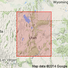
Includes Lodgepole Limestone of Kinderhookian and Osagean age and Mission Canyon Limestone of Meramecian age. Underlies a newly named unit, the Delle Phosphatic Member, basal member of the Aspen Range Formation, in North Georgetown Canyon, Aspen Range, ID in the Wasatch uplift. Correlation with lithostratigraphic units in the Great Basin province and Snake River basin shown on the correlation chart. Cross section.
Source: GNU records (USGS DDS-6; Denver GNULEX).
- Usage in publication:
-
- Madison Group*
- Modifications:
-
- Areal extent
- Revised
- AAPG geologic province:
-
- Montana folded belt
Summary:
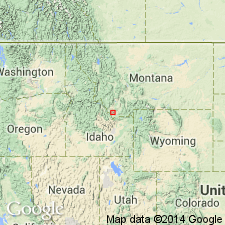
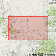
Replaced in northern Tendoy Mountains, Beaverhead Co, MT in the Montana folded belt province by Tendoy Group (new). The group is divided into Paine Limestone, at base (formerly Paine Member of Lodgepole Limestone of Madison Group), Middle Canyon Limestone (extended from east-central ID), Mission Canyon Limestone (formerly of Madison Group in this area), and McKenzie Canyon Limestone (new). Tendoy Group is a newly recognized carbonate sequence near the craton margin. The group ranges in age from Kinderhookian to early Meramecian, the age range of the Madison. Stratigraphic chart. Correlation chart.
Source: GNU records (USGS DDS-6; Denver GNULEX).
- Usage in publication:
-
- Madison Limestone*
- Modifications:
-
- Revised
- AAPG geologic province:
-
- Piceance basin
Summary:
Represents entire Mississippian section in report area. Overlies Devonian Chaffee Formation (no evidence for Mississippian age) and underlies Molas Shale (changed from Molas Formation; areal extension) in subsurface of Moffat Co, CO in Piceance basin. [Nearby on outcrop of eastern Uinta Mountains, CO, Madison overlies Cambrian Lodore Formation and underlies Upper Mississippian Humbug Formation (base) and Doughnut Shale (top) which are mapped undivided.]
Source: GNU records (USGS DDS-6; Denver GNULEX).
- Usage in publication:
-
- Madison Limestone*
- Modifications:
-
- Areal extent
- Revised
- AAPG geologic province:
-
- Denver basin
- Powder River basin
- Wind River basin
Summary:
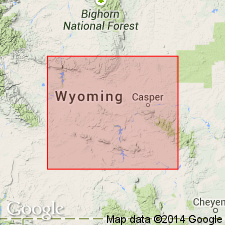
Name applied to carbonate rocks in Natrona Co in the Wind River basin and in Converse Co in the Powder River basin conformably above the Englewood Formation and disconformably below the Darwin Sandstone Member (new affiliation) of the Casper Formation. Name also extended to Hartville area, Platte Co in the Denver basin to rocks above the Englewood and below the Darwin Sandstone Member (new affiliation) of the Hartville Formation. Was previously included in the upper part of the Guernsey Formation (a name not used in this report). Includes (ascending order): Big Goose, Little Tongue, and Bull Ridge Members previously recognized only in north-central WY. Is of Kinderhookian to early Meramecian, or Early and Late Mississippian age. Southeast WY was probably subject to a longer period of emergence than was the Bighorn Mountain area.
Source: GNU records (USGS DDS-6; Denver GNULEX).
- Usage in publication:
-
- Madison Group
- Modifications:
-
- Not used
Summary:
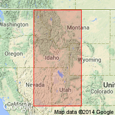
Cottonwood Canyon Member, basal member of Lodgepole Formation [Limestone] of Madison Group, raised to formation rank in northeast UT and southeast ID on the Wasatch uplift because of its distinctive lithology. Sequence above Cottonwood Canyon, formerly also assigned to Lodgepole, reassigned to the newly named Henderson Canyon Formation in the northeast UT-southeast ID area. Name Lodgepole reserved for an unstable shelf, cyclical shallowing-upward deposit in MT and WY. The ID-UT rocks of the Henderson Canyon, which are equivalent to the Lodgepole, are deeper water deposits.
Source: GNU records (USGS DDS-6; Denver GNULEX).
For more information, please contact Nancy Stamm, Geologic Names Committee Secretary.
Asterisk (*) indicates published by U.S. Geological Survey authors.
"No current usage" (†) implies that a name has been abandoned or has fallen into disuse. Former usage and, if known, replacement name given in parentheses ( ).
Slash (/) indicates name conflicts with nomenclatural guidelines (CSN, 1933; ACSN, 1961, 1970; NACSN, 1983, 2005, 2021). May be explained within brackets ([ ]).

