The National Geologic Map Database is migrating to a new infrastructure. We apologize for any service disruptions during this process.
|
|---|


- Usage in publication:
-
- Lodgepole limestone*
- Modifications:
-
- Named
- Dominant lithology:
-
- Limestone
- Shale
- AAPG geologic province:
-
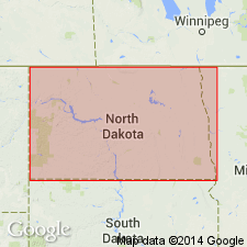
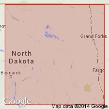
- Williston basin
Summary:
Named as a formation in Madison group for Lodgepole Canyon in Little Rocky Mountains, Blaine and Phillips Cos, MT in Williston basin, Blaine Co, MT. Type section not given. Consists of thin-bedded limestone and shale; many fossils. Thickness 800 ft. Overlain by Mission Canyon limestone (new); underlain by Jefferson limestone. Mississippian in age.
Source: GNU records (USGS DDS-6; Denver GNULEX).
- Usage in publication:
-
- Lodgepole limestone*
- Modifications:
-
- Biostratigraphic dating
- AAPG geologic province:
-
- Williston basin
Summary:
Lists conodonts found in a basal shale member of Lodgepole limestone in Little Rocky Mountains, MT. Gives measured section showing conodont-bearing beds along a tributary of Peoples Creek, sec 5, T25N, R24E, Blaine Co, MT in Williston basin. Assigned an Early Mississippian (Kinderhook) age.
Source: GNU records (USGS DDS-6; Denver GNULEX).
- Usage in publication:
-
- Lodgepole limestone
- Modifications:
-
- Overview
- AAPG geologic province:
-
- Sweetgrass arch
- Williston basin
- Powder River basin
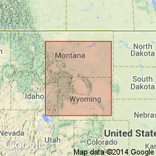
- Montana folded belt
- Central Montana uplift
- Yellowstone province
Summary:
Widespread in MT as lower of two formations in Madison group. Divisible at most places into an upper member, Woodhurst member, largely limestone with thin shale partings, and Paine member, with a much larger percentage of shale. Suites of insoluble residues make possible correlation of major stratigraphic units in entire area covered [most of MT and parts of adjacent areas to south, east, and north]. Gives measured sections at nine localities in MT and WY, including sections in Little Belt Mountains; Big Snowy Mountains; Little Rocky Mountains; at Logan; Bridger Range; Quadrant Mountain; Cooke City; Pryor Mountains, and Gallatin Range, Sweetgrass arch, Central Montana uplift, Williston basin, Montana folded belt province, Yellowstone province, and Powder River basin. Overlain conformably by Mission Canyon limestone; underlain unconformably by Three Forks formation or older rocks. Section in Little Rocky Mountains is along Lodgepole Creek [exact location not given]. Limestone, shaly limestone, and shale subdivided into Woodhurst member, 360 ft thick; and the underlying Paine member, 212 ft thick, including a unit at base about 20 ft thick consisting of yellowish and light-green calcareous shale with zones of black, fissile, conodont shale. Overlies Three Forks formation; underlies Mission Canyon limestone. Mississippian in age.
Source: GNU records (USGS DDS-6; Denver GNULEX).
- Usage in publication:
-
- Lodgepole limestone*
- Modifications:
-
- Overview
- AAPG geologic province:
-
- Williston basin
Summary:
Subdivided in a generalized columnar section for Blaine and Phillips Cos, in the Williston basin into (ascending): a basal shale member consisting of light greenish-gray clay with thin lenses of black fissile shale, 10 ft thick; and an overlying principal member, chiefly thin-bedded limestone with some massive ledges of limestone, small lenses of chert, and thin partings of shale, 550 ft thick. Overlain by Mission Canyon limestone; overlies Jefferson formation. Mississippian in age.
Source: GNU records (USGS DDS-6; Denver GNULEX).
- Usage in publication:
-
- Lodgepole limestone
- Modifications:
-
- Overview
- AAPG geologic province:
-
- Montana folded belt
Summary:
Type section of Madison group measured near Three Forks, Gallatin Co, MT (T2N, R2E) in Montana folded belt province. Lodgepole unconformably overlies Sappington sandstone and conformably underlies Mission Canyon limestone (not measured). A thin black shale identified at base that is overlain by a medium-dark-gray, thin-bedded, finely crystalline limestone which becomes higher in the section dark-gray, hard, very finely crystalline limestone rhythmically interbedded with softer, light-gray to yellow-gray argillaceous limestone. Is 584 ft thick at type Madison. Contains a Kinderhook, Early Mississippian age fauna.
Source: GNU records (USGS DDS-6; Denver GNULEX).
- Usage in publication:
-
- Lodgepole formation
- Modifications:
-
- Revised
- AAPG geologic province:
-
- Williston basin
- Sweetgrass arch
Summary:
Revised to exclude a basal thin black shale or black shale and sandstone unit in an extensive area in northern MT, southern Saskatchewan, southwestern Manitoba, and northwestern ND in Williston basin and on Sweetgrass arch. This black shale is herein named the Bakken formation (new). At the type section in Lodgepole Canyon in Little Rocky Mountains, Blaine Co, MT in Williston basin, overlies either the Bakken or Three Forks formations, possibly with minor hiatus. Conformably overlain by Mission Canyon limestone. Correlation diagrams show relations of the Lodgepole formation (revised) and adjacent units including the relations in vicinity of type area in Little Rocky Mountains, MT. Basal formation in Madison group. Early Mississippian (Kinderhook) in age.
Source: GNU records (USGS DDS-6; Denver GNULEX).
- Usage in publication:
-
- Lodgepole limestone*
- Modifications:
-
- Revised
- AAPG geologic province:
-
- Williston basin
Summary:
Subdivided into an upper, unnamed member, and a lower, Little Chief Canyon member (new), in the Little Rocky Mountains, Blaine and Phillips Cos, MT in Williston basin. Discusses distribution and correlation of Little Chief Canyon member in MT and nearby areas. Contact of the two members is conformable. Overlies unnamed light-gray blocky claystone. Overlain by Mission Canyon limestone. Mississippian in age.
Source: GNU records (USGS DDS-6; Denver GNULEX).
- Usage in publication:
-
- Lodgepole limestone*
- Modifications:
-
- Overview
- Dominant lithology:
-
- Limestone
- Chert
- Shale
- AAPG geologic province:
-
- Williston basin
Summary:
Gives type locality as sec 29, T26N, R25E, Blaine Co, MT in Williston basin along a part of Lodgepole Creek known as Little Chief Canyon, about 3 mi south of the Lodgepole sub-agency of the Fort Belknap Indian Reservation. [Map shows that outcrops along Little Chief Canyon are in secs 19 and 30, rather than sec 29]. Subdivided into an upper unnamed part consisting chiefly of thin-bedded limestone with some massive limestone ledges, many small lenses of chert, and thin partings of shale; and a lower, Little Chief Canyon member, consisting of black, conodont-bearing shale. Thickness 478 ft at type locality and 630 ft in a well in sec 29, T23N, R26E, Phillips Co, MT. Overlies Three Forks? shale; underlies Mission Canyon limestone. A formation in the Madison group. Early Mississippian in age.
Source: GNU records (USGS DDS-6; Denver GNULEX).
- Usage in publication:
-
- Lodgepole facies
- Modifications:
-
- Redescribed
- AAPG geologic province:
-
- Williston basin
Summary:
Uses "facies" as designation for formational unit in Madison Group in north-central ND and southeastern Saskatchewan, in the Williston basin, to emphasize that its boundaries transgress time lines. Is represented by dense, argillaceous, often cherty, limestones characteristic of carbonate deposition in deep water, off the marine shelf. Although these beds are generally quite dense, porosity has developed locally in certain areas as will be seen by designations on type logs for Canadian and Bottineau, ND, areas. Base of Lodgepole facies is locally unconformable contact of lowest carbonate with black shale of underlying Bakken formation. Upper part interfingers with partly equivalent and partly overlying Mission Canyon facies. Includes an unnamed electric and radioactivity-log [shale] unit at base and, locally, equivalents of Tilston member which is an overlying electric- and radioactivity-log unit. Mississippian in age.
Source: GNU records (USGS DDS-6; Denver GNULEX).
- Usage in publication:
-
- Lodgepole limestone*
- Modifications:
-
- Biostratigraphic dating
- AAPG geologic province:
-
- Montana folded belt
- Williston basin
Summary:
Shows distribution on map of coral zones in four stratigraphic sections, in Gallatin and Madison Cos, MT in Montana folded belt province, and in Blaine and Wibaux Cos, Williston basin. Coral zones in Lodgepole are (ascending): Zone C2 is arbitrarily placed at contact of Lodgepole with overlying Mission Canyon limestone in 4 sections. Lists characteristic coral genera in the zones. Zone A and part of Zone B may be represented in Little Chief Canyon member of Lodgepole of central MT and Bakken formation of Williston basin. Zone C1 is readily identified in cores drilled in Williston basin (section 8). Coral faunas do not provide a satisfactory basis for detailed correlation with type Mississippian of Midcontinent region, because their sensitivity to depositional conditions appears to have given rise to different assemblages and distribution patterns in rocks believed to be nearly contemporaneous. Preliminary studies by Dutro, Jr., of brachiopods associated with coral assemblages suggests tentative correlations with type Mississippian: Zone A appears to be entirely of Kinderhook age. Beds equivalent to part of Kinderhook may be present in Zone B, and they possibly extend into C1. Osage equivalents are found in C1. These correlations are confirmed, in general, by distribution patterns of coral genera common to Madison and type Mississippian sequences.
Source: GNU records (USGS DDS-6; Denver GNULEX).
- Usage in publication:
-
- Lodgepole limestone*
- Modifications:
-
- Overview
- Biostratigraphic dating
- AAPG geologic province:
-
- Williston basin
Summary:
Corals from three wells in Wibaux, Dawson, and Roosevelt Cos, respectively, northeastern MT, Williston basin, are divided into three groups for facies analysis: nondissepimented solitary corals, dissepimented solitary corals, and colonial corals. Lateral changes in abundance, diversification, and vertical limits of coral fauna seem to be directly related to changes in lithic facies. A northward impoverishment of fauna of Lodgepole [of Madison group] seems to be correlated with increase in clay content and decrease in grain size of limestone toward center of a basin characterized by poor circulation of sea water. Dissepimented corals are much more abundant in Lodgepole than in overlying Mission Canyon limestone; Mission Canyon fauna consists predominantly of solitary forms suggesting better aerated conditions in Mission Canyon time. Corals hold little promise as horizon markers because of strong facies control and long stratigraphic range of common genera. They offer greater potential for regional correlation because of wide distribution of distinctive associations of genera and species in rocks of Early Mississippian age. Describes 24 species distributed among 18 genera, collected from (ascending) Lodgepole and Mission Canyon limestones and Charles formation. Shows frequency distributions and stratigraphic ranges of coral types or coral genera. Early Mississippian in age.
Source: GNU records (USGS DDS-6; Denver GNULEX).
- Usage in publication:
-
- Lodgepole Formation
- Modifications:
-
- Areal extent
- AAPG geologic province:
-
- Williston basin
Summary:
Also called Lodgepole facies. Virtually equivalent to the Bottineau [mechanical log] interval in eastern ND in Williston basin. Uses Bottineau interval instead of Lodgepole Formation in subdividing Madison Group in north-central and eastern ND.
Source: GNU records (USGS DDS-6; Denver GNULEX).
- Usage in publication:
-
- Lodgepole Limestone*
- Modifications:
-
- Overview
- AAPG geologic province:
-
- Snake River basin
Summary:
Underlies newly named Little Flat Formation of Chesterfield Range Group in the Chesterfield Range, Bannock Co, ID in the Snake River basin. Little Flat and overlying Monroe Canyon Limestone (new) of Chesterfield Range Group replaces term Brazer Limestone in southeast ID. Of Mississippian age.
Source: GNU records (USGS DDS-6; Denver GNULEX).
- Usage in publication:
-
- Lodgepole limestone*
- Modifications:
-
- Overview
- AAPG geologic province:
-
- Montana folded belt
Summary:
Characteristically begins with one or two ledges, 10 to 20 ft high, succeeded by a long grassy slope, and ends at base of a ledge, as much as 100 ft high of the Mission Canyon limestone. Lies above Three Forks shale. Maintains a constant thickness (600-700 ft). Detailed lithologic descriptions. Fossil lists (brachiopods, etc) included. Sections measured and described in sec 10, T1N, R1W (+/-600 ft thick) and in SW1/4 NW1/4 sec 4, T1S, R1W (450 ft thick). Is a marine sublittoral to shallow neritic deposit. Report area covers Gallatin, Jefferson, and Broadwater Cos, MT in the Montana folded belt province. Geologic map. [Compare with work by Peale, 1893, 1896 and Berry, 1943]. Considered Early Mississippian age.
Source: GNU records (USGS DDS-6; Denver GNULEX).
- Usage in publication:
-
- Lodgepole Limestone*
- Modifications:
-
- Revised
- AAPG geologic province:
-
- Montana folded belt
- Central Montana uplift
Summary:
The newly named Cottonwood Canyon Member is assigned to the Lodgepole Limestone in southern MT in Montana folded belt province and Central Montana uplift where the member is represented only by its upper tongue. Assigned to the Early Mississippian.
Source: GNU records (USGS DDS-6; Denver GNULEX).
- Usage in publication:
-
- Lodgepole Limestone*
- Modifications:
-
- Revised
- Reference
- Biostratigraphic dating
- Dominant lithology:
-
- Limestone
- Shale
- AAPG geologic province:
-
- Williston basin
- Sweetgrass arch
- Central Montana uplift
Summary:
A section 555 ft thick measured in Little Chief Canyon, NE1/4 NW1/4 sec 30, T26N, R25E, Blaine Co, MT, Williston basin designated type section of Lodgepole. Divided into Paine Member (base), a medium- to olive-gray, medium- to fine-grained, crinoidal, silty to argillaceous limestone; and Woodhurst Member (top), a fine- to coarse-grained, light-gray to brown crinoidal limestone. A thin black shale beneath Paine, formerly called Little Chief Canyon Member of Lodgepole reassigned to underlying Bakken Formation. Little Chief Canyon abandoned. Term "shale" removed from formal name Paine because "shale" doesn't apply to rocks identified as limestone. Term "limestone" removed from Woodhurst because limestone part of formation name. Two other sections measured where Lodgepole overlies Three Forks Formation. Black shale beneath Paine in two sections retained as Cottonwood Canyon Member of Lodgepole. Underlies Mission Canyon Limestone at all three sections. Extends into Sweetgrass arch and Central Montana uplift. Fossil (brachiopods, corals, fusulinids) lists. Correlation diagram. Cottonwood Canyon and Paine are Kinderhookian, Woodhurst is Osagean, or all of Early Mississippian age.
Source: GNU records (USGS DDS-6; Denver GNULEX).
- Usage in publication:
-
- Lodgepole Limestone*
- Modifications:
-
- Revised
- AAPG geologic province:
-
- Great Basin province
Summary:
Underlies a newly named unit, the Delle Phosphatic Member, basal member of: the Woodman Formation in the Lakeside Mountains, Tooele Co, the Deep Creek Formation in the Deep Creek Mountains of the Great Basin province, the Deep Creek Formation in Hunter Canyon, Deep Creek Mountains, ID on the Wasatch uplift, the Little Flat Formation in Chesterfield Range, Bannock Co, ID in the Snake River basin, and the Brazer Dolomite in Brazer Canyon, Crawford Mountains, Rich Co, UT in the Wasatch uplift. Delle-Lodgepole contact placed at the top of a hardground at the Lodgepole. Correlation of Lodgepole with other lithostratigraphic units in the Great Basin province and on the Wasatch uplift, UT, and in the Snake River basin, ID shown on correlation chart.
Source: GNU records (USGS DDS-6; Denver GNULEX).
- Usage in publication:
-
- Lodgepole Limestone*
- Modifications:
-
- Not used
Summary:
Lower Mississippian Paine Member removed from Lodgepole Limestone of Madison Group and assigned formation rank as Paine Limestone of Tendoy Group in the northern Tendoy Mountains, Beaverhead Co, MT in the Montana folded belt province. Is correlative with Paine and Middle Canyon Formations of Tendoy.
Source: GNU records (USGS DDS-6; Denver GNULEX).
- Usage in publication:
-
- Lodgepole Limestone
- Modifications:
-
- Not used
Summary:
Cottonwood Canyon Member, basal member of Lodgepole Formation [Limestone] of Madison Group, raised to formation rank in northeast UT and southeast ID on the Wasatch uplift because of its distinctive lithology. Sequence above Cottonwood Canyon, formerly also assigned to Lodgepole, reassigned to the newly named Henderson Canyon Formation on northeast UT-southeast ID area. Name Lodgepole reserved for an unstable shelf, cyclical shallowing-upward deposit in MT and WY. The ID-UT rocks of the Henderson Canyon which are equivalent to the Lodgepole are deeper water deposits.
Source: GNU records (USGS DDS-6; Denver GNULEX).
For more information, please contact Nancy Stamm, Geologic Names Committee Secretary.
Asterisk (*) indicates published by U.S. Geological Survey authors.
"No current usage" (†) implies that a name has been abandoned or has fallen into disuse. Former usage and, if known, replacement name given in parentheses ( ).
Slash (/) indicates name conflicts with nomenclatural guidelines (CSN, 1933; ACSN, 1961, 1970; NACSN, 1983, 2005, 2021). May be explained within brackets ([ ]).