The National Geologic Map Database is migrating to a new infrastructure. We apologize for any service disruptions during this process.
|
|---|


- Usage in publication:
-
- Chadwell Member*
- Modifications:
-
- Original reference
- Dominant lithology:
-
- Sandstone
- Conglomerate
- AAPG geologic province:
-
- Appalachian basin
Summary:
Pg. B30-B38. Chadwell Member of Lee Formation. Name proposed for strata previously referred to as sandstone member A (Englund and others, 1963). Crops out in two resistant ledges of well-sorted quartzose sandstone which are separated by tongue of Pennington shale northeast of Chadwell Gap. Near White Rocks, lower ledge wedges out and at its extremity grades into sandstone of Pennington Formation. Both ledges are exposed in Cumberland Gap section where they total 150 feet in thickness, including intervening bed of carbonaceous shale with thin coal beds and associated underclay. Thickness 182.5 feet at type section. Underlies White Rocks Sandstone Member and where White Rocks is absent the Dark Ridge Member (new). Locally overlies Pinnacle Overlook Member (new). Age is Mississippian and Pennsylvanian.
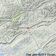
Type section: Chadwell Gap, a notch in Cumberland Mountain, about 10 mi northeast of Cumberland Gap, southeastern KY.
Source: US geologic names lexicon (USGS Bull. 1350, p. 139-140).
- Usage in publication:
-
- Chadwell Member*
- Modifications:
-
- Areal extent
- AAPG geologic province:
-
- Appalachian basin
Summary:
Shown extending from the KY part of Chadwell Gap section to VA part of Chadwell Gap section, as well as in Burnt Ridge and White Rocks sections in Lee Co., VA. [Naming paper did not mention existence on VA side of Cumberland Gap or Chadwell Gap, but this report compares Lee Formation members on both sides of KY-VA boundary.]
Source: GNU records (USGS DDS-6; Reston GNULEX).
- Usage in publication:
-
- Chadwell Member*
- Modifications:
-
- Age modified
- AAPG geologic province:
-
- Appalachian basin
Summary:
Age changed from Mississippian and Pennsylvanian to Late Mississippian because, in Cumberland Mountain area, Chadwell Member intertongues with Pennington Formation, which contains a Late Mississippian fauna.
Source: GNU records (USGS DDS-6; Reston GNULEX).

- Usage in publication:
-
- Chadwell
- Modifications:
-
- Not used
- AAPG geologic province:
-
- Appalachian basin
Summary:
Warren Point Sandstone, extended into KY and assigned to the Breathitt Group, replaces White Rocks and Chadwell Members of Lee Formation. Until further study, the White Rocks and Chadwell should only be used as informal beds within the Warren Point. Combined with Sewanee Sandstone, interval replaces Middlesboro Member of Lee Formation. Lee Formation is formally "dropped" from usage and all strata assigned to the Breathitt Group, here revised in rank.
Source: GNU records (USGS DDS-6; Reston GNULEX).
- Usage in publication:
-
- Chadwell Member*
- Modifications:
-
- Revised
- AAPG geologic province:
-
- Appalachian basin
Summary:
In pilot bore section, rocks identified as Chadwell Member of Lee by Vanover and others (1989, Itinerary, Day 2-Pilot bore traverse, IN Dean, C.S., and Moshier, S.O., eds., Cumberland Mountain: the inside story: Geological Survey of Kentucky Field Trip Guidebook, p. 24-30) and by Vanover (1989, Pilot tunnel stratigraphy, IN Dean, C.S., and Moshier, S.O., eds., Cumberland Mountain: the inside story: Geological Survey of Kentucky Field Trip Guidebook, p. 39-43) are here reidentified as Pinnacle Overlook Member of Lee Formation.
Source: GNU records (USGS DDS-6; Reston GNULEX).

- Usage in publication:
-
- Chadwell Member
- Modifications:
-
- Areal extent
- AAPG geologic province:
-
- Appalachian basin
Summary:
Chadwell Member crops out between Cumberland Gap and Falling Water Gap. Unit is 180 ft at its type locality, but thins to the northeast and pinches out in the vicinity of White Rocks. It thickens to the southwest of Cumberland Gap to as much as 350 ft in KY. Consists of one or two ledges of well sorted, fine- to coarse-grained, quartzarenite, and commonly a thin basal bed with quartz pebbles as much as 1 in. in diameter. Locally contains olive-gray siltstone as well as carbonaceous shale and coal. Northeast of Chadwell Gap, the member grades into grayish-red to grayish-green siltstones of the Bluestone Formation. Age in this report is considered Late Mississippian (Chesterian).
Source: GNU records (USGS DDS-6; Reston GNULEX).

- Usage in publication:
-
- Chadwell Member*
- Modifications:
-
- Areal extent
- AAPG geologic province:
-
- Appalachian basin
Summary:
Chadwell Member of Lee Formation. [Pebbly sandstone up to 350 feet thick], in lower part of Lee Formation below Dark Ridge Member and above Pinnacle Overlook Member. Correlative with White Rocks Member of Lee Formation. Age is Mississippian. [In footnote 30, authors state the Chadwell was placed in Mississippian by Englund, 1964 (Englund considered the Chadwell to be Mississippian and Pennsylvanian, see fig. 1), but is here considered Pennsylvanian based on fossils (miospores; oral commun., C.F. Eble, Kentucky Geological Survey, 1993, 1994).]
Recognized in Upper Cumberland River district, southeastern KY.
[See also Rice and others (1994, GSA Spec. Paper, p. 121).]
Source: Publication.

- Usage in publication:
-
- Chadwell Member
- Modifications:
-
- Areal extent
- AAPG geologic province:
-
- Appalachian basin
Summary:
Corr. chart. Chadwell Member of Warren Point Sandstone of Breathitt Group. Conglomerate and/or sandstone. Is lower member of Warren Point Sandstone in southeastern Kentucky. Underlies White Rocks Sandstone Member of Warren Point. Age is Early Pennsylvanian (late Namurian).
[See also geologic descriptions of stratigraphic units in the Kentucky Geological Survey database (http://kgs.uky.edu/kgsmap/KGSLitho/lithoSearch.asp#).]
Source: Publication.
For more information, please contact Nancy Stamm, Geologic Names Committee Secretary.
Asterisk (*) indicates published by U.S. Geological Survey authors.
"No current usage" (†) implies that a name has been abandoned or has fallen into disuse. Former usage and, if known, replacement name given in parentheses ( ).
Slash (/) indicates name conflicts with nomenclatural guidelines (CSN, 1933; ACSN, 1961, 1970; NACSN, 1983, 2005, 2021). May be explained within brackets ([ ]).