- Usage in publication:
-
- Bee-rock bed
- Modifications:
-
- Original reference
- Dominant lithology:
-
- Sandstone
- AAPG geologic province:
-
- Appalachian basin
Summary:
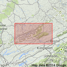
The highest bed of the Seral (Pottsville) conglomerate at Big Stone Gap is called "Bee-rock." The name is adopted for the bed. It is a moderately fine grained sandstone. Shows many impressions of SIGILLARIA.
Source: GNU records (USGS DDS-6; Reston GNULEX).

- Usage in publication:
-
- Bee Rock
- Modifications:
-
- Overview
- AAPG geologic province:
-
- Appalachian basin
Summary:
Bee rock. A term that has been applied locally to Yellow Creek and Cawood sandstone members of Hance formation (of Pottsville group) of southeastern Kentucky, "because of their tendency to weather out large cavities resembling a magnified honey comb." (G.H. Ashley and L.C. Glenn, USGS Prof. Paper 49, p. 38, [1906].) The term has also been applied to top sandstone of the Pottsville of southwestern Virginia, "because the laurel blossoms which cover it in early summer are the resort of immense numbers of bees." (J.J. Stevenson, Amer. Phil. Soc. Proc., v. 19, p. 96, [1881].) The top sandstone of Lee formation in Bigstone Gap coal field of southwestern Virginia has also been called "Bee rock" (M.R. Campbell, USGS Bull. 111, p. 17, [1893]), "probably because it weathers into a pitted surface in which bees probably found refuge at times." (M.R. Campbell, personal commun.)
Source: US geologic names lexicon (USGS Bull. 896, p. 143).
- Usage in publication:
-
- Bee Rock conglomerate
- Modifications:
-
- Areal extent
- AAPG geologic province:
-
- Appalachian basin
Summary:
Pg. 88; GSA Mem. 13, p. 136, 1946. Bee Rock conglomerate. Topmost conglomeratic sandstone of Lee formation. [Recognized in southwestern Virginia. Age is Early Pennsylvanian.]
Source: US geologic names lexicon (USGS Bull. 1200, p. 278).
- Usage in publication:
-
- Bee Rock Sandstone Member*
- Modifications:
-
- Revised
- Reference
- Dominant lithology:
-
- Sandstone
- Shale
- AAPG geologic province:
-
- Appalachian basin
Summary:
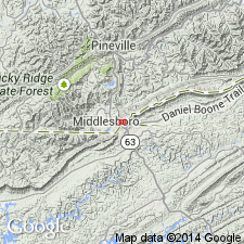
Massive sandstone at Bee Rock within Lee conglomerate (Campbell, 1893, p. 36) is here revised as Bee Rock Sandstone Member of Lee Formation and is extended from Big Stone Gap area of southwestern VA into southeastern KY. Is uppermost conglomeratic sandstone in the Lee Formation along Cumberland Mountain. The name, well established in the Pennington Gap area, has been extended southward to the Cumberland Gap area by interpretation of aerial photographs and field mapping. A good reference section may be found at northeast end of Brush Mountain where the member crops out in a cliff overlooking Martins Fork. Consists of two massive, sparsely conglomeratic, quartzose sandstone beds of about equal thickness separated by a thin shale bed. Quartz pebbles decrease in size and abundance southwestward along outcrop belt and are absent southwest of Cumberland Gap. Thickness ranges from 200 to 250 ft. Basal contact with Hensley Member is sharp and undulatory; contact with overlying beds of Hance Formation is gradational. Age is Pennsylvanian.
Source: GNU records (USGS DDS-6; Reston GNULEX).
- Usage in publication:
-
- Bee Rock Sandstone Member*
- Modifications:
-
- Areal extent
- AAPG geologic province:
-
- Appalachian basin
Summary:
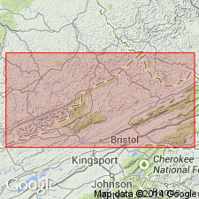
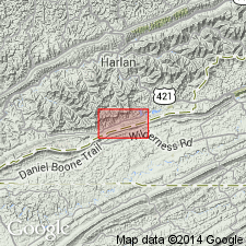
Bee Rock Sandstone Member grades at its northeastern fringe into thin, nonresistant, feldspathic sandstone. Overlain by Hance Formation in Harlan and Bell Cos., KY, and by Norton Formation in Lee and Wise Cos., VA. Where Bee Rock tongues out in Wise Co., the top of Lee Formation was mapped by earlier workers at top of next lower quartzose sandstone, which is about 500 ft lower stratigraphically. This downward placement of Lee-Norton contact was pointed out by Gathright (1964). Placing top contact of Lee at uppermost quartzose sandstone is also done in other areas. Therefore, the Lee Formation is recognized regionally as a rock-stratigraphic unit with lower and upper contacts defined by quartzose sandstone.
Source: GNU records (USGS DDS-6; Reston GNULEX).
- Usage in publication:
-
- Bee Rock Sandstone Member*
- Modifications:
-
- Age modified
- AAPG geologic province:
-
- Appalachian basin
Summary:
Age of Bee Rock Sandstone refined from Pennsylvanian to Early Pennsylvanian.
Source: GNU records (USGS DDS-6; Reston GNULEX).
- Usage in publication:
-
- Bee Rock Sandstone Member*
- Modifications:
-
- Areal extent
- AAPG geologic province:
-
- Appalachian basin
Summary:
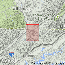
Topmost members of Lee Formation in Cumberland Mountain area are Bee Rock Sandstone Member east of Rocky Face fault and Naese Sandstone Member west of the fault. In most areas where Naese is present, it unconformably overlies Bee Rock; elsewhere, replaces Bee Rock. Bee Rock pinches out to southeast in VA. In KY, Bee Rock thickens to northwest. Where not overlain by Naese, intertongues with overlying Hance Formation. At northeast end of Pine Mountain, Bee Rock is wholly or in part equivalent to upper member of Lee Formation or to upper sandstone member of Alvord and Miller (1972). Naese grades laterally into overlying Hance; where Yellow Creek Sandstone Member of Hance directly overlies Naese, both are mapped as single unit. Boundary between Bee Rock and Naese is difficult to discern because of lithologic similarity. Englund (1968) suggests that Bee Rock is truncated by unconformity at base of Naese west of Cumberland Gap, that Bee Rock is absent in TN, and that Naese wedges out southeastward in TN. Bee Rock and Naese are partly or wholly equivalent to Rockcastle Sandstone Member of Lee in eastern KY. Also may be equivalent to Rockcastle Conglomerate of Crab Orchard Mountains Group of Tennessee Division of Geology nomenclature. Top of Bee Rock traditionally marked Lower-Middle Pennsylvanian Series boundary in KY. Englund and others (1979) place boundary above Bee Rock equivalents. Because Naese overlies Bee Rock, is Early to Middle Pennsylvanian.
Source: GNU records (USGS DDS-6; Reston GNULEX).
- Usage in publication:
-
- Bee Rock Sandstone Member*
- Modifications:
-
- Areal extent
- AAPG geologic province:
-
- Appalachian basin
Summary:
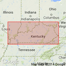
Bee Rock Sandstone Member of Lee Formation mapped in the Jellico East quad. of TN where it overlies the Hensley Member and underlies the Naese Sandstone Member, both of Lee Formation. The base of the Bee Rock in this area corresponds to the base of the sandstone portion of Englund's (1968) sandstone bed 1 of the Middlesboro Member in the adjacent Jellico West and Ivydell quads. Upper part of Bee Rock corresponds to part of his Hensley Member. According the Englund (1968), the Bee Rock is truncated by the Naese Sandstone Member west of the Cumberland Gap.
Source: GNU records (USGS DDS-6; Reston GNULEX).
- Usage in publication:
-
- Bee Rock Sandstone
- Modifications:
-
- Revised
- AAPG geologic province:
-
- Appalachian basin
Summary:
Bee Rock raised to formation rank and assigned to Breathitt Group. Lee Formation is formally "dropped" from usage and all strata assigned to Breathitt. The Rockcastle Sandstone and the Livingston Conglomerate as mapped in KY are here designated formal members of the Bee Rock. Unit also contains the informal Naese member (Ashley and Glenn, 1906) and the informal "K" sandstone member (Puffett, 1962: USGS GQ-179). Cross sections show Bee Rock Sandstone in TN, KY, VA, and WV. Reaches a maximum of 150 m. Thins and pinches out to the northwest and to the southeast, where it interbeds with the Alvy Creek. Northeast-southwest-trending belt of Bee Rock is approximately 57 mi wide. Overlies Hensley Member of Alvy Creek formation; underlies Grundy Formation (both of Breathitt Group). According to the author, formal nomenclature presented in this report for units occurring in KY has been accepted by the Kentucky Stratigraphic Nomenclature Committee. Units that occur largely outside KY are considered informal. Report includes correlation charts, cross sections, and measured sections.
Source: GNU records (USGS DDS-6; Reston GNULEX).
- Usage in publication:
-
- Bee Rock Sandstone Member
- Modifications:
-
- Areal extent
- AAPG geologic province:
-
- Appalachian basin
Summary:
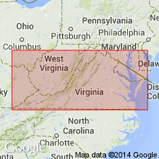
Bee Rock Sandstone Member of the Lee Formation crops out along Stone Mountain from Ramsey to Pennington Gap and also along Pine Mountain in northwestern Dickenson and Wise Cos. Underlies extreme northwestern Buchanan Co. and western Dickenson and Wise Cos. Thickness is irregular, ranging between 0 and 260 ft. Sandstone is quartzose, fine to coarse grained and has conglomeratic lenses containing well rounded quartz pebbles averaging 0.5 in. in diameter. May also include an olive-gray, very fine grained, wavy-bedded sandstone lens 0 to 50 ft thick. In Lee, western Wise, and northwestern Dickenson and Buchanan Cos., the Bee Rock unconformably overlies the Hensley member. In western Wise and Lee Cos., the contact with the overlying Naese Sandstone Member is unconformable. Where the Norton Formation overlies the Bee Rock, the contact is abrupt but conformable. Unit grades laterally to the southeast into the McClure Sandstone Member of the Norton Formation.
Source: GNU records (USGS DDS-6; Reston GNULEX).
- Usage in publication:
-
- Bee Rock Sandstone Member*
- Modifications:
-
- Areal extent
- AAPG geologic province:
-
- Appalachian basin
Summary:
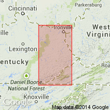
Bee Rock Sandstone Member of Lee Formation. Sandstone. Recognized in Upper Cumberland River district, southeastern Kentucky, between the Naese Sandstone Member (above) and Hensley Member (both of Lee Formation). Correlative with most of Rockcastle Sandstone Member of Lee Formation in Southwestern district, eastern Kentucky. Age is Early Pennsylvanian.
Source: Publication.
- Usage in publication:
-
- Bee Rock Sandstone
- Bee Rock Sandstone Member
- Modifications:
-
- Areal extent
- AAPG geologic province:
-
- Appalachian basin
Summary:
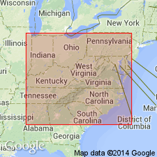
Corr. chart. Bee Rock Sandstone of Breathitt Group (KY); Bee Rock Sandstone Member of Lee Formation (VA). Sandstone. In eastern and southeastern Kentucky is a formation in lower part of Breathitt Group below Grundy Formation and above Alvy Creek formation (informal). In eastern Kentucky includes (descending) Pine Creek sandstone member (informal), Barren Fork coal bed, and Rockcastle Sandstone Member. In southeastern Kentucky includes (descending) Naese coal bed, Naese Sandstone Member, and Bee Rock coal bed. In southwestern Virginia is uppermost member of Lee Formation, thickness 80 to 325 feet. Overlies Hensley Member of Lee Formation, underlies and [interbedded with] Norton Formation. Age is Early Pennsylvanian (Westphalian; Morrowan).
[See also Chesnut, 1997 (revised Oct. 12, 1999), Stratigraphy of the coal-bearing strata of the Eastern Kentucky coal field, available online through the Kentucky Geol. Survey (http://www.uky.edu/KGS/coal/coalcorrel.htm).]
Source: Publication.
For more information, please contact Nancy Stamm, Geologic Names Committee Secretary.
Asterisk (*) indicates published by U.S. Geological Survey authors.
"No current usage" (†) implies that a name has been abandoned or has fallen into disuse. Former usage and, if known, replacement name given in parentheses ( ).
Slash (/) indicates name conflicts with nomenclatural guidelines (CSN, 1933; ACSN, 1961, 1970; NACSN, 1983, 2005, 2021). May be explained within brackets ([ ]).

