The National Geologic Map Database is migrating to a new infrastructure. We apologize for any service disruptions during this process.
|
|---|


- Usage in publication:
-
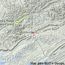
- Middlesboro Member*
- Modifications:
-
- Named
- Dominant lithology:
-
- Sandstone
- Shale
- AAPG geologic province:
-
- Appalachian basin
Summary:
Named as a member of Lee Formation. Named for city of Middlesboro at northwest approach to Cumberland Gap. Is the principal cliff- and ridge-forming unit along Cumberland Mountain and along Pine Mountain on northwest limb of Middlesboro syncline. Also caps Rocky Face Mountain. Previously mapped as sandstone member C of Lee Formation on some quadrangle maps in southeastern KY. Consists predominantly of fine- to coarse-grained, white to very light-gray, quartzose sandstone with an abundance of well-rounded quartz pebbles that commonly range from 0.5 to 1 inch in diameter. Conglomeratic sandstone generally occurs in four beds that are locally separated by thin beds of shale, coal, underclay, and thin-bedded, very fine to fine-grained sandstone. Where intervening beds are absent, member also tends to crop out in a series of four ledges or hogbacks. Thickness ranges from 400 to 500 ft. Basal contact with Dark Ridge Member is sharp and undulates several feet into underlying beds; upper contact placed where conglomeratic quartzose sandstone of Middlesboro Member is succeeded by shale and thin-bedded, nonconglomeratic sandstone of Hensley Member. Age is Pennsylvanian.
Source: GNU records (USGS DDS-6; Reston GNULEX).
- Usage in publication:
-
- Middlesboro Member*
- Modifications:
-
- Areal extent
- AAPG geologic province:
-
- Appalachian basin
Summary:
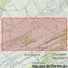
Middlesboro Member extended from KY into southwestern VA as shown on map and correlation chart. Evidence is seen in Butcher Knob section, Lee Co., VA; and in White Rocks, Falling Water Gap, and Wagonroad Tunnel sections in Lee Co., VA, and Harlan Co., KY. Member's four coalescing conglomeratic sandstone units become less quartzose and diverge and split to the northeast, tonguing out completely in Russell Co., VA. At extremities, conglomeratic sandstone grades into nonresistant, feldspathic, micaceous sandstone with lower quartz content.
Source: GNU records (USGS DDS-6; Reston GNULEX).
- Usage in publication:
-
- Middlesboro Member*
- Modifications:
-
- Age modified
- AAPG geologic province:
-
- Appalachian basin
Summary:
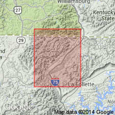
Middlesboro Member extended into TN from KY as shown in the Jellico West quad (plate 2). Age of member is refined to Early Pennsylvanian as shown in correlation chart on plate 2.
Source: GNU records (USGS DDS-6; Reston GNULEX).
- Usage in publication:
-
- Middlesboro Member*
- Modifications:
-
- Revised
- AAPG geologic province:
-
- Appalachian basin
Summary:
In this quadrangle, Middlesboro Member is reassigned from Lee Formation to New River Formation as Middlesboro Sandstone Member (lower and upper tongues), overlying Pocahontas Formation and underlying Council Sandstone Member of New River Formation. Middlesboro Member remains member of Lee Formation to the west in VA and KY.
Source: GNU records (USGS DDS-6; Reston GNULEX).
- Usage in publication:
-
- Middlesboro Member*
- Modifications:
-
- Overview
- AAPG geologic province:
-
- Appalachian basin
Summary:
Along much of Pine Mountain, presence of Middlesboro is mapped with a query because it may contain unrecognized members of Pennington and Lee Formations. For example, in Wallins Creek quad, Middlesboro(?) Member is in places overlain by fossiliferous shale that may be Mississippian and is perhaps separated by an unrecognized unconformity from overlying Middlesboro-type sandstone. Marine fossils have not been found in Middlesboro elsewhere in KY. Middlesboro does contain coalified plant material and, in places, thin beds of coal and carbonaceous shale. Middlesboro not mapped at northeast end of Pine Mountain, but is probably equivalent to both lower and middle sandstone members of Lee Formation of Alvord (1971) and all of lower and most of upper member of Lee Formation of Rice (1973). To the southwest, Middlesboro is mapped in TN in areas adjacent to KY. In the nomenclature used by Tennessee Division of Geology, Middlesboro Member may be equivalent in part to Warren Point Sandstone of Gizzard Group and is probably equivalent to Sewanee Conglomerate and Newton Sandstone of Crab Orchard Mountains Group (Milici and others, 1979).
Source: GNU records (USGS DDS-6; Reston GNULEX).
- Usage in publication:
-
- Middlesboro Member*
- Modifications:
-
- Revised
- AAPG geologic province:
-
- Appalachian basin
Summary:
Middlesboro Member of Lee Formation is divided into informal lower and upper parts. Lower part locally contains pebbles at base. In northwestern part of this quad, lower part coincides with sandstone member A of Englund and others (1964; an older version of this quadrangle). Another paper by Englund (1964) formally named the Chadwell Member to replace sandstone member A. Englund (1964) also placed the Mississippian-Pennsylvanian boundary at top of underlying Chadwell Member. Because of lithologic similarities between this and the overlying unit, and in the absence of definitive fossils, this unit is assigned on Pine Mountain to Middlesboro Member following usage on adjacent Pineville quad (Froelich and Tazelaar, 1974). Although additional data may show the Mississippian-Pennsylvanian boundary on Pine Mountain to be within Middlesboro Member, it is here interpreted to be an unconformity at base of Middlesboro Member.
Source: GNU records (USGS DDS-6; Reston GNULEX).

- Usage in publication:
-
- Middlesboro
- Modifications:
-
- Not used
- AAPG geologic province:
-
- Appalachian basin
Summary:
In the south-central part of the study area, where the Bottom Creek formation is absent, the Warren Point underlies the Sewanee Sandstone and the two are combined as the Warren Point-Sewanee Sandstones, equivalent to and formally replacing the Middlesboro Member of the Lee Formation of Englund (1964). The Warren Point also replaces the White Rocks and Chadwell Members of the Lee. According to the author, formal nomenclature presented in this report for units occurring in KY has been accepted by the Kentucky Stratigraphic Nomenclature Committee. Units that occur largely outside KY are considered informal. Report includes correlation charts and cross sections.
Source: GNU records (USGS DDS-6; Reston GNULEX).
- Usage in publication:
-
- Middlesboro Member*
- Modifications:
-
- Revised
- AAPG geologic province:
-
- Appalachian basin
Summary:
In pilot bore section, rocks identified as Middlesboro Member of Lee Formation by Vanover and others (1989, Itinerary, Day 2-Pilot bore traverse, IN Dean, C.S., and Moshier, S.O., eds., Cumberland Mountain: the inside story: Geological Survey of Kentucky Field Trip Guidebook, p. 24-30) and by Vanover (1989, Pilot tunnel stratigraphy, IN Dean, C.S., and Moshier, S.O., eds., Cumberland Mountain: the inside story: Geological Survey of Kentucky Field Trip Guidebook, p. 39-43) are now identified as a sequence including Chadwell, Dark Ridge, and Middlesboro Members of Lee. This sequence is equivalent to New River Formation elsewhere in Appalachian basin.
Source: GNU records (USGS DDS-6; Reston GNULEX).

- Usage in publication:
-
- Middlesboro Member
- Modifications:
-
- Overview
- Areal extent
- AAPG geologic province:
-
- Appalachian basin
Summary:
The Middlesboro Member of the Lee Formation crops out along the eastern edge of the Appalachian plateaus from Russell Co. to Pennington Gap. The member also crops out along the southeastern slope of Pine Mountain in Dickenson and Wise Cos. It extends beneath the younger Pennsylvanian strata between these two outcrop belts. In the subsurface in Buchanan Co., the member is between 600 and 1,000 ft thick. In Dickenson, Lee, Russell, Scott, and Wise Cos, the Middlesboro ranges between 700 and 1200 ft. Consists predominantly of white to very light gray, fine- to coarse-grained quartzarenite with abundant quartz pebbles ranging between 0.5 and 2.0 in. in diameter. Contains interbedded medium- to dark-gray siltstone and coal beds. Other sandstones present in the member are fine- to medium-grained, medium gray, lithic sandstone. Coal beds may include the Pocahontas Nos. 6, 7, 8, and 9, Little Fire Creek, Lower Horsepen, Beckley, War Creek, Middle and Upper Horsepen, Lower and Middle Seaboard, and the Greasy Creek. The lower quartzarenite tongue lies disconformably on the Mississippian Bluestone Formation and Pennsylvanian Pocahontas Formation in northwestern Buchanan, Dickenson, and Wise Cos, but in central and southeastern parts of theses Cos., the lower tongue grades laterally into shale, siltstone, and fine-grained lithic sandstone or quartzose lithic sandstone of the Pocahontas Formation below the Pocahontas No. 8 coal bed. Underlies the Norton Formation. In Lee Co., extreme southwestern VA, the Middlesboro Member lies between the Dark Ridge and Hensley Members of the Lee.
Source: GNU records (USGS DDS-6; Reston GNULEX).
For more information, please contact Nancy Stamm, Geologic Names Committee Secretary.
Asterisk (*) indicates published by U.S. Geological Survey authors.
"No current usage" (†) implies that a name has been abandoned or has fallen into disuse. Former usage and, if known, replacement name given in parentheses ( ).
Slash (/) indicates name conflicts with nomenclatural guidelines (CSN, 1933; ACSN, 1961, 1970; NACSN, 1983, 2005, 2021). May be explained within brackets ([ ]).