

- Usage in publication:
-
- Humbug intercalated series*
- Modifications:
-
- First used
- Dominant lithology:
-
- Limestone
- Sandstone
- AAPG geologic province:
-
- Wasatch uplift
Summary:
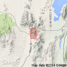
First published use as a map unit composed of fossiliferous, gray to black, highly crystalline to very fine grained limestone that alternates with gray sandy, brown-weathering limestone and reddish to greenish, and brown quartzitic to limy sandstone. Individual beds do not persist along strike. Occurs in two outcrops in the east-central part of the map area in Utah Co, UT on the Wasatch uplift. The northern outcrop area includes the Humbug mine (the source of the geographic name) in T10S, R2W. The southern outcrop is just east of Sioux Peak where a section 250 ft thick was measured. Intent to name a new unit not stated. No type locality designated. Is younger than Godiva limestone (first used). Quaternary alluvium is the only younger sedimentary deposit. Crinoid and coral fossils found in the limestones. Thought to be a shallow water deposit. Belongs to the Coal Measures of Carboniferous age.
Source: GNU records (USGS DDS-6; Denver GNULEX).
- Usage in publication:
-
- Humbug formation*
- Modifications:
-
- Revised
- AAPG geologic province:
-
- Wasatch uplift
- Great Basin province
Summary:
Occurs in east-central part of Tintic mining district in Utah Co on the Wasatch uplift, and in Juab Co in the Great Basin province. Basal contact selected with assurance only where the lowest sandy or shaly beds exposed. Some of the limestone near the base resembles the underlying Pine Canyon limestone (named). Term Godiva limestone, formerly thought to underlie Humbug, not used. Upper Mississippian fossils.
Source: GNU records (USGS DDS-6; Denver GNULEX).
- Usage in publication:
-
- Humbug formation*
- Modifications:
-
- Areal extent
- Contact revised
- AAPG geologic province:
-
- Great Basin province
Summary:
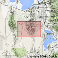
Extended geographically into Tooele Co, UT in the Great Basin province. Lower contact revised in that Humbug conformably overlies the newly named Upper Mississippian Deseret limestone. Lower contact placed at base of lowest brown quartzite or sandstone (Humbug) above dark-blue cherty limestone (Deseret). Conformably underlies the Upper Mississippian Great Blue limestone. Upper contact arbitrarily placed at top of highest "considerable" group of sandstone beds (Humbug) beneath dark-blue limestone (Great Blue). Mapped (geologic map) in central and central-south part of area in Tooele Co. Forms a ledge and slope topography. Section 645.5 ft thick measured on north wall of Ophir Canyon, south slope of Dry Mountains, 300-400 ft above Ophir Creek where Humbug consists of interbedded gray, blue limestone, gray sandy limestone, buff to brown limy sandstone, brown sandy shale, and gray to brown, fine-grained quartzite. Some of the limestone is coarse, crystalline; some beds have calcite blotches; some beds are fossiliferous. Two white calcite breccia beds. Sandstone and quartzite make up about 30 percent of the section. Fossils (brachiopods, crinoids) listed. May be equivalent to part of Brazer limestone. Deposited during periods of alternating calm and active currents. Late Mississippian age. Stratigraphic chart.
Source: GNU records (USGS DDS-6; Denver GNULEX).
- Usage in publication:
-
- Humbug formation*
- Modifications:
-
- Revised
- AAPG geologic province:
-
- Wasatch uplift
Summary:
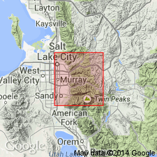
Underlies the newly named Doughnut formation east and northeast of Doughnut Falls, South Fork of Big Cottonwood Creek, Salt Lake Co, UT on the Wasatch uplift. Of Carboniferous age. Geologic map.
Source: GNU records (USGS DDS-6; Denver GNULEX).

- Usage in publication:
-
- Humbug formation*
- Modifications:
-
- Overview
- AAPG geologic province:
-
- Wasatch uplift
- Great Basin province
Summary:
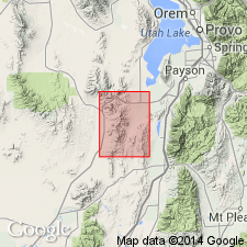
Crops out extensively in East Tintic Mountains, Utah Co, UT on the Wasatch uplift and Juab Co, UT in the Great Basin province. Contains abundant sandstone beds which distinguish it from the Deseret limestone (below) and the Great Blue formation (revised, above). Upper and lower contacts placed at base and at top, respectively of most prominent sandstone or quartzite bed. A section 597 ft thick measured in S1/2 sec 15, T8S, R3W. Assigned a Late Mississippian age. Geologic map. Correlation diagrams.
Source: GNU records (USGS DDS-6; Denver GNULEX).
- Usage in publication:
-
- Humbug Formation
- Modifications:
-
- Not used
Summary:
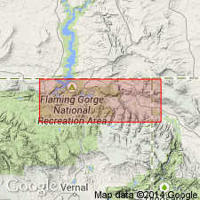
Mississippian sequence mapped in small area on map along north side of Spring Creek between Death Valley and Dowd Mountain in secs 23 and 24, T2N, R19E, and in small outcrops near the Uinta fault, Daggett Co, UT on the Uinta uplift. Sequence divided into a lower limestone unit, middle sandstone and limestone unit, and upper shale unit. A part of these units have been "incorrectly" assigned to the Humbug Formation. Humbug not used in this report. Lower unit is younger than the Uinta Mountain Group. Upper unit is older than the Round Valley Limestone.
Source: GNU records (USGS DDS-6; Denver GNULEX).
- Usage in publication:
-
- Humbug Formation*
- Modifications:
-
- Areal extent
- AAPG geologic province:
-
- Piceance basin
Summary:
Extended to Moffat Co, CO, Piceance basin area. Described as a light-gray to red, fine to very fine grained sandstone interbedded with light-gray limestone and red to black shale. Hematitic sandstone at top locally. Forms ledgy slopes. Mapped with the overlying Doughnut Shale. Overlies Madison Limestone unconformably. Of Late Mississippian age.
Source: GNU records (USGS DDS-6; Denver GNULEX).
- Usage in publication:
-
- Humbug Formation*
- Modifications:
-
- Areal extent
- AAPG geologic province:
-
- Wasatch uplift
Summary:
Extended to Oneida Co, southeast ID on the Wasatch uplift. Described as a dark-brown calcareous sandstone and siltstone 280 m thick that weathers to brown or orange plates. Is equivalent to the Little Flat Formation in the Chesterfield Range, ID. Overlies Lodgepole Limestone; underlies Great Blue Limestone. Of Late Mississippian age.
Source: GNU records (USGS DDS-6; Denver GNULEX).
- Usage in publication:
-
- Humbug Formation*
- Modifications:
-
- Areal extent
- AAPG geologic province:
-
- Great Basin province
Summary:
Topache Limestone abandoned. Rocks formerly assigned to Topache in the Star Range are reassigned to the Devonian and Mississippian Fitchville Formation, Mississippian Gardison and Deseret Limestones, and Humbug Formation.
Source: GNU records (USGS DDS-6; Denver GNULEX).
- Usage in publication:
-
- Humbug Formation*
- Modifications:
-
- Areal extent
- AAPG geologic province:
-
- Uinta uplift
- Green River basin
Summary:
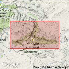
Mapped with Doughnut Shale along the Green River from Split Mountain, Uintah Co, UT in the Uinta basin east to Echo Park, Moffat Co, CO, Greater Green River basin, then south of the Yampa River in Moffat Co, CO in the Greater Green River basin. Forms ledgy slopes. Composed of light-gray to red, fine- to very fine grained sandstone interbedded with light gray marine limestone and red to black shale. Overlies Madison Limestone. Underlies Doughnut Shale. Of Late Mississippian age.
Source: GNU records (USGS DDS-6; Denver GNULEX).
- Usage in publication:
-
- Humbug Formation*
- Modifications:
-
- Areal extent
- AAPG geologic province:
-
- Green River basin
- Snake River basin
Summary:
Is considered offshore equivalent in present-day greater Green River and Snake River basins of Darwin Sandstone Member.
Source: GNU records (USGS DDS-6; Denver GNULEX).
For more information, please contact Nancy Stamm, Geologic Names Committee Secretary.
Asterisk (*) indicates published by U.S. Geological Survey authors.
"No current usage" (†) implies that a name has been abandoned or has fallen into disuse. Former usage and, if known, replacement name given in parentheses ( ).
Slash (/) indicates name conflicts with nomenclatural guidelines (CSN, 1933; ACSN, 1961, 1970; NACSN, 1983, 2005, 2021). May be explained within brackets ([ ]).