

- Usage in publication:
-
- Cody shale*
- Modifications:
-
- Original reference
- Dominant lithology:
-
- Shale
- Sandstone
- AAPG geologic province:
-
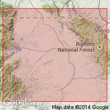
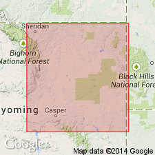
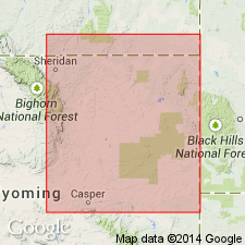
- Bighorn basin
Summary:
Jan. 21, 1916; p. 166, 171, table, etc. Cody shale, included in Colorado group as its uppermost formation. Gray and dark shale, with 1 bed of sandstone near base and several thin fossiliferous sandstones near top. Thickness 3,360+/- feet. Includes Basin (Niobrara) shale, and overlying Pierre shale of Hintze 1915 classification. Underlies Mesaverde formation of Montana group and overlies Frontier formation of Colorado group. Town of Cody is located on outcrop of this shale near Shoshone River, where it is 2,150 feet thick. [Detailed description of formation given, and fossils listed.] Age is Late Cretaceous. Report includes history of nomenclature chart.
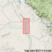
Type locality: exposures at town of Cody near Shoshone River [Lat. 44 deg. 31 min. 35 sec. N., Long 109 deg. 03 min. 24 sec. W., Cody 7.5-min quadrangle], Park Co., WY. [From GNC index card files; Lat/Long coords. from USGS GNIS database, accessed on Darwin's 200th birthday, 2009).]
Measured section: in southeast part T. 51 N., R. 93 W., [southeast of Basin, WY, and west of Bighorn River, in vicinity of Lat. 44 deg. 21 min. 50 sec. N., Long. 107 deg. 59 min. 50 sec. W., Greybull South 7.5-min quadrangle, Big Horn Co., WY (from USGS GNIS database and ACME Mapper 2.0, accessed on Darwin's 200th birthday, 2009).]
Source: US geologic names lexicon (USGS Bull. 896, p. 480); GNC index card files (USGS-Menlo); supplemental information from GNU records (USGS DDS-6; Denver GNULEX).
- Usage in publication:
-
- Cody shale*
- Modifications:
-
- Areal extent
- AAPG geologic province:
-
- Wind River basin
Summary:
Pg. 126 (fig. 2), 138. Cody shale. In Wind River Mountains, consists of about 4,500 feet of dark-gray shales interbedded with thin sandstone members. Overlies Frontier formation; underlies Mesaverde formation. Name Cody preferred to Steele because Cody was described as resting on the Frontier in Bighorn basin whereas the Steele was described as resting on the Niobrara. Near Wind River Mountains, there is no lower division that should be differentiated as Niobrara formation although fossils of Niobrara age are present.
Source: US geologic names lexicon (USGS Bull. 1200, p. 867-869).
- Usage in publication:
-
- Cody shale*
- Modifications:
-
- Biostratigraphic dating
Summary:
Pg. 1967. Cody shale. Analysis of 94 species of Late Cretaceous Foraminifera from three well-exposed sections of Cody shale in northern Wyoming and southern Montana indicates correlation of the Cody with Niobrara chalk of Great Plains and with upper part of Alberta shale of Canada. Correlation of entire Cody shale with the Niobrara supports Reeside's conclusions from mollusk evidence but is contrary to frequent practice of designating the lower Cody as Carlile in age.
Source: US geologic names lexicon (USGS Bull. 1200, p. 867-869).
- Usage in publication:
-
- Cody shale*
- Modifications:
-
- Areal extent
- AAPG geologic province:
-
- Wind River basin
Summary:
Cody shale. Stratigraphic section [southeastern part of Wind River basin and adjacent area in central Wyoming] shows that Cody shale overlies Wall Creek sandstone member of Frontier formation and underlies Parkman sandstone member of Mesaverde formation. Includes Shannon sandstone member in upper part. Term Cody as used here replaces terms Carlile shale, Niobrara shale, and Steele shale as used in this aea by Hares (1916, USGS Bull. 1641-I).
[US geologic names lexicon (USGS Bull. 1200, p. 868) lists Hoare and others, 1946, USGS Oil and Gas Inv. Prelim. Map 51. Believe this is a Misprint.]
Source: US geologic names lexicon (USGS Bull. 1200, p. 867-869).
- Usage in publication:
-
- Cody shale
- Modifications:
-
- Overview
- AAPG geologic province:
-
- Bighorn basin
Summary:
p. 138, 139. Cody shale of Montana group. Consists of series of gray to black marine shales, shaly buff sandstones (upper part only), gray calcareous shale, and a few thin bentonites. Maximum thickness about 3,500 feet at type locality; thins to about 2,600 feet in southeastern part of Bighorn basin. Unconformably overlies Frontier formation and conformably underlies Mesaverde formation. Near Elk basin oil field and Montana-Wyoming line, Claggett shale, Eagle sandstone, and Telegraph Creek formation occupy same stratigraphic interval as upper part of Cody elsewhere in Bighorn basin. Near city of Cody, the Eagle sandstone and Telegraph Creek sandy shale "shale out," and the shale facies are included in the Cody as defined. The buff to gray Claggett sandy shale equivalent forms top of the Cody shale. Age is Late Cretaceous.
Source: US geologic names lexicon (USGS Bull. 1200, p. 867-869).
- Usage in publication:
-
- Cody shale
- Modifications:
-
- Revised
- AAPG geologic province:
-
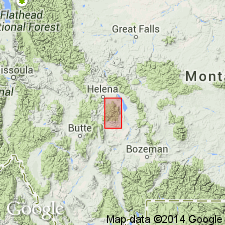
- Yellowstone province
Summary:
Pg. 5-8, 41. Cody shale. Measured sections show that Cody shale underlies Bacon Ridge sandstone (new) in southeast part of Jackson Hole area. Overlies Frontier formation. This contact is established in conformity with USGS classification and common usage for central Wyoming. At type area of Frontier, this contact may come well down within the Frontier. Contact is arbitrarily placed at approximate point below which sandstones predominate and above which sandy shales predominate. This contact is gradational within an interval of approximately 20 feet. Maximum thickness 2,211 feet. Age is Late Cretaceous.
Source: US geologic names lexicon (USGS Bull. 1200, p. 867-869).
- Usage in publication:
-
- Cody shale*
- Modifications:
-
- Mapped
- Revised
- AAPG geologic province:
-
- Powder River basin
- Central Montana uplift
Summary:
See also P.W. Richards, 1955, USGS Bull. 1026, p. 59-62, pls. 1, 2. Cody shale; lower part included in Colorado group and upper part included in Montana group. In Bighorn River Canyon, Hardin area, Big Horn County, Montana, comprises (ascending) lower shale, 205 feet; Greenhorn calcareous member, 97 feet; Carlile shale member, 280 feet; Niobrara shale member, 409 feet; Telegraph Creek member, 867 feet; shale member equivalent to Eagle sandstone, 375 feet; Claggett shale member, 367 feet. Lower part (lower shale through Niobrara) included in Colorado group and upper part (Telegraph Creek through Claggett) included in Montana group. Total thickness 2600 +/- feet. Several members mapped as formations by Thom and others (1935, USGS Bull. 856), however, differences in lithology are commonly too little to distinguish members where shale is not well exposed. Overlies Frontier formation of Colorado group; underlies Parkman sandstone of Montana group. Age is Late Cretaceous. Report includes geologic map (members separately mapped), measured sections.
Source: US geologic names lexicon (USGS Bull. 1200, p. 867-869); supplemental information from GNU records (USGS DDS-6; Denver GNULEX).
- Usage in publication:
-
- Cody shale*
- Modifications:
-
- Revised
- AAPG geologic province:
-
- Powder River basin
Summary:
Pg. 3-11. Cody shale. In southwestern Powder River basin, divided into (ascending): (1) unnamed member; (2) Shannon sandstone member; (3) unnamed member; (4) Sussex sandstone member (new); and (5) unnamed member. Name Cody preferred to Steele shale; Steele applied in areas where the Niobrara formation can be distinguished. Upper Cretaceous stratigraphic sequence of southwestern Powder River basin (ascending): Frontier formation (incl. "First Wall Creek sandstone" at top), Cody shale (incl. Shannon and Sussex sandstone members), and Mesaverde formation (incl. Parkman and Teapot sandstone members). Upper Cretaceous stratigraphic sequence of equivalent strata elsewhere (ascending): Frontier formation (incl. "First Wall Creek sandstone" at top), Carlile shale, Niobrara formation, Steele shale, and Mesaverde formation (incl. Parkman and Teapot sandstone members). Report includes E-log cross section, nomenclature chart.
Source: US geologic names lexicon (USGS Bull. 1200, p. 867-869); supplemental information from GNU records (USGS DDS-6; Denver GNULEX).
- Usage in publication:
-
- Cody shale*
- Modifications:
-
- Mapped 1:48k
- AAPG geologic province:
-
- Powder River basin
Summary:
Pg. B61-B63, pls. 6, 8. Cody shale. Described in Crazy Woman area, Johnson County, Wyoming, where it is about 3,670 feet thick, overlies Frontier formation and underlies Parkman sandstone. Includes Shannon sandstone member. Age is Late Cretaceous. Report includes geologic map.
Source: US geologic names lexicon (USGS Bull. 1200, p. 867-869).
- Usage in publication:
-
- Cody shale*
- Modifications:
-
- Areal extent
- AAPG geologic province:
-
- Powder River basin
Summary:
Cody shale. Cody, as mapped in northeastern Wyoming, includes Shannon sandstone 2,000 feet above base and Sussex sandstone member 2,500 feet above base. Age is Late Cretaceous.
Source: US geologic names lexicon (USGS Bull. 1200, p. 867-869).
- Usage in publication:
-
- Cody shale*
- Modifications:
-
- Revised
- AAPG geologic province:
-
- Powder River basin
Summary:
Pg. 12 (fig. 3), 15, 16, 17-34, pls. 1, 2. Cody shale; lower part included in Colorado group and upper part included in Montana group. Revised locally in Hardin district, Montana and Wyoming. Includes all units between Mowry shale and Judith River formation. As thus defined, the Cody comprises (ascending) Belle Fourche shale, Greenhorn calcareous shale, Carlile and Niobrara shale (undifferentiated), Telegraph Creek shale, unnamed sandy shale, and Claggett shale members. Strata formerly designated Frontier formation are assigned to Belle Fourche member. Age is Late Cretaceous. Report includes geologic map, stratigraphic nomenclature chart.
The following changes in local nomenclature favored by the authors have not been adopted by the USGS: elimination of name "Cody shale"; introduction of name Steele shale to designate a formation containing the three members of the Cody (Telegraph Creek, unnamed member, and Clagget member) that fall within Montana group; promotion to formation rank of each of the three members of the Cody (Belle Fourche, Greenhorn, and Carlile-Niobrara) that are included in the Colorado group.
Source: Publication; US geologic names lexicon (USGS Bull. 1200, p. 867-869).
- Usage in publication:
-
- Cody shale
- Modifications:
-
- Revised
- AAPG geologic province:
-
- Wind River basin
Summary:
Cody shale. Revised in east-central Wyoming (Wind River basin), to include transgressive marine sequences previously assigned to the Mesaverde formation. Author assigns regressive marine sequences to the Mesaverde formation and transgressive marine sequences to the Cody shale. The lowermost regressive unit is named Phayles Reef member of Mesaverde formation. The overlying transgressive unit, formerly called middle member of Mesaverde formation, is named the Wallace Creek tongue of Cody shale. Age is Late Cretaceous. Report includes cross sections.
Phayles Reef and Wallace Creek named on diagrammatic cross section of Mesaverde formation.
Source: Modified from GNU records (USGS DDS-6; Denver GNULEX).
- Usage in publication:
-
- Cody shale*
- Modifications:
-
- Areal extent
- AAPG geologic province:
-
- Powder River basin
Summary:
Pls. 1, 3. Cody shale; included in Colorado group and in Montana group. Formation includes sequence of marine sandstone and shale of Late Cretaceous age which in Buffalo-Lake De Smet area overlies conglomeratic sandstone of Frontier formation and underlies Parkman sandstone. Intense folding and faulting at some places and poor exposures at other prevent reliable measurement of thickness of formation in Buffalo-Lake De Smet area; thickness about 3,550 feet near Elgin Creek about 3 miles south of area. Seven members recognized (ascending): unnamed lower shale, Greenhorn calcareous, Carlile shale, Niobrara shale, unnamed sandstone and shale, Shannon sandstone, unnamed upper shale. Report includes geologic map, measured sections, fossil list.
Source: US geologic names lexicon (USGS Bull. 1200, p. 867-869).
- Usage in publication:
-
- Cody Shale*
- Modifications:
-
- Revised
- AAPG geologic province:
-
- Montana folded belt
Summary:
Divided into lower shale member, Eldridge Creek Sandstone Member (new), and upper shale member in Park Co, MT in the Montana folded belt province. Of Late Cretaceous age.
Source: GNU records (USGS DDS-6; Denver GNULEX).

- Usage in publication:
-
- Cody Shale*
- Modifications:
-
- Areal extent
- AAPG geologic province:
-
- Wind River basin
Summary:
Applied to the shale beneath the Mesaverde Formation in the southeastern Wind River basin where the Niobrara Formation is poorly developed or missing, and to the shale called Wallace Creek Tongue (of the Cody) which separates two sandstones of the Mesaverde--the older Fales Sandstone Member from the younger Parkman Sandstone Member. Correlation with other late Santonian to late Campanian, or Late Cretaceous units in south-central WY shown on table 1.
Source: GNU records (USGS DDS-6; Denver GNULEX).
- Usage in publication:
-
- Cody Shale*
- Modifications:
-
- Biostratigraphic dating
- AAPG geologic province:
-
- Wind River basin
- Bighorn basin
Summary:
Age of base and top varies across central WY. Basal part of Cody is early Niobrara age (approximately equal to SCAPHITES VENTRICOSUS zone (Coniacian)) in western half of Wind River basin and is of probable late Carlile age (late Turonian) in eastern half. Basal Cody in southern Bighorn basin is as old as early Greenhorn (middle Cenomanian). Upper part of Cody west of line extending from south-central Wind River basin north to southern Bighorn basin is approximately within HARESICERAS MONTANAENSE-SCAPHITES HIPPOCREPIS I zone (lower Campanian); eastward of this line upper strata of main body of Cody is within BACULITES MCLEARNI and possibly BACULITES ASPERIFORMIS zones (middle Campanian). Wallace Creek Tongue of Cody is in still younger (middle Campanian) zone of BACULITES PERPLEXUS. Faunal zones shown on table 2. Overlies Frontier Formation with transitional contact in many places; underlies Mesaverde Formation with transitional and intertonguing contact. Cross sections; outcrop map. Age is Late Cretaceous (middle Cenomanian to middle Campanian).
Source: GNU records (USGS DDS-6; Denver GNULEX).
- Usage in publication:
-
- Cody Shale*
- Modifications:
-
- Areal extent
- AAPG geologic province:
-
- Montana folded belt
- Bighorn basin
- Wind River basin
Summary:
Pg. C6-C7, C27-C29, C68-C70, pls. 1, 2. Cody Shale. Nonresistant, dark-brownish-gray, partly silty and sandy marine shale containing thin interbeds of bentonite and sandstone; forms grassy slopes and valleys. Includes (ascending): (1) unnamed lower shale member, dark-gray to dark-brown marine shale interbedded with siltstone, 400 to 590 feet; (2) Eldridge Creek Sandstone Member, persistent thin-bedded, greenish-gray, fine-grained sandstone, 90 to 120 feet; and (3) unnamed upper shale member, dark-gray to brown marine shale and siltstone interbedded with very fine-grained sandstone, 500 to 845 feet. Described in detail from composite measured section; thickness 1,285 feet. To the southeast in Bighorn basin is 3,360 feet and in Wind River basin is 5,000+ feet. Overlies Frontier Formation; underlies Telegraph Creek Formation. Lower shale member correlative with Greenhorn through lower Niobrara strata of northeastern Wyoming; calcareous unit in lower shale member correlative with Greenhorn Calcareous Member of Cody Shale of south-central Montana and Cone Calcareous Member of Marias River Shale of northwestern Montana. Formation represents transgressive return to deeper water marine conditions. Age is Late Cretaceous (Cenomanian to Santonian); Eldridge Creek and upper shale members yielded fossils of late Conacian and Santonian age (identified by W.A. Cobban, USGS, 1955). [Fossils listed.]
Composite section: (1) outcrop on north side of Canyon Mountain, in sec. 27, T. 2 S., R. 9 E.; (2) subsurface Deerfield Oil Corp. Strong No. 1 well, in sec. 11, T. 2 S., R. 9 E., Park Co., MT.
Source: Publication.
- Usage in publication:
-
- Cody Shale*
- Modifications:
-
- Revised
- AAPG geologic province:
-
- Powder River basin
- Wind River basin
Summary:
Sage Breaks and Niobrara (both revised) assigned as members of Cody in its lowermost part in western Powder River basin and eastern Wind River basin. As shown on four cross sections (OC-73 to OC-76), Sage Breaks and Niobrara are members of Cody in central Johnson, southwesternmost Campbell, and western two-thirds of Converse Cos, WY, western Powder River basin and in eastern Natrona Co, WY, Wind River basin. Conformably overlies Wall Creek Sandstone Member of Frontier Formation; conformably underlies Parkman Sandstone Member of Mesaverde Formation. Late Cretaceous age.
Source: GNU records (USGS DDS-6; Denver GNULEX).
- Usage in publication:
-
- Cody Shale
- Modifications:
-
- Overview
- AAPG geologic province:
-
- Powder River basin
Summary:
The Powder River basin names Sussex and Shannon Sandstone Members [of the Cody Shale in the western part of the basin or of the Steele Shale in the central and east part of the basin] have been applied erroneously in the subsurface of the Denver basin to younger sandstones of the Pierre Shale. The Denver basin outcrop names Terry Sandstone Member (rather than Sussex) and Hygiene Sandstone Member (rather than Shannon) should be used in the subsurface of the Denver basin. The Terry and Hygiene are shelf deposits equivalent to the Parkman Sandstone of south-central WY. Stratigraphic chart. Cody is an Upper Cretaceous unit.
Source: GNU records (USGS DDS-6; Denver GNULEX).
- Usage in publication:
-
- Cody Shale*
- Modifications:
-
- Biostratigraphic dating
- AAPG geologic province:
-
- Bighorn basin
- Powder River basin
Summary:
Is assigned (in part) an early late Cenomanian (Late Cretaceous) age based on presence of the ammonites DUNVEGANOCERAS PONDI and TARRANTOCERAS FLEXICOSTATUM from silty concretions 80 ft above base at USGS Mesozoic locality 21850, Big Horn Co, WY in Bighorn basin; indicates D. PONDI zone. Base of Greenhorn Calcareous Member of Cody Shale is assigned a latest Cenomanian (Late Cretaceous) age based on presence of NEOCARDIOCERAS JUDDII from limestone concretions in bentonite bed M of Knechtel and Patterson (1956, p. 21) at USGS localities D8463 and 21366, Big Horn Co, MT in Powder River basin; assigned to N. JUDDII zone.
Source: GNU records (USGS DDS-6; Denver GNULEX).
- Usage in publication:
-
- Cody Shale*
- Modifications:
-
- Age modified
- Biostratigraphic dating
- AAPG geologic province:
-
- Powder River basin
Summary:
Age refined to early Turonian (in part), on basis of ammonites identified from Greenhorn Member of Cody in south-central MT. WATINOCERAS REESIDEI recorded from USGS Mesozoic locality 20935, Big Horn Co, MT, Powder River basin. Fauna places Greenhorn Member of Cody in middle or upper zone of tripartite zonation of the early Turonian. Updated list of ammonites and inoceramid from this important locality given.
Source: GNU records (USGS DDS-6; Denver GNULEX).
- Usage in publication:
-
- Cody Shale*
- Modifications:
-
- Revised
- Age modified
- Geochronologic dating
- AAPG geologic province:
-
- Powder River basin
Summary:
Upper part divided into (ascending): Niobrara and Steele (revised) Members. Steele divided into (ascending): informal Fishtooth sandstone, Shannon Sandstone Beds (rank reduced), and Sussex Sandstone Bed (rank reduced); each of these units is bounded by shales of the Steele. Shown on stratigraphic chart of Upper Cretaceous rocks in subsurface of western part of Powder River basin, WY (fig 3). Shannon assigned early Campanian age based on K-Ar date of 81 Ma on associated bentonite beds (J. D. Obradovich, U.S.G.S., oral commun., 1989). Geologic map. Underlies Mesaverde Formation; underlying unit not discussed. Age of upper part of Cody modified to Campanian. [Authors provide no discussion of stratigraphic reassignments.]
Source: GNU records (USGS DDS-6; Denver GNULEX).
- Usage in publication:
-
- Cody Shale*
- Modifications:
-
- Areal extent
- AAPG geologic province:
-
- Montana folded belt
Summary:
Pg. B4, B6 (fig. 3). Cody Shale. In Elkhorn Mountains, Jefferson and Broadwater Counties, southwestern Montana, the 265- to 390-foot-thick black shale, previously called upper black shale unit of Colorado [Formation] by Klepper and others (1957), is assigned to Cody Shale. Correlates with Cody Shale of Livingston area, rather than Marias River Shale of Colorado Group of north-central Montana, based on lithology, age, and stratigraphic relations. Age is Late Cretaceous (Coniacian).
Source: Publication.
For more information, please contact Nancy Stamm, Geologic Names Committee Secretary.
Asterisk (*) indicates published by U.S. Geological Survey authors.
"No current usage" (†) implies that a name has been abandoned or has fallen into disuse. Former usage and, if known, replacement name given in parentheses ( ).
Slash (/) indicates name conflicts with nomenclatural guidelines (CSN, 1933; ACSN, 1961, 1970; NACSN, 1983, 2005, 2021). May be explained within brackets ([ ]).