The National Geologic Map Database is migrating to a new infrastructure. We apologize for any service disruptions during this process.
|
|---|


- Usage in publication:
-
- Breathitt formation*
- Modifications:
-
- Original reference
- Dominant lithology:
-
- Shale
- Sandstone
- AAPG geologic province:
-
- Appalachian basin
Summary:
Breathitt formation [of Pottsville group]. Sandy shale and coarse ferruginous sandstone with occassional coal seams, the Pittsburg (Kentucky) coal lying at base. Thickness 550 feet. Overlies Corbin conglomerate lentil of Lee formation and includes all post-Lee Pennsyvlanian rocks. Named from Breathitt County, southeastern Kentucky, where it is present in great force. [As defined included rocks of Pottsville age only, the Allegheny formation not being present in this part of Kentucky.]
Source: US geologic names lexicon (USGS Bull. 896, p. 257-258).
- Usage in publication:
-
- Breathitt formation
- Modifications:
-
- Revised
- AAPG geologic province:
-
- Appalachian basin
Summary:
Crandall, like Mr. Campbell, made no attempt to define upper limits of any formation which has as its base a contact with the Conglomerate Series. Crandall in his report on Whitely County enumerated 9 coal seams in the Measures above the Conglomerate. Whether all of these will be finally included in the Breathitt is yet to be determined. [He included in the Breathitt, Lilly coal or No. 4 (No. 1 of old writers), Lower Blue Gem coal (No. 5), Upper Blue Gem coal (No. 6), and Main Jellico coal (No. 7), also 200 feet of beds above Jellico coal.]
Source: US geologic names lexicon (USGS Bull. 896, p. 257-258).

- Usage in publication:
-
- Breathitt formation
- Modifications:
-
- Revised
- AAPG geologic province:
-
- Appalachian basin
Summary:
Pg. 10. Breathitt formation. Overlies Corbin conglomerate and includes Homewood sandstone at top. Thickness 525 to 600 feet. [Recognized in southeastern Kentucky. Age is Pennsylvanian.]
Source: US geologic names lexicon (USGS Bull. 896, p. 257-258).
- Usage in publication:
-
- Breathitt formation
- Modifications:
-
- Revised
- AAPG geologic province:
-
- Appalachian basin
Summary:
Pg. 82, 88, 94. Breathitt formation. Magoffin shale and limestone, Kendrick shale, and Elkins Fork shale are listed in Breathitt formation. [Age is Middle Pennsylvanian.]
Source: US geologic names lexicon (USGS Bull. 1200, p. 463-464).

- Usage in publication:
-
- Breathitt formation
- Modifications:
-
- Revised
- AAPG geologic province:
-
- Appalachian basin
Summary:
Chart no. 6 (column 22, Kentucky River valley, eastern Kentucky, collated by H.R. Wanless and J.M. Weller). Breathitt formation (Appalachian Kanawha to Allegheny Series). Pennsylvanian correlation chart shows Lost Creek limestone and Flint Ridge flint in upper part of Breathitt formation in Kentucky River valley. Age is [Middle Pennsylvanian]; Lampasas [Atokan] to Desmoinesian; Westphalian B to D.
Source: Publication; US geologic names lexicon (USGS Bull. 1200, p. 463-464).
- Usage in publication:
-
- Breathitt formation
- Modifications:
-
- Revised
- AAPG geologic province:
-
- Appalachian basin
Summary:
Pg. 64, 65, 76, 136, 153. Breathitt formation. Includes Whetstone Creek shale member (new) in Whitley County area, [southeastern Kentucky]. In Letcher County, includes Bee Tree shale. [Age is Middle Pennsylvanian.]
Source: US geologic names lexicon (USGS Bull. 1200, p. 463-464).
- Usage in publication:
-
- Breathitt formation
- Modifications:
-
- Areal extent
- AAPG geologic province:
-
- Appalachian basin
Summary:
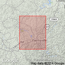
Pg. 11 (fig. 2), 13-28. Breathitt formation. In Paintsville quadrangle, named units, not including coals are (ascending) Quakertown shale, Campbell Creek limestone, Elkins Fork shale, Kendrick shale, and Magoffin limestone. [Age is Middle Pennsylvanian.]
Source: US geologic names lexicon (USGS Bull. 1200, p. 463-464).
- Usage in publication:
-
- Breathitt formation
- Modifications:
-
- Areal extent
- AAPG geologic province:
-
- Appalachian basin
Summary:
Pg. 32-36. Breathitt formation. At type locality, the Breathitt includes rocks of Pottsville age only. However, no upper boundary has been defined, and formation includes rocks of Allegheny age in other localities. In Paintsville area, all consolidated rocks above massive sandstones of Lee formation are included in the Breathitt. [Age is Middle Pennsylvanian.]
Source: US geologic names lexicon (USGS Bull. 1200, p. 463-464).
- Usage in publication:
-
- Breathitt Group*
- Modifications:
-
- Revised
- AAPG geologic province:
-
- Appalachian basin
Summary:
Breathitt Formation raised to group rank in extreme southeastern KY and southwestern VA. There Breathitt Group comprises, in ascending order, the Hance, Mingo, Catron, Hignite, and Bryson Formations (Bryson not present in Ewing quad).
Source: GNU records (USGS DDS-6; Reston GNULEX).

- Usage in publication:
-
- Breathitt Formation*
- Modifications:
-
- Revised
- AAPG geologic province:
-
- Appalachian basin
Summary:
Breathitt Formation applied throughout eastern KY. Extended southeast of the Pine Mountain fault where Breathitt Group is reduced in rank to Breathitt Formation.
Source: GNU records (USGS DDS-6; Reston GNULEX).
- Usage in publication:
-
- Breathitt Formation*
- Modifications:
-
- Areal extent
- AAPG geologic province:
-
- Appalachian basin
Summary:
Long discussion of alleged unsatisfactory definitions and usage of the Hance, Mingo, Catron, Hignite, and Bryson Formations of the Breathitt Group in the Cumberland overthrust block in extreme southeast KY and eastern TN. Separation of formations is based on key beds (coal beds) and not on lithologic differences. The coal beds are not present everywhere and have been miscorrelated in the past. Mapping of contacts between formations has been inconsistent. The authors recommend that the Breathitt Group be reduced in rank to Breathitt Formation in the area as it is in KY northwest of the overthrust block and that in the future no attempt be made to identify and map the component formations listed above.
Source: GNU records (USGS DDS-6; Reston GNULEX).
- Usage in publication:
-
- Breathitt Formation*
- Modifications:
-
- Age modified
- AAPG geologic province:
-
- Appalachian basin
Summary:
Age of Breathitt in report area is Middle Pennsylvanian only. Basal contact is at top of Lower Pennsylvanian Naese Sandstone Member of Lee Formation. Nomenclature in this report follows that suggested by Rice (1984) and McDowell and others (1985). Breathitt in this area is reduced to formation rank and Catron, Mingo, and Hance Formations are "abandoned" for this report. Breathitt in this area includes Betsie and Kendrick Shale Members and several coal beds (Jellico, Blue Gem, Little Blue Gem, River Gem, Kent, Mingo, Rich Mountain, Phoebe, Murray, Rex, Naese, Buckeye Spring, Poplar Lick and Sterling).
Source: GNU records (USGS DDS-6; Reston GNULEX).

- Usage in publication:
-
- Breathitt group
- Modifications:
-
- Revised
- AAPG geologic province:
-
- Appalachian basin
Summary:
Breathitt Formation is informally elevated to group rank and subdivided into the following eight informal formations: Pocahontas, Bottom Creek, Alvy Creek, Grundy, Pikeville, Hyden, Four Corners, and Princess formations. These formations include several new informal members. [Revisions made in this paper are strongly contested by C. Rice and other USGS scientists who work in this area (oral commun., 9/3/93).]
Source: GNU records (USGS DDS-6; Reston GNULEX).

- Usage in publication:
-
- Breathitt Group
- Modifications:
-
- Revised
- AAPG geologic province:
-
- Appalachian basin
Summary:
The Breathitt is formally elevated to group rank. In this report, the Breathitt is subdivided into (ascending) Pocahontas Formation, Warren Point Sandstone, informal Bottom Creek formation, Sewanee Sandstone, informal Alvy Creek formation, Bee Rock Sandstone, Grundy Formation (new), Corbin Sandstone, Pikeville Formation (new), Hyden Formation (new), Four Corners Formation (new), and Princess Formation (new). The Group is undivided toward the northwest in southern OH. The Breathitt, above the level of the Pocahontas Formation, unconformably overlaps underlying strata to the northwest. This unconformity is Early Pennsylvanian. Breathitt overlies the Pennington Group and underlies the Conemaugh and Monongahela Formations. A generalized age of Pennsylvanian is shown for all of the Breathitt. According to the author, formal nomenclature presented in this report for units occurring in KY has been accepted by the Kentucky Stratigraphic Nomenclature Committee. Units that occur largely outside KY are considered informal. Report includes correlation charts, cross sections, and measured sections.
Source: GNU records (USGS DDS-6; Reston GNULEX).
- Usage in publication:
-
- Breathitt Formation
- Modifications:
-
- Revised
- AAPG geologic province:
-
- Appalachian basin
Summary:
The name Crummies Member is here given to a marine unit in the Breathitt Formation. This is the same interval referred to as the Cannelton limestone in the Kanawha River valley of WV (White, 1885). Unit has been miscorrelated by other workers with the Campbell Creek Limestone of White (1885). The Crummies and equivalent strata extend throughout eastern KY and adjacent WV, VA, and TN. The member attains its greatest thickness in southeasternmost KY and is present as a thin, discontinuous sandstone and sandy siltstone unit in northeastern KY. It separates the lower and upper Elkhorn coal zones of the Breathitt.
Informal Kilgore flint of Webb (1963) is here formally named as Kilgore Flint Member of Breathitt Formation in northeastern KY. Named for Kilgore, KY. Correlates with informal Flint Ridge flint of Morse (1931), Kanawha black flint of Wanless (1939, 1975) in Kanawha Formation of WV, and Putnam Hill Limestone Member of Allegheny Formation in OH. Obryan Member is here named for rocks previously identified as Vanport Limestone of White (1878), Vanport Limestone Member of Breathitt Formation, or Vanport Limestone Member as used by Phalen (1912). Obryan is extended into southern OH as a member of Allegheny Formation for rocks previously called informal Vanport or "Ferriferous" limestone member of the Allegheny by Stout (1916).
Source: GNU records (USGS DDS-6; Reston GNULEX).

- Usage in publication:
-
- Breathitt Formation*
- Modifications:
-
- Revised
- Areal extent
- AAPG geologic province:
-
- Appalachian basin
Summary:
Breathitt Formation is upper part of Pennsylvanian in much of eastern KY. Includes all strata between Lee and Conemaugh Formations. As much as 3120 ft in Harlan Co., KY. Intertongues with sandstone members of Lee Formation. Generally restricted to Cumberland overthrust sheet in TN; elsewhere in TN, Breathitt is equivalent to Crooked Fork Group and Slatestone, Indian Bluff, Graves Gap, Redoak Mountain, Vowell Mountain, and Cross Mountain Formations (Wilson and others, 1956; Hardeman and others, 1966). Breathitt not used in VA. Use of Breathitt Group is discontinued because of abandonment of component formations. Includes strata previously included in Hance, Mingo, Catron, Hignite, and Bryson Formations (all abandoned herein). Jesse Sandstone Member reassigned from Catron to Breathitt in KY. Magoffin Member reassigned from Hignite to Breathitt in KY. Also includes Betsie Shale Member in KY and TN, and Kilgore Flint Member, Crummies Member, Kendrick Shale Member, Reynolds Sandstone Member, and Stoney Fork Member (replaces informal Lost Creek limestone) in KY.
Source: GNU records (USGS DDS-6; Reston GNULEX).
- Usage in publication:
-
- Breathitt Formation
- Modifications:
-
- Revised
- AAPG geologic province:
-
- Appalachian basin
Summary:
The Hazel Patch sandstone of the Breathitt Formation is informally named in this report for outcrops near Hazel Patch in Laurel Co., KY. Overlies and underlies 5 to 8 m of dark, silty, carbonaceous shale. Thickness ranges from 15 to 40 m in the type area. Unit contains a wide variety of rhythmic bedding. Previously interpreted as a series of distributary channels based on the coarse-grained, cross-bedded facies found at the type, but new exposures along I-75 reveal large sections of a sheet-form, finer grained, ripple-dominated facies. The Hazel Patch is divided into five lithofacies: cross-bedded, swaly to even-bedded, even-bedded scour-fill, ripple-bedded, and inclined heterolithic scour-fill. Present study supports interpretation of tidal currents and waves as the dominant sedimentary process during deposition.
Source: GNU records (USGS DDS-6; Reston GNULEX).

- Usage in publication:
-
- Breathitt Group
- Modifications:
-
- Areal extent
- AAPG geologic province:
-
- Appalachian basin
Summary:
Corr. chart. Breathitt Group. Recognized in eastern and southeastern Kentucky. Maximum thickness 3,120 feet. Includes (descending): Princess Formation (in eastern Kentucky), Four Corners Formation, Hyden Formation, Pikevile Formation, Grundy Formation, Bee Rock Sandstone, Alvy Creek formation (informal), Sewanee Sandstone, Bottom Creek Formation (informal), and Warren Point Sandstone. In eastern Kentucky underlies Conemaugh Formation. Age is Early to Middle Pennsylvanian (Namurian to Westphalian; Morrowan to Desmoinesian).
Source: Publication.
For more information, please contact Nancy Stamm, Geologic Names Committee Secretary.
Asterisk (*) indicates published by U.S. Geological Survey authors.
"No current usage" (†) implies that a name has been abandoned or has fallen into disuse. Former usage and, if known, replacement name given in parentheses ( ).
Slash (/) indicates name conflicts with nomenclatural guidelines (CSN, 1933; ACSN, 1961, 1970; NACSN, 1983, 2005, 2021). May be explained within brackets ([ ]).