The National Geologic Map Database is migrating to a new infrastructure. We apologize for any service disruptions during this process.
|
|---|


- Usage in publication:
-
- Fort Pierre group*
- Modifications:
-
- Named
- Dominant lithology:
-
- Clay
- AAPG geologic province:
-
- Williston basin
Summary:
Named as basal formation of Upper Cretaceous series, base of Upper Cretaceous. Formerly called "formation No. 4" (Meek and Hayden, 1857). Type not designated. Named for Fort Pierre, eastern Stanley Co, SD in Williston basin on Missouri River, where formation composes all hills on both sides of river. Consists of fine, gray and dark-colored clays in moderately distinct layers (never laminated or slaty structure as in Fort Benton Group); clays are soft and plastic when wet, crack and crumble upon drying; locally, a basal bed 10-30 ft thick composed of dark, unctuous clay with abundant fish scales, much iron pyrite and carbonaceous matter, and gypsum, fills depressions in eroded upper surface of underlying Niobrara Division. Lower and upper parts fossiliferous; middle part nearly barren. Estimated thickness 700 ft. Underlies Fox Hills Beds (new). Fossils listed. Is well developed at Black Hills and along Rocky Mountains as far south as Pikes Peak; also in NE; occurs as far north as South Branch of Saskatchewan River in Canada. Is correlated with "Austin Limestone" and "Fish-bed" in TX, and with Coastal Plain units from Green Sand of NJ to "Rotten Limestone" of AL. Fort Pierre Group and Fox Hills Beds of Upper Cretaceous series are synchronous with the Upper or White Chalk, and Maestricht beds of Europe (=Senonien of D'Orbigny) on basis of both stratigraphic and paleontologic evidence.
Source: GNU records (USGS DDS-6; Denver GNULEX).
- Usage in publication:
-
- Fort Pierre group*
- Modifications:
-
- Named
- Dominant lithology:
-
- Clay
- AAPG geologic province:
-
- Williston basin
Summary:
Pg. 419, 424. Fort Pierre group (Formation No. 4 of Cretaceous), base of Upper Cretaceous. Well developed in Nebraska Territory [which then included Wyoming, Montana, and the Dakotas], along Rocky Mountains as far south as Pikes Peak, Colorado, to as far north as South Branch of Saskatchewan River in Canada, and in Black Hills. Thickness 700 feet in Nebraska Territory. Consists of (descending): (1) dark-gray and bluish fossilifeorus plastic clays exposed on Sage Creek, on Cheyenne River, and on White River above Bad Lands; (2) middle zone, nearly barren of fossils, which occurs at Fort Pierre and out on to Bad Lands --down the Missouri on high country to Great Bend; (3) lower fossiliferous zone, which occurs at Great Bend of the Missouri below Fort Pierre; and (4) dark bed of very fine unctuous clay containing much carbonaceous matter, with veins and seams of gypsum, masses of sulphuret of iron, and numerous small scales of fishes, and occurring near Bijou Hill, on the Missouri, fills depressions in eroded upper surface of underlying Niobrara. Clays in moderately distinct layers (never laminated or slaty structure as in Fort Benton group); are soft and plastic when wet, crack and crumble upon drying. Underlies Fox Hills beds and overlies Niobrara division. Is correlated with "Austin limestone" and "Fish-bed" of Texas, and with Coastal Plain units from "green sand" of New Jersey to "Rotten limestone" of Alabama. Fort Pierre group and Fox Hills beds of Upper Cretaceous series are synchronous with the "upper," or "white chalk," and Maestricht beds of Europe (=Senonien of D'Orbigny) on basis of both stratigraphic and paleontologic evidence. Fossils listed.
Named from exposures at old Fort Pierre, in either Stanley or Hughes Co., SD. The exact location of the old fort is not known (US geologic names lexicon, USGS Bull. 896, p. 1657).
Fort Pierre No. 1 (est. 1832): once located along western bank of Missouri River, Lat. 44 deg. 23 min. 16 sec. N., Long. 100 deg. 22 min. 58 sec. W., Oahe Dam 7.5-min quadrangle, Stanley Co., SD (US Board Geog. Names citing Hist. Comm. Brown Co. Mus. and Hist. Soc., Brown Co. Hist., Aberdeen, SD, North Plains Press, p. 246).
Fort Pierre No. 2 (est. 1859): once located along western bank of Missouri River (north of No. 1), Lat. 44 deg. 25 min. 22 sec. N., Long. 100 deg. 23 min. 10 sec. W., Oahe Dam 7.5-min quadrangle, Stanley Co., SD (US Board Geog. Names citing R.H. Mattison, 1962, South Dakota Hist. Collns., v. 31, p. 246).
See also Vereingte Staaten von Nord Amerika, 1879. Map of forts, rivers, settlements in Dakota. Available online from the South Dakota State Archives (http://www.sdhistory.org/arc/military/Forts/fort_pierre.htm).
Source: US geologic names lexicon (USGS Bull. 896, p. 1657); supplemental information from GNU records (USGS DDS-6; Denver GNULEX).
- Usage in publication:
-
- Fort Pierre group*
- Modifications:
-
- Overview
- AAPG geologic province:
-
- Williston basin
- Chadron arch
- Powder River basin
Summary:
Plainly recognizable entirely around the Black Hills in Williston and Powder River basins and on Chadron arch. Thickness estimated at 150 to 250 ft. Lists fossils collected on south branch of the Cheyenne River, southeast flank of Black Hills, SD. Cretaceous in age.
Source: GNU records (USGS DDS-6; Denver GNULEX).
- Usage in publication:
-
- Pierre group*
- Modifications:
-
- Areal extent
- AAPG geologic province:
-
- Denver basin
- Las Vegas-Raton basin
Summary:
Occurs in the Denver and Las Vegas-Raton basins and on the Las Animas arch of CO above the Niobrara group. Is composed of laminated, argillaceous shale more than 4,000 ft thick. Divisible into a lower part 400 or 500 ft thick (nearly barren of fossils), a zone with ovoid concretions, 600 ft thick, the Rusty zone, 100 to 200 ft thick characterized by abundance of fossil BACULITES COMPRESSUS. Tepee zone about 1,000 ft thick of gray shale with abundant concretions, usually larger than those of the Rusty zone, and a large bivalve INOCERAMUS SAGENSIS, and an upper part (barren of fossils) whose thickness was not stated. Underlies the Fox Hills group. Assigned to the Late Cretaceous.
Source: GNU records (USGS DDS-6; Denver GNULEX).
- Usage in publication:
-
- Pierre formation*
- Modifications:
-
- Revised
- AAPG geologic province:
-
- Denver basin
Summary:
Is a thick (5,000+ ft) slate gray, dark brown to black shale that overlies the Niobrara formation and underlies Fox Hills formation. Has several limy beds. Calcareous nodules with concentrations of iron occur as beds and as well-formed nodules. Sandstone may occur at any place in section. One persistent, ridge-forming, gray, calcareous sandstone about one-third the way up from base of Pierre, named Hygiene sandstone member. Rest of Pierre unnamed and mapped with Fox Hills. A transition zone exists between the Pierre and Fox Hills and is marked by slate colored, more arenaceous (than lower part) shale with limestone and ferruginous nodules. Of Cretaceous age. Geologic map.
Source: GNU records (USGS DDS-6; Denver GNULEX).
- Usage in publication:
-
- Pierre formation*
- Modifications:
-
- Revised
- AAPG geologic province:
-
- Wind River basin
Summary:
In the northeast corner of Natrona Co., WY, Wind River basin, Pierre formation, basal formation of Upper Cretaceous Montana group divided into (ascending): unnamed gray shale of marine origin, Shannon sandstone lentil (named) of marine origin, shale with some sandstone of marine origin, Parkman sandstone member (rank modified in report area) of marine and freshwater origin, and shale and sandstone of marine origin. Overlies Niobrara shale, upper formation of Colorado group. Underlies Fox Hills sandstone of Montana group. Is 3,600 ft thick. Fossils: dinosaur, crocodile, ammonites, Mosasaur remains.
Source: GNU records (USGS DDS-6; Denver GNULEX).
- Usage in publication:
-
- Pierre shale*
- Modifications:
-
- Revised
- Areal extent
- AAPG geologic province:
-
- Denver basin
Summary:
Forms extensive outcrop in Larimer, Morgan, and Washington Cos, CO in the Denver basin. Geologic map. Five sandstones distinguished but not mapped in a measured section on Fossil Creek south of Fort Collins. These sandstones assigned by Ball (1924) as unranked units to the Mesaverde formation. They are reassigned to the Pierre and ranked as members are (ascending order): Hygiene, Terry, Rocky Ridge, Larimer, and Richard sandstone members. Overlies Niobrara formation. Underlies Fox Hills sandstone. Thought to be 9,969 ft thick on Fossil Creek, but this thickness may be excessive due to uncertain thickness of covered intervals. Of Late Cretaceous age.
Source: GNU records (USGS DDS-6; Denver GNULEX).
- Usage in publication:
-
- Pierre shale
- Modifications:
-
- Revised
- AAPG geologic province:
-
- Anadarko basin
Summary:
Pierre shale [of Wallace County, northwestern Kansas] includes (ascending) Sharon Springs, Weskan, Lake Creek, Salt Grass, and Beecher Island members; all newly named. Overlies Niobrara chalk. [Age is Late Cretaceous.]
Source: US geologic names lexicon (USGS Bull. 1200, p. 3013-3014).
- Usage in publication:
-
- Pierre shale*
- Modifications:
-
- Revised
- AAPG geologic province:
-
- Powder River basin
- Williston basin
Summary:
Divided into five members in northeastern WY and southeastern MT, in Powder River and Williston basins, including (ascending): Gammon ferruginous member (new), 800-1,000 ft thick; Mitten black shale member (new), 150-200 ft thick; an unnamed shale member, 500-800 ft thick; Monument Hill bentonitic shale member (new), about 150 ft thick; and an unnamed shale member, 150-250 ft thick. Gammon ferruginous member contains near top Groat sandstone bed (new), 150 ft thick in the northern part of the area, and, at base, Padro bentonite bed (new), locally 20 ft thick. Sections not given. Overlies Niobrara formation with a possible unconformity; underlies Fox Hills sandstone gradationally. Compares samples of Upper Cretaceous mudstone, shale, and marl, (including three samples from Pierre shale) for their mineralogy, chemical composition, grain size, density, porosity, fissility, and bedding laminations. Late Cretaceous in age.
Source: GNU records (USGS DDS-6; Denver GNULEX).
- Usage in publication:
-
- Pierre shale
- Modifications:
-
- Revised
- Overview
- AAPG geologic province:
-
- Las Vegas-Raton basin
- Denver basin
Summary:
Pg. 399. Pierre shale, basal formation of Montana group. Divided into (in ascending order) barren zone, rusty zone, tepee zone, cone-in-cone zone, and transition zone. Barren zone, 420 to 575 feet thick; consists of dark-brown to black, tough, fissile, sparingly fossiliferous (mollusks) clay shale with large, oval, gray calcareous, septarian concretions, and bentonite beds; includes Apache sandstone member of H.W.C. Prommel (unpub. report), a 20 feet thick sandstone recognized in Walsenberg area, Huerfano County, Colorado. Rusty zone, average thickness 670 feet; consists of gray to black shales interbedded with bentonite and limestone; differentiated by numerous ironstone beds that weather to give zone a rust-colored appearance. Tepee zone, 500 to 1,000 feet thick; consists of fossiliferous gray clay shale, bentonite and limestone with conspicuous concretionary masses. Cone-in-cone zone, 1,000-1,300 feet thick; consists of conspicuous cone-in-cone beds, bentonite, gray clay shale. Transition zone, 650 to 875 feet thick; consists of a fossiliferous (ammonites) gray and buff shale, scattered buff calcareous concretions, sandstone and limestone beds. Underlies Fox Hills sandstone of Montana group. Age is Late Cretaceous. Report includes cross sections.
Source: US geologic names lexicon (USGS Bull. 1200, p. 3013-3014); supplemental information from GNU records (USGS DDS-6; Denver GNULEX).
- Usage in publication:
-
- Pierre formation
- Modifications:
-
- Revised
- AAPG geologic province:
-
- Williston basin
- Sioux uplift
Summary:
Subdivided into (ascending): Gregory (new), Sully (new), Virgin Creek (new), Mobridge (new), and Elk Butte (new) members along the Missouri River in SD, in exposures extending from Gregory Co on the Sioux uplift, northward to Corson Co in Williston basin. Sully member further subdivided into the informal Agency shale, Oacoma zone (new), and Verendrye beds (new). Total thickness varies from about 400 ft to nearly 1,100 ft. Describes the members and lists fossils. Discusses correlation. Conformably overlies Niobrara formation; conformably overlain by Fox Hills formation. Cretaceous in age.
Source: GNU records (USGS DDS-6; Denver GNULEX).
- Usage in publication:
-
- Pierre formation
- Modifications:
-
- Revised
- AAPG geologic province:
-
- Sioux uplift
- Williston basin
Summary:
Revised nomenclature of members in the lower part of Pierre in the lower Missouri River Valley, SD on the Sioux uplift and in Williston basin to include Sharon Springs member at base [previously lower Gregory member (Searight, 1937]. Sharon Springs member overlain by Sully member, revised to include Gregory marl [previously upper Gregory member (Searight, 1937)] at base. Cretaceous in age.
Source: GNU records (USGS DDS-6; Denver GNULEX).
- Usage in publication:
-
- Pierre formation
- Modifications:
-
- Revised
- AAPG geologic province:
-
- Williston basin
- Chadron arch
Summary:
Describes bentonite zone in the lower part of Pierre formation in southwestern SD in Williston basin and on Chadron arch. Bentonite beds mostly confined to a 15- to 20-ft zone beginning some 60 or 70 ft above bottom of formation. In Fall River Co, SD the bentonite zone has 8-12 beds separated by shale. The lowest bed in the zone is about 8 in thick and is almost invariably brown. The next overlying bentonite bed averages a little over 3 ft in thickness and since this bed is the one quarried on a commercial scale at Ardmore, Fall River Co, SD, it is designated the Ardmore bed (new). Overlying the Ardmore bed are alternating layers of bentonite and shale, the bentonite varying in thickness from 1-20 in. North of Buffalo Gap, Custer Co, SD, the various beds in the bentonite zone cannot be correlated with certainty with individual beds in Fall River Co. Map shows outcrop of the bentonite zone in Fall River Co. Gives sections of the zone in Fall River, Custer, and Pennington Cos, SD. Late Cretaceous in age.
Source: GNU records (USGS DDS-6; Denver GNULEX).
- Usage in publication:
-
- Pierre formation
- Modifications:
-
- Revised
- AAPG geologic province:
-
- Sioux uplift
Summary:
Revised nomenclature of members in the lower part of the formation in Buffalo and Brule Cos, SD on the Sioux uplift. Includes Sharon Springs member at base (upper contact revised downward) overlain by Gregory member (revised). Gregory member overlain by Crow Creek zone (new) of Sully member. Remaining members are (ascending): Virgin Creek, Mobridge, and Elk Butte. Cretaceous in age.
Source: GNU records (USGS DDS-6; Denver GNULEX).
- Usage in publication:
-
- Pierre formation
- Modifications:
-
- Overview
- AAPG geologic province:
-
- Sioux uplift
- Williston basin
- Chadron arch
Summary:
Describes lithology, thickness, stratigraphic relations and distribution of formation and its members and gives stratigraphic sections in: Missouri River Valley, central SD; in areas north of Black Hills, northwestern SD; and in areas south of Black Hills, southwestern SD in Williston basin; and on Sioux uplift and Chadron arch. Combines the terms Agency shale and Oacoma zones of Sully member to form Agency-Sully zone (new) of Sully in Missouri River Valley, SD on Sioux uplift and in Williston basin. Sully thus subdivided into (ascending): Crow Creek, Agency-Sully, and Verendrye zone (all informal). Other subdivisions of formation, as used by Gries and Rothrock (1941), left unmodified in Missouri River Valley. Applies name Sharon Springs member, 150-200 ft thick, to basal part of formation on southeast side of Black Hills in Fall River, Custer, and Pennington Cos, SD on Chadron arch. Described as dark-gray to black fissile shale containing abundant fish remains. Characterized by many bentonite beds, ranging in thickness from a fraction of an in to over 3 1/2 ft. Several zones of large, biscuit-shaped concretions, averaging perhaps 1 x 3 ft in the upper part of member. Underlain by Niobrara formation; overlain by an unnamed part of Pierre. Not otherwise formally subdivided north and south of the Black Hills, SD. Age not discussed.
Source: GNU records (USGS DDS-6; Denver GNULEX).
- Usage in publication:
-
- Pierre shale*
- Modifications:
-
- Overview
- Biostratigraphic dating
- AAPG geologic province:
-
- Williston basin
- Powder River basin
- Chadron arch
Summary:
Age shown as Campanian and Maestrichtian (Late Cretaceous) in the Great Plains region. Separated from the underlying Niobrara formation by an unconformity representing early Campanian and late Santonian time. Conformably underlies Fox Hills sandstone.
Source: GNU records (USGS DDS-6; Denver GNULEX).
- Usage in publication:
-
- Pierre formation
- Modifications:
-
- Contact revised
- AAPG geologic province:
-
- Williston basin
Summary:
Contact with overlying Fox Hills formation (redescribed) is gradational over an interval of 50 ft or more. In general, the Pierre is dark gray and the Fox Hills is yellowish. The contact is somewhat arbitrary. It was assumed in this report that all the bentonites are Pierre and all the fossiliferous concretions were in the Fox Hills. The top bentonite is used as the top key Pierre bed. Upper contact revised in that Pierre formation underlies the newly named Trail City member of the Fox Hills formation (redescribed). Ranges from 200 to 1,400 ft thick in report area. Of Late Cretaceous age. Columnar section.
Source: GNU records (USGS DDS-6; Denver GNULEX).
- Usage in publication:
-
- Pierre shale
- Modifications:
-
- Revised
- AAPG geologic province:
-
- Sioux uplift
- Williston basin
Summary:
Pierre shale, as herein revised for central South Dakota (Missouri River Valley, Sioux uplift and Williston basin), comprises (ascending): Sharon Springs, Gregory, Crow Creek, DeGrey, Verendrye, Virgin Creek, Mobridge, and Elk Butte members. Briefly describes distinguishing features of the members. Reviews history of nomenclature. Age not discussed.
Source: US geologic names lexicon (USGS Bull. 1200, p. 3013-3014); supplemental information from GNU records (USGS DDS-6; Denver GNULEX).
- Usage in publication:
-
- Pierre shale*
- Modifications:
-
- Overview
- AAPG geologic province:
-
- Williston basin
- Powder River basin
Summary:
Divided in Carter Co, MT, Butte Co, SD, and Crook Co, WY in Powder River and Williston basins into (ascending): Gammon ferruginous member, including Groat sandstone bed in upper part, about 800 ft thick; Mitten black shale member, about 150 ft thick; unnamed silty to sandy shale member, 200 ft thick; unnamed black-gray shale member, about 250 ft thick; Monument Hill bentonitic member, about 165 ft thick; and unnamed dark shale member, about 200 ft thick. Overlies Niobrara formation; underlies Fox Hills sandstone. Equivalent to (ascending): Telegraph Creek formation, Eagle sandstone, Claggett shale, Judith River formation, and Bearpaw shale of central MT. Persistent group of yellowish bentonite beds found at base of Mitten black shale member, and at base of Claggett shale in MT. Late Cretaceous in age.
Source: GNU records (USGS DDS-6; Denver GNULEX).
- Usage in publication:
-
- Pierre shale*
- Modifications:
-
- Overview
- AAPG geologic province:
-
- Williston basin
- Chadron arch
- Powder River basin
- Sioux uplift
Summary:
Subdivided in Black Hills, SD and WY, into (ascending): 1) west rim, Powder River basin--Gammon ferruginous and Mitten black shale members and an unnamed upper part (includes Monument Hill bentonitic member); 2) north and east rim, Williston basin--Gammon ferruginous and Sharon Springs members, and an unnamed upper part; 3) south rim, Chadron arch--Sharon Springs member and an unnamed upper part. Subdivided in central SD, Williston basin and Sioux uplift, into (ascending): Sharon Springs shale, Gregory marl, Crow Creek, DeGrey, Verendrye shale, Virgin Creek shale, and Mobridge shale members. Subdivided on Cedar Creek anticline, MT, Williston basin, into (ascending): Gammon ferruginous member, "Judith River sands" of drillers, and an unnamed upper part. Not divided in ND or northeastern SD. Overlies Niobrara formation; contact conformable on west rim Black Hills, Cedar Creek anticline, and Williams Co, ND. Contact unconformable elsewhere. Overlain conformably by Fox Hills sandstone everywhere except south rim of Black Hills where it is overlain by Oligocene rocks. Santonian and Campanian age on west, east, and north rim of Black Hills and on Cedar Creek anticline. Campanian on south rim of Black Hills. Campanian and Maestrichtian age in central SD and ND.
Source: GNU records (USGS DDS-6; Denver GNULEX).
- Usage in publication:
-
- Pierre shale*
- Modifications:
-
- Overview
- AAPG geologic province:
-
- Williston basin
- Powder River basin
Summary:
Shows distribution of Gammon ferruginous member, including Groat sandstone bed, and Mitten black shale member in parts of Crook Co, WY and Butte Co, SD in Williston and Powder River basins. Identifies and maps two persistent bentonite beds, designated beds H and I. Bed H, 70-75 ft below top of Gammon, is 1 1/2 ft thick; and bed I, at base of Mitten black shale member, is a multiple bed or zone consisting of as many as eight layers of bentonite interbedded with shale in an interval as thick as 12 ft. Gives results of tests of the bentonite for use as sand bonding clay and drilling mud. Late Cretaceous in age.
Source: GNU records (USGS DDS-6; Denver GNULEX).
- Usage in publication:
-
- Pierre shale*
- Modifications:
-
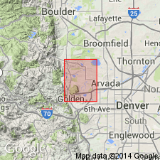
- Mapped 1:24k (Golden quad, Jefferson Co, CO)
- Dominant lithology:
-
- Shale
- Siltstone
- Sandstone
- AAPG geologic province:
-
- Denver basin
Summary:
Is Upper Cretaceous formation mapped in northern Jefferson Co, CO (Denver basin). Conformably overlies Niobrara formation (Upper Cretaceous); conformably underlies Fox Hills sandstone (Upper Cretaceous). Outcrops in western part of map from southern to northern borders. Well exposed along banks of Ralston Reservoir and in Denver and Salt Lake Railway cut in northern part of area. Is mostly shale but includes some siltstone and silty sandstone. Described as predominantly medium- to light-gray, noncalcareous, brown-weathering, clayey shale, containing some hard, calcareous, lenticular concretions that are locally fossiliferous. Contains at least two thick siltstone beds and many thin ones. In area of Ralston Reservoir several irregular-shaped igneous bodies intrude Pierre. Contains several fossil zones based on BACULITES. Is of marine origin. Thickness is estimated to be less than 8,000 ft.
Source: GNU records (USGS DDS-6; Denver GNULEX).
- Usage in publication:
-
- Pierre shale*
- Modifications:
-
- Biostratigraphic dating
- Overview
- AAPG geologic province:
-
- Powder River basin
- Williston basin
Summary:
Subdivided in northeast part of Powder River basin and southern part of Williston basin, Crook Co, WY, and Carter Co, MT into (ascending): Gammon, Mitten black shale, unnamed sandy shale, unnamed shale, Monument Hill bentonitic, and unnamed shale members. Subdivided in southeast part of Powder River basin, Niobrara Co, WY, into five lithologic members, all unnamed. Underlain by Niobrara formation; overlain by Fox Hills sandstone. Lists index fossils and discusses their stratigraphic and geographic distribution in Powder River basin and southern part of Williston basin. 15 faunal zones represented. Base of formation younger by one zone in southeastern part of Powder River basin than in northeastern part. Upper part of formation younger by two zones in the southeastern part of basin that in northeastern part. Shows correlation with rocks on west side of basin. Late Cretaceous (Campanian and Maestrichtian) in age.
Source: GNU records (USGS DDS-6; Denver GNULEX).
- Usage in publication:
-
- Pierre formation
- Modifications:
-
- Revised
- AAPG geologic province:
-
- Powder River basin
Summary:
Revised locally on the east side of Powder River basin [WY]. Where Parkman and Eagle formations are not recognizable, the name Pierre formation can be properly applied to all beds between base of [Fox Hills member of] Hell Creek formation and the top of Niobrara [formation]. Where Eagle is recognizable but Parkman is not, name Pierre can be applied to all beds between base of [Fox Hills member of] Hell Creek and top of Eagle. Names used for equivalent rocks in most parts of Powder River basin and shown on six correlation diagrams are (ascending): Telegraph Creek, Eagle, Claggett, Parkman, and Bearpaw formations. A formation in Montana group. Late Cretaceous in age.
Source: GNU records (USGS DDS-6; Denver GNULEX).
- Usage in publication:
-
- Pierre shale*
- Modifications:
-
- Revised
- AAPG geologic province:
-
- Chadron arch
- Williston basin
Summary:
Subdivided lower part into (ascending): Gammon, Sharon Springs, and Gregory members on the southeastern side of Black Hills, Fall River, Custer, Pennington, and Meade Cos, SD, on Chadron arch and in Williston basin. Gammon member (Gammon ferruginous member of previous authors) was formerly included in Sharon Springs member in this area. Name Gregory is extended from central SD and applied to previously unnamed gray shale containing limestone and ferruginous concretions. Late Cretaceous in age.
Source: GNU records (USGS DDS-6; Denver GNULEX).
- Usage in publication:
-
- Pierre shale*
- Modifications:
-
- Revised
- Biostratigraphic dating
- AAPG geologic province:
-
- Powder River basin
- Williston basin
Summary:
Recognizes two different sequences within formation on northern and western sides of Black Hills in Williston and Powder River basins. In Carter Co, MT, and northern Crook Co, WY, subdivided into (ascending): Gammon ferruginous member, including Groat sandstone bed, Mitten black shale member, and an upper part that includes Monument Hill bentonitic member near top. In southern Crook Co, and most of Weston Co, WY, subdivided (ascending) into: Gammon ferruginous and Mitten black shale members, and an upper part that includes Kara bentonitic member (new) in middle to upper part. Groat sandstone bed not recognized in outcrops south of T55N, R67W in west-central Crook Co, WY. Monument Hill and Kara are of different ages, Kara being the younger. Gives descriptions and measured sections of members, and lists fossils collected from different parts of formation at 57 localities. Underlain by Niobrara formation; overlain by Fox Hills sandstone. Late Cretaceous in age.
Source: GNU records (USGS DDS-6; Denver GNULEX).
- Usage in publication:
-
- Pierre shale*
- Modifications:
-
- Overview
- AAPG geologic province:
-
- Williston basin
- Powder River basin
- Sioux uplift
Summary:
Is between 500 and 1,000 ft thick in central and southern SD; about 2,200 ft in southeastern MT; and about 3,900 ft in east-central WY on the Sioux uplift and in Williston and Powder River basins. Much of westward and northward thickening of lower part takes place in Gammon ferruginous member. Gammon is a much thickened lateral equivalent of part of Niobrara formation and also Eagle and Telegraph Creek formations of MT. Sharon Springs and Mitten black shale members of Pierre, and Claggett shale, are contemporaneous, organic-rich black shale and non-swelling bentonite beds that are a useful gamma-ray and electric-log datum throughout region. Silty and sandy beds above Mitten along west side of Black Hills are 400-600 ft thick, and are eastward equivalents of nonmarine Judith River and Mesaverde formations of MT and WY; are represented by less than 100 ft of shale of Gregory member of Pierre in central SD, and a convenient horizon on which to divide Pierre into upper and lower parts. Upper part in southern Black Hills is about 1,400 ft thick and is equivalent of Bearpaw shale in central MT and DeGrey, Verendrye, Virgin Creek, and Mobridge members along Missouri river in central SD. Elk Butte member lies on Mobridge member, grades vertically and laterally into overlying Fox Hills sandstone and is absent in Black Hills, where Fox Hills sandstone lies conformably on pre-Elk Butte Pierre rocks. Mineralogy of Pierre, but not age, discussed.
Source: GNU records (USGS DDS-6; Denver GNULEX).
- Usage in publication:
-
- Pierre shale*
- Modifications:
-
- Revised
- AAPG geologic province:
-
- Powder River basin
- Williston basin
- Chadron arch
Summary:
Applies name Red Bird Silty Member (new) to interval 200-725 ft thick of soft, light- to medium-gray silty shale, containing numerous limestone concretions, that conformably overlies Mitten Black Shale Member and is conformably overlain by an unnamed dark-gray shale member at Red Bird, Niobrara Co, WY in Powder River basin. Crops out along the flanks of the Black Hills in eastern WY, southeastern MT, and western SD, in Powder River and Williston basins and on Chadron arch. Late Cretaceous in age.
Source: GNU records (USGS DDS-6; Denver GNULEX).

- Usage in publication:
-
- Pierre shale*
- Modifications:
-
- Mapped 1:24k (Littleton quad, Arapahoe, Douglas, and Jefferson Cos, CO)
- Dominant lithology:
-
- Shale
- Sandstone
- AAPG geologic province:
-
- Denver basin
Summary:
Is Upper Cretaceous formation mapped in east-central Jefferson Co, CO (Denver basin). Well exposed in flanks of eroded pediments; best outcrops occur between South Platte River and Deer Creek; also mapped north of Deer Creek in west-central and northwest part of map. Map unit consists of marine sediments which is divided into five parts which are, in ascending order (from table 2): olive-gray shale, Hygiene sandstone member, olive-gray shale, olive-brown shaly sandstone, and clayey or silty olive-gray shale. Conformably overlies Smoky Hill shale member of Niobrara formation (Upper Cretaceous); underlies Fox Hills sandstone (Upper Cretaceous) with gradational contact. Fossil zonation (shown in table 5) ranges from BACULITES ASPERIFORMIS 500 ft from base of unit in lower shale to BACULITES CLINOLOBATUS 6200 ft from base of unit in uppermost shale; fourteen zones mapped. Measured section. Thickness is about 6630 ft.
Source: GNU records (USGS DDS-6; Denver GNULEX).
- Usage in publication:
-
- Pierre shale*
- Modifications:
-
- Overview
- AAPG geologic province:
-
- Williston basin
- Powder River basin
- Chadron arch
- Sioux uplift
Summary:
Divides Pierre shale and equivalent rocks into three facies belts for purposes of analyzing variations in chemical and mineralogic composition. Central belt consists of marine shale and minor amounts of predominantly marine sandstone in Black Hills area of WY, MT, and SD, in Williston and Powder River basins and on Chadron arch. Eastern belt consists of shale and marlstone in central SD, in Williston basin and on Sioux uplift. Analysis of rocks described. Shows correlations in a line extending from north-central MT through Black Hills region to south-central SD. Correlates Mitten black shale member in northern Black Hills, MT and SD, with Sharon Springs member in southwestern Black Hills, WY. Gammon ferruginous member is a wedge of shale that appears between Sharon Springs member and underlying Niobrara rocks a few mi north of Newcastle, Weston Co, WY, and thickens northward. Late Cretaceous in age.
Source: GNU records (USGS DDS-6; Denver GNULEX).
- Usage in publication:
-
- Pierre shale*
- Modifications:
-
- Mapped 1:24k (Kassler quad, Douglas and Jefferson Cos, CO)
- Dominant lithology:
-
- Shale
- Sandstone
- AAPG geologic province:
-
- Denver basin
Summary:
Is Upper Cretaceous (Campanian to Maestrichtian) formation mapped in northwestern Douglas and southeastern Jefferson Cos, CO (Denver basin). Outcrops as northwesterly striking, northeast dipping, broad band parallel to Hogback in central part of map. Hygiene sandstone member occurs in middle part and is separately mapped. Pierre described (p.99-104) as consisting predominantly of olive-gray clayey shale and sandstone of marine origin; limestone and ironstone concretions are abundant and characteristic; contains abundant fossils. Hygiene is medium-grained, olive-brown, thin-bedded, friable, micaceous, shaly sandstone. Ammonites and ammonite zones listed (table 2). Best exposed in southern part of quad, however, rocks are faulted and complete stratigraphic section cannot be measured. Unit not resistant enough to form ridges, but is well exposed on flanks of eroded pediments and in stream banks. Thickness is about 5,200 ft. Partial measured section. Conformably overlies Niobrara formation (Upper Cretaceous); conformably underlies Fox Hills sandstone (Upper Cretaceous), contact poorly exposed.
Source: GNU records (USGS DDS-6; Denver GNULEX).
- Usage in publication:
-
- Pierre Shale*
- Modifications:
-
- Revised
- AAPG geologic province:
-
- Las Vegas-Raton basin
Summary:
Reference section [written prior to inclusion of principal reference section as a formal procedure] designated for Apache Creek Sandstone Member of Pierre which lies between the transition member (below) and Sharon Springs Member (above), both of Pierre. Original description did not include designation of a type. Age of Apache Creek is very early late Campanian. Overall age of Pierre is Late Cretaceous. Correlation chart.
Source: GNU records (USGS DDS-6; Denver GNULEX).
- Usage in publication:
-
- Pierre shale*
- Modifications:
-
- Overview
- AAPG geologic province:
-
- Powder River basin
- Williston basin
Summary:
Adopts subdivisions of Robinson, Mapel, and Cobban (1959) in northwestern part of Black Hills, WY, MT, and SD, with certain modifications, as follows: Gammon ferruginous member pinches out locally at Pedro, in Weston Co, WY. From Pedro southeastward to a point a few mi south of Newcastle, rocks belonging to Gammon ferruginous member, where present, are less than 100 ft thick, and are included with overlying Mitten black shale member. Pedro bentonite bed is at base of Mitten black shale member at Pedro, Weston Co, WY. Lists numerous fossil collections, gives stratigraphic sections, and shows distribution of outcrop in part of Weston Co and Crook Co, WY and in parts of Carter Co, MT and Butte Co, SD. Late Cretaceous in age.
Source: GNU records (USGS DDS-6; Denver GNULEX).
- Usage in publication:
-
- Pierre Shale*
- Modifications:
-
- Biostratigraphic dating
- Reference
- Dominant lithology:
-
- Shale
- Bentonite
- AAPG geologic province:
-
- Williston basin
Summary:
Subdivided in eastern ND, Williston basin into (ascending): Pembina, Gregory, DeGrey, and Odanah Members and an unnamed member. Gives four incomplete reference sections: 1) measured in roadcuts along State Hwy 46 near Little Yellowstone Park about 20 mi south of Valley City in sec 31, T137N, R57W, and secs 35 and 36, T137N, R58W, Barnes Co, ND; includes Pembina, Gregory, and part of DeGrey; thickness of Pierre Shale measured, 161.2 ft; 2) measured in roadcut 1/2 mi north of North Valley City in NE1/4 sec 9, T140N, R58W, Barnes Co, ND; includes parts of Gregory and DeGrey; thickness measured, 145 ft; 3) measured on Olson farm in NE1/4 sec 25, T161N, R57W, and at spillway cut for Tongue River retention dam T-3-5, SE1/4 NE1/4 sec 24, and along State Hwy 5, NW1/4 NE1/4 sec 24, T161N, R57W, Cavalier Co, ND; includes Pembina, Gregory, DeGrey, and part of Odanah; thickness of Pierre measured, 194 ft; 4) measured in roadcut west of Pembina River, SW1/4 sec 30, T163N, R57W, Cavalier Co, ND; includes part of Pembina; thickness measured 12.60 ft. Underlain by Niobrara Formation; overlying rocks not described (upper part of formation above Odanah largely removed in eastern ND by pre-Pleistocene erosion). Lists critical index fossils; shows ammonite zonation and correlates with rocks in central MT, southern Black Hills, SD, Chamberlain area, SD, and in southern Manitoba. Late Cretaceous (Campanian and lower Maestrichtian) in age.
Source: GNU records (USGS DDS-6; Denver GNULEX).
- Usage in publication:
-
- Pierre Shale*
- Modifications:
-
- Reference
- Overview
- Biostratigraphic dating
- Geochronologic dating
- Dominant lithology:
-
- Shale
- Bentonite
- AAPG geologic province:
-
- Powder River basin
Summary:
Establishes detailed reference locality [section] for Pierre Shale in northern Great Plains 1 1/2-2 1/2 mi northeast of Red Bird store and 1-2 1/2 mi east of U.S. Hwy 85 in secs 13, 14, 23, and 24, T38N, R62W, Niobrara Co, WY, Powder River basin. Is about 3,100 ft thick at Red Bird and consists of dark- to light-gray-weathering, noncalcareous clayey to silty shale that is entirely of marine origin. Rests on chalky Niobrara Formation and is overlain by Fox Hills Sandstone; both contacts conformable and gradational. Contains (oldest to youngest): Gammon Ferruginous Member, Sharon Springs Member, Mitten Black Shale Member, Red Bird Silty Member, a lower unnamed shale member, Kara Bentonitic Member, and an upper unnamed shale member. Members are correlated with named and unnamed members of Pierre Shale of eastern CO, western KS, central SD, eastern ND, and southeastern MT and with equivalent formations in southwestern CO, central WY, MT, southwestern AT, and east-central TX. Recognizes 18 zones of ammonites. Analyzes K-Ar dates for rocks that can be correlated with formation, and concludes that formation at Red Bird spans about 12 m.y., and that each ammonite zone spans about 1/2 m.y. Lists fossils and shows faunal zonation. Discusses depositional environments, including proximity to strandlines, depth of sea, effects of currents, dissolution of molluscan shells, and rate of deposition. Late Cretaceous (Campanian and Maestrichtian) age.
Source: GNU records (USGS DDS-6; Denver GNULEX).
- Usage in publication:
-
- Pierre Shale
- Modifications:
-
- Contact revised
- AAPG geologic province:
-
- Williston basin
Summary:
Upper contact revised in Meade Co, SD, Williston basin in that Pierre underlies the newly named Fairpoint Member of Fox Hills Formation. Geologic map. Columnar sections. Upper contact is transitional and, therefore, arbitrarily placed as it represents a change from marine shale (Pierre) to continental sandstone (Fox Hills). Contact in type section of Fairpoint placed at base of 2 inch layer of fine-grained, subangular, salt-and-pepper sandstone. Above this sandstone there is more silt and sand. Below this sandstone there is less sand and silt. Of Late Cretaceous age.
Source: GNU records (USGS DDS-6; Denver GNULEX).

- Usage in publication:
-
- Pierre Shale*
- Modifications:
-
- Overview
- AAPG geologic province:
-
- Powder River basin
Summary:
Divided into 8 members at Red Bird, Niobrara Co, WY in the Powder River basin: Gammon Ferruginous, Sharon Springs, Mitten Black Shale, Red Bird Silty, lower unnamed shale, Kara Bentonitic, and upper unnamed shale. Is of early Campanian at base and ranges up into the early Maestrichtian at the top. Correlation with units of Campanian and Maestrichtian age, or Late Cretaceous age, in south-central WY shown on Table 1.
Source: GNU records (USGS DDS-6; Denver GNULEX).
- Usage in publication:
-
- Pierre Shale*
- Modifications:
-
- Revised
- Overview
- AAPG geologic province:
-
- North Park basin
Summary:
In the Kremmling area, divided into: 1) a lower part composed of about 1,500 ft of dark-gray to black fissile nonsandy marine shale, several bentonite beds and several types of concretions and the 45 ft thick Sharon Springs Member (extended from Great Plains area) which lies about 1,100 ft above base of Pierre; 2) middle part 3,300 ft thick composed of alternating marine silty shale and sandstone, middle part includes Kremmling Sandstone Member (new) about 1,900 ft above base of Pierre and is 20 to 70 ft thick; Muddy Buttes Sandstone Member (new) about 100 to 200 ft above the Kremmling ranges from 5 to 30 ft thick, Hygiene Sandstone Member (extended from east flank of Front Range); Carter Sandstone Member (new) about 350 ft above the Hygiene Member which ranges from 30 to 65 ft thick; Gunsight Pass Member 4,535 ft above the base of Pierre is about 150-170 ft thick; these sandstone members separated by unnamed shale of the Pierre; and 3) upper part is about 200 ft of uniform marine shale with numerous gray dense limestone concretions. Is about 5,000 ft thick. Overlies Niobrara Formation; underlies Middle Park Formation. Ranges from early Campanian (or about 81 +/-2 m.y.) to late Campanian (or about 71 m.y.), Late Cretaceous age in Kremmling area. Latest Campanian and Maestrichtian age rocks eroded from area. Correlation with Mancos Shale and Mesaverde Group in WY and CO shown on Table 1 and fig. 2.
Source: GNU records (USGS DDS-6; Denver GNULEX).

- Usage in publication:
-
- Pierre Shale*
- Modifications:
-
- Mapped 1:24k (Morrison quad, Jefferson Co, CO)
- Dominant lithology:
-
- Shale
- Sandstone
- Limestone
- AAPG geologic province:
-
- Denver basin
Summary:
Is Upper Cretaceous formation mapped in north-central Jefferson Co, CO (Denver basin). Outcrops occur on east side of Hogback. Conformably overlies Niobrara Formation (Upper Cretaceous); conformably underlies Fox Hills Sandstone (Upper Cretaceous). Thin bentonite layers common; shale and bentonite beds have potential of swelling when wetted and shrinking when dried. Concretions contain marine fossils. Thickness is 6,200 ft. Divided into three separately mapped units (descending): upper transition member, Hygiene Sandstone Member, and lower part. Upper member is olive-gray shale, fine-grained brown sandstone layers containing hard 4-ft brown sandstone concretions, and interbedded yellowish-brown to olive-gray silty sandstone and sandy shale containing limestone and ironstone concretions. Underlying olive-gray claystone contains ironstone and limestone concretions. Large limestone masses, informally called Tepee Butte limestone, lie between BACULITES ELIASI and BACULITES SCOTTI zones; thin sandstone bed in DIDYMOCERAS CHEYENNENSE zone. At base is yellowish-brown sandy siltstone equivalent to upper part of type Hygiene. Hygiene is yellowish-gray or olive-brown sandstone. Lower map unit is olive-gray clayey shale containing ironstone and limestone concretions.
Source: GNU records (USGS DDS-6; Denver GNULEX).
- Usage in publication:
-
- Pierre Shale*
- Modifications:
-
- Mapped 1:24k (Indian Hills quad, Jefferson Co, CO)
- Dominant lithology:
-
- Claystone
- Siltstone
- Sandstone
- AAPG geologic province:
-
- Denver basin
Summary:
Is Upper Cretaceous formation mapped in central Jefferson Co, CO (Denver basin). Outcrops in northeast part of quad. Conformably overlies Niobrara Formation (Upper Cretaceous); older than Tertiary gravel map unit. Divided into three separately mapped units (ascending): Lower part described as blocky weathering siltstone and claystone containing thin bentonite beds, limestone concretions, and iron concretions; about 1200 ft thick. Hygiene Sandstone Member described as dusky-yellow to light-yellowish-brown thin-bedded friable sandstone containing scattered to abundant limestone concretions and beds between BACULITES GREGORYENSIS and ANAPACHYDISCUS COMPLEXUS zones; about 370 ft thick. Upper part described as olive-gray claystone and siltstone which may contain a few hundred feet of unexposed shaly sandstone directly above BACULITES GRANDIS zone; at base is yellowish-brown sandy siltstone equivalent to upper part of Hygiene; about 4180 ft thick. Total thickness of Pierre is about 5750 ft.
Source: GNU records (USGS DDS-6; Denver GNULEX).
- Usage in publication:
-
- Pierre Shale*
- Modifications:
-
- Biostratigraphic dating
- Geochronologic dating
- AAPG geologic province:
-
- Powder River basin
- Williston basin
- Sioux uplift
Summary:
Pierre Shale. Samples collected from:
(1) a bentonite bed in the Pierre Shale, at base of BACULITES GRANDIS ammonite zone, in NW/4 SE/4 sec. 14, T. 38 N., R. 62 W., Niobrara Co., WY (Powder River basin). K-Ar age on biotite 68.5 +/-0.7 Ma. Age is Late Cretaceous (Maastrichtian).
(2) a 15-cm-thick bentonite bed within the DIDYMOCERAS NEBRASCENSE ammonite zone, 8 m above base of DeGrey Member of Pierre Shale, in NW/4 NE/4 sec. 24, T. 161 N., R. 57 W., Cavalier Co., ND (Williston basin). K-Ar age on biotite 72.2 Ma (weighted mean). Age is Late Cretaceous (Campanian).
(3) a 6-cm-thick bentonite bed within the D. NEBRASCENSE ammonite zone, 16.5 m below top of DeGrey Member of Pierre Shale, in NW/4 sec. 26, T. 108 N., R. 76 W., Lyman Co., SD (Sioux uplift). K-Ar age on biotite 72.2 Ma (weighted mean). Age is Late Cretaceous (Campanian).
Source: Modified from GNU records (USGS DDS-6; Denver GNULEX).
- Usage in publication:
-
- Pierre Shale*
- Modifications:
-
- Mapped 1:24k (Bottle Pass quad, Grand Co, CO)
- Dominant lithology:
-
- Shale
- Claystone
- AAPG geologic province:
-
- North Park basin
Summary:
In Upper Cretaceous formation mapped in central and northwest parts of quadrangle in Grand Co., CO (North Park basin). Overlies Niobrara Formation (Upper Cretaceous); unconformably overlain by Middle Park formation (Paleocene and Upper Cretaceous?) and by Windy Gap Volcanic Member (Upper Cretaceous?) of the Middle Park. Map unit described as light-olive-gray to dark-brownish-gray fissile to subfissile shale and silty claystone; locally calcareous; scattered iron-stained concretions. Unit is potentially unstable and prone to landsliding. Thickness in adjacent areas more that 4,600 ft.
Source: GNU records (USGS DDS-6; Denver GNULEX).
- Usage in publication:
-
- Pierre Shale*
- Modifications:
-
- Revised
- AAPG geologic province:
-
- Denver basin
Summary:
Nomenclature applied to divisions of the Pierre Shale in exposures at Francis Ranch, secs 7-10 and 15-16, T14N, R69W and in subsurface in Apache Corp. 1 Polo Ranch, sec 14, T14N, R68W, Laramie Co, WY, Denver basin modified. Term: 1) Gammon Ferruginous Member replaces use of lower transition zone; 2) Mitten Black Shale Member replaces use of rusty zone; 3) Hygiene replaces use of the subsurface Sussex; 4) Rocky Ridge, Larimer, and Richard Sandstone Members replace use of the subsurface Parkman. Terry Sandstone Member of Pierre in the Fort Collins, CO area is equivalent to the subsurface Sussex and is not present at Francis Ranch or in the Apache Corp. well. Use of Shannon, Sussex, and Parkman is discontinued in the Denver basin because the sandstones of the Denver basin are not time-equivalents or time-transgressive facies of the Shannon, Sussex, or Parkman of the Powder River basin. As modified, divisions of Pierre are (ascending): Gammon, Sharon Springs, Mitten, Hygiene Members, unnamed interval, Rocky Ridge Sandstone Member, unnamed interval, Larimer Sandstone Member, unnamed interval, Richard Sandstone Member, unnamed interval, units A, B, C, unnamed interval. [See also Kiteley, 1978, USGS OC-78, for cross sections of northern Denver basin showing subdivisions of Pierre.] Pierre overlies Niobrara Formation and underlies Fox Hills Sandstone. Measured section; nomenclature chart. Of Campanian age.
Source: GNU records (USGS DDS-6; Denver GNULEX).
- Usage in publication:
-
- Pierre Shale*
- Modifications:
-
- Mapped 1:24k (Fort Logan quad, Arapahoe, Denver, and Jefferson Cos, CO)
- Dominant lithology:
-
- Shale
- Siltstone
- Sandstone
- AAPG geologic province:
-
- Denver basin
Summary:
Is Upper Cretaceous formation mapped in eastern Jefferson Co, CO (Denver basin). Is oldest unit exposed in quad; conformably underlies Fox Hill Sandstone (Upper Cretaceous). Unit described as medium-gray to olive-gray shale, interbedded with siltstone and sandstone. Exposed only in extreme southwest corner of quad. Engineering properties discussed. Thickness ranges from 6,957 ft to 7,253 ft reported in two well logs, respectively from two miles south of Marston Lake in southern part of quad and from four miles northwest of Moffat Filtration Plant in northwest part of quad.
Source: GNU records (USGS DDS-6; Denver GNULEX).
- Usage in publication:
-
- Pierre Shale
- Modifications:
-
- Revised
- AAPG geologic province:
-
- Denver basin
Summary:
Names Shannon and Sussex Sandstone Members of the Steele Shale of central and eastern part of the Powder River basin have been erroneously applied to the Hygiene and Terry Sandstone Members of the Pierre Shale of the Denver basin. The Hygiene and Terry are coarsening-upward, bioturbated, sandy mudstone and muddy sandstone, burrowed, cross-stratified sandstone, and fine- to medium-grained, non burrowed , cross-stratified sandstone deposited in shallow marine water derived from south-central Wyoming during a south-tracking storm system which removed sediment from delta-front and transported it 80 miles south.
Source: GNU records (USGS DDS-6; Denver GNULEX).
- Usage in publication:
-
- Pierre Shale*
- Modifications:
-
- Areal extent
- AAPG geologic province:
-
- Las Vegas-Raton basin
Summary:
Divisible into (but not mapped): lower member; Sharon Springs Member; middle member; and transition member in northeast part of quad, Colfax Co, NM in Las Vegas-Raton basin. Ranges from 1780 to 1930 ft thick. Crops out along Cimarroncito and Urraca Creeks and on Cimarron River. Assigned to the Late Cretaceous.
Source: GNU records (USGS DDS-6; Denver GNULEX).
- Usage in publication:
-
- Pierre Shale*
- Modifications:
-
- Revised
- AAPG geologic province:
-
- Williston basin
Summary:
Three yellowish-white bentonite beds and two intervening gray shale beds 8 ft above stream level at elevation 1,825 ft in Government Draw, Stanley Co, SD in Williston basin named Government Draw Bentonite Beds of Virgin Creek Member of Pierre Shale. Bentonite beds B1 and B4 form the base and the top, respectively, of Government Draw. Assigned a Late Cretaceous age.
Source: GNU records (USGS DDS-6; Denver GNULEX).
- Usage in publication:
-
- Pierre Shale*
- Modifications:
-
- Biostratigraphic dating
- AAPG geologic province:
-
- Chadron arch
- Denver basin
- North Park basin
- Powder River basin
Summary:
Is a formation in Dawes Co, NE on Chadron arch; Niobrara Co, WY in Powder River basin; Jackson Co, CO in North Park basin; Laramie Co, WY and Larimer Co, CO in Denver basin. Collections of the ammonite genus RHAEBOCERAS from numerous localities indicate an early Maestrichtian (Late Cretaceous) age for upper part of Pierre. General stratigraphic position of RHAEBOCERAS includes the zones of BACULITES REESIDEI Elias and B. JENSENI Cobban.
Source: GNU records (USGS DDS-6; Denver GNULEX).

- Usage in publication:
-
- Pierre Shale*
- Modifications:
-
- Areal extent
- Revised
- AAPG geologic province:
-
- Powder River basin
Summary:
Pierre Shale identified in subsurface of eastern Powder River basin in WY in Niobrara, Weston, eastern Campbell, and Crook Cos, and in MT in Powder River and eastern Big Horn Cos. Pierre divided (ascending) into Gammon Ferruginous, Mitten and Red Bird Silty Members, and an unnamed upper part. Pierre overlies Niobrara Formation and underlies Fox Hills Sandstone. To west, name Pierre replaced by (ascending) Steele Shale (and its Ardmore Bentonite-newly assigned--in lower part, Sussex and Shannon Sandstone Members which are separated by, overlain and underlain by unnamed parts of Steele), Mesaverde Formation (and its Parkman Sandstone Member, at base, unnamed middle part, Teapot Sandstone Member at top), and Lewis Shale (and its unnamed upper and lower parts separated by Teckla Sandstone Member). Sussex and Shannon Members of Steele continue eastward under basin, and they become (new assignment) Sussex and Shannon Sandstone Beds of Gammon Member. Ardmore also continues eastward where it becomes (new assignment) a bed at or near base of Mitten. Red Bird is equivalent to Parkman, basal member of Mesaverde to west. Of Late Cretaceous age. [This nomenclature shown on 22 cross sections in this OC series.]
Source: GNU records (USGS DDS-6; Denver GNULEX).
- Usage in publication:
-
- Pierre Shale*
- Modifications:
-
- Mapped 1:12k (Jefferson Co, CO)
- Dominant lithology:
-
- Shale
- Siltstone
- Sandstone
- AAPG geologic province:
-
- Denver basin
Summary:
Is Upper Cretaceous formation mapped in northern Jefferson Co, CO (Denver basin). Oldest unit mapped; conformably underlies and interfingers with Fox Hills Sandstone (Upper Cretaceous). Small outcrop in northwesternmost part of map area. Map unit described as consisting of four major lithologic units composed primarily of shale and lesser amounts of siltstone and sandstone; subdivisions are, in descending order, upper transition (365 m thick), upper shale (1,190 m thick), lower sandstone (180 m thick), and lower shale (490 m thick) units. Upper shale unit consists of dark-gray to olive-gray, clayey to sandy shale that contains thin beds of siltstone and sandstone and limestone and ironstone concretions. Lower sandstone unit is composed of dark-brown, massive to thinly laminated, well cemented, fine-grained, calcareous sandstone that is interbedded with dark-gray to dark-brown shale and sandy siltstone; locally contains ironstone and calcareous, sandy concretions and is equivalent to Hygiene Sandstone Member of Pierre. Lower shale unit consists of dark-gray to olive-gray, massive to thinly bedded, clayey, fissile shale that contains ironstone concretions and bentonite beds; bentonite interval is equivalent to Sharon Springs Member of Pierre. Unit mined and processed into light-weight aggregate for building material. Total thickness is 2,225 m.
Source: GNU records (USGS DDS-6; Denver GNULEX).
For more information, please contact Nancy Stamm, Geologic Names Committee Secretary.
Asterisk (*) indicates published by U.S. Geological Survey authors.
"No current usage" (†) implies that a name has been abandoned or has fallen into disuse. Former usage and, if known, replacement name given in parentheses ( ).
Slash (/) indicates name conflicts with nomenclatural guidelines (CSN, 1933; ACSN, 1961, 1970; NACSN, 1983, 2005, 2021). May be explained within brackets ([ ]).