

- Usage in publication:
-
- Oquirrh formation*
- Modifications:
-
- First used
- AAPG geologic province:
-
- Great Basin province
Summary:
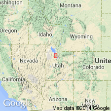
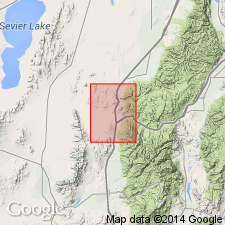
First published use. Western facies [correct facies designation for Gold Hill quad not clearly stated] of Oquirrh formation represented in Gold Hill quad, Tooele Co, UT in the Great Basin province. Composed of a light-colored sandstone, at base; a 3,000 ft thick middle unit of massively bedded limestone; and an upper unit of interbedded sandstone and dolomite with minor limestone. Is about 8,000 ft thick. Very fossiliferous. Pottsville age fauna. Central and eastern facies described [but boundaries of all three not clearly stated]. Of Pennsylvanian and Permian age (table 1). Is younger than Manning Canyon formation and older than Gerster formation (new).
Source: GNU records (USGS DDS-6; Denver GNULEX).
- Usage in publication:
-
- Oquirrh formation*
- Modifications:
-
- Named
- Dominant lithology:
-
- Limestone
- Quartzite
- Sandstone
- AAPG geologic province:
-
- Wasatch uplift
- Great Basin province
Summary:
Named for Oquirrh Mountains which extend across central part of mapped area (geologic map), Tooele Co, UT, Great Basin province, and Utah Co, UT, Wasatch uplift. No type locality designated. Produces ledge and slope topography. Formerly called "Upper Intercalated series" by Spurr (1895). Lower contact with Manning Canyon shale (new) is gradational; contact chosen at location where limestone (Oquirrh) is preponderant over shale (Manning Canyon). Upper contact not present in these quads. Thought to be 16,000-18,000 ft thick. Few distinctive beds, so thickness figures may be as much as 20 percent in error. Consists of interbedded limestone, coarse quartzite and sandstone, and some dolomite and shale. Quartzite or silica-cemented sandstones predominate over lime-cemented sandstone. Quartzite beds are lenticular and vary in thickness a short distance along strike. Thirteen quartzites were traced along strike for about 4 mi. Three sections less than 2 mi apart on west slope, Lewiston Peak, measured and plotted graphically. May be equivalent to parts or Butterfield limestone, Oquirrh formation of Gold Hill district, Brazer limestone, Wells formation of northeast UT, and to Talisman quartzite and Elephant limestone of San Francisco district. Several fossil collections listed (brachiopods, fusulinids, pelecypods, corals). Deposited by widely fluctuating currents with a tremendous amount of detritus in Pennsylvanian time. Stratigraphic table.
Source: GNU records (USGS DDS-6; Denver GNULEX).
- Usage in publication:
-
- Oquirrh formation*
- Modifications:
-
- Overview
- Biostratigraphic dating
- AAPG geologic province:
-
- Uinta basin
- Wasatch uplift
Summary:
Chart correlates thirteen measured sections in the Wasatch Mountains southeast of Salt Lake City and east of Provo, UT. Age is Pennsylvanian and Permian(?) on the basis of fusulinids.
Source: GNU records (USGS DDS-6; Menlo GNULEX).
- Usage in publication:
-
- Oquirrh formation*
- Modifications:
-
- Areal extent
- AAPG geologic province:
-
- Great Basin province
Summary:
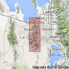
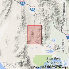
Oquirrh formation is extended to the southern Oquirrh Mountains between Fivemile and Tenmile passes, where it is divided into five unnamed subunits. Age is Pennsylvanian.
Source: GNU records (USGS DDS-6; Menlo GNULEX).
- Usage in publication:
-
- Oquirrh formation
- Modifications:
-
- Revised
- AAPG geologic province:
-
- Wasatch uplift
- Great Basin province
Summary:
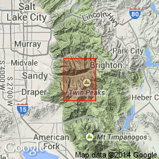
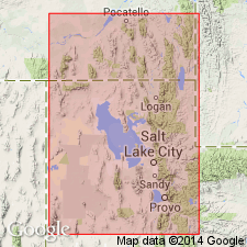
This is a study of the lower part of the 26,000 ft thick Oquirrh formation near Logan, Cache Co., and south in West Canyon, Utah Co., UT on the Wasatch uplift, and on South Mountain, Tooele Co. in the Great Basin province. The lower Member, named West Canyon Limestone Member, is 510 (near Logan) to 1,456 (near West Canyon) ft thick. The overlying sandy part varies from 1,121 (near Logan) to 3,663 (in the Wasatch Mountains) ft thick. Rhythmic or cyclic patterns recognized in the sandy part. The West Canyon is a bioclastic limestone that has some sandstone and siltstone interbeds. Measured sections. Isopach maps. Fossils (fusulinids) of Morrowan and early Des Moinesian age --no Atokan fossils found; corals of Atokan or Des Moinesian age. Overlies Mississippian and Pennsylvanian Manning Canyon formation.
Source: GNU records (USGS DDS-6; Denver GNULEX).
- Usage in publication:
-
- Oquirrh formation
- Modifications:
-
- Revised
- AAPG geologic province:
-
- Wasatch uplift
- Great Basin province
Summary:
Divided into 5 newly named members in the southern Oquirrh Mountains and contiguous Fivemile Pass and northern Boulter Mountains quad., Tooele Co., UT in the Great Basin province and Utah Co., UT on the Wasatch uplift. The new members are (ascending): Hall Canyon (Morrowan), Meadow Canyon (Derryan), Cedar Fort (Desmoinesian), Lewiston Peak (Missourian), and Pole Canyon (Virgilian). Two geologic maps. Measured sections of type localities for each member presented. Lists of fossils identified from each member. Overlies Manning Canyon shale. Wolfcampian strata not mapped or specifically identified in report area, but "some of the sandstones, orthoquartzites, argillaceous and sandy limestones in the trough of the Pole Canyon syncline" are believed to be Wolfcampian; these possibly Wolfcampian rocks may be as much as 300 ft thick --the top having been removed by erosion --and were mapped as part of Pole Canyon member. Author suggests possible future separation of the Virgilian and Wolfcampian rocks and assignment of different name to the Wolfcampian rocks. Rocks mapped as younger than the Pole Canyon member are the Quaternary deposits.
Source: GNU records (USGS DDS-6; Denver GNULEX).
- Usage in publication:
-
- Oquirrh formation*
- Modifications:
-
- Revised
- AAPG geologic province:
-
- Wasatch uplift
Summary:
Limestone 1,200 ft thick at base of Oquirrh formation named Bridal Veil limestone member. Basal limestone probably equivalent to the West Canyon limestone member of Oquirrh at the south end of the Oquirrh Mountains. The younger main body of Oquirrh consists of fine- to medium-grained, thin- to thick-bedded, tan-weathering sandstone and quartzite, most of which is calcareous. Numerous beds of medium- to dark-gray limestone occur giving main body of Oquirrh a banded appearance. Total thickness of formation is about 26,000 ft. Bridal Veil is fossiliferous [not listed] and is of Early Pennsylvanian age. Main body has fusulinids. Oquirrh is probably Des Moines or older in quad. Overlies Manning Canyon shale. Underlies Doughnut formation (named). Geologic map. Cross sections. Map area is in Utah Co, on the Wasatch uplift. Occurs in southeast and north-central part of map.
Source: GNU records (USGS DDS-6; Denver GNULEX).
- Usage in publication:
-
- Oquirrh formation*
- Modifications:
-
- Areal extent
- Biostratigraphic dating
- AAPG geologic province:
-
- Great Basin province
Summary:
Unit is geographically extended to the Deep Creek Mountains, ID. Age is Pennsylvanian (probable Atoka, Des Moines, Missouri, Virgil) and Permian (Wolfcamp) based on fusulinids. Correlation chart.
Source: GNU records (USGS DDS-6; Menlo GNULEX).

- Usage in publication:
-
- Oquirrh formation*
- Modifications:
-
- Age modified
- AAPG geologic province:
-
- Wasatch uplift
- Great Basin province
Summary:
Occurs in northern part of report area (T7S, R3W) Utah Co, UT on the Wasatch uplift, to southern part of area (T13S, R2W) Juab Co, UT in the Great Basin province. Assigned to the Pennsylvanian and Permian. Fusulinids identified as ranging from Atoka or Middle Pennsylvanian to Virgil or Late Pennsylvanian and Wolfcamp or Early Permian. Corals and bryozoans identified during present study. Geologic map. Correlation diagrams.
Source: GNU records (USGS DDS-6; Denver GNULEX).
- Usage in publication:
-
- Oquirrh group
- Modifications:
-
- Revised
- AAPG geologic province:
-
- Wasatch uplift
- Great Basin province
Summary:
Raised to group rank in central UT, Wasatch uplift and Great Basin province, where it is divided into the (ascending): Maple (Morrowan and Atokan), White Pine (early and middle Desmoinesian), Butterfield (Desmoinesian), and Bingham Mine (Missourian and Virgilian) formations. Restricted to rocks of Pennsylvanian age. Cross section. Upper 3 formations mapped (geologic map) in Salt Lake and Tooele Cos. Overlies Manning Canyon shale. Underlies Curry formation (named) of Wolfcampian age.
Source: GNU records (USGS DDS-6; Denver GNULEX).
- Usage in publication:
-
- Oquirrh Formation*
- Modifications:
-
- Areal extent
- AAPG geologic province:
-
- Great Basin province
Summary:
Unit is present in south-central part of Dromedary Peak 71/2' quad. Age is Pennsylvanian.
Source: GNU records (USGS DDS-6; Menlo GNULEX).
- Usage in publication:
-
- Oquirrh Formation
- Modifications:
-
- Revised
- AAPG geologic province:
-
- Great Basin province
Summary:
Revised in the Albion Range, Cassia Co, ID, Great Basin province, where it is identified tentatively and is assigned to the newly named Dove Creek Group. Overlies the newly named View Formation (Mississippian?) of Dove Creek Group; contact placed at base of first limestone (of Oquirrh?) above quartzite (of View). Is the youngest unit mapped; geologic map. Consists in report area of pure, fine-grained, crinoid-fragment clastic limestones to gray limestone marbles and sandy micaceous limestone marbles, and some thin pure quartzites, carbon-sericite-quartz black schist, ferruginous quartz sandstone, and impure dolomite. These strata are more than 4,000 ft thick on ridge north of Mount Harrison. Pennsylvanian age assigned.
Source: GNU records (USGS DDS-6; Denver GNULEX).
- Usage in publication:
-
- Oquirrh formation
- Modifications:
-
- Overview
- AAPG geologic province:
-
- Great Basin province
Summary:
Exposed (geologic map) at Samaria Mountain area, ID and UT in Great Basin province where it can be separated ascending (into): West Canyon Limestone Member 1,307 ft thick, middle member 1,670+ ft thick, and upper member 1,200 ft thick. Overlies Manning Canyon Formation. Underlies Phosphoria Formation unconformably. West Canyon used in preference to Bridal Veil Limestone Member. These two names have been applied to the basal part of the Oquirrh. Name West Canyon has priority. West Canyon assigned to the Morrowan and early Atokan is separated from the middle member by an unconformity representing part of Atokan, all of Desmoinesian, and part of the Missourian. The middle member of Missourian and Virgilian age is separated from the upper member by an unconformity representing late Virgilian time. The upper member is Wolfcampian age. Correlation chart. Measured sections of Oquirrh. Graphic section. Fossils in West Canyon (brachiopods, coral) and upper member (fusulinids) discussed.
Source: GNU records (USGS DDS-6; Denver GNULEX).
- Usage in publication:
-
- Oquirrh Group*
- Modifications:
-
- Revised
- AAPG geologic province:
-
- Great Basin province
Summary:
Two sequences recognized in Tooele Co, Great Basin province, and Utah and Salt Lake Cos, Wasatch uplift. One in Rogers Canyon is divisible into the newly named Lake Point Limestone, at base, Erda Formation and Kessler Canyon Formation, at top. Overlies Green Ravine Formation (new) and underlies Park City Formation. The second called Bingham sequence for Bingham mining district divided into (ascending): West Canyon Limestone (new), Butterfield Peaks Formation (new), and Bingham Mine Formation. Bingham Mine divisible into Clipper Ridge (base) and Markham Peak (top) Members, both new. Overlies Manning Canyon Shale and top eroded. Ranges in age from Early Pennsylvanian, Morrow, Middle Pennsylvanian, Atoka and Des Moines, and Late Pennsylvanian, Missouri and Virgil. Is very fossiliferous locally (listed). Measured sections. Columnar sections. Correlation chart.
Source: GNU records (USGS DDS-6; Denver GNULEX).
- Usage in publication:
-
- Oquirrh Formation*
- Modifications:
-
- Revised
- AAPG geologic province:
-
- Great Basin province
Summary:
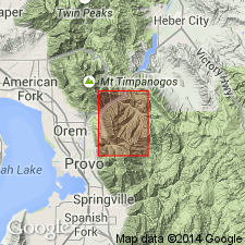
Subdivided in Bridal Veil Falls 7.5' quad (Utah and Wasatch Cos, UT) into 4 units on basis of fusulinids (ascending); Bridal Veil Limestone Member (Morrow to Des Moines age), interbedded quartzitic sandstone and limestone (containing coral CHAETES), Shingle Mill Limestone Member (new) (Des Moines age), and upper member of quartzitic sandstone and limestone (Missouri to Virgil age). Age of Oquirrh is Pennsylvanian in quad.
Source: GNU records (USGS DDS-6; Menlo GNULEX).
- Usage in publication:
-
- Oquirrh Formation*
- Modifications:
-
- Areal extent
- AAPG geologic province:
-
- Great Basin province
Summary:
Oquirrh(?) Formation is extended into Raft River Mountains where it is present in numerous klippen. Two stratigraphic subunits are recognized (lower limestone, upper sandstone). Age is Pennsylvanian (Felix, 1956).
Source: GNU records (USGS DDS-6; Menlo GNULEX).
- Usage in publication:
-
- Oquirrh Group*
- Modifications:
-
- Biostratigraphic dating
- AAPG geologic province:
-
- Great Basin province
Summary:
Oquirrh Group in report area Great Basin province divided into the West Canyon Limestone, Butterfield Peaks Formation, and Bingham Mine Formation. Conodonts (listed) in the West Canyon suggestive of Morrowan age. Fusulinids (listed) in the Butterfield Peaks are Atokan and Des Moinesian. The oldest Fusulinids in this study are from Butterfield Peaks "equivalents" and are latest Atokan to early Des Moinesian age. Late Des Moinesian fusulinids --MILLERELLA sp, WEDEKINDELLA spp, and BEEDEINA spp --identified in upper part of Butterfield Peaks. Fusulinid fauna in the Bingham Mine is more restricted here than in the Bingham Mining district; TRITICITES were collected from near the base was of Missourian age and a younger Virgilian age. TRITICITES also found but site of find within formation not stated. The three formations mapped (geologic map).
Source: GNU records (USGS DDS-6; Denver GNULEX).
- Usage in publication:
-
- Oquirrh Formation*
- Modifications:
-
- Areal extent
- Biostratigraphic dating
- AAPG geologic province:
-
- Great Basin province
Summary:
Oquirrh Formation is extended into the Bally Mountains and southern Raft River Mountains where it is divided into three subunits (sandstone, limestone, marble). Age of limestone subunit is Late Pennsylvanian (Virgilian) based on fusulinids. Map shows Pennsylvanian age.
Source: GNU records (USGS DDS-6; Menlo GNULEX).
- Usage in publication:
-
- Oquirrh Formation*
- Modifications:
-
- Revised
- AAPG geologic province:
-
- Uinta basin
Summary:
Divided in the Strawberry quad, Uinta basin, Wasatch Co, UT into the Atokan to Des Moinesian Bear Canyon Member (base), Des Moinesian Shingle Mill Limestone, Missourian and Virgilian Wallsburg Ridge Member, and Wolfcampian Granger Mountain Member, all newly defined.
Source: GNU records (USGS DDS-6; Denver GNULEX).
- Usage in publication:
-
- Oquirrh Group*
- Modifications:
-
- Revised
- AAPG geologic province:
-
- Great Basin province
Summary:
Revised to include newly named Furner Valley Limestone which overlies Bingham Mine Formation in Juab Co, UT in Great Basin province. Disconformably underlies Diamond Creek Sandstone. Overlies Manning Canyon Shale. Fossil lists. Measured sections for Furner Valley Limestone. Isopach map. Age is Early Pennsylvanian (Morrowan) to Early Permian (Wolfcampian).
Source: GNU records (USGS DDS-6; Denver GNULEX).
- Usage in publication:
-
- Oquirrh Group
- Modifications:
-
- Revised
- AAPG geologic province:
-
- Great Basin province
Summary:
Includes rocks formerly assigned to Wells Formation by Bissell (1960) and Cramer (1971). Term Oquirrh preferred because of lithologic similarity to Oquirrh. Name applied to 3600+ m thick strata that overlie Manning Canyon Shale and underlies Park City Group or Dinwoody Formation in central ID. Divisible in report area, Cassia and Oneida Cos, ID, Great Basin province, into: 1) basal unnamed sandstone; 2) Heglar Canyon Formation of Atokan age, a cherty and micritic limestone 300+ m thick, formerly assigned to Wells Formation; 3) Tussing Formation, a 1300 m thick sandstone and sandy limestone; 4) Trail Canyon Formation of Virgilian to Wolfcampian age, a fusulinid-rich limestone and sandstone 1300 m thick; 5) Hudspeth Cutoff Formation, a 700 m thick sandstone of Wolfcampian and Leonardian age. Nomenclature chart. Columnar section. Geologic map. Most complete and best exposed section is in east half of Ts12 and 13S, R30E and on west edge of T13S, R31E.
Source: GNU records (USGS DDS-6; Denver GNULEX).
- Usage in publication:
-
- Oquirrh Formation*
- Modifications:
-
- Areal extent
- AAPG geologic province:
-
- Great Basin province
Summary:
Areally extended to the Dog Valley Mountain area and to the southern Pavant Range, west-central UT in the Great Basin province, where it overlies the Mississippian Redwall Limestone and underlies the Early Permian Talisman Quartzite. Assigned an Early Pennsylvanian to Early Permian age.
Source: GNU records (USGS DDS-6; Denver GNULEX).
- Usage in publication:
-
- Oquirrh Formation*
- Modifications:
-
- Geochronologic dating
- AAPG geologic province:
-
- Great Basin province
Summary:
Pg. 13, geologic time scale (inside front cover). Argillite sample from limestone member of Oquirrh Formation (Pennsylvanian), in Black Pine Mountains, Lat. 42 deg. 03 min. 30 sec. N., Long. 113 deg. 05 min. 00 sec. W., in SE/4 sec. 5, T. 16 S., R. 29 E., Strevell 15-min quadrangle, Cassia County, Idaho, yielded a K-Ar age of 117 +/-4 Ma (whole-rock) [Early Cretaceous]. Age is result of thermal event(s), rocks are part of an allochthonous block in the Black Pine Mountains area (see also entry under Manning Canyon Shale). Ages calculated using decay constants of Steiger and Jager, 1977 (Earth Planet. Sci. Letters, v. 36, p. 359-362).
Source: Publication.
- Usage in publication:
-
- Oquirrh Formation*
- Modifications:
-
- Areal extent
- Biostratigraphic dating
- AAPG geologic province:
-
- Great Basin province
Summary:
Unit geographically extended into map area (Campo Junction quad, Box Elder Co, UT). Age shown locally as Early, Middle(?), and Late Pennsylvanian, and Early Permian based on fossils (conodonts, corals, bryozoans) and stratigraphic relations.
Source: GNU records (USGS DDS-6; Menlo GNULEX).
- Usage in publication:
-
- Oquirrh Group*
- Modifications:
-
- Revised
- Age modified
- AAPG geologic province:
-
- Great Basin province
- Snake River basin
Summary:
Covers an area of 30,000 km sq in north-central UT and southeast ID, Great Basin province and Snake River basin. Ranges in age from late Chesterian to Atokan. Only lower Oquirrh rocks studied. Lower Oquirrh has extensive lithologic variation. In southeast ID where the basal unit grades upward from sandy limestone and sandstone to limestone, the new name Bannock Peak Limestone is applied to the basal Oquirrh. These rocks were assigned to the West Canyon Limestone of the Oquirrh in earlier reports. In north-central UT, Great Basin province, the basal Oquirrh rocks grade upward from limestone to sandy limestone and sandstone; in the northern Oquirrh Mountains of north-central, UT, the name Lake Valley Limestone is applied to the basal Oquirrh; in the southern Oquirrh Mountains, in the Grassy, Cedar, Stansbury, Lake, and Timpanogos Mountains, the name West Canyon Limestone is applied to basal Oquirrh rocks. Correlation charts. Lake Point overlies Green Ravine Formation. The West Canyon and Bannock Peak Limestones overlie the Manning Canyon Shale. Butterfield Peaks Formation of Oquirrh Group overlies West Canyon. Erda of Oquirrh Group overlies Lake Point. The Bannock Peak is overlain by undivided Oquirrh. Age of lower part of Oquirrh ranges from Late Mississippian (Chesterian), Early Pennsylvanian (Morrowan) to Middle Pennsylvanian (Atokan). Chesterian age assignment is new with this report.
Source: GNU records (USGS DDS-6; Denver GNULEX).
- Usage in publication:
-
- Oquirrh Formation*
- Modifications:
-
- Areal extent
- AAPG geologic province:
-
- Great Basin province
Summary:
Unit geographically extended into report area [North Promontory Mountains, Box Elder Co, UT]. Age given as Middle Pennsylvanian to Early Permian.
Source: GNU records (USGS DDS-6; Menlo GNULEX).
For more information, please contact Nancy Stamm, Geologic Names Committee Secretary.
Asterisk (*) indicates published by U.S. Geological Survey authors.
"No current usage" (†) implies that a name has been abandoned or has fallen into disuse. Former usage and, if known, replacement name given in parentheses ( ).
Slash (/) indicates name conflicts with nomenclatural guidelines (CSN, 1933; ACSN, 1961, 1970; NACSN, 1983, 2005, 2021). May be explained within brackets ([ ]).