The National Geologic Map Database is migrating to a new infrastructure. We apologize for any service disruptions during this process.
|
|---|


- Usage in publication:
-
- Niobrara division*
- Modifications:
-
- Named
- Dominant lithology:
-
- Marl
- Limestone
- AAPG geologic province:
-
- Salina basin
Summary:
Named as top formation of Lower Cretaceous series, top of Lower Cretaceous. Formerly called "formation No. 3" (Meek and Hayden, 1857). Type not designated. Named for Niobrara River, Knox Co, NE in Salina basin, where formation forms 90-100 ft cliffs near mouth along Missouri River. Consists of lead-gray, calcareous marl that weathers to light buff or whitish color resembling true chalk; lower part grades into more compact beds of soft, bluish-gray limestone; locally weathers to hard, whitish limestone. Traced in outcrop from northeastern KS through AR into TX and NM. Occurs in Black Hills and along Rocky Mountains. Invertebrate fossils listed. Dakota Group (new), Fort Benton Group (new), and Niobrara Division together represent the Lower, or Gray Chalk, and probably the Upper Green Sand of British geologists (=Turonien and Cenomanien of D'Orbigny).
Source: GNU records (USGS DDS-6; Denver GNULEX).
- Usage in publication:
-
- Niobrara group*
- Modifications:
-
- Areal extent
- AAPG geologic province:
-
- Williston basin
Summary:
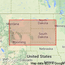
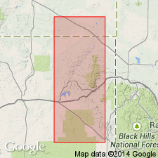
Recognized for first time on west side of Beaver Creek, on the Belle Fourche near the Great Bend, and near Bear Butte in the Black Hills area, Pennington Co, SD in the Williston basin. Estimated at 100 to 200 ft thick.
Source: GNU records (USGS DDS-6; Denver GNULEX).
- Usage in publication:
-
- Niobrara group*
- Modifications:
-
- Revised
- AAPG geologic province:
-
- Las Animas arch
Summary:
Divided into the newly named Timpas formation (base) and Apishapa formation (top) in Otero Co, CO on the Las Animas arch. Composed of about 700 ft of shale and some limestone. Overlies Dakota sandstone; underlies Pierre group. Is of Cretaceous age.
Source: GNU records (USGS DDS-6; Denver GNULEX).
- Usage in publication:
-
- Niobrara formation*
- Modifications:
-
- Overview
- AAPG geologic province:
-
- Williston basin
- Chadron arch
- Powder River basin
Summary:
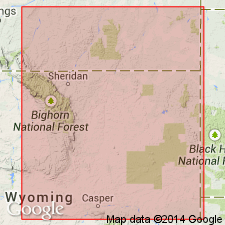
Shows outcrop and describes formation in southern part of Black Hills, WY and SD and areas to the south including Old Woman anticline, eastern Converse Co [now Niobrara Co] WY in Powder River and Williston basins and on Chadron arch. Consists of chalk and calcareous shale. Average thickness 225 ft. Underlain by Carlile formation; overlain by Pierre shale. Late Cretaceous in age.
Source: GNU records (USGS DDS-6; Denver GNULEX).
- Usage in publication:
-
- Niobrara shale*
- Modifications:
-
- Revised
- AAPG geologic province:
-
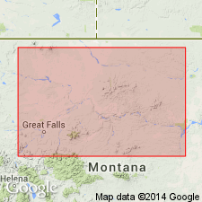
- Central Montana uplift
Summary:
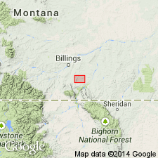
Revised in that Niobrara shale of the Colorado group underlies the newly named Telegraph Creek formation. Telegraph Creek occurs at the head of Telegraph Creek, T2S, Rs28 and 29E, Yellowstone Co, MT on the Central Montana uplift. Is of Late Cretaceous age.
Source: GNU records (USGS DDS-6; Denver GNULEX).
- Usage in publication:
-
- Niobrara formation*
- Modifications:
-
- Revised
- Overview
- AAPG geologic province:
-
- Williston basin
- Powder River basin
Summary:
Lower contact revised and formation subdivided into Sage Breaks shale member (new), 250-325 ft thick, and overlying Beaver Creek chalky member (new), 125-200 ft thick on west side of the Black Hills, northeastern WY and southeastern MT in the Williston and Powder River basins. Overlies Turner sandy member (new) of the Carlile shale, underlies Gammon ferruginous member (new) of the Pierre shale. Rocks of Sage Breaks shale member were included in Carlile shale of previous reports. Samples of Upper Cretaceous claystone, shale, and marl, including a sample from Beaver Creek chalky member, compared for their mineralogy, chemical composition, grain size, density, porosity, fissility, and bedding laminations. A formation in the Colorado group. Late Cretaceous in age.
Source: GNU records (USGS DDS-6; Denver GNULEX).
- Usage in publication:
-
- Niobrara formation*
- Modifications:
-
- Age modified
- Overview
- AAPG geologic province:
-
- Williston basin
- Powder River basin
- Chadron arch
Summary:
Age shown as Late Cretaceous (Coniacian and Santonian) in Great Plains region [Black Hills, SD, MT, and WY in Williston and Powder River basins and on Chadron arch]. Overlain unconformably by Pierre shale; conformably overlies Carlile shale.
Source: GNU records (USGS DDS-6; Denver GNULEX).
- Usage in publication:
-
- Niobrara calcareous shale member*
- Modifications:
-
- Areal extent
- AAPG geologic province:
-
- San Juan basin
Summary:
Extended into San Juan basin, NM as a member (one of five members) of Mancos shale. Consists of 250-350 ft of gray brittle calcareous shale and gray shaly limestone and soft calcareous shale. INOCERAMUS GRANDIS fragments and oyster shells identified. Overlies Carlile shale member (areal limits extended) of Mancos. Underlies upper shale member of Mancos. Of Late Cretaceous age.
Source: GNU records (USGS DDS-6; Denver GNULEX).
- Usage in publication:
-
- Niobrara formation*
- Modifications:
-
- Revised
- AAPG geologic province:
-
- Powder River basin
- Williston basin
Summary:
Restricted in northern Black Hills area, Williston and Powder River basins, to exclude Sage Breaks member, which is assigned to underlying Carlile shale. Consists of calcareous shale and marl that previously were included in Beaver Creek chalky member, a name no longer needed, and therefore abandoned. Discusses lithology, lists representative fossils, and shows faunal zonation. Conformably overlies Sage Breaks member of Carlile shale; overlying rocks in Black Hills not discussed. Late Cretaceous (Coniacian and Santonian) in age.
Source: GNU records (USGS DDS-6; Denver GNULEX).
- Usage in publication:
-
- Niobrara shale member*
- Modifications:
-
- Mapped 1:63k
- Revised
- AAPG geologic province:
-
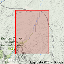
- Powder River basin
- Central Montana uplift
Summary:
Reduced in rank and assigned as fourth member from base of seven members (formal and informal) of Cody shale (revised). Mapped with Carlile shale member of Cody over much of western two-thirds of study are in Big Horn and Yellowstone Cos, MT, northwestern Powder River basin and Central Montana uplift. As shown on measured section (sheet 2), Niobrara is 409 ft thick and consists mostly of dark-gray shale. Overlies Carlile shale member (revised) of Cody; underlies Telegraph Creek member (revised) of Cody. Late Cretaceous age.
Source: GNU records (USGS DDS-6; Denver GNULEX).
- Usage in publication:
-
- Niobrara formation*
- Modifications:
-
- Overview
- AAPG geologic province:
-
- Williston basin
Summary:
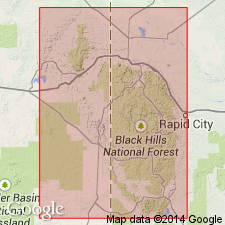
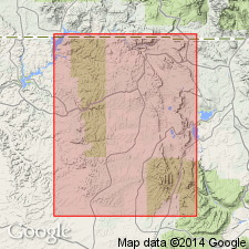
Sharply elongated from the Sage Breaks [member of Carlile shale]. At base--9 mi south-southeast of Rapid City, Pennington Co, SD in Williston basin--is a thin conglomerate of phosphatic pebbles and sharks' teeth that rests with knife-edged sharpness on Sage Breaks. Contact is disconformable at this locality, as well as at Belle Fourche, Butte Co, SD and farther northwestward in Carter Co, MT, all in Williston basin.
Source: GNU records (USGS DDS-6; Denver GNULEX).
- Usage in publication:
-
- Niobrara formation*
- Modifications:
-
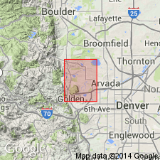
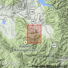
- Mapped 1:24k (Golden quad, Jefferson Co, CO)
- Dominant lithology:
-
- Shale
- Limestone
- Chalk
- AAPG geologic province:
-
- Denver basin
Summary:
Is Upper Cretaceous formation mapped in northern Jefferson Co, CO (Denver basin). Unconformably overlies Benton shale (Lower Cretaceous); conformably underlies Pierre shale (Upper Cretaceous). Occurs as northwest striking band in west-central part of quad. Southern extent truncates against Golden fault. Divided into (ascending) Fort Hays limestone and Smoky Hill shale members, which are separately mapped. Fort Hays is 78 percent medium- to yellowish-gray, hard, dense limestone and 22 percent medium dark gray, calcareous shale; generally forms small bench between Benton and Smoky Hill; INOCERAMUS DEFORMIS occurs in limestone; thickness of member is 28 ft. Smoky Hill is mainly light-gray to dusky-yellow, calcareous shale but includes a few thin beds of bentonite and gypsum; a 25-ft-thick bed of light-gray shaly chalk occurs 150 ft above base; fossil BACULITES sp. encrusted with STRAMENTUM HAWORTHI found n shaly chalk 260 above base; thickness of member is 320 ft. Lithology and fossils indicate deposition in a marine environments. Thickness of formation is about 350 ft.
Source: GNU records (USGS DDS-6; Denver GNULEX).
- Usage in publication:
-
- Niobrara formation*
- Modifications:
-
- Biostratigraphic dating
- Overview
- AAPG geologic province:
-
- Powder River basin
- Williston basin
Summary:
Lists index fossils and discusses their stratigraphic and geographic distribution in Powder River basin, MT and WY [including the adjacent part of Williston basin in Carter Co, MT]. Is a member of Cody shale in northwestern part of basin; equivalent rocks are undifferentiated part of Cody shale in the southwestern part of the basin; and a formation on the east side of the basin [and in Williston basin]. Upper part ranges in age from early Santonian to possibly early Campanian in age, becoming younger southeastward; lower part is Coniacian in age. Overlain conformably by the Telegraph Creek member of Cody shale in the northwestern part of the basin; by Gammon member of Pierre shale in northeastern part of basin; and by an unnamed lower shale member of Pierre shale in the southeastern part of the basin. Overlies conformably the Carlile shale member of Cody shale in the northwestern part of the basin and by Sage Breaks member of Carlile shale on the eastern side of the basin.
Source: GNU records (USGS DDS-6; Denver GNULEX).

- Usage in publication:
-
- Niobrara formation*
- Modifications:
-
- Mapped 1:24k (Littleton quad, Arapahoe, Douglas, and Jefferson Cos, CO)
- Dominant lithology:
-
- Limestone
- Chalk
- Shale
- AAPG geologic province:
-
- Denver basin
Summary:
Is Upper Cretaceous formation mapped in east-central Jefferson Co, CO (Denver basin). Outcrops in area of Deer Creek to south edge of quad. Resistant beds at base, in middle, and at top locally form small hogbacks. Divided into separately mapped Fort Hays limestone member at base and Smoky Hill shale member at top [lithology described under respective units]. Niobrara consists predominantly of marine limestone, chalk, and chalky shale. Measured section. Overlies Carlile shale (Upper Cretaceous); conformably underlies Pierre shale (Upper Cretaceous). Thickness of Smoky Hill is about 500 ft and Fort Hays averages 35 ft.
Source: GNU records (USGS DDS-6; Denver GNULEX).
- Usage in publication:
-
- Niobrara formation*
- Modifications:
-
- Mapped 1:24k (Kassler quad, Douglas and Jefferson Cos, CO)
- Dominant lithology:
-
- Limestone
- Shale
- AAPG geologic province:
-
- Denver basin
Summary:
Is Upper Cretaceous formation mapped in northwestern Douglas and southeastern Jefferson Cos, CO (Denver basin). Outcrops as northwesterly striking, northeast dipping, narrow band along Hogback in central part of map. Consists of separately mapped Fort Hays limestone and Smoky Hill shale members. Described (p.97-99). Fort Hays (Coniacian age) averages 35 ft thick; consists of yellowish gray, dense hard thick massive limestone beds at base and softer, thin tabular limestone beds at top; thin calcareous silty shale beds and bentonite beds separate limestone beds; lower 15 ft contains INOCERAMUS sp. and OSTREA CONGESTA; upper 20 ft contains INOCERAMUS DEFORMIS and OSTREA CONGESTA. Smoky Hill (Coniacian and Santonian age) is 535 ft thick; consists of chalky shale with several thick beds of chalky limestone; fossils include INOCERAMUS DEFORMIS, I. PLATINUS, OSTREA CONGESTA, and CLIOSCAPHITES CHOTEAUENSIS. Measured section. Unconformably overlies Carlile shale; conformably underlies Pierre shale (Upper Cretaceous).
Source: GNU records (USGS DDS-6; Denver GNULEX).
- Usage in publication:
-
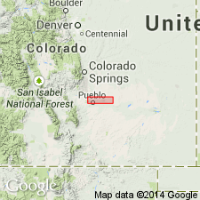
- Niobrara Formation*
- Modifications:
-
- Overview
- Biostratigraphic dating
- AAPG geologic province:
-
- Denver basin
Summary:
Divided in the Pueblo area, Pueblo Co, CO in the Denver basin, into the Fort Hays Limestone Member, a 40 ft thick limestone of late Turonian and early Coniacian age at base, and the Smoky Hill Shale Member, a 700 ft thick unit of equal amounts of chalk and shale, and lesser amount of limestone that is of early Coniacian to late Campanian age. Smoky Hill divisible into seven informal units. Each unit has a distinctive fauna--INOCERAMUS PERPLEXUS (Fort Hays) to INOCERAMUS SIMPSONI (upper chalk unit at top of Smoky Hill). Correlation charts. Geologic map. Measured sections. Fort Union and Smoky Hill Members replace older terms Timpas Limestone and Apishapa Shale Members of Niobrara in this area. Timpas and Apishapa abandoned.
Source: GNU records (USGS DDS-6; Denver GNULEX).

- Usage in publication:
-
- Niobrara Formation*
- Modifications:
-
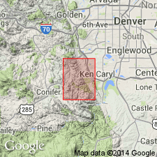
- Mapped 1:24k (Morrison quad, Jefferson Co, CO)
- Dominant lithology:
-
- Shale
- Limestone
- AAPG geologic province:
-
- Denver basin
Summary:
Is Upper Cretaceous formation mapped in north-central Jefferson Co, CO (Denver basin). Outcrops occur along east side of Hogback in southern half of quad. Unconformably overlies Carlile Shale (Upper Cretaceous); conformably underlies Pierre Shale (Upper Cretaceous). Divided into separately mapped (descending) Smoky Hill Shale Member and Fort Hays Limestone Member. Smoky Hill described as pale- to yellowish-brown soft thin-bedded calcareous shale and interbedded thin layers of limestone; three ridge-forming beds: yellowish-orange chalk at top, yellowish-gray chalky limestone in middle, and gray soft platy limestone in lower third; contains many bentonite beds; marine fossils; thickness of Smoky Hill is 410 ft. Fort Hays described as yellowish-gray dense hard limestone in beds 1-7 ft thick; thin shale beds make up only about 5% of member; contains marine fossils; thickness of Fort Hays is 35 ft.
Source: GNU records (USGS DDS-6; Denver GNULEX).
- Usage in publication:
-
- Niobrara Formation*
- Modifications:
-
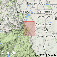
- Mapped 1:24k (Indian Hills quad, Jefferson Co, CO)
- Dominant lithology:
-
- Shale
- Limestone
- AAPG geologic province:
-
- Denver basin
Summary:
Is Upper Cretaceous formation mapped in central Jefferson Co, CO (Denver basin). Outcrops in northeast part of quad on east side of Hogback. Unconformably overlies Carlile Shale (Upper Cretaceous); conformably underlies Pierre Shale (Upper Cretaceous). Divided into two separately mapped units (ascending): Fort Hays Limestone Member described as yellowish-gray hard thick-bedded fossiliferous limestone layers containing thin silty shale beds and bentonite layers near middle; lowest bentonite layer about 11 ft above base; about 35 ft thick. Smoky Hill Shale Member described as yellowish-gray chalky shale and chalky limestone; upper half of member is grayish-orange fissile to thick-bedded chalky shale and has yellowish-orange thick-bedded fossiliferous chalky ridge-forming limestone at top; lower part is chalky platy limestone and calcareous shale with bentonite beds; about 135 ft above base is a harder yellowish-gray fossiliferous chalky ridge-forming limestone; limestone ridges are especially well developed along Ken Caryl Road near Massey Draw watergap; about 500 ft thick. Total thickness of Niobrara is about 535 ft.
Source: GNU records (USGS DDS-6; Denver GNULEX).
- Usage in publication:
-
- Niobrara Formation*
- Modifications:
-
- Overview
- AAPG geologic province:
-
- North Park basin
Summary:
Is Upper Cretaceous formation mapped in central and northern parts of quadrangle in Grand Co., CO (North Park basin). Overlies Benton Formation (Upper and Lower Cretaceous). Overlain by Pierre Shale (Upper Cretaceous). Map unit described as gray calcareous subfissile claystone; weathers light gray to white, and locally speckled in upper part; thin impure limestone beds intercalated with calcareous siltstone in lower part. Thickness about 400 ft in undeformed sections, but thickened or thinned drastically by folding near major faults.
Source: GNU records (USGS DDS-6; Denver GNULEX).
- Usage in publication:
-
- Niobrara Formation*
- Modifications:
-
- Areal extent
- AAPG geologic province:
-
- Williston basin
Summary:
Niobrara Formation. †Warm Creek Shale of Collier and Cathcart (1922, p. 172) and Knechtel (1959, p. 740-741) in north-central Montana abandoned. Rocks reallocated to (ascending) Belle Fourche Shale, Greenhorn Formation, Carlile Shale, Niobrara Formation, and Telegraph Creek Formation.
Source: Changes in stratigraphic nomenclature, 1975 (USGS Bull. 1422-A, p. A66-A67).
- Usage in publication:
-
- Niobrara Formation*, Member*
- Modifications:
-
- Overview
- AAPG geologic province:
-
- Powder River basin
- Wind River basin
Summary:
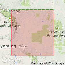
Assigned to Cody Shale on various cross sections in western part of Powder River basin and eastern Wind River basin. As shown on four cross sections (OC-73 to OC-76), Niobrara is assigned to Cody Shale in central Johnson, southwesternmost Campbell, and western two-thirds of Converse Cos, WY, western Powder River basin and in eastern Natrona Co, WY, Wind River basin. Elsewhere in WY portion of Powder River basin, Niobrara is a formation-rank unit. Where Niobrara is member of Cody, conformably (in places unconformably) overlies Sage Breaks Member (revised) of Cody and conformably underlies unnamed part of Cody. Where Niobrara is a formation (in central and eastern parts of basin), it conformably (in places unconformably) overlies Sage Breaks Member of Carlile Shale and conformably underlies Gammon Ferruginous Member of either Pierre Shale (in eastern part of basin) or Steele Shale (in central part of basin). Late Cretaceous age.
Source: GNU records (USGS DDS-6; Denver GNULEX).
- Usage in publication:
-
- Niobrara Formation*
- Modifications:
-
- Overview
- AAPG geologic province:
-
- Iowa shelf
- Sioux uplift
Summary:
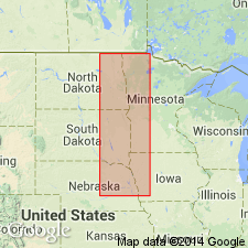
Near Sioux City, Woodbury Co, IA on the Iowa shelf and Yankton, Yankton Co, SD on the Sioux uplift, lower Upper Cretaceous sequence consists of Dakota Formation (lower to upper Cenomanian), Graneros Shale (upper Cenomanian), Greenhorn Formation (lower Turonian), Carlile Shale (middle Turonian), which is overlain unconformably by Niobrara Formation (upper Coniacian and lower Santonian). Carlile in this area is equivalent to Pool Creek Member of Osage area, northeast WY. Rocks equivalent to Turner Sandy and Sage Breaks Members of Carlile missing at Sioux City and Yankton.
Source: GNU records (USGS DDS-6; Denver GNULEX).
- Usage in publication:
-
- Niobrara Member*
- Modifications:
-
- Overview
- AAPG geologic province:
-
- Powder River basin
Summary:
Assigned as member of Cody Shale. Shown on stratigraphic chart of Upper Cretaceous rocks in subsurface of western part of Powder River basin, WY (fig 3). Underlies Steele Member (revised) of Cody; underlying unit not shown. Upper part assigned Santonian age.
Source: GNU records (USGS DDS-6; Denver GNULEX).

- Usage in publication:
-
- Niobrara Formation*
- Modifications:
-
- Areal extent
- AAPG geologic province:
-
- Powder River basin
Summary:
Identified throughout the subsurface of the Powder River basin in MT and WY where it overlies Sage Breaks Shale Member of Carlile Shale unconformably in the east part of the basin, and the Sage Breaks Shale unconformably in the west part of the basin. Underlies Gammon Ferruginous Member of Pierre Shale in east part of basin, and Steele Shale in west part of basin. Of Late Cretaceous age. [This nomenclature shown on 22 cross sections in this OC series.]
Source: GNU records (USGS DDS-6; Denver GNULEX).
For more information, please contact Nancy Stamm, Geologic Names Committee Secretary.
Asterisk (*) indicates published by U.S. Geological Survey authors.
"No current usage" (†) implies that a name has been abandoned or has fallen into disuse. Former usage and, if known, replacement name given in parentheses ( ).
Slash (/) indicates name conflicts with nomenclatural guidelines (CSN, 1933; ACSN, 1961, 1970; NACSN, 1983, 2005, 2021). May be explained within brackets ([ ]).