The National Geologic Map Database is migrating to a new infrastructure. We apologize for any service disruptions during this process.
|
|---|


- Usage in publication:
-
- Mural limestone*
- Modifications:
-
- Original reference
- Dominant lithology:
-
- Limestone
- AAPG geologic province:
-
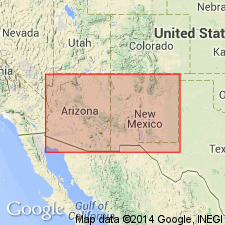
- Pedregosa basin
Summary:
Pg. 56, 65+. Mural limestone of Bisbee group. Upper member consists of 350+/- feet of relatively thick-bedded and pure limestones. Lower member consists of 300+/- feet of thin-bedded impure limestones with 25+/- feet of buff sandstones at top. Underlies (conformably) Cintura formation and overlies (conformably) Morita formation, all of which belong to Bisbee group. Age is Early Cretaceous (Comanchean); fossil assemblage same as Trinity and lower Fredericksburg of Texas. Report includes geologic map, cross sections, columnar section.
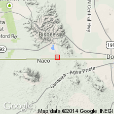
Caps Mural Hill, northeast of Bisbee, in T. 23 S., R. 24 E., Bisbee quadrangle, Cochise Co., southeastern AZ.
Source: US geologic names lexicon (USGS Bull. 896, p. 1451); supplemental information from GNU records (USGS DDS-6; Denver GNULEX).
- Usage in publication:
-
- Mural limestone
- Modifications:
-
- Age modified
- AAPG geologic province:
-
- Pedregosa basin
Summary:
Mural limestone of Bisbee group. Underlies Hay Flat limestone (new). Age is Early Cretaceous (Aptian; Trinity-Fredericksburg of Texas).
Source: Modified from GNU records (USGS DDS-6; Denver GNULEX).
- Usage in publication:
-
- Mural limestone
- Modifications:
-
- Areal extent
- AAPG geologic province:
-
- Pedregosa basin
Summary:
Pg. 23. Mural limestone of Bisbee group. Absent in Tombstone area, Cochise County, southeastern Arizona. Several miles to the southeast, at Bisbee, it separates the Morita formation below from the Cintura formation above, which are otherwise lithologically indistinguishable.
Source: Publication.
- Usage in publication:
-
- Mural limestone*
- Modifications:
-
- Age modified
- AAPG geologic province:
-
- Pedregosa basin
Summary:
Mural limestone of Bisbee group. Lower member considered Trinity age; upper member considered Fredericksburg age. (Early Cretaceous)
Source: Modified from GNU records (USGS DDS-6; Denver GNULEX).
- Usage in publication:
-
- Mural limestone
- Modifications:
-
- Revised
- Biostratigraphic dating
- AAPG geologic province:
-
- Pedregosa basin
Summary:
Pg. 6, 8, 20, 36 (table 6). Mural limestone of Bisbee group. Restricted to upper part of Ransome's Mural limestone; lower part of Ransome's Mural limestone = Lowell formation (new). Light-gray limestone, in lower part bedded, with ORBITOLINA TEXANA (Roemer) and LIMA MURALENSIS, n. sp.; upper part massive with rudistid reefs. Overlies Pedragosa member of Lowell formation (both new); underlies Cintura formation. Age is Early Cretaceous (Albian); DOUVILLEICERAS MAMMILLATUM to HOPLITES DENTATUS standard ammonite zone.
Source: Publication; US geologic names lexicon (USGS Bull. 1200, p. 2657).
- Usage in publication:
-
- Mural limestone*
- Modifications:
-
- Overview
- AAPG geologic province:
-
- Pedregosa basin
Summary:
Pg. 8 (table), 73-76, pl. 1. Mural limestone of Bisbee group (of Ransome, 1904). In central Cochise County, southeastern Arizona, extends in a strip about 1,000 feet wide along eastern side of Mule Mountains from Abbot Canyon, where it disappears beneath alluvium of Sulphur Spring Valley, to south edge of quadrangle. Composed of three members: lower member, 335 to 600 feet of relatively thin-bedded limestone interbedded with preponderant shale and sandstone; middle member 75 to 240 feet of massive fossiliferous (bivalves, forams) limestone with very little elastic material; and upper member, thinner beds ranging from shale and sandstone to mudstone and limestone, 20 to 140 feet. Total thickness about 650 feet. Overlies Morita formation and underlies Cintura formation (both of Bisbee group). Age is Early Cretaceous (Comanchean). Report includes geologic map.
Source: US geologic names lexicon (USGS Bull. 1200, p. 2657).
- Usage in publication:
-
- Mural limestone
- Modifications:
-
- Not used
- AAPG geologic province:
-
- Pedregosa basin
Summary:
Mural limestone of Bisbee group. Not recognized in Peloncillo Mountains, Hidalgo County, New Mexico, and Cochise County, Arizona.
See entry under Bisbee.
Source: Modified from GNU records (USGS DDS-6; Denver GNULEX).
- Usage in publication:
-
- Mural limestone*
- Modifications:
-
- Biostratigraphic dating
- AAPG geologic province:
-
- Pedregosa basin
Summary:
Is formation in Cochise Co, southeast AZ in Pedregosa basin. Above Lowell formation of Stoyanow (1949); below Cintura formation. Biostratigraphic dating on basis of the foraminiferal genus ORBITOLINA. ORBITOLINA MINUTA Douglass, n. sp. identified from measured section in eastern part of Mule Mountains, 6 mi east of Bisbee (secs 7 and 18, T23S, R25E) indicates an Albian age. Is noted that O. MINUTA is similar to O. TEXANA and that the two have not been separated by earlier authors. Stratigraphically the two species occur at separate horizons. O. MINUTA (present in the Mural) also occurs in central TX in upper part of Glen Rose limestone and as low as "SALENIA zone". O. TEXANA is confined to lower part of Glen Rose, below "SALENIA zone". Correlation (fig. 2) with Broken Jug limestone, Howells Ridge formation, and Playas Peak formation (part) in NM; Bluff formation (part) of Smith (1940) in Hudspeth Co, TX; Shafter limestone in Presidio Co, TX; and Glen Rose limestone (part) of the Trinity group in central TX. Age is Early Cretaceous (Albian).
Source: GNU records (USGS DDS-6; Denver GNULEX).
- Usage in publication:
-
- Mural limestone*
- Modifications:
-
- Overview
- AAPG geologic province:
-
- Pedregosa basin
Summary:
Name as used in the Bisbee area of Cochise Co, AZ, Pedregosa basin, was restricted by Stoyanow (1949) to upper member of Mural limestone of Ransome (1904). Stoyanow named Lowell formation to include lower member of Ransome's Mural limestone as well as 580 ft of the upper beds of Morita formation down to base of lowest fossiliferous zone. The base of Lowell formation found to not be readily traceable, whereas the base of Mural limestone as originally defined by Ransome (1904) can be mapped readily within narrow stratigraphic units. In addition, one hundred sixty ft of rocks at Lowell type section duplicated by a fault. Several writers assumed that Lowell was a replacement name only for the lower member of the Mural. Stoyanow did not clearly state that several hundred ft of Morita were also included in Lowell. Facies and thickness trends in Lower Cretaceous rocks observed in this area by workers since Stoyanow's time are not as extreme as thought prior to this paper. [Authors allude to their preference for Ransome's definition, though they do not "abandon" the Lowell.] Cross section.
Source: GNU records (USGS DDS-6; Denver GNULEX).
- Usage in publication:
-
- Mural Limestone
- Modifications:
-
- Areal extent
- AAPG geologic province:
-
- Pedregosa basin
Summary:
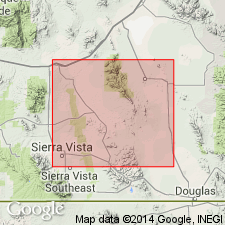
Extended as a formation of the Bisbee Group to Pedregosa Mountains in the Pedregosa basin where 3,320 ft thick. Algae collected from lower part of formation suggest that Mural was deposited in a tropical or subtropical environment. [The lower half of Mural as used by Konishi and Epis not accepted as part of Mural by Hayes, 1970.] Contacts are conformable with overlying Cintura formation and underlying Morita formation, both of Bisbee group. Well exposed in northeastern portion of Pedregosa Mountains quadrangle in secs 1, 2, 11, 12, 13, T20S, R29E and in south-central portion of quadrangle in secs 10, 11, 14, T22S, R29E. Is of Early Cretaceous age.
Source: GNU records (USGS DDS-6; Denver GNULEX).
- Usage in publication:
-
- Mural Limestone*
- Modifications:
-
- Areal extent
- AAPG geologic province:
-
- Pedregosa basin
Summary:
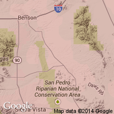
Mural Limestone of Bisbee Group. Extended into Huachuca Mountains, Cochise County, Arizona. Exposed on southwestern flank of range. Thickness about 600 feet. Age is Early Cretaceous.
Source: Modified from GNU records (USGS DDS-6; Denver GNULEX).

- Usage in publication:
-
- Mural Limestone*
- Modifications:
-
- Overview
- AAPG geologic province:
-
- Pedregosa basin
Summary:
Is formation of Bisbee Group (Lower Cretaceous) in Mule and Huachuca Mountains, southern Cochise Co, AZ in Pedregosa basin. Overlies Morita Formation of Bisbee; underlies Cintura Formation of Bisbee. Is divided into: a lower member that consists of interbedded mudstone, limestone, siltstone, and sandstone; and an upper member consisting mostly of limestone. Upper member contains rudist-rich bioherms and biostromes and the foraminifer ORBITOLINA. Upper member is correlated with upper part of Trinity Group and possibly lowest part of Fredericksburg Group of TX on basis of fossils; on basis of fossils and lithology is correlated with upper part of U-Bar Formation in Big Hatchet Mountains and upper parts of Broken Jug Limestone, Playas Peak and Howells Ridge Formations in Little Hatchet Mountains; and with less certainty with other rocks of Bisbee Group. [See fig. 5 for regional correlations.] Is of Aptian to Albian (Early Cretaceous) age [apparently on basis of fossils and correlation].
Source: GNU records (USGS DDS-6; Denver GNULEX).
- Usage in publication:
-
- Mural Limestone*
- Modifications:
-
- Principal reference
- Dominant lithology:
-
- Limestone
- Sandstone
- Siltstone
- AAPG geologic province:
-
- Pedregosa basin
Summary:
A formation of the Bisbee Group. Principal reference section (shown graphically) established separately for lower and upper members in Mule Mountains: lower member in NE1/4 NE1/4 sec 10, T23S, R24E; upper member in SW1/4 SE1/4 sec 12, T23S, R24E, Cochise Co, AZ in the Pedregosa basin. General description of formation given for both Mule and Huachuca Mountains. Lower member composed of pale-yellow-brown to olive-gray (weathered), gray (fresh), fine- to very fine grained, calcareous, mostly feldspathic, fossiliferous (mollusks) sandstone in beds less than 1 ft thick; calcareous and platy to shaly, gray to olive-gray (weathered) siltstone; and gray, fossiliferous (oysters), silty limestone in beds 1 to 3 ft thick that form ledges. Upper member is medium-light-gray (weathered), dark-gray (fresh), fossiliferous (mollusks), cliff- or ridge-forming limestone that has scattered red-brown chert nodules and a few thin interbeds of fine-grained, calcareous sandstone. Ranges from 500 to 650 ft thick in Mule Mountains and from 300 to 800 ft thick in Huachuca Mountains. Basal contact placed at top sandstone ledge at top of Morita Formation of Bisbee. Upper contact with Cintura Formation of Bisbee placed where predominant limestone gives way to predominant sandstone lithology. Is of Early Cretaceous age.
Source: GNU records (USGS DDS-6; Denver GNULEX).
- Usage in publication:
-
- Mural Limestone
- Modifications:
-
- Overview
- AAPG geologic province:
-
- Pedregosa basin
Summary:
Illustration indicates an unconformity between Mural Limestone and overlying Cintura Formation. Lowell Formation of Stoyanow (1949) shown as separate from Mural. [This paper may be based on preconceptions and inadequate review of the literature.] Is in the Pedregosa basin. Is of Early Cretaceous age.
Source: GNU records (USGS DDS-6; Denver GNULEX).
- Usage in publication:
-
- Mural Limestone*
- Modifications:
-
- Areal extent
- AAPG geologic province:
-
- Pedregosa basin
Summary:
Extended as a formation of the Bisbee Group within Pedregosa basin to northern part of Peloncillo Mountains, Hidalgo Co, NM to replace local formational name [Carbonate Hill Limestone of Bisbee Group] of Gillerman (1958). Described as several hundred meters thick. Conformably overlies Morita Formation and conformably underlies Cintura Formation of Bisbee Group. [Hayes (1970) tentatively correlated the rocks here included in the Mural with a part of the Morita Formation in the Mule Mountains.] Outcrops in south-central part of map area. Is of Early Cretaceous age.
Source: GNU records (USGS DDS-6; Denver GNULEX).
- Usage in publication:
-
- Mural Limestone*
- Modifications:
-
- Areal extent
- AAPG geologic province:
-
- Pedregosa basin
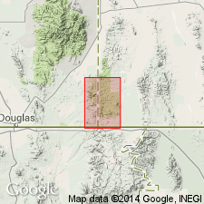
Summary:
Extended as a formation of the Bisbee Group to Perilla Mountains, 10-15 km northeast of Douglas, Cochise Co, AZ in Pedregosa basin. Outcrops southwest of College Peaks in Hog Canyon area and north of Highway 80. Conformable contacts with overlying Cintura Formation and underlying Morita Formation, both of Bisbee. Early Cretaceous age. Correlation chart.
Source: GNU records (USGS DDS-6; Denver GNULEX).
- Usage in publication:
-
- Mural Limestone*
- Modifications:
-
- Areal extent
- AAPG geologic province:
-
- Pedregosa basin
Summary:
Mural Limestone of Bisbee Group. Extended into southern Peloncillo Mountains, Cochise County, Arizona, and Hidalgo County, New Mexico. Exposed along southwestern side of Baker Canyon fault, southeasternmost Cochise County. Conformably underlies Cintura Formation and conformably overlies Morita Formation, both of Bisbee Group. Age is Early Cretaceous.
Source: Modified from GNU records (USGS DDS-6; Denver GNULEX).
- Usage in publication:
-
- Mural Limestone*
- Modifications:
-
- Areal extent
- AAPG geologic province:
-
- Pedregosa basin
Summary:
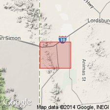
Mural Limestone of Bisbee Group. Extended into northern Animas Mountains of Hidalgo County, New Mexico. Mapped in central part of quadrangle, in T. 27 and 28 S., R. 18 W. Fossiliferous (rudistids, mollusks found in bioherms, ORBITOLINA, and saucer-shaped forams). Age is Early Cretaceous. Gillerman's (1958) local classification rejected; see entry under Bisbee.
Source: Modified from GNU records (USGS DDS-6; Denver GNULEX).
- Usage in publication:
-
- Mural Limestone*
- Modifications:
-
- Mapped 1:24k
- Dominant lithology:
-
- Limestone
- AAPG geologic province:
-
- Pedregosa basin
Summary:
Mural Limestone, near middle of Bisbee Group. Areally extended into Dragoon Mountains, central Cochise County, southeastern Arizona. May occur as a single thick unit or as a cluster of thin lentils of limestone in a dominantly siltstone or shale sequence. Mainly light-gray, bioclastic to micritic, thin-bedded limestone units 1 to 15 m thick. Some beds carry abundant molluscan fragments. Includes a limestone pebble conglomerate marker bed, commonly light-gray and moderately thick-bedded. Reef structures so common near its type locality 50 km to the south are absent in Dragoon Mountains. Underlies Cintura Formation and overlies Morita Formation (both of Bisbee); Cintura and Morita are inseparable where Mural is absent. Age is Early Cretaceous.
Source: Publication.
- Usage in publication:
-
- Mural Formation*
- Modifications:
-
- Mapped 1:24k
- Redescribed
- Dominant lithology:
-
- Shale
- Siltstone
- Limestone
- AAPG geologic province:
-
- Pedregosa basin
Summary:
Mural Formation of Bisbee Group. Gray shale and siltstone. In places includes thin beds of light-gray to light-medium-gray, fine-grained limestone. Thickness about 900 to 1,800 m. Conformably overlies Morita Formation and conformably underlies Cintura Formation, both of Bisbee Group. Sparsely fossilfierous (pelecypods, gastropods). Age is Early Cretaceous. Probably a lagoonal facies transitional between reef limestone of typical Mural Limestone to south and clastic fluvial beds to north.
Source: Modified from GNU records (USGS DDS-6; Denver GNULEX).
For more information, please contact Nancy Stamm, Geologic Names Committee Secretary.
Asterisk (*) indicates published by U.S. Geological Survey authors.
"No current usage" (†) implies that a name has been abandoned or has fallen into disuse. Former usage and, if known, replacement name given in parentheses ( ).
Slash (/) indicates name conflicts with nomenclatural guidelines (CSN, 1933; ACSN, 1961, 1970; NACSN, 1983, 2005, 2021). May be explained within brackets ([ ]).