The National Geologic Map Database is migrating to a new infrastructure. We apologize for any service disruptions during this process.
|
|---|


- Usage in publication:
-
- Mission Canyon limestone*
- Modifications:
-
- Named
- Dominant lithology:
-
- Limestone
- AAPG geologic province:
-
- Williston basin
Summary:
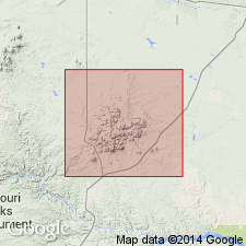
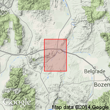
Named as a formation of the Madison group in Little Rocky Mountains, Blaine and Phillips Counties, Montana, in the Williston basin. Thickness is 500 feet. Consists of massive white limestone of marine origin. Not so fossiliferous; unlike the underlying Lodgepole limestone (new). Unconformably underlies Ellis formation; overlies Lodgepole (new). Age is Mississippian.
Type section not given. Named from Mission Canyon, Blaine Co., MT, in the Williston basin.
Source: Modified from GNU records (USGS DDS-6; Denver GNULEX).
- Usage in publication:
-
- Mission Canyon limestone
- Modifications:
-
- Overview
- Areal extent
- AAPG geologic province:
-
- Sweetgrass arch
- Central Montana uplift
- Williston basin
- Montana folded belt
- Yellowstone province
- Powder River basin
Summary:
Is the upper formation (of 2) of Madison group. Is widespread in Montana. Appears almost invariably as a uniform succession of poorly bedded, highly massive, pure limestones which form impressive cliffs, or weather into turreted or castellated shapes. Discusses measured sections from 9 localities in Montana and Wyoming: (1) the Little Belt Mountains, (2) Big Snowy Mountains, (3) Little Rocky Mountains, (4) at Logan, (5) the Bridger Range, (6) Quadrant Mountain, (7) near Cooke City, (8) the Pryor Mountains, and (9) the Gallatin Range [Sweetgrass arch, Central Montana uplift, Williston basin, Montana folded belt province, Yellowstone province, and Powder River basin]. Can be differentiated from underlying Lodgepole limestone by generally having less insoluble residue. Gives insoluble-residue percentages in samples from four sections (Logan, Little Belt Mountains, Big Snowy Mountains, and Little Rocky Mountains). Overlies Lodgepole limestone; unconformably underlies Kibbey formation of Big Snowy group, or younger rocks. Age is Mississippian.
Source: Modified from GNU records (USGS DDS-6; Denver GNULEX).
- Usage in publication:
-
- Mission Canyon limestone
- Modifications:
-
- Areal extent
- AAPG geologic province:
-
- Williston basin
- Central Montana uplift
Summary:
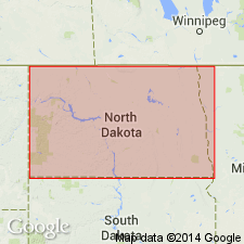
In the subsurface of central and eastern Montana, western North Dakota, and northwestern South Dakota [in the Williston basin and on central Montana uplift], conformably underlies Charles formation.
Source: Modified from GNU records (USGS DDS-6; Denver GNULEX).
- Usage in publication:
-
- Mission Canyon limestone
- Modifications:
-
- Overview
- AAPG geologic province:
-
- Williston basin
- Sweetgrass arch
Summary:
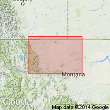
Mission Canyon limestone of Madison group. At type section [locality] in Little Rocky Mountains, Blaine County, Montana [in Williston basin], consists of approximately 330 feet of massive, predominantly white to cream limestone with a coarsely crystalline to fragmental texture. Exposures represent a partial section of the lithologic unit; estimated that pre-Middle Jurassic erosion has removed at least 150 feet of the formation at the type [locality]. In the subsurface, immediately south of the Little Rockies, the formation is complete[?]. A map illustrates the regional distribution and thickness in the northwestern part of Williston basin, Montana, northern part of Sweetgrass arch, Montana, and adjacent parts of Canada. Correlations from electrical and radioactivity curves, and generalized lithology, are presented. Thickness pattern is modified by pre-Middle Jurassic erosion throughout an extensive area in north-central Montana. Within that area, Jurassic sediments disconformably overlie the formation. Outside of the "eroded area," it is in apparent conformable and partly transitional contact with the overlying Charles formation. Underlain conformably by Lodgepole limestone. Age is Mississippian (Osage).
Source: Modified from GNU records (USGS DDS-6; Denver GNULEX).
- Usage in publication:
-
- Mission Canyon formation
- Modifications:
-
- Revised
- AAPG geologic province:
-
- Sweetgrass arch
Summary:
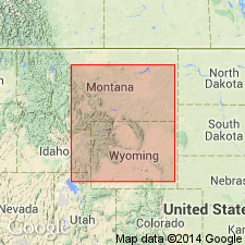
Mission Canyon formation of Madison group conformably underlies Sun River dolomite [a new name attributed to C. E. Erdmann (unpub. manuscript)] and overlies Woodhurst member of Lodgepole formation of Madison group, in the Sweetgrass arch. Age thought to be Early Mississippian (Osage).
Source: Modified from GNU records (USGS DDS-6; Denver GNULEX).
- Usage in publication:
-
- Mission Canyon formation
- Modifications:
-
- Revised
- AAPG geologic province:
-
- Williston basin
Summary:
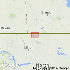
In Bottineau County, North Dakota [in Williston basin], subdivided into the lower Mission Canyon [about 120 feet thick], consisting largely of oolitic and fragmental limestone; a middle anhydrite zone, 20 to 30 feet thick, consisting of anhydrite; and the upper Mission Canyon [as much as 120 feet thick], consisting of limestone like that in the lower unit. Overlain conformably by Charles formation, or, where Charles is eroded away, unconformably by Spearfish formation; overlies Lodgepole formation conformably. Age is Mississippian.
Source: Modified from GNU records (USGS DDS-6; Denver GNULEX).
- Usage in publication:
-
- Mission Canyon limestone
- Modifications:
-
- Revised
- Overview
- AAPG geologic province:
-
- Williston basin
Summary:
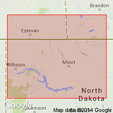
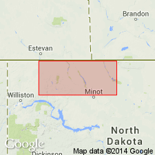
Introduces into northwestern ND a system of nomenclature for subdividing the formation, utilizing a notation established earlier in Saskatchewan. Subdivided into five units numbered (ascending) Mc-1 through Mc-5. [The boundaries of the units are electric-log markers thought to be time-stratigraphic horizons that can be carried across facies boundaries over large areas in northwestern ND and neighboring parts of Saskatchewan.] Describes lithologies of the subdivisions and shows their correlation in a series of electric-log correlation diagrams. Subdivisions are less clearly defined basinward. Unit Mc-5 contains the lower pay [oil-producing beds] in the Midale, Steelman, and Frobisher oil fields and constitutes the main pay in several other fields in Saskatchewan and ND. Mississippian in age.
Source: GNU records (USGS DDS-6; Denver GNULEX).
- Usage in publication:
-
- Mission Canyon magnafacies
- Modifications:
-
- Redescribed
- Areal extent
- Dominant lithology:
-
- Limestone
- AAPG geologic province:
-
- Williston basin
Summary:
Corresponds, in Williston basin, to Mission Canyon magnafacies, consisting of oolitic and fragmental limestone in eastern and central part of area discussed, grading to fine-grained, dense limestone in western part of area. Contact with underlying Lodgepole formation conformable; interfingers in its upper part with Charles formation (or magnafacies). Contact with Charles becomes stratigraphically higher to west. Superimposes a time-stratigraphic terminology that permits correlations across facies boundary. [Terminology is assembled from time-stratigraphic nomenclatural schemes used by petroleum geologists in Saskatchewan.] Certain marker beds selected on electric and radioactivity logs are used as boundaries for the time-stratigraphic intervals. Includes the following units in the terminology used for electric-log units (ascending): MC-1 and MC-2. Also includes one or more of the following (ascending): MC-3, Hastings, Frobisher, Midale, and Ratcliffe beds. The last four units pass from Charles to Mission Canyon magnafacies from east to west. Compares terminology with that of previous authors, including Anderson and Nelson (1956), and Harrison and Flood (1956) in ND. Is a formation in Madison group. Mississippian in age.
Source: GNU records (USGS DDS-6; Denver GNULEX).
- Usage in publication:
-
- Mission Canyon limestone*
- Modifications:
-
- Overview
- Dominant lithology:
-
- Limestone
- AAPG geologic province:
-
- Williston basin
Summary:
States that type locality is in Mission Canyon in sec 32, T26N, R24E, Blaine Co, MT in Williston basin, and that it is approximately 325 ft thick at this locality. Measured section not given. Uppermost formation in Madison group in Little Rocky Mountains, Blaine and Phillips Cos. Coarse-grained, massively bedded bioclastic limestone; locally cross-bedded; nodules and lenses of cherty material, some of which has a texture resembling novaculite. Underlain conformably by Lodgepole limestone; overlain disconformably by Rierdon formation. Early Mississippian in age.
Source: GNU records (USGS DDS-6; Denver GNULEX).
- Usage in publication:
-
- Mission Canyon facies
- Modifications:
-
- Revised
- AAPG geologic province:
-
- Williston basin
Summary:
Revised as a facies in north-central ND to emphasize that its boundaries transgress time lines. Is mainly a series of clastic carbonates with certain denser beds reflecting variations in depth and current activity. Typical Mission Canyon environment was in shallow water, between lagoonal barrier and the edge of open marine shelf. Ooliths, pseudo-ooliths, fossil fragments, composite grains, and fecal pellets are the main constituents of clastic beds, with type and amount of primary matrix being determined by local environmental factors affecting current activity. Base is defined simply as base of lowest clastic carbonate. Upper part interfingers with partly overlying Charles facies; lower part interfingers with mostly underlying Lodgepole facies. Contains one or more of the following [time-stratigraphic] mechanical-log units (ascending): Tilston member, Frobisher-Alida member, Ratcliffe member, and lower part of Poplar member. Is a formational unit in Madison group. Mississippian in age.
Source: GNU records (USGS DDS-6; Denver GNULEX).
- Usage in publication:
-
- Mission Canyon limestone*
- Modifications:
-
- Overview
- AAPG geologic province:
-
- Williston basin
Summary:
Corals from three wells in Wibaux, Dawson, and Roosevelt Cos, respectively, northeastern MT in Williston basin, are divided into three groups for facies analysis: nondissepimented solitary corals, dissepimented solitary corals, and colonial corals. Lateral changes in abundance, diversification, and vertical limits of coral fauna seem to be directly related to changes in lithic facies. Fauna of Mission Canyon of Madison group is more uniformly distributed than fauna of underlying Lodgepole limestone and it consists predominantly of solitary forms, suggesting a widespread, generally well-aerated environment in Mission Canyon time. Corals hold little promise as horizon markers because of strong facies control and long stratigraphic range of the common genera. They offer greater potential for regional correlation because of the wide distribution of distinctive associations of genera and species in rocks of Early Mississippian age. Describes 24 species distributed among 18 genera, collected from (ascending) Lodgepole and Mission Canyon limestones and Charles formation. Shows frequency distributions and stratigraphic ranges of coral types or coral genera in Madison group. Early Mississippian age.
Source: GNU records (USGS DDS-6; Denver GNULEX).
- Usage in publication:
-
- Mission Canyon limestone*
- Modifications:
-
- Biostratigraphic dating
- AAPG geologic province:
-
- Montana folded belt
- Williston basin
Summary:
Shows distribution of coral zones in four stratigraphic sections in MT that include Mission Canyon limestone of Madison group. These four sections are numbered: "4", Baldy Mountain, Madison Co, MT, Montana folded belt province; "5", type section of Madison group, north of Logan, Gallatin Co, MT, Montana folded belt province; "7", type section of Lodgepole limestone, along Lodgepole Creek, Blaine Co, MT, Williston basin; and "8", Shell Oil Co. Pine unit no. 1 well, Wibaux Co, MT, Williston basin. Coral zones in Mission Canyon are Zone C2 and overlying Zone D. Boundary of Zone C2 with underlying Zone C1 is arbitrarily placed at contact of Mission Canyon with underlying Lodgepole limestone in the four sections. Zone D extends upward in section 8 to include overlying Charles formation. Lists characteristic coral genera in the zones. Coral faunas do not provide a satisfactory basis for detailed correlation with type Mississippian of the Midcontinent region, because their sensitivity to depositional conditions appears to have given rise to different assemblages and distribution patterns in rocks believed to be nearly contemporaneous. Studies by Dutro of brachiopods associated with the coral assemblages suggests Osage equivalents are found in C2, and D, but part of Zone D is probably of Meramec age. These correlations are confirmed by distribution patterns of coral genera common to Madison and type Mississippian sequences.
Source: GNU records (USGS DDS-6; Denver GNULEX).
- Usage in publication:
-
- Mission Canyon limestone*
- Modifications:
-
- Overview
- AAPG geologic province:
-
- Montana folded belt
Summary:
Forms the highest and boldest ridge crests in the quad. Where dips are moderate, the formation is poorly exposed, forming long grassy slopes. Lies above Lodgepole limestone and below Big Snowy formation. Measured sections described in detail in SW1/4 SW1/4 sec 29 into NE1/4 NW1/4 sec 32, T3N, R2E (950 ft thick). Other measured sections only generally described. Considered Early Mississippian age. Geologic map covers parts of Jefferson, Gallatin, and Broadwater Cos, MT in the Montana folded belt province. [Compare with Peale, 1893, 1896 and Berry, 1943.]
Source: GNU records (USGS DDS-6; Denver GNULEX).
- Usage in publication:
-
- Mission Canyon Limestone*
- Modifications:
-
- Reference
- Biostratigraphic dating
- Dominant lithology:
-
- Limestone
- Breccia
- AAPG geologic province:
-
- Williston basin
- Sweetgrass arch
- Montana folded belt
Summary:
Four sections measured in MT: 1) Type section (incomplete) 295 ft thick measured south side Mission Canyon, SE1/4 NW1/4 sec 32, T26N, R24E, Blaine Co, MT, Williston basin. Consists of medium- to coarse-grained crinoidal limestone, light-olive-gray; nodules of brown chert; some interbedded, fine-grained limestone, and a few silty partings in upper part. 2) 315 ft measured in Little Chief Canyon, SW1/4 NW1/4 sec 20, T26N, R25E, Blaine Co, MT. 3) Reference section at Monarch, SW1/4 NE1/4 sec 27, T16N, R7E, northward across SE1/4 sec 22 into NE1/4 sec 22, T16N, R7E, Cascade Co, MT, Sweetgrass arch. Lower part mostly medium- to coarse-grained crinoidal limestone containing chert, and middle part, as much as 150 ft thick, is solution- and collapse-breccia of cherty limestone; upper part about 861 ft thick is mostly fine-grained micrite, containing chert, some crinoidal and oolitic limestone. 4) Logan section, SE1/4 SW1/4 sec 25, T2N, R2E, 1,050 ft measured. Lower contact at top of highest shaly, thin-bedded, predominantly fine-grained limestone, Woodhurst Member of Lodgepole Limestone. Overlain unconformably by Kibbey Formation or its equivalents or by Rierdon Formation. Numerous collections of fossils, mainly brachiopods and corals, some Foraminifera. Correlation diagrams. Osagean (Early Mississippian) age at type; Osagean and early Meramecian (Early and Late Mississippian) in age at reference section.
Source: GNU records (USGS DDS-6; Denver GNULEX).
- Usage in publication:
-
- Mission Canyon Limestone*
- Modifications:
-
- Revised
- AAPG geologic province:
-
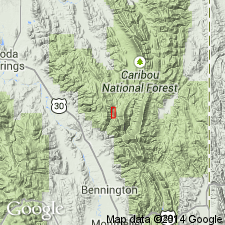
- Wasatch uplift
Summary:
Revised in that Mission Canyon Limestone overlies the newly named Aspen Range Formation in North Georgetown Canyon, Aspen Range, Bear Lake Co, ID on the Wasatch uplift. Rocks called Aspen Range in this report were assigned to the Deseret equivalent and to the Brazer Limestone in earlier reports. Only the lower part of Mission Canyon is present in North Georgetown Canyon; this location is probably the westernmost known occurrence of the formation. Of Osagean age. Correlation chart. Cross section.
Source: GNU records (USGS DDS-6; Denver GNULEX).
- Usage in publication:
-
- Mission Canyon Limestone*
- Modifications:
-
- Revised
- AAPG geologic province:
-
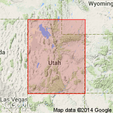
- Wasatch uplift
Summary:
Is the upper formation of the Madison Group that overlies the Lodgepole Limestone of the Madison and underlies the newly named Delle Phosphatic Member, basal member of the Aspen Range Formation at North Georgetown Canyon, Aspen Range, Bear Lake Co, ID on the Wasatch uplift. The upper contact is placed at the top of a hardground formed on the top of the Mission Canyon. Of Osagean, Early Mississippian age. Correlation of Mission Canyon with other lithostratigraphic units in Great Basin province and on the Wasatch uplift, UT and in the Snake River basin, ID, shown on correlation chart.
Source: GNU records (USGS DDS-6; Denver GNULEX).
- Usage in publication:
-
- Mission Canyon Limestone*
- Modifications:
-
- Revised
- AAPG geologic province:
-
- Montana folded belt
Summary:
Reassigned from Madison Group to Tendoy Group (new) in the northern Tendoy Mountains, Beaverhead Co, MT in the Montana folded belt province. Is the third of four formations assigned to Tendoy. Overlies Middle Canyon Formation (extended from ID) of Tendoy. Underlies McKenzie Canyon Limestone (new) of Tendoy in the northern Tendoy Mountains. Underlies Snowcrest Range Group (new; Wardlaw and Pecora, 1985) as far as Horseshoe Hills, or Big Snowy Group in central MT. Is a 176 m thick unit of cherty encrinite and crinoidal wackestone. Consists of a lower member of Osagean age (conodonts) and an upper member of early Meramecian age (corals). Is of Early and Late Mississippian age. Geologic maps. Composite section. Correlation chart.
Source: GNU records (USGS DDS-6; Denver GNULEX).
For more information, please contact Nancy Stamm, Geologic Names Committee Secretary.
Asterisk (*) indicates published by U.S. Geological Survey authors.
"No current usage" (†) implies that a name has been abandoned or has fallen into disuse. Former usage and, if known, replacement name given in parentheses ( ).
Slash (/) indicates name conflicts with nomenclatural guidelines (CSN, 1933; ACSN, 1961, 1970; NACSN, 1983, 2005, 2021). May be explained within brackets ([ ]).