

- Usage in publication:
-
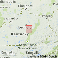
- Lexington limestone*
- Modifications:
-
- Named
- Dominant lithology:
-
- Limestone
- AAPG geologic province:
-
- Cincinnati arch
Summary:
Named Lexington limestone for Lexington, KY. Described as thin-bedded gray limestone containing nodules at base. 140-160 ft thick. Underlain by the High Bridge limestone; overlain by the Flanagan chert.
Source: GNU records (USGS DDS-6; Reston GNULEX).
- Usage in publication:
-
- Lexington Limestone*
- Modifications:
-
- Revised
- AAPG geologic province:
-
- Cincinnati arch
Summary:
Lexington Limestone extensively revised. Upper contact raised to include all rocks previously included in the Cynthiana Formation. Tanglewood Limestone Member named. Lexington Limestone defined to have following members: Curdsville Limestone, Logana, Grier Limestone, Perryville, Brannon, Sulphur Well, Tanglewood Limestone, Devils Hollow, Millersburg, and Nicholas Limestone Members. Macedonia Bed and Cave Run Bed of the Grier Limestone Member named.
Source: GNU records (USGS DDS-6; Reston GNULEX).
- Usage in publication:
-
- Lexington Limestone
- Modifications:
-
- Overview
- AAPG geologic province:
-
- Cincinnati arch
Summary:
Nomenclature of the Lexington in this report follows Stith (1986: OH Rept. Inv. 132) who extended the Curdsville and Logana Members to OH. Upper Lexington is undifferentiated. Gradationally underlies Point Pleasant Formation in southwestern OH.
Source: GNU records (USGS DDS-6; Reston GNULEX).
- Usage in publication:
-
- Lexington Limestone
- Modifications:
-
- Revised
- AAPG geologic province:
-
- Cincinnati arch
Summary:
A 7.9-m interval, occurring within the upper part of the Lexington Limestone and containing two to four impure K-bentonite beds is here informally named the Westboro K-bentonite zone. In hand sample, the Westboro is a fossiliferous claystone. Consists of a mixture of altered volcanic ash and marine sediments. Beds range from 0.03 m to 0.15 m thick. Zone occurs 3.6 m to 11.6 m below the Lexington-Point Pleasant contact. Beds are Mohawkian (Shermanian).
Source: GNU records (USGS DDS-6; Reston GNULEX).

- Usage in publication:
-
- Lexington Limestone*
- Modifications:
-
- Overview
- AAPG geologic province:
-
- Cincinnati arch
Summary:
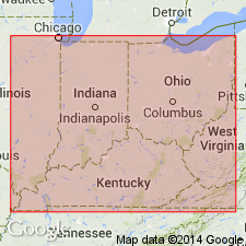
The Lexington Limestone in KY consists of a complex facies mosaic of bioclastic and fossiliferous limestone that includes the Curdsville Limestone, Logana, Grier Limestone, Perryville Limestone, Tanglewood Limestone, Brannon, Sulphur Well, Stamping Ground, Devils Hollow, and Millersburg Members, and Greendale Lentil. Thickness is up to 320 feet, but thins to less than 200 feet to the north and south where the upper members intertongue with the overlying Clays Ferry Formation. Unconformably overlies the Tyrone Limestone of the High Bridge Group and conformably underlies the Clays Ferry Formation. The Lexington Limestone is of Middle and Late Ordovician age (Kirkfieldian to Edenian).
Source: GNU records (USGS DDS-6; Reston GNULEX).

- Usage in publication:
-
- Lexington Limestone*
- Modifications:
-
- Overview
- Age modified
- AAPG geologic province:
-
- Cincinnati arch
Summary:
Lexington Limestone in KY consists of Curdsville Limestone Member and Logana Member of Kirkfieldian age; Grier Limestone Member of Kirkfieldian and Shermanian age; and Perryville Limestone Member, Brannon Member, Sulphur Well Member, Devils Hollow Member, Strodes Creek Member, Millersburg Member, and Tanglewood Limestone Member (and its Nicholas Bed) of Shermanian age. Boundary between Shermanian and Edenian Stages (and therefore the tops of the Millersburg, Tanglewood (and Nicholas), is queried. Figure 2 shows Lexington as Champlainian (Kirkfieldian and Shermanian) age in central KY and southwestern OH, but as young as Cincinnatian (Edenian) in southeastern IN.
Source: GNU records (USGS DDS-6; Reston GNULEX).
- Usage in publication:
-
- Lexington Limestone*
- Modifications:
-
- Overview
- AAPG geologic province:
-
- Appalachian basin
Summary:
In section F-F', the Lexington Limestone occurs in the Waverly arch area of OH. Overlies the Black River Group and underlies the Point Pleasant Formation. Unit correlates with the Trenton Limestone and lowest beds of the Reedsville Shale in the Ohio-West Virginia hinge zone. The Lexington Limestone is of Middle Ordovician (Kirkfieldian and Shermanian) age.
Source: GNU records (USGS DDS-6; Reston GNULEX).
For more information, please contact Nancy Stamm, Geologic Names Committee Secretary.
Asterisk (*) indicates published by U.S. Geological Survey authors.
"No current usage" (†) implies that a name has been abandoned or has fallen into disuse. Former usage and, if known, replacement name given in parentheses ( ).
Slash (/) indicates name conflicts with nomenclatural guidelines (CSN, 1933; ACSN, 1961, 1970; NACSN, 1983, 2005, 2021). May be explained within brackets ([ ]).