- Usage in publication:
-
- Leadville limestone*
- Modifications:
-
- Original reference
- Dominant lithology:
-
- Limestone
- Chert
- AAPG geologic province:
-
- Eagle basin
Summary:
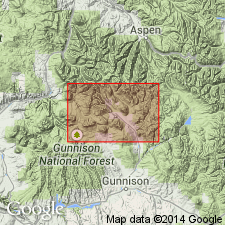
[Credited to G.H. Eldridge, "Description of the sedimentary formations" section.] Leadville limestone. Upper third, massive blue and cavernous limestone; lower two-thirds bedded gray to brown limestones, somewhat dolomitic and carrying a few beds of dark-gray or black chert, and sometimes separated by bands of calcareous shale. Thickness 400 to 525 feet. Carries Sub-Carboniferous [Mississippian] fossils. Unconformably underlies Weber limestone [Pennsylvanian] and overlies Yule limestone [Ordovician]. Known to miners as the "Blue" limestone.
[Named from occurrence in Leadville district, Lake Co., west-central CO.]
Source: US geologic names lexicon (USGS Bull. 896, p. 1160).
- Usage in publication:
-
- Leadville limestone*
- Blue limestone
- Modifications:
-
- Areal extent
- AAPG geologic province:
-
- Eagle basin
Summary:
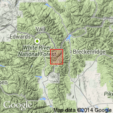
Blue or Leadville limestone, the principal ore-bearing horizon of Leadville, Red Cliff, Aspen, and other mining districts, [west-central Colorado], is not exposed in this district. Near Leadville it rests unconformably on Parting quartzite. [Age is Early Mississippian.]
Source: US geologic names lexicon (USGS Bull. 896, p. 1160).
- Usage in publication:
-
- Leadville limestone*
- Modifications:
-
- Revised
- AAPG geologic province:
-
- Eagle basin
- San Juan Mountains province
Summary:
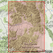
Leadville limestone here restricted to the Mississippian limestones of Colorado, and the new name Chaffee formation is introduced for the Devonian rocks of Colorado in areas to north and east of southwestern Colorado, where the Devonian limestone will continue to be called Ouray limestone and the underlying Devonian formation will continue to be called Elbert formation. The Mississippian part of Ouray limestone of southwestern Colorado to hereafter be called Leadville limestone. The typical Leadville limestone rests unconformably on Devonian limestones, which overlie the Devonian Parting quartzite.
Source: US geologic names lexicon (USGS Bull. 896, p. 1160).
- Usage in publication:
-
- Leadville limestone*
- Modifications:
-
- Adopted
- Areal extent
- Dominant lithology:
-
- Limestone
- AAPG geologic province:
-
- San Juan Mountains province
Summary:
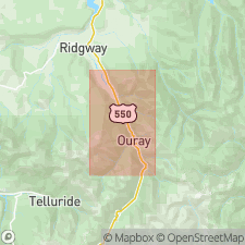
Pg. 194, 196 (chart). Leadville limestone. Name introduced into Uncompahgre district for beds containing Mississippian fossils that lie just above Ouray limestone which is restricted to dolomitic limestone beds of Late Devonian age. Lower part of unit consists of predominantly dark blue-gray or brownish-gray limestone with sandy layers near base; upper part mostly coarser textured clastic limestone with interbeds of reddish shale; locally, thin-bedded cherty and ferruginous limestone at top. Thickness 180 to 230 feet.
[Typographical error (US geologic names lexicon, USGS Bull. 1200, p. 2126): USGS Bull. 906-E was published in 1940, not 1941.]
Source: US geologic names lexicon (USGS Bull. 1200, p. 2126-2127).
- Usage in publication:
-
- Leadville limestone
- Modifications:
-
- Areal extent
- AAPG geologic province:
-
- Eagle basin
Summary:
Pg. 1386. Leadville limestone. North of Leadville, in Gore area, Eagle County, Colorado, unconformably underlies Belden shale member (new) of Battle Mountain formation. Age is Early Mississippian.
Source: Publication; US geologic names lexicon (USGS Bull. 1200, p. 2126-2127).
- Usage in publication:
-
- Leadville limestone
- Modifications:
-
- Areal extent
- [Revised]
- AAPG geologic province:
-
- Eagle basin
Tweto, Ogden, and Lovering, T.S., 1947, The Gilman district, Eagle County, [Colorado]: Colorado Mineral Resources Board [Bulletin], p. 378-387., (Part 2 prepared by the U.S. Geological Survey, under the general supervision of W.S. Burbank.)
Summary:
Pg. 380 (chart of geologic formations in Gilman district). Leadville limestone. In Gilman district, [Eagle County, Colorado], subdivided to include Gilman sandstone member ["new"] at base. Overlies Dyer dolomite member of Chaffee formation; underlies Maroon formation. [Age is Early and Late Mississippian.]
Source: Publication; US geologic names lexicon (USGS Bull. 1200, p. 2126-2127).
- Usage in publication:
-
- Leadville limestone
- Modifications:
-
- Areal extent
- AAPG geologic province:
-
- Eagle basin
Summary:
Pg. 1220 (fig. 2), 1221-1222. Leadville limestone. Described in McCoy area where it is about 150 feet thick and consists of massive- to thin-bedded, fine-grained, bluish-gray limestone that is locally lithographic. Disconformable contact with overlying McCoy formation and underlying Sawatch formation. Age is Early Mississippian.
Source: US geologic names lexicon (USGS Bull. 1200, p. 2126-2126).
- Usage in publication:
-
- Leadville dolomite*
- Modifications:
-
- Revised
- AAPG geologic province:
-
- Eagle basin
Summary:
Pg. 152 (table 1), 177-186. Leadville dolomite. In Pando area, Eagle County, Colorado, comprises basal sandy member, Gilman sandstone, about 20 feet thick, unconformably overlain by dolomite member with average thickness of about 80 feet. Unconformably overlies Dyer dolomite member of Chaffee formation; unconformably underlies Belden shale. [In an earlier publication of the Gilman district, about 8 to 10 miles north of Pando (Tweto Ogden and T.S. Lovering, 1947, Colorado Mining Resources Board [Bull.], p. 380, chart), the Leadville is shown underlying Maroon formation.] Age is Mississippian.
Source: US geologic names lexicon (USGS Bull. 1200, p. 2126-2126).
- Usage in publication:
-
- Leadville limestone
- Modifications:
-
- Areal extent
- AAPG geologic province:
-
- Eagle basin
- Piceance basin
Summary:
Pg. 29-33. Leadville limestone. In Thomasville-Woods Lake area, [Eagle and Pitkin Counties, Colorado], is 68 to 180 feet thick and consists of arenaceous, gray dolomitic limestone at base rapidly becoming nearly pure, bluish-gray limestones. Unconformably overlies Chaffee limestone; unconformably underlies Weber(?) formation. [Age is Early and Late Mississippian.]
Source: US geologic names lexicon (USGS Bull. 1200, p. 2126-2126).
- Usage in publication:
-
- Leadville limestone
- Modifications:
-
- Areal extent
- AAPG geologic province:
-
- Paradox basin
- San Juan basin
Cooper, J.C., 1955, Cambrian, Devonian, and Mississippian rocks of the Four Corners area: Four Corners Geological Society Field Conference Guidebook, [1st] Field Conference, [no. 1], p. 59-65.
Summary:
Pg. 63, 65. Leadville limestone. Many names have been used for rocks of Mississippian age in Four Corners area. Proposed here that Mississippian rocks in area be called Leadville limestone for upper limestone unit and Madison formation for underlying dolomite. Leadville is unconformably overlain by Molas shale and underlain by transitional conformable contact with Madison formation. [Age is Early and Late Mississippian.]
[Correlated in subsurface across Montezuma Co., CO, San Juan Co., NM, and Garfield and San Juan Cos., UT.]
Source: US geologic names lexicon (USGS Bull. 1200, p. 2126-2126).
- Usage in publication:
-
- Leadville limestone
- Modifications:
-
- Areal extent
- AAPG geologic province:
-
- San Juan Mountains province
Summary:
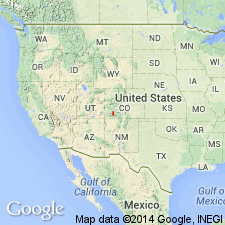
Pg. 2109 (table 1), 2111 (fig. 2), 2115 (fig. 4). Leadville limestone. In San Juan-Needles Mountains area, [southwestern Colorado], disconformably underlies Coalbank Hill member (new) of Molas formation. [Age is Early and Late Mississippian.]
Source: US geologic names lexicon (USGS Bull. 1200, p. 2126-2126).
- Usage in publication:
-
- Leadville Limestone*
- Modifications:
-
- Age modified
- AAPG geologic province:
-
- Eagle basin
- Piceance basin
Summary:
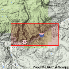
Age refined from Mississippian to Early and Late Mississippian. Consists of two parts in Glenwood Canyon at the east end near Garfield-Eagle Co line, CO in the Eagle and the Piceance basins. Lower part, about 85 ft thick, includes interbedded sandy and cherty limestone and dolomite; Gilman Sandstone Member is at base. Age of lower part is probably Kinderhook and Osage. Upper part is about 80 ft thick and is a massive oolitic cliff-forming limestone with endothyrids in lower half of upper part. The Osage-Meramec boundary is in the upper part; age of Osage and Meramec? assigned to upper part. [Tweto and Lovering (1977, p. 32) report that Skipp (oral commun., Feb., 1969) amended her earlier identification of ENDOTHYRA aff. E. SCITULA Toomey on which the Meramecian age assignment was based; thus Leadville is no younger than Osagean in Glenwood Canyon.]
Source: GNU records (USGS DDS-6; Denver GNULEX).
- Usage in publication:
-
- Leadville Limestone*
- Modifications:
-
- Areal extent
- AAPG geologic province:
-
- Piceance basin
Summary:
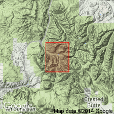
Mapped in the south-central and southeast part of quad in Gunnison Co, CO in the Piceance basin. Unconformably overlies Chaffee Formation and unconformably underlies Molas Formation. Divisible into a lower 120-130 ft of: thin beds of sandy limestone, limy quartzite, or hornfels [Gilman], and white to gray, gray- to buff-weathering, very fine to coarse grained dolomite, marble, and dolomitic limestone, and an upper 90-130 ft of white to very coarse crystalline marble with lenses of dolomite and stringers of chert. Mississippian age.
Source: GNU records (USGS DDS-6; Denver GNULEX).
- Usage in publication:
-
- Leadville Limestone
- Modifications:
-
- Revised
- AAPG geologic province:
-
- Eagle basin
Summary:
Leadville Limestone. In Eagle, Lake, and Pitkin Counties, west-central Colorado, divided into (ascending) Gilman Member, Redcliff member (informal), and Castle Butte member (informal); members separated by unconformities. Overlies Devonian Dyer Formation. Age is Early and Late Mississippian (Kinderhookian and Osage).
Source: Modified from GNU records (USGS DDS-6; Denver GNULEX).
- Usage in publication:
-
- Leadville Limestone*
- Modifications:
-
- Areal extent
- AAPG geologic province:
-
- Denver basin
Summary:
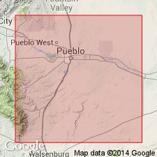
Is applied to Mississippian rocks that overlie Upper Devonian Williams Canyon Formation along the eastern side of southern Front Range, Pueblo Co., CO in Denver basin. These Mississippian rocks were assigned previously to Hardscrabble and Beulah Limestones; both Hardscrabble and Beulah are abandoned in this report.
Source: GNU records (USGS DDS-6; Denver GNULEX).
- Usage in publication:
-
- Leadville Limestone*
- Modifications:
-
- Biostratigraphic dating
- Areal extent
- AAPG geologic province:
-
- San Juan basin
- San Juan Mountains province
- San Luis basin
Summary:
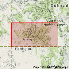
Pg. 3-15, pl. Leadville Limestone. Consists of: a lower part, generally unfossiliferous dolomite and lime mudstone, 2 to 50 m thick; and an upper part, pellet-echinoderm-ooid-foraminifer packstone-wackestone, 2 to 26 m thick, containing zone 9 microfossil assemblage (late Tournaisian; Osagean). Underlies Lower Pennsylvanian (Morrowan) Molas Formation; contact is a regional unconformity. Disconformably overlies Upper Devonian (Famennian) Ouray Limestone. On either side of boundary rocks are similar and devoid of diagnostic fossils; criteria for placement of contact based on color, lithology, bedding, and megafossils (stromatolites), as shown in detailed measured sections [p. 3+, pl.] and outlined on p. 13. Fossils [listed]. Age is considered late Early Mississippian (late Tournaisian; late Osagean).
Measured sections in Archuleta, La Plata, Ouray, Saguache, and San Juan Cos., southwestern CO.
Source: Publication.
- Usage in publication:
-
- Leadville Limestone*
- Leadville Dolomite*
- Modifications:
-
- Revised
- Redescribed
- Dominant lithology:
-
- Limestone
- Dolomite
- AAPG geologic province:
-
- Eagle basin
Summary:
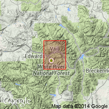
Gilman Sandstone removed as lower member of Leadville and assigned to Chaffee Group as its uppermost formation. Leadville restricted to carbonate rocks unconformably above Gilman and unconformably below Pennsylvanian Molas or Belden Formations. In most parts of central CO, Leadville is entirely limestone, however, through most of Minturn quad and southeastward through Leadville district and Mosquito Range to area of Buffalo Peaks, a distance of 42 mi, Leadville is a dolomite. Limestone-dolomite boundary is approximately along Cross Creek in Minturn quad. In canyon area between Minturn and Red Cliff and in Eagle mine, thickness ranges from 110-140 ft; thins to zero beneath Pennsylvanian rocks east and northeast of canyon area; also thins southeastward; at Leadville ranges from 0-190 ft thick, averaging 80 ft. Measured section; geologic map; stratigraphic chart. Assigned Early Mississippian (late Kinderhookian and Osagean) age. Late Mississippian (Meramecian) age for upper part of Leadville reported by Hallgarth and Skipp (1962). However, Skipp (oral commun., Feb. 1969) amended her identification of ENDOTHYRA aff. E. SCITULA Toomey on which Meramecian age assignment was made. As reported by Conley (1965, Mountain Geologist, v. 2, no. 3, p. 181-182) Skipp found no forams younger than late Osagean in White River Plateau. Generally considered equivalent of Madison Limestone which ranges in age from Kinderhookian to Meramecian.
Source: GNU records (USGS DDS-6; Denver GNULEX).
- Usage in publication:
-
- Leadville Limestone*
- Modifications:
-
- Biostratigraphic dating
- AAPG geologic province:
-
- Green River basin
- Piceance basin
- Uinta basin
Summary:
Shown on paleogeographic maps to occur as part of carbonate platform during time of lower part of SIPHONODELLA ISOSTICHA-Upper S. CRENULATA Zone (late Kinderhookian) to time of lower part of "SPATHOGNATHODUS" n. sp. Zone (late Osagean). Leadville occurs in Uinta, Greater Green River, and Piceance basins as well as others but maps are too generalized to determine all basins. Correlation charts for Kinderhookian to Meramecian rocks in UT, WY, ID, and MT.
Source: GNU records (USGS DDS-6; Denver GNULEX).
- Usage in publication:
-
- Leadville Dolomite
- Modifications:
-
- Principal reference
- Revised
- AAPG geologic province:
-
- Eagle basin
Summary:
Leadville Dolomite. Divided into (ascending): (1) Red Cliff Member, revised to include top 15+ feet of dolomite previously assigned to the underlying Gilman Sandstone of Chaffee Group by Tweto and Lovering, 1977 (=their beds 6, 7, and 8); and (2) Castle Butte Member. Total thickness 141 feet. Separated from underlying Gilman (restricted) by M-1 unconformity and from overlying Belden Formation by M-3 unconformity. Age is Mississippian.
Principal reference section (measured by Tweto and Lovering, 1977, USGS Prof. Paper 956, p. 23-32): at Rock Creek, 0.4 mi northwest of Gilman, in SW/4 sec. 12, T. 6 S., R. 81 W., Leadville mining district, Lake Co., west-central CO.
Source: Modified from GNU records (USGS DDS-6; Denver GNULEX).
- Usage in publication:
-
- Leadville Limestone*
- Modifications:
-
- Age modified locally
- Areal extent
- AAPG geologic province:
-
- San Juan basin
Summary:
Age changed from Early Mississippian (Kinderhookian and Osagean) to Early and Late Mississippian (Kinderhookian, Osagean, and Meramecian) in the San Juan basin subsurface of northwest NM where the Mississippian rocks are assigned to the Leadville Limestone. The lower part of the Leadville in this area is Kinderhookian and Osagean, and is thought to be (correlation chart) equivalent to the Whitmore Wash, Thunder Springs, and Mooney Falls Members of the Redwall Limestone of the Black Mesa basin in northeast AZ. The upper part of the Leadville is separated from the lower part by a regional unconformity representing late Osagean and early to middle Meramecian time. The upper part of the Leadville is shown on the chart as equivalent to an upper part of the Redwall (to part of the Mooney Falls and/or to the Horseshoe Mesa Members) and as of middle to early late Meramecian age. Meramecian age assignment of upper part of Leadville based on recognition of a distinctive suite of Foraminifera characterized by EOENDOTHYRANOPSIS MACRA (Zeller) in it.
Source: GNU records (USGS DDS-6; Denver GNULEX).
- Usage in publication:
-
- Leadville Limestone*
- Leadville Dolostone*
- Modifications:
-
- Age modified
- Redescribed
- AAPG geologic province:
-
- Denver basin
- Eagle basin
- Las Vegas-Raton basin
- San Juan basin
- San Juan Mountains province
Summary:
Occurs in the San Juan basin, San Juan Mountains (San Juan Mountain province), near Beulah (Denver basin), Sawatch and Mosquito Ranges (both in Eagle basin), central Colorado (Denver basin), and in northern part of Sangre de Cristo Range (Las Vegas-Raton basin) south-central CO. Locally, unconformably overlies the Devonian and Mississippian Chaffee Group and unconformably underlies the Molas Formation which could be Pennsylvanian age, or as old as late Visean and Namurian, and reworked during Early Pennsylvanian time. Unconformably overlies Ouray Limestone in the San Juan areas. Unconformably overlies the Kinderhookian and Osagean Williams Canyon Limestone near Beulah where it unconformably underlies Fountain Formation of Morrowan and younger age. Was deposited in intertidal and supratidal environments, as part of a regional Osagean, late Tournaisian to Visean, Meramecian and Chesterian, marine transgression that covered parts of central NM, and southern and central CO. Was extensively dolomitized in the Colorado Mineral Belt --Mosquito and Sawatch Ranges --where is newly referred to as the Leadville Dolostone. Elsewhere, it is Leadville Limestone. The dolostone which replaced lime mudstone has some zebra beds (dolomite pseudomorphs of anhydrite). Fossils (listed): rugose corals, brachiopods, microbial mats, small stromatolies, conodonts, etc...Divisible into a lower part of Osagean age, a middle part of Meramecian age, and only in the Beulah area, an upper part of Chesterian age. The parts are separated from each other by unconformities. The lower part correlates with Espiritu Santo and Ladron Member of Kelley Limestone. The middle part correlates with the Manuelitas Member of Tererro Formation, and the lower part of the Hachita Formation. The upper part correlates with the Cowles Member of the Tererro Formation. Measured sections. Correlation chart.
Source: GNU records (USGS DDS-6; Denver GNULEX).
- Usage in publication:
-
- Leadville Limestone*
- Modifications:
-
- Areal extent
- AAPG geologic province:
-
- Black Mesa basin
- Paradox basin
- San Juan basin
Summary:
Pg. A5 (fig. 3), A18, A20 (fig. 9, isopach map). Leadville Limestone. Is an oil- and (or) gas-producing unit. Consists of yellowish-brown and light- to dark-gray, finely to coarsely crystalline, fossiliferous dolomite in lower part and limestone in upper part. Top of Leadville deeply eroded karst topography. Thickness up to 300 feet west of Reservation. [Not mapped (pl. 1, geol. map).] Unconformably underlies Molas Formation (Upper Mississippian? to Middle Pennsylvanian; Chesterian? to Atokan) [on geol. map stratigraphic range of Molas stated as Pennsylvanian]. Unconformably(?) overlies Upper Devonian Ouray Limestone. Age is Early Mississippian (Kinderhookian).
Recognized in the Four Corners region of southwestern Colorado, northwestern New Mexico, northeastern Arizona, and southeastern Utah.
Source: Publication.
For more information, please contact Nancy Stamm, Geologic Names Committee Secretary.
Asterisk (*) indicates published by U.S. Geological Survey authors.
"No current usage" (†) implies that a name has been abandoned or has fallen into disuse. Former usage and, if known, replacement name given in parentheses ( ).
Slash (/) indicates name conflicts with nomenclatural guidelines (CSN, 1933; ACSN, 1961, 1970; NACSN, 1983, 2005, 2021). May be explained within brackets ([ ]).

