

- Usage in publication:
-
- Kootenai formation*
- Modifications:
-
- Overview
- AAPG geologic province:
-
- Montana folded belt
Summary:
Was included as part of Dakota formation by Peale (1893), but term Dakota no longer used in Montana. A section, 150 feet thick, is measured in drainage of Milligan Creek, in T. 2 N., R. 1 W. A section, about 600 feet thick, measured in northeast corner of quadrangle, in T. 3 N., R. 2 E. Overlies Morrison formation. Underlies Elkhorn Mountains Volcanics. Numerous gastropods found, but no diagnostic fossils found. Interpreted as a nonmarine deposit. Age is Early Cretaceous. Report includes geologic map.
Source: Modified from GNU records (USGS DDS-6; Denver GNULEX).
- Usage in publication:
-
- Kootenai Formation*
- Modifications:
-
- Revised
- AAPG geologic province:
-
- Montana folded belt
Summary:
Pryor Conglomerate Member newly assigned to Kootenai Formation as its basal member in Livingston area, Park Co, MT in the Montana folded belt province. Pryor is the basal member of the Cloverly Formation east of Livingston on the Central Montana uplift and in the Powder River basin. Kootenai is 245 to 295 ft thick. Is a continental sequence marked at base by a massive bed of indurated chert pebbles followed by alluvial fan, channel sandstone, and flood-plain deposits in the middle, and fine-grained lacustrine deposits at the top. Is probably equivalent to Lakota Formation of northeast WY. Of Early Cretaceous, Aptian age.
Source: GNU records (USGS DDS-6; Denver GNULEX).
- Usage in publication:
-
- Kootenai formation
- Modifications:
-
- Revised
- AAPG geologic province:
-
- Sweetgrass arch
Summary:
The Lower Cretaceous Kootenai formation in the North Cut Bank field, Glacier County, Montana, on the Sweetgrass arch, is divisible into: (1) Cut Bank member, at base; (2) Lander member (first published use); (3) Moulton member (first published use); and (4) an upper unnamed varicolored sandy shale member. Varies from about 450 to 640 feet thick, thinning to the southeast. Source area probably to the west-southwest near the Coeur d'Alene-Bitterroot Mountains area. Was deposited in a fluctuating floodplain to freshwater lake environment. Unconformably overlies Jurassic Rierdon formation of Ellis group. Unconformably underlies Cretaceous Dakota formation. Age is Early Cretaceous. Report includes cross sections.
Source: Modified from GNU records (USGS DDS-6; Denver GNULEX).
- Usage in publication:
-
- Kootenai Formation*
- Modifications:
-
- Reference
- Dominant lithology:
-
- Claystone
- Siltstone
- Conglomerate
- AAPG geologic province:
-
- Montana folded belt
- Central Montana uplift
- Powder River basin
Summary:
Pg. C6-C7, C12-C16, C58-C61. Kootenai Formation. Reference section designated [a few miles southeast of Bozeman, Montana]; thickness 255.5 feet. Includes (ascending): (1) a basal massive, cross-bedded, ridge-forming conglomerate, conglomeratic sandstone, and coarse-grained sandstone (Pryor Conglomerate Member); and (2) an overlying unnamed sequence of variegated siltstone, claystone, mudstone, limestone and tuff interbedded with calcareous sandstone. Overlies Morrison Formation and underlies Thermopolis Shale. Age is Early Cretaceous (Aptian and early Albian). Report includes geologic map, correlation chart, fossils.
Ranges from 245 to 295 feet thick of which the basal 24 to 37 feet is the Pryor. Extends from Montana folded belt province eastward into Central Montana uplift and Powder River basin. Is 255.5 feet thick at reference section, and consists of: olive-gray claystones and olive-gray, calcareous mudstone, massive; green-gray, very fine-grained, very thin-bedded to massive sandstones, some are poorly sorted, silty, and calcareous; olive-gray to gray-red, very fine-grained massive limestones, some are fossiliferous and argillaceous; and yellow-brown, sandy, calcareous, thin-bedded to massive siltstones. Basal conglomerate (Pryor) is poorly bedded, cross-bedded, massive, and has pebbles of chert and quartz, and sandstone.
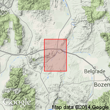
Reference section: [roadcut about 6.5 mi southeast of Bozeman, south side of Northern Pacific RR and Rocky Creek], in NE/4 sec. 25, T. 2 S., R. 6 E., [in vicinity of Lat. 45 deg. 38 min. 25 sec. N., Long. 110 deg. 55 min. 13 sec. W., Kelly Creek 7.5-min quadrangle, Gallatin National Forest], Gallatin Co., MT (Montana folded belt province).
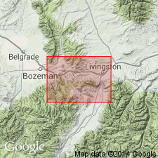
Two other sections measured (Montana folded belt province): (1) NW/4 sec. 22, T. 3 S., R. 9 E., Park Co., MT; and (2) in sec. 35, T. 2 S., R. 9 E., in Park Co., MT.
Nonmarine sequence of conglomerate, sandstone, siltstone, claystone, mudstone, limestone, and tuff.
Source: Modified from GNU records (USGS DDS-6; Denver GNULEX).
- Usage in publication:
-
- Kootenai Formation*
- Modifications:
-
- Revised
- Areal extent
- AAPG geologic province:
-
- Sweetgrass arch
Summary:
Kootenai Formation. Geographically extended into northwestern Montana, and in that area divided into (ascending): Cut Bank Sandstone, Sunburst Sandstone, and Moulton Members (formerly economic terms). Kootenai usage elsewhere ramains unchanged. Age is Early Cretaceous.
Source: Changes in stratigraphic nomenclature, 1975 (USGS Bull. 1422-A, p. A22-A23, A66-A67).
- Usage in publication:
-
- Kootenai Formation*
- Modifications:
-
- Areal extent
- AAPG geologic province:
-
- Montana folded belt
- Snake River basin
Summary:
Present along southeast edge of mapped area in Beaverhead and Madison Counties, Montana, in the Montana folded belt province, and in Clark County, Idaho, in the Snake River basin. Consists of the Pryor Conglomerate Member at base, a unit of conglomerate and conglomeratic, salt-and-pepper sandstone 8 m thick; a middle light-gray marly limestone and claystone unit about 148 m thick; and an upper light-gray limestone-claystone bed about 2 m thick that has coiled gastropod molds. Age is Early Cretaceous.
Source: Modified from GNU records (USGS DDS-6; Denver GNULEX).
- Usage in publication:
-
- Kootenai Formation*
- Modifications:
-
- Revised
- AAPG geologic province:
-
- Sweetgrass arch
Summary:
Rocks in the Sawtooth Range, Teton County, Montana, on the Sweetgrass arch, assigned to Kootenai Formation in earlier reports, are now assigned to Mount Pablo Formation (new). Kootenai (restricted) is applied to rocks unconformably above a gray, massive siltstone of Mount Pablo, or at base of a hard, light-gray to gray, noncalcareous, very fine- to coarse-grained sandstone that is poorly sorted, has rounded to subangular grains of clear quartz, and a few scattered grains of chert and feldspar. In the Sun River and areas north of Blackleaf Creek, the basal Kootenai is a greenish-gray, fine- to coarse-grained, cross-bedded sandstone with chert, quartz, and varying amounts of magnetite grains. Conglomerate of pebbles and cobbles of quartzite, quartz, chert, and igneous rocks in a coarse-grained sandy matrix are at base locally. Age is Early Cretaceous.
Source: Modified from GNU records (USGS DDS-6; Denver GNULEX).
- Usage in publication:
-
- Kootenai Formation
- Modifications:
-
- Overview
- AAPG geologic province:
-
- Montana folded belt
Summary:
Was deposited in the nonmarine Cordilleran foreland basin during a time of intensified uplift to the west in the Sevier fold-thrust belt during the Early Cretaceous, in southwest MT, Montana folded belt province. Divided into: 1) a basal conglomerate member deposited by a shallow braided-stream system, that drained predominantly eastward; 2) the first sandstone, called Pryor Member by others, deposited in a braided-stream system with paleodrainage direction to south; 3) a period of mud-dominant sedimentation followed during the lower fine-grained member; probably resulting from increased tectonism, influx of volcanic ash, and change in source; 4) renewed tectonic activity resulted in the coarse-grained alluvial system that produced the second sandstone member; 5) the remainder of Kootenai dominated by muddy fluvial and fluviolacustrine deposition and this part of Kootenai can be separated into the middle fine-grained, lower calcareous, upper fine-grained, and upper calcareous members. Fossils in upper calcareous are Aptian. Overlies Morrison Formation of Kimmeridgian age; underlies Blackleaf Formation of Albian age. Of Early Cretaceous age.
Source: GNU records (USGS DDS-6; Denver GNULEX).
- Usage in publication:
-
- Kootenai Formation*
- Modifications:
-
- Overview
- AAPG geologic province:
-
- Montana folded belt
Summary:
Only the upper part of the Kootenai Formation is discussed in this report. The top of the "gastropod limestone" is used to mark the top of the Kootenai in southwest Montana, in the Montana folded belt province. The contact is sharp and disconformable, and marks a change from nonmarine to marine strata. The "gastropod limestone" is used as the Kootenai-Blackleaf and Kootenai-Thermopolis contact because it is a widespread marker easily identified and readily mappable, whereas the carbonate beds above are discontinuous. Discontinuous lenses of nodular micritic limestone and calcareous mudstone, above the "gastropod limestone", are interbedded with the overlying sandstones and siltstones of the "lower sandstone member" of the Thermopolis Shale. Age is Late Albian, based on palynomorph assemblage identified in upper part of Kootenai. Report includes graphic columns.
Source: Modified from GNU records (USGS DDS-6; Denver GNULEX).
For more information, please contact Nancy Stamm, Geologic Names Committee Secretary.
Asterisk (*) indicates published by U.S. Geological Survey authors.
"No current usage" (†) implies that a name has been abandoned or has fallen into disuse. Former usage and, if known, replacement name given in parentheses ( ).
Slash (/) indicates name conflicts with nomenclatural guidelines (CSN, 1933; ACSN, 1961, 1970; NACSN, 1983, 2005, 2021). May be explained within brackets ([ ]).