

- Usage in publication:
-
- Kendrick shale
- Modifications:
-
- Original reference
- Dominant lithology:
-
- Shale
- AAPG geologic province:
-
- Appalachian basin
Summary:
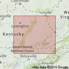
Kendrick shale. Fossiliferous limy shale, generally soft blue calcareous shale carrying many calcareous and magnesium nodules. [Thickness not stated.] Fossils (listed by C. Schuchert) are new and unmatched as a collection in or outside of Kentucky. Fauna is clearly Pottsville. Local stratigraphy suggests the Kendrick should be placed in lower part of Wise formation or Upper Pottsville, with Norton formation just below it. Lies about 170 feet above Prestonburg, Miller's Creek, or Van Lear coal. Type fossiliferous outcrop is 150 yds above Kendricks homestead, on headwaters of Cow Creek, Floyd County, southeastern Kentucky. Rests on blue sandy calcareous shale and is overlain by 15 to 20 feet of massive, somewhat cross-bedded sandstone. Age is Pennsylvanian.
Source: US geologic names lexicon (USGS Bull. 896, p. 1081).

- Usage in publication:
-
- Kendrick shales
- Modifications:
-
- Principal reference
- AAPG geologic province:
-
- Appalachian basin
Summary:
Pg. 298. Kendrick shales named by Jillson from exposures at Dr. Kendrick homestead. [Gives detailed section at type locality, where they are 19.5 feet thick.] They form roof shales of Thacker coal and lie 221 feet below "Taylor" or Copeland coal. In Pottsville group. Age is Pennsylvanian.
Source: US geologic names lexicon (USGS Bull. 896, p. 1081).
- Usage in publication:
-
- Kendrick shale*
- Modifications:
-
- Revised
- AAPG geologic province:
-
- Appalachian basin
Summary:
Pg. 88. Kendrick shale in Breathitt formation. Marine shale in Breathitt formation; directly overlies Amburgy coal. [Age is Pennsylvanian.]
Source: US geologic names lexicon (USGS Bull. 1200, p. 1989).
- Usage in publication:
-
- Kendrick shale
- Modifications:
-
- Areal extent
- AAPG geologic province:
-
- Appalachian basin
Summary:
Pg. 11, 17. Kendrick shale in Breathitt formation. Thickness at type locality 50 feet. [Age is Middle Pennsylvanian.]
Source: US geologic names lexicon (USGS Bull. 1200, p. 1989).
- Usage in publication:
-
- Kendrick Shale*
- Modifications:
-
- Mapped
- AAPG geologic province:
-
- Appalachian basin
Summary:
Kendrick Shale of Jillson (1919). Consists of interlaminated, very fine-grained sandstone and siltstone in upper part, grades down to sandy siltstone; commonly is sandy or silty clay shale in lower part; clay shale is dark greenish gray to dark gray, weathers to distinctive float mottled dark gray and white to dark greenish gray and light brown, blocky to fissile. Middle and lower parts of Kendrick Shale contain thin discontinuous lenses or nodules of siderite; lower part commonly contains abundant marine fossils and rarely limestone concretions showing cone-in-cone structure. Kendrick Shale ranges in thickness from about 20 feet in northwest to about 65 feet in southeast.
Source: GNU records (USGS DDS-6; Reston GNULEX).
- Usage in publication:
-
- Kendrick Shale Member*
- Modifications:
-
- Revised
- AAPG geologic province:
-
- Appalachian basin
Summary:
Kendrick Shale is redefined and is designated a member of the Breathitt Formation. Consists mainly of a single upward-coarsening sequence of shale and siltstone. Sandstone is rare except in laminae. At base, there is generally a discrete dark-gray carbonaceous shale bed as much as 2 m thick that contains abundant marine fossils and dense nodular limestone concretions. Upper part of the unit contains sparse silty limestone concretions as much as 2 m in diameter and thin (2-4 cm) lenses and nodules of siderite. Divided into 2 facies: an "open-bay" facies that commonly contains abundant marine fossils and a "marginal-bay" facies that contains few or no fossils. Grades laterally into facies called fluvial distributary facies. Not present in areas where the distributary facies occurs. Thickness ranges from 0 to more than 21 m, commonly about 10 m thick. Occurs above the Williamson (Amburgy) coal bed or coal zone and below the coal beds of the Whitesburg coal zone.
Source: GNU records (USGS DDS-6; Reston GNULEX).
- Usage in publication:
-
- Kendrick Shale Member
- Modifications:
-
- Revised
- AAPG geologic province:
-
- Appalachian basin
Summary:
Wise Formation in Lee Co., VA, includes (ascending) Cannelton Shale Member (White, 1885), Clover Fork Sandstone Member (Miller, 1969), Marcum Hollow Sandstone Member (Miller, 1969), Kendrick Shale Member (Jillson, 1919), and Magoffin Member (Morse, 1931). Also includes many named coal beds. Wise overlies Gladeville Sandstone.
Source: GNU records (USGS DDS-6; Reston GNULEX).

- Usage in publication:
-
- Kendrick Shale Member
- Modifications:
-
- Revised
- AAPG geologic province:
-
- Appalachian basin
Summary:
Breathitt Formation is informally elevated to group rank and subdivided into the following eight informal formations: Pocahontas, Bottom Creek, Alvy Creek, Grundy, Pikeville, Hyden, Four Corners, and Princess formations. Kendrick Shale Member is here assigned to the base of the Hyden formation. Overlies the Amburgy coal bed of the Pikeville formation and underlies the lower Whitesburg coal. [Revisions made in this paper are strongly contested by C. Rice and other USGS scientists who work in this area (oral commun., 9/3/93).]
Source: GNU records (USGS DDS-6; Reston GNULEX).

- Usage in publication:
-
- Kendrick Shale Member
- Modifications:
-
- Revised
- AAPG geologic province:
-
- Appalachian basin
Summary:
Kendrick Shale Member marks the base of the Hyden Formation, formally named in this report and assigned to the Breathitt Group. Correlation chart indicates that unit occurs across TN, KY, and VA in the Cumberland overthrust sheet, but is replaced by the Dingess in the VA and WV portion of the Cumberland plateau. Dingess is not mentioned in the text. The Kendrick overlies coal-bearing strata of the Pikeville Formation (new) and underlies variously named coal beds of the Hyden. According to the author, formal nomenclature presented in this report for units occurring in KY has been accepted by the Kentucky Stratigraphic Nomenclature Committee. Units that occur largely outside KY are considered informal. Report includes correlation charts, cross sections, and measured sections.
Source: GNU records (USGS DDS-6; Reston GNULEX).

- Usage in publication:
-
- Kendrick Shale Member*
- Modifications:
-
- Areal extent
- AAPG geologic province:
-
- Appalachian basin
Summary:
Kendrick Shale Member of Breathitt Formation. (= Kendrick Shale of Jillson, 1920.) [Marine shale, up to 69 feet thick], in middle part of Breathitt Formation below Magoffin Member (locally lies beneath Puckett Sandstone Member) and above Crummies Member. Lies below the Bull Creek, Little Fire Clay, Stray, Upper Pioneer, or Whitesburg coals; lies above the Amburgy, Cannel City, Creech, Gun Creek, Klondike, Lower Pioneer, Sterling, or Williamson coals. [Equivalent to Dingess Shale Member of Kanawha Formation in West Virginia.] Age is Middle Pennsylvanian.
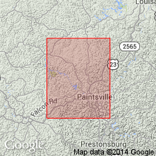
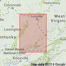
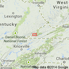
Recognized in Princess, Licking River, Hazard, Southwestern, and Big Sandy districts of eastern Kentucky, and Upper Cumberland River district, southeastern KY.
[See also Rice and others, 1994, GSA Spec. Paper 294, p. 131.]
Source: Publication.

- Usage in publication:
-
- Kendrick Shale Member
- Modifications:
-
- Areal extent
- AAPG geologic province:
-
- Appalachian basin
Summary:
Corr. chart. Kendrick Shale Member of Hyden Formation of Breathitt Group (KY); Kendrick Shale Member of Wise Formation (VA). Shale and/or mudstone. In Kentucky is basal member of Hyden Formation above the Elkins Fork shale, an informal, unranked unit in Pikeville Formation; lies between the Whitesburg or Stray coals above and Amburgy (Cannel City) coal bed or Creech (Upper Taggart) coal zone in the Pikeville below. [Locally underlies Puckett Sandstone Member of Hyden in Upper Cumberland River district, southeastern Kentucky.] In Virginia is a member in middle of Wise Formation between Magoffin Member above and Marcum Hollow Sandstone Member below; lies below the House coal bed and above Low Splint coal bed. Correlative with Dingess Shale Member of Kanawha Formation in West Virginia, and an unnamed marine shale near base of Graves Gap Formation in Tennessee. [Currently the Kendrick is restricted from Tennessee. Rice and others' (1994, GSA Spec. Paper 294, p. 131) correlated the Kendrick with a marine shale above the Lower Pioneer coal, which is much higher in section.] Carries marine fossils. Age is Middle Pennsylvanian (Westphalian; Atokan).
[Peppers (1996, GSA Memoir 188, p. 9, pl.) placed rocks = Kendrick, btw. the Whitesburg and Amburgy coals of eastern Kentucky, in upper part of Westphalian B, MICRORETICULATISPORITES NOBILIS-FLORINITES JUNIOR (NJ) miospore assemblage zone of western Europe. Eble and others (2009, Kentucky Geol. Survey, ser. XII, Spec. Pub. 10, fig. 5.2) placed equivalent rocks of West Virginia in upper part of Duckmantian (upper part of Westphalian B) on basis of miospores.]
Source: Publication.
For more information, please contact Nancy Stamm, Geologic Names Committee Secretary.
Asterisk (*) indicates published by U.S. Geological Survey authors.
"No current usage" (†) implies that a name has been abandoned or has fallen into disuse. Former usage and, if known, replacement name given in parentheses ( ).
Slash (/) indicates name conflicts with nomenclatural guidelines (CSN, 1933; ACSN, 1961, 1970; NACSN, 1983, 2005, 2021). May be explained within brackets ([ ]).