

- Usage in publication:
-
- Waldrip-Cisco series
- Modifications:
-
- Overview
- Dominant lithology:
-
- Clay
- Shale
- Limestone
- Coal
- AAPG geologic province:
-
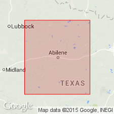
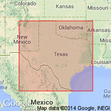
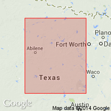
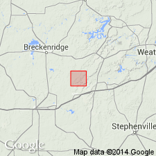
- Bend arch
- Fort Worth syncline
Summary:
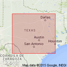
Pl. 3, p. lxvii. Waldrip-Cisco series. [=Waldrip division of Tarr (1890) and Cisco division of Cummins (1891).] Alternating clays, shales, fire clays, and limestones, with coal seams. Coal seams exposed from Waldrip, along Colorado River, to Montague County; more sulphurous in places. Overlies Brownwood-Ranger series and underlies Coleman-Albany series. Study area in central basin, approximately from Colorado River north to Red River, north-central Texas. Age is Carboniferous (Coal Measures).
Source: US geologic names lexicon (USGS Bull. 896, p. 446); supplemental information from GNU records (USGS DDS-6; Denver GNULEX).
- Usage in publication:
-
- Cisco division
- Modifications:
-
- Principal reference
- Dominant lithology:
-
- Conglomerate
- Sandstone
- Limestone
- Clay
- Shale
- AAPG geologic province:
-
- Many basins
Summary:
Pg. 361-398. Cisco division, 2nd from top of 6 divisions of Carboniferous "Coal Measures." Conglomerates, sandstones, limestones, clays, and sandy shales, 840 feet thick. Includes "Coal Seam No. 7." Conglomerates and sandstones resemble those of Strawn division. Overlies heavy limestone beds of Canyon division and underlies Albany division [Wichita formation]. Age is Carboniferous (Coal Measures). Most extensive and continuous of all divisions; occurs in entire Carboniferous area. Carboniferous area of Texas stretches from below Colorado River northward to Red River, average width about 75 miles; comprises Brazos coal field (north) and Colorado coal field (south), separated by Cretaceous rocks. Report includes measured sections, fossils.
Named from town of Cisco, on Texas and Pacific RR, Eastland Co., TX.
Source: US geologic names lexicon (USGS Bull. 896, p. 446); supplemental information from GNU records (USGS DDS-6; Denver GNULEX).

- Usage in publication:
-
- Cisco division
- Modifications:
-
- Revised
- AAPG geologic province:
-
- Bend arch
- Llano uplift
Summary:
Pg. 371-372, 387. Cisco division [2nd from top of 5 Carboniferous divisions of Cummins, 1891]. Consists of: beds of blue clay, which are shaly at some localities; sandstone, usually conglomeritic, and often a pure conglomerate; and thinly bedded limestone and some coal. Divided into (descending) Santa Anna Branch, Bed No. 18, Santa Anna, Horse Creek, Watts Creek, Camp Colorado, Bed No. 13, Stockwether, Coon Mountain, Camp Creek, Saddle Creek, Waldrip, Chaffin, Parks Mountain, Lohn, Speck Mountain limestone, Speck Mountain clay, BELLEROPHON, and Trickham beds. Overlies Canyon division and underlies Albany division. Age is Pennsylvanian.
Source: Publication.
- Usage in publication:
-
- Cisco division
- Modifications:
-
- Revised
- AAPG geologic province:
-
- Bend arch
Summary:
Cisco division. Outcrops in belt about 18 miles wide in western portion of the Pennsylvanian outliers. Overlies Upper Pennsylvanian Canyon division and underlies Permian rocks. Age is Late Pennsylvanian. In area of report, Brazos River Valley, north-central Texas, divided into 7 formations (ascending): Jacksboro, Bunger, Gunsight, Breckenridge, Waldrip, Pueblo, and Moran. These formations compare with Drake's (1893) Colorado River Valley section as follows:
-----------------------------------------
THIS REPORT (Brazos River Valley)
7. Moran formation
6a. Dothan limestone [unranked]
6. Pueblo formation
5. Waldrip formation
4. Breckenridge formation
3. Gunsight formation
2. Bunger formation
1. Jacksboro formation
-----------------------------------------
DRAKE (1893) (Colorado River Valley)
7. Camp Colorado bed
6a. Stockwether bed
6. Saddle Creek bed
5. Waldrip bed
4. Chaffin bed
3. Speck Mountain limestone
2. Trickham bed
1. CAMPOPHYLLUM bed
-----------------------------------------
Source: Modified from GNU records (USGS DDS-6; Denver GNULEX).
- Usage in publication:
-
- Cisco formation*
- Modifications:
-
- Revised
- AAPG geologic province:
-
- Bend arch
Summary:
Cisco formation. Includes (descending) Bunger limestone member and Gonzales limestone member. Age is Pennsylvanian.
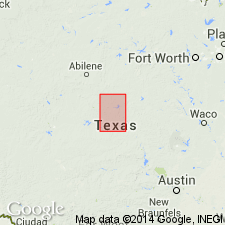
Recognized in Lacasa area, Stephens Co., Brazos River region, central northern TX.
Source: Modified from GNU records (USGS DDS-6; Denver GNULEX).

- Usage in publication:
-
- Cisco group
- Modifications:
-
- Revised
- AAPG geologic province:
-
- Bend arch
- Fort Worth syncline
- Llano uplift
Summary:
Pg. 24, 32, etc.; Univ. Texas Bull. 2132. Cisco group. Divided into (descending) Putnam, Moran, Pueblo, Harpersville, Thrifty, and Graham formations. [Age is Pennsyvlanian.]
Source: US geologic names lexicon (USGS Bull. 896, p. 446).
- Usage in publication:
-
- Cisco group
- Modifications:
-
- Revised
- AAPG geologic province:
-
- Bend arch
- Fort Worth syncline
- Llano uplift
Summary:
(Credits Wallace Lee and C.O. Nickell.) Pg. 12-90, 118-134. Cisco group. In Brazos River Valley and Colorado River Valley, Texas, includes (ascending) Graham, Thrifty, Harpersville, and Pueblo formations. Moran and Putnam formations formerly included in the Pennsylvanian are now placed in the Permian, thus restricting definition of Cisco group. [Age is Late Pennsylvanian.]
Source: US geologic names lexicon (USGS Bull. 1200, p. 807-809).

- Usage in publication:
-
- Cisco series
- Modifications:
-
- Revised
- AAPG geologic province:
-
- Bend arch
Summary:
Pg. 66 (fig. 1), 90-92. Cisco series includes Pennsylvanian sediments above widespread disconformity which followed deposition of Home Creek limestone of Caddo Creek group, Canyon series. The Cisco is intended to be approximate Texas equivalent of Virgil series of northern Midcontinent region. Upper boundary for series and Pennsylvanian System is placed at disconformity in Harpersville formation about Waldrip-Newcastle coal zone and below SCHWAGERINA-bearing "Waldrip limestone No. 3" and Saddle Creek limestone. As thus defined, Permian-Pennsylvanian boundary is 40 to 150 feet below Saddle Creek limestone. "Harpersville" beds below boundary are assigned to Obregon (new) and Chaffin formations of Thrifty group; those above systemic boundary are assigned to Saddle Creek formation of expanded Pueblo group. Series comprises Graham and Thrifty groups.
Source: US geologic names lexicon (USGS Bull. 1200, p. 807-809).
- Usage in publication:
-
- Cisco group
- Modifications:
-
- Age modified
- AAPG geologic province:
-
- Bend arch*
- Fort Worth syncline
- Llano uplift
Summary:
Pg. 288 (fig. 1), 299. Rocks of Kawvian series (new) [Upper Pennsylvanian] are widespread in North America. In north-central Texas, series includes the Canyon and Cisco groups.
Source: US geologic names lexicon (USGS Bull. 1200, p. 807-809).

- Usage in publication:
-
- Cisco group
- Modifications:
-
- Areal extent
- AAPG geologic province:
-
- Bend arch
Summary:
In Colorado River area, Texas, base of rocks classed as Permian lies about 50 feet below Saddle Creek limestone member of Pueblo formation. Beds between Saddle Creek units and boundary at base of Permian are assigned to Waldrip shale member of Pueblo. First limestone above disconformity is a 1-foot fusuline-bearing limestone called Waldrip No. 3 limestone by Drake (1893). Disconformity marks top of Cisco group. In accordance with Cheney's (1940) classification, term Harpersville is suppressed. [Age is Late Pennsylvanian.]
Source: US geologic names lexicon (USGS Bull. 1200, p. 807-809).
- Usage in publication:
-
- Cisco group*
- Modifications:
-
- Revised
- AAPG geologic province:
-
- Bend arch
Summary:
Pg. 58 (table 1), 68-74, pl. 27. Cisco group. Drake (1893) referred lower part of what is now considered Cisco group, including his Bluff Creek and CAMPOPHYLLUM beds, to Cummins' (1891) Canyon division. To Cummins' Cisco division he referred the rocks from base of his Trickham bed up to base of his Coleman Junction bed (Coleman Junction limestone of Putnam formation, Wichita group, Moore, 1949). Plummer and Moore [1922] reclassified Drake's beds as members and considered his Bluff Creek bed to be a member of their Graham formation. Gunsight limestone (Plummer, 1919) and the newly named Wayland shale were also included in Graham formation which they placed in Cisco group. Plummer and Moore [1922] placed upper boundary of Cisco at top of their Coleman Junction limestone. Thus they considered Cisco group to consist of all beds from their Home Creek limestone to top of their Coleman Junction limestone. They placed in Thrifty formation all beds between their Wayland shale and top of Breckenridge limestone (Drake's Chaffin bed). Their Harpersville formation consisted of Drake's Waldrip and Saddle Creek beds. They also included the Pueblo, Moran, and Putnam formations in this Cisco group. Sellards (Univ. Texas Bull. 3232, 1933) considered top of Home Creek as base of Cisco group, but lowered top of Cisco to top of Plummer and Moore's [1922] Camp Colorado limestone of Pueblo formation. Bullard and Cuyler (Univ. Texas Bull. 3501, 1935) retained these boundaries but raised Graham-Thrifty boundary to top of Speck Mountain limestone member. Present report [Brown and Coleman Counties] places top of Thrifty formation of Cisco group at top of Chaffin limestone member, the most persistent mappable unit in that part of stratigraphic sequence, and uppermost unit in which distinctive Pennsylvanian fusulinids have been found. Because boundary between Permian and Pennsylvanian is obscure and probably gradational, no definite upper boundary between the two systems has been drawn. Formations and members of Cisco group as recommended in this report are (ascending) Graham formation with Bluff Creek shale, Gunsight limestone, Wayland shale, and Ivan limestone members; and Thrifty formation with Speck Mountain limestone, Breckenridge limestone, Parks Mountain sandstone, and Chaffin limestone members. Overlies Caddo Creek formation of Canyon group; underlies Pueblo formation of Wichita group. Thickness about 400 feet.
Source: US geologic names lexicon (USGS Bull. 1200, p. 807-809).

- Usage in publication:
-
- Cisco Group
- Modifications:
-
- Areal extent
- AAPG geologic province:
-
- Bend arch
- Fort Worth syncline
Summary:
Cisco Group mapped in the southern part of the mapped area, north-central TX, in Throckmorton and Young Cos (Bend arch) and Jack Co (Fort Worth syncline). Equivalent to lower part of Wichita Group (revised) and Bowie Group (first used) of northeastern part of mapped area. Cisco is divided into following mapped units (ascending): Graham and Thrifty Formations (undivided), Harpersville, Pueblo, Moran, and Sedwick Formations, and Santa Anna Branch Shale. Is of Virgil (Late Pennsylvanian) to Wolfcamp (Early Permian) age. Geologic map.
Source: GNU records (USGS DDS-6; Denver GNULEX).
For more information, please contact Nancy Stamm, Geologic Names Committee Secretary.
Asterisk (*) indicates published by U.S. Geological Survey authors.
"No current usage" (†) implies that a name has been abandoned or has fallen into disuse. Former usage and, if known, replacement name given in parentheses ( ).
Slash (/) indicates name conflicts with nomenclatural guidelines (CSN, 1933; ACSN, 1961, 1970; NACSN, 1983, 2005, 2021). May be explained within brackets ([ ]).