- Usage in publication:
-
- Bolsa quartzite*
- Modifications:
-
- Original reference
- Dominant lithology:
-
- Quartzite
- AAPG geologic province:
-
- Pedregosa basin
Summary:
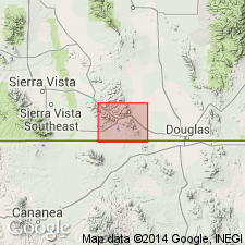
Pg. 28-30. Bolsa quartzite. Consists of (descending): (1) thinner bedded [than below], more vitreous, fine-grained quartzites showing no feldspathic material; (2) hard pebbly grits in beds 10 to 20 feet thick, cross-bedded in lower part; (3) conglomerate at base, 0.5 to 1-foot thick. Thickness 430 feet. Rests unconformably on pre-Cambrian schists and conformably overlain by Abrigo limestone. Is without much doubt = Tonto sandstone of Grand Canyon. Age is Middle Cambrian. [For reason for introduction of name see entry No. 2 under Dragoon quartzite.]
Named from exposures in newly named Bolsa Canyon, [in T. 23 S., R. 23 E.], on southwest side of Escabrosa Ridge, [Mule Mountains], Bisbee quadrangle, Cochise Co., southeastern AZ. Typical section on northeast slope of Mount Martin.
Source: US geologic names lexicon (USGS Bull. 896, p. 229-230); supplemental information from GNU records (USGS DDS-6; Denver GNULEX).
- Usage in publication:
-
- Bolsa quartzite*
- Modifications:
-
- Areal extent
- AAPG geologic province:
-
- Pedregosa basin
Summary:
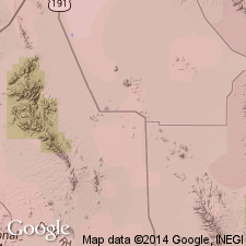
Pg. 31, 32 (fig. 13). Bolsa quartzite. Deposited on surface of considerable relief on Apache gorup (Dripping Spring quartzite). Thickness varies abruptly from 335 to less than 50 feet in Johnson Camp area, Cochise County, central Arizona. [Age is Middle Cambrian.]
Source: US geologic names lexicon (USGS Bull. 1200, p. 419-420).
- Usage in publication:
-
- Bolsa quartzite*
- Modifications:
-
- Areal extent
- Overview
- AAPG geologic province:
-
- Pedregosa basin
Summary:
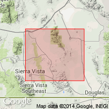
Pg. 14-15, pls. 5, 11, 12. Bolsa quartzite. In Dragoon, Whetstone, and Swisshelm Mountains, central Cochise County, southeastern Arizona, rocks commonly cross-bedded, and beds range from few inches to as much as 10 feet in thickness, average 2 to 4 feet. Rests on smooth surface carved across Precambrian rocks, largely Pinal schist. Underlies Abrigo limestone with transitional contact. Age is Middle Cambrian. Report includes geologic map.
Source: US geologic names lexicon (USGS Bull. 1200, p. 419-420); supplemental information from GNU records (USGS DDS-6; Denver GNULEX).
- Usage in publication:
-
- Bolsa quartzite
- Modifications:
-
- Areal extent
- Age modified
- AAPG geologic province:
-
- Basin-and-Range province
- Pedregosa basin
Summary:
In Arizona, Bolsa quartzite is recognized as far north as Sierra Ancha, Gila County, as far west as Vekol Mountains, Pinal County, and as far east as Apache Pass, Cochise County. In its easternmost and northernmost exposures it is considered partially or entirely Late Cambrian, whereas in southern and western exposures it is considered Middle Cambrian.
[GNU remark (ca. 1984, USGS DDS-6; Denver GNULEX): Some of the northern exposures assigned to the Bolsa in this report, now may be more appropriately assigned to the Tapeats Sandstone or possibly the Troy Quartzite. Some of the eastern exposures assigned to the Bolsa in this report, now would be included in the Coronado Sandstone.]
Source: Modified from GNU records (USGS DDS-6; Denver GNULEX).
- Usage in publication:
-
- Bolsa quartzite
- Modifications:
-
- Areal extent
- Age modified
- AAPG geologic province:
-
- Pedregosa basin
Summary:
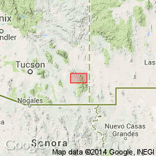
Pg. 469-472, fig. 4. Bolsa quartzite. Transgresses upward through time (Lower Cambrian? to Upper Cambrian) in west to east section through Dos Cabezas and Chiricahua Mountains, Cochise County, Arizona. Consists of: basal quartzite pebble and boulder conglomerate, a few inches to 15 feet thick; coarse- to medium-grained pink quartzite, commonly arkosic; and siltstone and sandstone. Thickness 0 to 620 feet. Unconformably overlies Pinal schist or Precambrian granite; underlies El Paso formation. Equivalent to Bliss sandstone of New Mexico. Fossiliferous (trilobites).
[GNU remark (August 16, 1984, USGS DDS-6; Denver GNULEX): The rocks called Bolsa quartzite in this paper were later referred to the Coronado sandstone by Hayes, 1972.]
Source: US geologic names lexicon (USGS Bull. 1200, p. 419-420); supplemental information from GNU records (USGS DDS-6; Denver GNULEX).
- Usage in publication:
-
- Bolsa quartzite
- Modifications:
-
- Areal extent
- AAPG geologic province:
-
- Pedregosa basin
Summary:
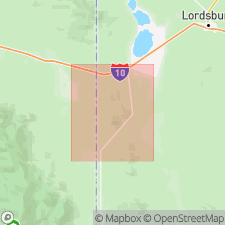
p. 18-21, tables 1, 2, pl. 1. Bolsa quartzite. Described from central Peloncillo Mountains of New Mexico. Arkosic and orthoquartzitic sandstone and conglomerate containing some glauconite and thin shale beds in middle part of unit. Thickness ranges from 60 to 400 feet. Underlies El Paso limestone. Age is Middle and Late Cambrian.
Source: US geologic names lexicon (USGS Bull. 1200, p. 419-420).
- Usage in publication:
-
- Bolsa Quartzite*
- Modifications:
-
- Principal reference
- Dominant lithology:
-
- Sandstone
- AAPG geologic province:
-
- Pedregosa basin
Summary:
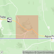
Pg. F5-F8, F37+, pl. 1. Bolsa Quartzite. Very resistant, evenly bedded yellowish- to reddish-brown-weathering grayish-red to pinkish-gray siliceous sandstone. Shaly siltstone partings generally less than 1-inch thick present at several horizons in upper two-thirds of formation. Thickness 344 feet. Unconformably overlies Pinal Schist; conformably underlies Abrigo Limestone. No fossils. Age is Middle Cambrian based on stratigraphic relations.
Type section (is same or very near section measured by Ransome, 1904, USGS Prof. Paper 21, p. 29, pl. 6A): in Spring Canyon, in NW/4 SE/4 SE/4 sec. 7, T. 23 S., R. 24 E., Escabrosa Ridge, Mule Mountains, Bisbee quadrangle, Cochise Co., southeastern AZ.
Source: Publication.
- Usage in publication:
-
- Bolsa Quartzite*
- Modifications:
-
- Areal extent
- Adopted
- AAPG geologic province:
-
- Pedregosa basin
- Basin-and-Range province
Summary:
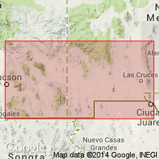
Bolsa Quartzite. Geographically restricted to area of southeastern Arizona where overlying Abrigo Formation is recognized. Rocks previously assigned to the Bolsa elsewhere are reallocated to the Coronado Sandstone. Age is Middle Cambrian.
Source: Changes in stratigraphic nomenclature, 1972 (USGS Bull. 1274-A, p. A6-A7); supplemental information from GNU records (USGS DDS-6; Denver GNULEX).
- Usage in publication:
-
- Bolsa Quartzite*
- Modifications:
-
- Areal extent
- AAPG geologic province:
-
- Basin-and-Range province
Summary:
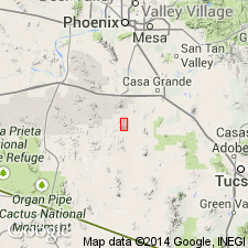
The quartzite above Apache Group and beneath Abrigo Formation formerly assigned to Bolsa? Quartzite of Vekol Mountains, Pinal Co, AZ in Basin-and-Range province identified with certainty as Bolsa Quartzite. Deposited on a surface of considerable relief carved on Precambrian rocks. Bolsa is absent due to non-deposition over some areas, but is generally 150 to 200 ft thick. Is Cambrian in age.
Source: GNU records (USGS DDS-6; Denver GNULEX).
- Usage in publication:
-
- Bolsa Quartzite*
- Modifications:
-
- Age modified
- Areal extent
- AAPG geologic province:
-
- Basin-and-Range province
Summary:
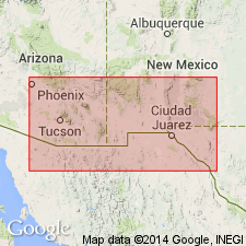
Areal limits of formation shown in Pedregosa basin and Basin-and-Range province, AZ and NM (fig. 6). Descriptions of lithology, sedimentary structures, thickness, and age over the known area of occurrence are given. Measured section at Brandenburg Mountain, N1/2 SW1/4 sec 7, T6S, R16E described; here Bolsa is 127 ft thick, overlies Precambrian diabase and underlies Abrigo Formation. At Garden Canyon section, in sec 5, T23S, R20E, 499 ft were described; here Bolsa overlies Precambrian rocks and underlies Abrigo. No age-diagnostic fossils have been reported from Bolsa. Since originally defined by Ransome (1904), age has been considered to be Middle Cambrian based on conformable relationship with overlying Abrigo, whose lower part is known to be late Middle Cambrian age. However, based on regional studies "it seems very possible that at least part of the Bolsa... (in the Slate and Vekol Mountains...) is of Early Cambrian age." [Author uses Middle Cambrian age for Bolsa throughout report.] Pima Co, AZ in the Basin-and-Range province may be of Early Cambrian age as well as Middle Cambrian.
Source: GNU records (USGS DDS-6; Denver GNULEX).
- Usage in publication:
-
- Bolsa Quartzite
- Modifications:
-
- Areal extent
- AAPG geologic province:
-
- Basin-and-Range province
Summary:
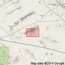
Extended to Harquahala Mountains, Yuma County, Arizona. Intruded by Socorro Granite. In fault contact with Redwall Limestone. As much as 106 m thick. Is of Cambrian age.
Source: GNU records (USGS DDS-6; Denver GNULEX).
- Usage in publication:
-
- Bolsa Quartzite*
- Modifications:
-
- Mapped 1:24k
- Dominant lithology:
-
- Quartzite
- Sandstone
- AAPG geologic province:
-
- Pedregosa basin
Summary:
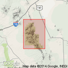
Bolsa Quartzite. Brownish-gray, light-gray, or purplish-gray, medium- to thick-bedded, coarse-grained quartzite and sandstone. Upper part contains some siltstone; lower part contains quartzite pebble conglomerates and arkosic beds. Thickness about 80 to 100 m; locally as much as 150 m. Age is Middle Cambrian.
Source: Publication.
- Usage in publication:
-
- Bolsa Quartzite*
- Modifications:
-
- Revised
- AAPG geologic province:
-
- Basin-and-Range province
GNU Staff, 1995, Draft copy of Force, E.R., Geology and mineral resources of a Tucson-to-San Manuel transect across the Santa Catalina Mountains, southeastern Arizona, IN Mineral resource studies along the Sierrita-Mogollon transect, Arizona-New Mexico, USGS Bull. 2042-A (unpublished): U.S. Geological Survey Digital Data Series, DDS-6, 1 CD-ROM., release 3
Summary:
[Early draft, unpub. ms.] Maroon siltstone in lower part of Bolsa of Creasey (1967) is transferred to underlying Campo Bonito Formation (new). Disconformably overlies Campo Bonito (Upper Proterozoic?); conformably underlies Abrigo Formation (Middle and Upper Cambrian). Revised thickness of Creasey's measured Bolsa is 93 m (305 feet).
Study area in Santa Catalina Mountains, Pima Co, AZ.
Source: Modified from GNU records (USGS DDS-6; Denver GNULEX).
For more information, please contact Nancy Stamm, Geologic Names Committee Secretary.
Asterisk (*) indicates published by U.S. Geological Survey authors.
"No current usage" (†) implies that a name has been abandoned or has fallen into disuse. Former usage and, if known, replacement name given in parentheses ( ).
Slash (/) indicates name conflicts with nomenclatural guidelines (CSN, 1933; ACSN, 1961, 1970; NACSN, 1983, 2005, 2021). May be explained within brackets ([ ]).

