

- Usage in publication:
-
- Belle Fourche shale*
- Modifications:
-
- Overview
Collier, A.J., 1920, [Belle Fourche shale]: U.S. Geological Survey Press Bulletin, 9065.
Summary:
Belle Fourche shale. Upper Cretaceous. Underlies Greenhorn limestone and overlies Mowry shale.
Source: US geologic names lexicon (USGS Bull. 896, p. 152).
- Usage in publication:
-
- Belle Fourche shale member*
- Modifications:
-
- Original reference
- Dominant lithology:
-
- Shale
- Bentonite
- AAPG geologic province:
-
- Powder River basin
Summary:
Table opp. p. 76, p. 88, etc. Belle Fourche shale member of Graneros shale. Top member of Graneros shale. Consists of dark-gray shale, which varies in hardness but is all softer than underlying Mowry shale. Thickness 560+/- feet. Contains calcareous concretions near top and zone of Mowry-like shale 100+/- feet below top. Many ironstone concretions occur in lower part, and thick bed of bentonite near base. [Underlies Greenhorn limestone.] Few fossils. Age is Late Cretaceous.
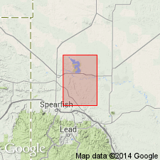
Named from exposure along Belle Fourche River in neighborhood of Wind Creek, [in T. 50 N., R. 67 W.], Crook Co., northeastern WY.
Source: US geologic names lexicon (USGS Bull. 896, p. 152); supplemental information from GNU records (USGS DDS-6; Denver GNULEX).
- Usage in publication:
-
- Belle Fourche shale*
- Modifications:
-
- Revised
- Age modified
- AAPG geologic province:
-
- Williston basin
- Powder River basin
- Chadron arch
Summary:
Shown on correlation chart as Belle Fourche shale; occurs above Mowry shale and below Greenhorn limestone. Age is Late Cretaceous (Cenomanian).
Source: US geologic names lexicon (USGS Bull. 1200, p. 287); supplemental information from GNU records (USGS DDS-6; Denver GNULEX).
- Usage in publication:
-
- Belle Fourche shale
- Modifications:
-
- Areal extent
- AAPG geologic province:
-
- Powder River basin
- Williston basin
Summary:
Shows in a diagram intertonguing relations with the partly equivalent and partly overlying Greenhorn limestone in Carter Co, MT and Crook Co, WY in the Williston and Powder River basins. Gray-red bentonite bed (informal term) and younger biotite bentonite bed (informal term) are shown in the formation as key horizons for correlation. Late Cretaceous in age.
Source: GNU records (USGS DDS-6; Denver GNULEX).
- Usage in publication:
-
- Belle Fourche shale member
- Modifications:
-
- Areal extent
- AAPG geologic province:
-
- Williston basin
Summary:
Pg. 8, 9-10. Belle Fourche shale member of Graneros formation. Belle Fourche is uppermost part of Graneros. Estimated thickness 580 feet. Includes Orman Lake limestone (new) near middle. Overlies Mowry shale member; underlies Greenhorn formation. [Age is Late Cretaceous.]
Source: US geologic names lexicon (USGS Bull. 1200, p. 287).
- Usage in publication:
-
- Belle Fourche shale*
- Modifications:
-
- Biostratigraphic dating
- AAPG geologic province:
-
- Powder River basin
Summary:
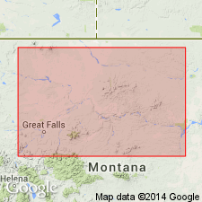
Pg. 2181-2183, 2197. Belle Fourche shale. Formations in Black Hills that are equivalent in Colorado shale are Fall River sandstone, Skull Creek shale, Newcastle sandstone, Mowry shale, Belle Fourche shale, Greenhorn formation, Carlile shale, and Niobrara formation. Belle Fourche shale of northern Black Hills, near Belle Fourche River, in sec. 22, T. 57 N., R. 62 W., Crook County, northeastern Wyoming, consists of 565 feet of dark bluish shale, with many beds of bentonite and ferruginous concretions. Subdivided into three members: (1) lowest member, 47 feet, contains abundant ironstone concretions; (2) medial member, 233 feet of more or less sandy shale with several bentonite layers; and (3) upper member, 285 feet of bluish gray non-sandy shale containing ferruginous concretions and bentonite layers. In central Montana, it is represented by 240 to more than 315 feet of similar beds in middle of Colorado shale. Westward these beds become increasingly sandier and much thinner, and on west flank of Sweetgrass arch as little as 13 feet of sandy shale is of Belle Fourche age. No fossils in lower part; upper part carries marine invertebrates. Age is Late Cretaceous (early Cenomanian); CALYCOCERAS spp. to ACANTHOCERAS(?) n. sp. zones.
Source: Publication; US geologic names lexicon (USGS Bull. 1200, p. 287).
- Usage in publication:
-
- Belle Fourche shale member
- Modifications:
-
- Revised
- AAPG geologic province:
-
- Powder River basin
Summary:
Pg. 12 (fig. 3), 15-16, 17-21, pls. 1, 2. Belle Fourche shale member of Cody shale of Colorado group. Belle Fourche revised locally in Hardin district, Montana and Wyoming, to basal member of Cody shale of Colorado group. Rocks of this interval have, in part, been designated Frontier formation in earlier publications dealing with this district (Thom and others, 1935, USGS Bull. 856; Richards and Rogers, 1951, USGS Oil and Gas Inv. Prelim. Map OM-111; Knechtel and Patterson, 1952, USGS Circ. 150); authors believe predominance of shaly material is more typical of the Belle Fourche than to the Frontier [Frontier remains unchanged outside of Hardin district]. At Soap Creek dome, thickness about 482 feet; includes Soap Creek bentonite bed in upper half. Underlies Greenhorn calcareous shale member of Cody shale; overlies Mowry shale. Age is Late Cretaceous.
The following changes in local nomenclature favored by the authors have not been adopted by the USGS: elimination of name "Cody shale"; introduction of name Steele shale to designate a formation containing the three members of the Cody (Telegraph Creek, unnamed member, and Clagget member) that fall within Montana group; promotion to formation rank of each of the three members of the Cody (Belle Fourche, Greenhorn, and Carlile-Niobrara) that are included in the Colorado group.
[GNC remark (ca. 1966, US geologic names lexicon, USGS Bull. 1200, p. 287): The USGS classifies the Belle Fourche as a member of the Colorado shale in Montana on basis of a study in progress.]
Source: US geologic names lexicon (USGS Bull. 1200, p. 287, Cody entry p. 867-869); supplemental information from GNU records (USGS DDS-6; Denver GNULEX).
- Usage in publication:
-
- Belle Fourche shale*
- Modifications:
-
- Biostratigraphic dating
- AAPG geologic province:
-
- Powder River basin
- Williston basin
Summary:
Pg. 117 (fig. 2), 118-119. Belle Fourche shale. Age is Late Cretaceous (Cenomanian). Index megafossils: ACANTHOCERAS? AMPHIBOLUM and ACANTHOCERAS? WYOMINGENSE (found in upper part of Belle Fourche).
Source: Publication.
- Usage in publication:
-
- Belle Fourche Shale Member*
- Modifications:
-
- Biostratigraphic dating
- AAPG geologic province:
-
- Green River basin
Summary:
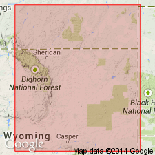
D59 (table 1), D61. Belle Fourche Shale Member of Frontier Formation. Recognized along Rawlins uplift, northwestern Carbon County, central southern Wyoming. Consists of shale, siltstone, and sandstone; lower 80 feet contains ironstone concretions; upper 150 feet contains calcareous concretions which are partly septarian and commonly fossiliferous, and bentonite beds. Thickness 425 to 475 feet. Characteristic ammonites collected from upper part of member include ACANTHOCERAS AMPHIBOLUM Morrow, PLESIACANTHOCERAS WYOMINGENSE (Reagan), DUNVEGANOCERAS PONDI Haas, DUNVEGANOCERAS ALBERTENSE (Warren), and DUNVEGANOCERAS CONDITUM Haas. Age is Late Cretaceous (Cenomanian). [Table 1 shows correlation with Belle Fourche Shale and Greenhorn Formation of Black Hills region, northeastern Wyoming.]
Source: Publication.
- Usage in publication:
-
- Belle Fourche Shale*
- Modifications:
-
- Areal extent
- AAPG geologic province:
-
- Williston basin
Summary:
Belle Fourche Shale. †Warm Creek Shale of Collier and Cathcart (1922, p. 172) and Knechtel (1959, p. 740-741) in north-central Montana abandoned. Rocks reallocated to (ascending) Belle Fourche Shale, Greenhorn Formation, Carlile Shale, Niobrara Formation, and Telegraph Creek Formation.
Source: Changes in stratigraphic nomenclature, 1975 (USGS Bull. 1422-A, p. A66-A67).
- Usage in publication:
-
- Belle Fourche Member*
- Modifications:
-
- Redescribed
- Dominant lithology:
-
- Shale
- Siltstone
- Sandstone
- AAPG geologic province:
-
- Powder River basin
- Green River basin
- Wind River basin
Summary:
Belle Fourche Member, basal member of Frontier Formation. Consists of interstratified shale, siltstone, sandstone, conglomerate, and bentonite; thus "Shale" designation dropped from name. Thickness <150 m (southwestern Carbon County) to 240+ m (southeastern Converse County) in eastern Wyoming. Correlates with Belle Fourche Shale and part of Greenhorn Formation of Black Hills. Unconformably underlies unnamed member or Wall Creek Member of Frontier; overlies Mowry Shale. Fossils. Age is Late Cretaceous (Cenomanian and early Turonian).
Source: Modified from GNU records (USGS DDS-6; Denver GNULEX).
- Usage in publication:
-
- Belle Fourche Shale*
- Modifications:
-
- Revised
- AAPG geologic province:
-
- Williston basin
- Sweetgrass arch
- Central Montana uplift
Summary:
Revised in central MT in the Williston basin, Sweetgrass arch, and Central Montana uplift. Belle Fourche Shale-Greenhorn Formation contact is revised upward from the base of the Mosby Sandstone Member (where the Mosby occurs) to the top of noncalcareous shale that overlies the Mosby. Thus, the Mosby (formerly the basal member of the overlying Greenhorn) is reassigned to the Belle Fourche. Revision is based on lithology. Belle Fourche (revised) is mainly noncalcareous shale with minor siltstone and sandstone, particularly in upper part, while Greenhorn (revised) is primarily calcareous shale and limestone. [Age of Belle Fourche Shale and its Mosby Sandstone Member is incorrectly stated to be Cenomanian and Turonian; age is Cenomanian only.]
Source: GNU records (USGS DDS-6; Denver GNULEX).
- Usage in publication:
-
- Belle Fourche Shale*
- Modifications:
-
- Biostratigraphic dating
- AAPG geologic province:
-
- Powder River basin
Summary:
Belle Fourche Shale. Fossils identified from upper 31 feet; formation penetrated in borehole in Osage oil field on west flank of Black Hills, in SW/4 NW/4 sec. 30, T. 46 N., R. 63 W., Weston County, Wyoming. Consists of noncalcareous shale with several beds of bentonite. Fossils include ACANTHOCERAS AMPHIBOLUM Morrow and INOCERAMUS RUTHERFORDI Warren, both restricted to middle Cenomanian zone of A. AMPHIBOLUM. At outcrops near borehole, a disconformity separates Belle Fourche from overlying Greenhorn Formation; fossils of the PLESIACANTHOCERAS WYOMINGENSE zone, which normally should be in uppermost Belle Fourche, are absent.
Source: Modified from GNU records (USGS DDS-6; Denver GNULEX).
- Usage in publication:
-
- Belle Fourche Shale*
- Belle Fourche Member*
- Modifications:
-
- Biostratigraphic dating
- AAPG geologic province:
-
- Powder River basin
Summary:
Pg. 3, 7, 12, 21-23. Belle Fourche Shale (eastern Wyoming); Belle Fourche Member of Frontier Formation (east-central Wyoming). Age is Late Cretaceous (late middle to middle late Cenomanian) based on ammonites.
Limestone concretions in the Belle Fourche Shale, Niobrara County, eastern Wyoming, yielded TARRANTOCERAS SELLARDSI (Adkins), indicating the ACANTHOCERAS AMPHIBOLUM AMPHIBOLUM subzone (late middle Cenomanian). Limestone concretions in the Belle Fourche Shale near Upton, Weston County, eastern Wyoming, yielded holotypes NEOCARDIOCERAS UPTONENSE Cobban, n. sp. and NEOCARDIOCERAS LAEVIGATUM Cobban, n. sp., indicating the DUNVEGANOCERAS PONDI to DUNVEGANOCERAS PROBLEMATICUM zone (early late Cenomanian).
Source: Publication.
- Usage in publication:
-
- Belle Fourche Member*
- Modifications:
-
- Biostratigraphic dating
- AAPG geologic province:
-
- Wind River basin
Summary:
Within report area of Natrona Co, WY, Wind River basin, Belle Fourche is lower of two or three members of Frontier Formation. Report describes most of known species of cephalopods (chiefly ammonites) from Frontier in Natrona Co. Seven of twelve established ammonite zones of middle and late Cenomanian age in Western Interior of the United States can be recognized in Belle Fourche in Natrona Co (see fig. 2 for ammonite zonation). Conformably overlies Mowry Shale; disconformably underlies the informal member of Emigrant Gap of the Frontier (formerly called the unnamed member) or where member of Emigrant Gap is absent, disconformably underlies Wall Creek Member of Frontier. Belle Fourche is early to late Cenomanian age.
Source: GNU records (USGS DDS-6; Denver GNULEX).
- Usage in publication:
-
- Belle Fourche Formation*
- Belle Fourche Shale*
- Belle Fourche Member*
- Modifications:
-
- Revised
- Redescribed
- Biostratigraphic dating
- Dominant lithology:
-
- Shale
- Sandstone
- Bentonite
- AAPG geologic province:
-
- Powder River basin
Summary:
Pg. T6-T7 (fig. 4), T8-T9 (fig. 5), T13 (fig. 7), T17-T29.
Belle Fourche Formation (northwestern Powder River basin; notably Big Horn County, southern Montana). Includes strata previously assigned to Belle Fourche Shale Member of Cody Shale by Knechtel and Patterson (USGS Bull. 1023, 1956), and to Frontier Formation and Cody Shale by Richards (USGS Bull. 1026, 1955). Consists of shale, minor sandy shale, sparse thin beds of sandstone, and several beds of bentonite (Soap Creek Bentonite Bed in middle part, 94.9 Ma). Thickness about 475 feet (145 m); thickness in subsurface about 530 feet (162 m). Conformably overlies Mowry Shale; conformably underlies calcareous Greenhorn Formation. Fossils of the ACANTHOCERAS AMPHIBOLUM zone collected from middle part, just below the Soap Creek Bentonite Bed. Age is Late Cretaceous (Cenomanian); 97.2 to 93.6 Ma.
Belle Fourche Shale (southeastern Powder River basin; notably northeastern Niobrara County, northern Wyoming). Thickness about 320 feet (98 m). Includes Soap Creek Bentonite Bed at top. Conformably overlies Mowry Shale; underlies and intertongues with Greenhorn Formation. Southwestward across basin, grades laterally into mudrock, siltstone, and sandstone in lower part of Belle Fourche Member of Frontier Formation. Fossils of the ACANTHOCERAS AMPHIBOLUM zone collected from upper part, just below the Soap Creek Bentonite Bed. Age is Late Cretaceous (early and middle Cenomanian).
Belle Fourche Member of Frontier Formation (southwestern Powder River basin; notably Natrona County, central Wyoming). Mudstone and silty shale, clayey or sandy siltstone, and fine- to medium-grained and partly conglomeratic sandstone. Thickness about 591 to 787 feet (180 to 240 m). Is basal member of Frontier Formation. Conformably overlies Mowry Shale; disconformably underlies either Emigrant Gap Member (new) or Wall Creek Member of Frontier. Fossils of the DUNVEGANOCERAS PONDI and DUNVEGANOCERAS PROBLEMATICUM zones collected from upper part. Age is Late Cretaceous (Cenomanian).
Source: Publication.
For more information, please contact Nancy Stamm, Geologic Names Committee Secretary.
Asterisk (*) indicates published by U.S. Geological Survey authors.
"No current usage" (†) implies that a name has been abandoned or has fallen into disuse. Former usage and, if known, replacement name given in parentheses ( ).
Slash (/) indicates name conflicts with nomenclatural guidelines (CSN, 1933; ACSN, 1961, 1970; NACSN, 1983, 2005, 2021). May be explained within brackets ([ ]).