- Usage in publication:
-
- Woodbine formation*
- Modifications:
-
- Original reference
- Dominant lithology:
-
- Sand
- Clay
- AAPG geologic province:
-
- Fort Worth syncline
- Ouachita folded belt
- South Oklahoma folded belt
- Strawn basin
Summary:
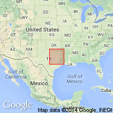
Pg. 293. Woodbine formation. Ferruginous argillaceous sands, in places unconsolidated, accompanied by laminated, usually sandy clays, in some places bituminous. Thickness 45 to 600 feet. Divided into (descending): (1) sands and clays [now known to belong to Eagle Ford clay]; (2) Lewisville beds; and (3) Dexter sands, including Basal clay of Taff. Underlies Eagle Ford formation and unconformably overlies Washita division. Replaces Timber Creek group and Lower Cross Timbers formation. Basal formation of Upper Cretaceous of Texas.
Named from exposures at Woodbine, Cooke Co., TX, but best exposures are at Denison, TX, in southern half of city.
Source: US geologic names lexicon (USGS Bull. 896, p. 2364).

- Usage in publication:
-
- Woodbine sand*
- Woodbine clay*
- Modifications:
-
- Overview
- AAPG geologic province:
-
- Fort Worth syncline
- Ouachita folded belt
- South Oklahoma folded belt
- Strawn basin
Summary:
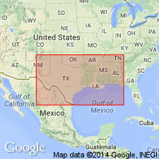
Woodbine sand (also Woodbine clay). Recognized in Texas, central southern and southeastern Oklahoma, western Louisiana, and southwestern Arkansas. Age is Late Cretaceous (Gulf).
Source: US geologic names lexicon (USGS Bull. 896, p. 2364).
- Usage in publication:
-
- Woodbine group
- Modifications:
-
- Revised
- AAPG geologic province:
-
- Strawn basin
Summary:
Pg. 475, 476, 477, 480. Woodbine group. Comprises (ascending) Euless formation (new) with basal Dexter sand member, Lewisville formation with basal Pine Bluff tuffaceous gravelly member, and Eagle Ford formation with Tarrant member. Unconformably overlies South Tyler formation (new); unconformably underlies Austin chalk. Age is Late Cretaceous (Gulf).
Source: US geologic names lexicon (USGS Bull. 1200, p. 4287-4288).
- Usage in publication:
-
- Woodbine formation*
- Modifications:
-
- Revised
- AAPG geologic province:
-
- Fort Worth syncline
- Ouachita folded belt
- South Oklahoma folded belt
Summary:
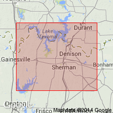
Woodbine formation. Crops out in belt a few miles wide to form Eastern Cross Timbers area between Black and Grand Prairies of northeastern Texas. Belt extends northward from Hill County nearly to the Red River, but from northeastern Cooke County, it trends southeast across Grayson County into northwestern part of Fannin County. Along this belt, formation consists of varied and interlensing sequence of nonmarine, brackish water, and marine beds of sand, shale, clay, and sandstone about 350 feet thick. Seemingly lies unconformably on Washita group and older beds of Comanche series. At some places, Grayson marl appears to grade upward into Woodbine and it is difficult to determine where unconformity occurs. At these places, Woodbine appears to be conformable with fossiliferous clay and shale younger than Grayson marl. Top of Woodbine of Red River area is about 40 to 50 feet below base of METOICOCERAS WHITEI zone of lower Eagle Ford shale. Sequence exposed in Cooke, Grayson, and Fannin Counties is divided into (ascending) Dexter (restricted), Red Branch (new), Lewisville, and Templeton (new) members. Fossils. Age is Late Cretaceous (Gulf). Report includes structure, isopach maps.
Source: US geologic names lexicon (USGS Bull. 1200, p. 4287-4288); supplemental information from GNU records (USGS DDS-6; Denver GNULEX).
- Usage in publication:
-
- Woodbine group
- Modifications:
-
- Areal extent
- AAPG geologic province:
-
- Ouachita folded belt
Summary:
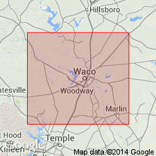
Pg. 105-161, pls. Woodbine group. Report is symposium on Woodbine group and adjacent strata. Relationships of Woodbine and Eagle Ford and Comanchean beds discussed in detail. Pepper shale is believed to be southward continuation of part of Woodbine group (Lewisville formation) in north-central Texas. In Dallas, McLennan, and Travis Counties, the Woodbine underlies Lake Waco formation (new). [Age is Late Cretaceous (Gulf).]
Source: US geologic names lexicon (USGS Bull. 1200, p. 4287-4288).
- Usage in publication:
-
- Woodbine formation*
- Modifications:
-
- Biostratigraphic dating
- AAPG geologic province:
-
- Fort Worth syncline
- Ouachita folded belt
- South Oklahoma folded belt
- Strawn basin
Summary:
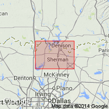
Pg. 1-226, pls. Woodbine formation. As originally defined, is made up of deposits laid down in fresh, brackish, and very shallow marine waters. Formation intervenes between deeper marine facies of Comanche Series below and Eagle Ford and younger formations above. Basal unit of Woodbine is Dexter member which consists chiefly of nonmarine sands interbedded with clays, but includes also important marine fossil-bearing zones in Tarrant and Denton Counties. Dexter is overlain in different areas by nearly contemporaneous nonmarine carbonaceous shales and tuffaceous sandstones of Red Branch member and marine shaly beds of Euless member. These in turn are overlain by marine sandy shales and sandstones of Lewisville member, and these by marine shales and minor sands of Templeton member. Hazzard, Blanpied, and Spooner's classification discussed and reasons cited for not accepting it. As used in present report, name Euless member is restricted to an upper shale unit between Dexter member and Lewisville member and "Tarrant" unit is also considered part of Lewisville. Systematic description of larger invertebrate fossils. [Age is Late Cretaceous (Gulf).]
Source: US geologic names lexicon (USGS Bull. 1200, p. 4287-4288).
- Usage in publication:
-
- Woodbine formation*
- Modifications:
-
- Revised
- Biostratigraphic dating
- AAPG geologic province:
-
- Ouachita folded belt
Summary:
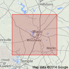
Pg. 57-66, pls. Woodbine formation. Includes Pepper shale member. Evidence afforded by assemblage of molluscan fossils from Pepper shale confirms conclusion that the Pepper is southward extension of the Woodbine, and is probably extension of Lewisville member. [Age is Late Cretaceous (Gulf).]
Source: US geologic names lexicon (USGS Bull. 1200, p. 4287-4288).
- Usage in publication:
-
- Woodbine formation
- Modifications:
-
- Areal extent
- AAPG geologic province:
-
- Ouachita folded belt
Summary:
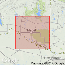
Pg. 39-42. Woodbine formation. Described in McCurtain County, Oklahoma, where it is as much as 355 feet thick. Lower member is principally cross-bedded dark tuffaceous sand, red clay, and gravel lentils. Upper member mostly gray to brown cross-bedded quartz sand and sandy gravel. Unconformably underlies Tokio formation; unconformably overlies Washita group. [Age is Late Cretaceous (Gulf).]
Source: US geologic names lexicon (USGS Bull. 1200, p. 4287-4288).
- Usage in publication:
-
- Woodbine Group, undivided
- Modifications:
-
- Mapped 1:250k
- Dominant lithology:
-
- Sand
- Clay
- Lignite
- Tuff
- AAPG geologic province:
-
- Arkla basin
- Ouachita folded belt
Summary:
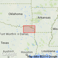
Woodbine Group, undivided. In Texas and Oklahoma, quartz sand, clay, some thin beds of lignite, volcanic sand and tuff. Quartz sand, in part glauconitic, ferruginous, cross-bedded, gray to brown. Clay, in part lignitic, thinly bedded, some sideritic concretions, dark to brown. Volcanic sand and tuff, coarse-grained, cross-bedded, dark-green and olive-green. Fossil plants and a few marine megafossils. Thickness 500 feet, thins eastward. In Arkansas, tuffaceous material more abundant, conglomerate at base; some fossil plants; thickness 200 to 375 feet, thins eastward. Lies above Lower Cretaceous Washita Group, undivided, and below Eagle Ford Formation. Age is Late Cretaceous.
[Mapped in northern part of map sheet, Red River area, in Lamar and Red River Cos., northeastern TX, Bryan, Choctaw, and McCurtain Cos., southeastern OK, and Howard and Sevier Cos., southwestern AR.]
Source: Publication.
- Usage in publication:
-
- Woodbine Formation
- Modifications:
-
- Mapped 1:250k
- Dominant lithology:
-
- Sand
- Silt
- Clay
- Lignite
- AAPG geologic province:
-
- Ouachita folded belt
Summary:
Woodbine Formation. Rounded fine-grained quartz sand, silt, clay, sideritic and phosphatic locally, some lignite, ripple marked, cross-bedded, some channeling. Thickens northward to 175 feet. Lies above Grayson Marl ("Del Rio Clay") and below Lake Waco Formation of Eagle Ford Group. Equivalent to Pepper Shale (recognized south of Brazos River). Age is Late Cretaceous.
Recognized north of Brazos River. Mapped in McLennan and Hill Cos., notably along Aquilla Creek, eastern TX.
Source: Publication.
- Usage in publication:
-
- Woodbine Formation
- Modifications:
-
- Mapped 1:250k
- Dominant lithology:
-
- Sandstone
- Clay
- Shale
- AAPG geologic province:
-
- Fort Worth syncline
- Ouachita folded belt
- Strawn basin
Summary:
Woodbine Formation. Sandstone, some clay and shale. Upper part, mostly sandstone, fine-grained, well-sorted, in part tuffaceous, ripple marked, large scale cross-bedding, reddish brown; near top some sandstone with large discoid concretions, medium- to coarse-grained, friable; some shale, jarositic, gray, fissile; some marine megafossils, oyster reefs locally. Middle part, mostly sandstone, fine-grained, cross-bedded; some interbeds of clay, carbonaceous, in part sandy, gray to brown. Lower part, interbedded sandstone and clay; sandstone, fine-grained, very thinly bedded to massive, some beds of ironstone and ironstone conglomerate, white, red, brown; clay, sandy, gray to brown; channeled locally. Thickness 175 to 250 feet, thickens northward. Lies below Eagle Ford Group and above Grayson Marl (Lower Cretaceous). Age is Late Cretaceous.
[Mapped in Denton, Hill, Johnson, and Tarrant Cos., eastern TX.]
Source: Publication.
- Usage in publication:
-
- Woodbine Formation*
- Modifications:
-
- Biostratigraphic dating
- AAPG geologic province:
-
- Ouachita folded belt
- South Oklahoma folded belt
Summary:
Six Flags Limestone Member of Woodbine Formation of Norton (1965) is tentatively assigned a late middle or early late Cenomanian (Late Cretaceous) age based on probable occurrence of ammonite EUCALYCOCERAS TEMPLETONENSE from Dallas Co, TX in Ouachita tectonic belt province. Taxon ranges through the latest middle Cenomanian PLEISIACANTHOCERAS WYOMINGENSE zone and the earliest late Cenomanian DUNVEGANOCERAS PONDI zone. Holotype of E. TEMPLETONENSE identified from silty limestone concretions 6.0-6.7 m above base of Templeton Member of Woodbine at USGS Mesozoic locality 20314 north of Bells, Grayson Co, TX in the South Oklahoma folded belt province.
Source: GNU records (USGS DDS-6; Denver GNULEX).

- Usage in publication:
-
- Woodbine Formation
- Modifications:
-
- Mapped 1:250k
- Dominant lithology:
-
- Sandstone
- Shale
- Lignite
- AAPG geologic province:
-
- Fort Worth syncline
- Ouachita folded belt
- South Oklahoma folded belt
Summary:
Pamphlet [p. 4]. Woodbine Formation. Mapped undivided south of Cooke County, Texas; in Cooke and Grayson Counties, Texas, and in Oklahoma, subdivided into four units (descending) Templeton Member, Lewisville Member, Red Branch Member, and Dexter Member [see also entries under individual members]. Lies above Cretaceous Grayson Marl, Main Street Limestone, and Bennington Limestone, and below Eagle Ford Formation. Age is Late Cretaceous.
Source: Publication.
For more information, please contact Nancy Stamm, Geologic Names Committee Secretary.
Asterisk (*) indicates published by U.S. Geological Survey authors.
"No current usage" (†) implies that a name has been abandoned or has fallen into disuse. Former usage and, if known, replacement name given in parentheses ( ).
Slash (/) indicates name conflicts with nomenclatural guidelines (CSN, 1933; ACSN, 1961, 1970; NACSN, 1983, 2005, 2021). May be explained within brackets ([ ]).

