The National Geologic Map Database is migrating to a new infrastructure. We apologize for any service disruptions during this process.
|
|---|


- Usage in publication:
-
- Stockwether bed
- Modifications:
-
- Original reference
- Dominant lithology:
-
- Limestone
- Chert
- AAPG geologic province:
-
- Bend arch
Summary:
Pg. 387, 417. Stockwether bed in Cisco division. Mostly hard, rather brittle, rough-weathering gray, containing yellowish or light-colored chert nodules. Thickness 15 to 25 feet. Member of Cisco division. Overlies Coon Mountain bed and is separated from overlying Camp Colorado limestone by bed No. 13 (40 to 75 feet of clay, mostly reddish). [Age is Pennsylvanian.]
[Named from the Stockwether Ranch, on Bull Creek, in Coleman Co., Colorado River region, central TX.]
Source: US geologic names lexicon (USGS Bull. 896, p. 2067).

- Usage in publication:
-
- Stockwether limestone member
- Modifications:
-
- Revised
- AAPG geologic province:
-
- Bend arch
Summary:
Pg. 172, 174, and charts; Jour. Geol., v. 30, p. 24, 31. Stockwether limestone member of Pueblo formation. Overlies Camp Creek shale member of Pueblo formation and is separated from overlying Camp Colorado limestone member of Pueblo by shale bed No. 13 of Drake. The Coon Mountain bed of Drake is largely Cretaceous.
Named from the Stockwether Ranch, on Bull Creek, in Coleman Co., Colorado River region, central TX.
Source: US geologic names lexicon (USGS Bull. 896, p. 2067).

- Usage in publication:
-
- Stockwether limestone member*
- Modifications:
-
- Overview
- AAPG geologic province:
-
- Bend arch
Summary:
Wallace Lee and C.O. Nickell (manuscript ready for publication by Texas Geol. Survey) define Stockwether limestone member of Pueblo formation as overlying Coon Mountain sandstone member, which rests on Camp Creek shale member of Pueblo formation. This is approved definition of the USGS.
Source: US geologic names lexicon (USGS Bull. 896, p. 2067).

- Usage in publication:
-
- Stockwether formation
- Modifications:
-
- Revised
- AAPG geologic province:
-
- Bend arch
Summary:
Stockwether formation of Pueblo group. Rank raised to formation in the Pueblo here given group status. Includes Coon Mountain sandstone member. Underlies Camp Colorado formation; overlies Saddle Creek formation. [Age is Early Permian (Wolfcamp).]
Source: US geologic names lexicon (USGS Bull. 1200, p. 3728-3729).

- Usage in publication:
-
- Stockwether limestone member*
- Modifications:
-
- Areal extent
- AAPG geologic province:
-
- Bend arch
Summary:
Sheet 2. Stockwether limestone member of Pueblo formation. Described in Colorado River Valley as limestone member of Pueblo formation. Typically fine-grained limestone containing numerous thin clear calcite veinlets and white porcelain-like foraminiferal remains; beds are uneven, to medium in thickness, and weather slabby. Thickness 5 to 30 feet, average 20 feet. Underlies Salt Creek Blend shale member; overlies Camp Creek shale member. [Age is Early Permian (Wolfcamp).]
Source: US geologic names lexicon (USGS Bull. 1200, p. 3728-3729).
- Usage in publication:
-
- Stockwether member
- Modifications:
-
- Areal extent
- AAPG geologic province:
-
- Bend arch
Summary:
Pg. 268-269. Stockwether member of Pueblo formation. Geographically extended into Brazos River Valley. Thickness 0.5 to 3 feet. Overlies Camp Creek shale member; underlies Salt Creek Bend shale member. [Age is Early Permian (Wolfcamp).]
Source: US geologic names lexicon (USGS Bull. 1200, p. 3728-3729).

- Usage in publication:
-
- Stockwether Limestone [unranked]
- Modifications:
-
- Mapped 1:250k
- Dominant lithology:
-
- Limestone
- AAPG geologic province:
-
- Bend arch
Summary:
Stockwether Limestone [unranked] in Pueblo Formation of Cisco Group. Fine-grained, locally argillaceous. South of Cretaceous divide contains gray and brown chert distributed irregularly through an interval of about 2 feet, gray to light brown, locally cut out by broad channel fills, some crinoid columnals and burrow casts in basal part. Thickness 1 to 12 feet, in central area 1 to 3 feet, feathers out northward near U.S. Highway 180. Lies above Saddle Creek Limestone [unranked] in Pueblo Formation and below Camp Colorado Limestone ("Noodle Creek Limestone") [unranked] in Moran Formation of Cisco Group. Age is Early Permian (Wolfcampian).
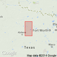
Mapped in Brown, Eastland, and Stephens Cos., central northern TX. [See also adjacent Geol. Atlas Texas, Brownwood sheet, 1976, to south.]
Source: Publication.
- Usage in publication:
-
- Stockwether Limestone [unranked]
- Modifications:
-
- Mapped 1:250k
- Dominant lithology:
-
- Limestone
- AAPG geologic province:
-
- Bend arch
- Llano uplift
Summary:
Stockwether Limestone [unranked] in middle of Pueblo Formation of Cisco Group. Microgranular to north, medium-grained to south, abundant light-colored chert to south, generally resistant, very light gray to light yellowish gray, weathers light gray to dark gray, commonly cut out to north by channel-fill bodies, forms scarp to
south, generally unfossiliferous, some crinoid fragments, bryozoa, and algae near top; thickness 2 to 4 feet in north, 15 to 18 feet in south. Lies above Camp Creek Shale and below Salt Creek Bend Shale [both unranked] in Pueblo. Age is Early Permian (Wolfcampian).
[Mapped in Brown, Coleman, and McCulloch Cos., central TX.]
Source: Publication.
For more information, please contact Nancy Stamm, Geologic Names Committee Secretary.
Asterisk (*) indicates published by U.S. Geological Survey authors.
"No current usage" (†) implies that a name has been abandoned or has fallen into disuse. Former usage and, if known, replacement name given in parentheses ( ).
Slash (/) indicates name conflicts with nomenclatural guidelines (CSN, 1933; ACSN, 1961, 1970; NACSN, 1983, 2005, 2021). May be explained within brackets ([ ]).