The National Geologic Map Database is migrating to a new infrastructure. We apologize for any service disruptions during this process.
|
|---|


- Usage in publication:
-
- Sedwick limestone member
- Modifications:
-
- Original reference
- Dominant lithology:
-
- Limestone
- Shale
- AAPG geologic province:
-
- Bend arch
Summary:
Pg. 176, 179-183. Sedwick limestone member of Moran formation of Cisco group. The persistent and prominent limestone at top of Moran formation was designated Sedwick in course of field work, but it appears desirable to apply a geographic term to entire limestone division in the [Moran] formation above Santa Anna bed. The Sedwick member may then be defined to include the series of thin yellow limestones with interbedded shales which lie at summit of Moran formation. The upper bed of Sedwick is 1 to 2 feet thick, of rather dirty yellow color, contains numerous small stringers of calcite and, locally, numerous fossils, and is more or less cherty. The next lower bed in Sedwick member, designated in field work Hart School bed, occurs 3 to 12 feet below top of the limestone. It is of yellow color, 2 to 6 feet thick, and characterized by abundance of small silicified gastropods and other fossils. [Several detailed sections of Moran formation show Sedwick member as consisting of 2 to 6 limestone beds, chiefly yellow, but in some places blue in lower part, varying in thickness from 1 to 6 feet, separated by shale beds varying in thickness from 1 to 19 feet, the total thickness of Sedwick member varying from 15 to 42 feet.]
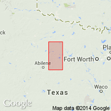
Named from outcrops west of Sedwick, Shackelford Co., central northern TX.
[GNC remark (US geologic names lexicon, USGS Bull. 896, p. 1950): Moran formation was transferred to Permian Wichita group in 1933.]
Source: US geologic names lexicon (USGS Bull. 896, p. 1949-1950).

- Usage in publication:
-
- Sedwick limestone member*
- Modifications:
-
- Original reference
- Dominant lithology:
-
- Limestone
- AAPG geologic province:
-
- Bend arch
Summary:
Pg. 40. Sedwick limestone member of Moran formation of Cisco group. Persistent yellowish limestones, commonly 3 in number, closely associated and characterized by widely distributed and abundant small silicified fossil casts, mainly gastropods. Forms top member of Moran formation. [Age is Permian.]
Recognized in Schackelford County region, central and northern central Texas.
[GNC remark (US geologic names lexicon, USGS Bull. 896, p. 1950): Moran formation was transferred to Permian Wichita group in 1933.]
Source: US geologic names lexicon (USGS Bull. 896, p. 1949-1950).

- Usage in publication:
-
- Sedwick formation
- Modifications:
-
- Revised
- AAPG geologic province:
-
- Bend arch
Summary:
Pg. 66 (fig. 1). Sedwick formation of Moran group. Rank raised to formation in Moran group. [Age is Early Permian (Wolfcamp).]
Source: US geologic names lexicon (USGS Bull. 1200, p. 3513).

- Usage in publication:
-
- Sedwick limestone member*
- Modifications:
-
- Areal extent
- AAPG geologic province:
-
- Bend arch
Summary:
Sheet 2. Sedwick limestone member of Moran formation. Described in Colorado River Valley as succession of dense hard brown-weathering limestone beds, each 1 to 2 feet thick, separated by brownish clay shale, 3 to 10 feet thick; persistent thin dark chert containing gastropods at top of member. About 25 feet thick. Overlies Santa Anna shale member of Moran; underlies Santa Anna Branch shale member of Putnam formation. Age is Early Permian (Wolfcamp).
Source: Publication; US geologic names lexicon (USGS Bull. 1200, p. 3513).
- Usage in publication:
-
- Sedwick limestone member*
- Modifications:
-
- Areal extent
- AAPG geologic province:
-
- Bend arch
Summary:
Pg. 270-271. Sedwick limestone member of Moran formation. Geographically extended into Brazos River Valley where it is 40 to 55 feet thick and consists principally of alternating thin limestone and thick shale beds. South of Clear Fork of Brazos River, basal limestone grades laterally into calcareous sandstone in part of Shackelford County, central northern Texas. Uppermost member of Moran formation, three underlying members of formation not differentiated in area. Underlies Santa Anna Branch shale member of Putnam formation. [Age is Early Permian (Wolfcamp).]
Source: Publication; US geologic names lexicon (USGS Bull. 1200, p. 3513).

- Usage in publication:
-
- Sedwick Formation
- Modifications:
-
- Areal extent
- AAPG geologic province:
-
- Bend arch
Summary:
Sedwick Formation of Cisco Group. Mostly mudstone with limestone beds at top and base; sandstone beds with large-scale crossbeds occurs at base. Thickness 30 to 40 feet. Overlies Moran Formation and underlies Santa Anna Branch Shale, both of Cisco Group. Equivalent to part of Archer City Formation of Bowie Group. Included in the Moran by earlier workers. Fossils (MYALINA). Age is Early Permian (Wolfcamp).
[Geographic extent arbitrarily placed. Recognized in southeastern Throckmorton Co., central northern TX.]
Source: Publication.
For more information, please contact Nancy Stamm, Geologic Names Committee Secretary.
Asterisk (*) indicates published by U.S. Geological Survey authors.
"No current usage" (†) implies that a name has been abandoned or has fallen into disuse. Former usage and, if known, replacement name given in parentheses ( ).
Slash (/) indicates name conflicts with nomenclatural guidelines (CSN, 1933; ACSN, 1961, 1970; NACSN, 1983, 2005, 2021). May be explained within brackets ([ ]).