- Usage in publication:
-
- San Rafael group*
- Modifications:
-
- Named
- Dominant lithology:
-
- Conglomerate
- Sandstone
- Shale
- Mudstone
- AAPG geologic province:
-
- Paradox basin
Summary:
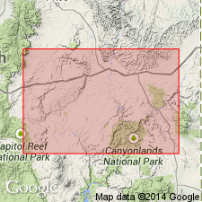
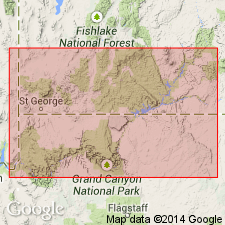
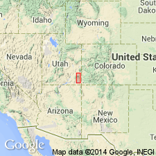
Named for exposures in San Rafael Swell, Emery Co, UT in the Paradox basin. Divided into: Carmel formation (base), Entrada sandstone (new), Curtis formation (new), and Summerville formation (new, at top). Overlies Navajo sandstone. Underlies Morrison formation. Measured sections. Assigned to the Late Jurassic.
Source: GNU records (USGS DDS-6; Denver GNULEX).
- Usage in publication:
-
- San Rafael group*
- Modifications:
-
- Areal extent
- AAPG geologic province:
-
- Plateau sedimentary province
- Paradox basin
Summary:
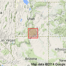
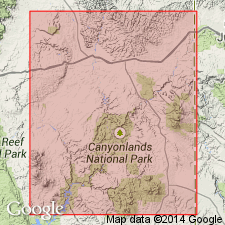
Extended south to the Kaiparowits region, Plateau sedimentary province from its original area in the San Rafael Swell, Paradox basin. Mapped in Kane and Garfield Cos. Divided into (ascending order): Carmel formation (first published description), Entrada sandstone, Curtis and Summerville formations. Assigned to the Upper Jurassic.
Source: GNU records (USGS DDS-6; Denver GNULEX).
- Usage in publication:
-
- San Rafael group
- Modifications:
-
- Revised
- AAPG geologic province:
-
- San Juan basin
Summary:
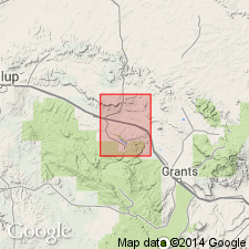
Divided into (ascending): Entrada sandstone, Todilto limestone, and the newly named Thoreau formation. Occurs in north part of quad, McKinley Co, NM in the San Juan basin. Geologic map. Columnar section. Of Jurassic age.
Source: GNU records (USGS DDS-6; Denver GNULEX).
- Usage in publication:
-
- San Rafael group*
- Modifications:
-
- Revised
- AAPG geologic province:
-
- Palo Duro basin
- Sierra Grande uplift
Summary:
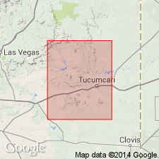
Known in the Palo Duro basin and Sierra Grande uplift where it is divided into the Entrada sandstone (previously thought to be Wingate sandstone) at base, and Bell Ranch formation (new name; previously thought to be Wanakah formation) at top. Overlies Redonda formation (formerly a member of Chinle formation); underlies Morrison formation. Assigned to the Late Jurassic.
Source: GNU records (USGS DDS-6; Denver GNULEX).
- Usage in publication:
-
- San Rafael Group*
- Modifications:
-
- Revised
- AAPG geologic province:
-
- Piceance basin
- Paradox basin
Summary:
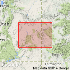
Lower part of the Jurassic San Rafael Group in east-central UT and west-central CO, Paradox and Piceance basins modified. Carmel Formation, the lowest formation in the group, restricted to the area west of Green River in UT. Rocks formerly assigned to Carmel east of Green River are reassigned to basal Entrada Sandstone as Dewey Bridge Member, a new unit. Slick Rock Member (new unit), and Moab Member (extended into CO) are the middle and upper members of the Entrada. Measured sections of Slick Rock, Dewey Bridge, and Moab Members of Entrada Sandstone and of Summerville included.
Source: GNU records (USGS DDS-6; Denver GNULEX).
- Usage in publication:
-
- San Rafael group*
- Modifications:
-
- Revised
- AAPG geologic province:
-
- Plateau sedimentary province
Summary:
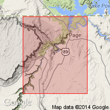
Divided into Carmel formation of Middle and Late Jurassic age and Entrada sandstone of Late Jurassic age. The contact relations between the Carmel and the underlying Navajo sandstone of the Glen Canyon group considered as complexly intertongued. The main body of the Navajo is overlain by a 0-22 ft thick, dark-brown to pale-gray, medium- to fine-grained, ledge-forming sandstone and siltstone named Judd Hollow tongue of the Carmel. The overlying 0-228 ft thick, massive, yellow, medium- to fine-grained, cross-bedded, slope-forming sandstone is named Thousand Pockets tongue of the Navajo. Above the Thousand Pockets is the main body of the Carmel. Columnar section. Geologic map. Report area lies in the Plateau sedimentary province.
Source: GNU records (USGS DDS-6; Denver GNULEX).
- Usage in publication:
-
- San Rafael Group
- Modifications:
-
- Overview
- Revised
- AAPG geologic province:
-
- Great Basin province
- Plateau sedimentary province
- Paradox basin
Summary:
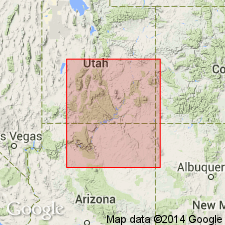
Divided into: l) Carmel Formation which includes Kolob Limestone Member (new, at base), Crystal Creek Member (new), Paria River Member (new), Winsor Member and Wiggler Wash Member (new, at top); the Judd Hollow Tongue is equivalent to the Kolob and Crystal Creek; 2) Entrada Sandstone which includes Gunsight Butte Member (new, at base), Cannonville Member (new), and Escalante Member (new, at top); 3) Summerville Formation and its White Point Sandstone Member (new) which has the same boundaries as the Summerville; and 4) Henrieville Sandstone (new, at top). New units represent reassignment of units within the San Rafael Group that modify areal limits or identification of Entrada, Carmel and Curtis. Area covered in report includes Washington Co, UT in the Great Basin province, Kane Co, UT in the Plateau sedimentary province, and Garfield Co, UT in the Paradox basin. Measured sections. Age is Middle and Late Jurassic.
Source: GNU records (USGS DDS-6; Denver GNULEX).
- Usage in publication:
-
- San Rafael Group*
- Modifications:
-
- Areal extent
- Revised
- AAPG geologic province:
-
- San Juan basin
Summary:
Eolian sandstone near Gallup-Grants area, McKinley Co, NM, of San Juan basin formerly assigned to Lukachukai Member of Wingate Sandstone of Glen Canyon Group assigned to Iyanbito Member (a new name) of Entrada Sandstone of San Rafael Group. Basal contact of Middle and Upper Jurassic San Rafael Group is modified in this area.
Source: GNU records (USGS DDS-6; Denver GNULEX).
- Usage in publication:
-
- San Rafael Group*
- Modifications:
-
- Revised
- Overview
- AAPG geologic province:
-
- Paradox basin
- Plateau sedimentary province
- Great Basin province
Summary:
Unconformably (J-1 and J-2 unconformities depending on location) overlies Navajo Sandstone. Two formations, Temple Cap Sandstone (formerly a member of Navajo) and Page Sandstone (formerly an unnamed part of Navajo), now assigned to San Rafael. Temple Cap divided into Sinawava (base) and White Throne (top) Members, both new. Page divided into Harris Wash Tongue (new) and Thousand Pockets Tongue (formerly part of Navajo). Units studied in this report are no younger than the Entrada Sandstone. Group thus ranges in age from early Bajocian to middle Callovian, or Middle Jurassic. Correlation chart. Cross sections. Measured sections.
Source: GNU records (USGS DDS-6; Denver GNULEX).
- Usage in publication:
-
- San Rafael Group*
- Modifications:
-
- Revised
- AAPG geologic province:
-
- Paradox basin
Summary:
Includes Carmel Formation, Entrada Sandstone and Wanakah Formation of Middle Jurassic age in report area. Term Summerville Formation, formerly part of group and recognized in southeast UT, is not used in San Juan Co, UT. Summerville is beveled out eastward by an unconformity at the base of the Morrison Formation and is absent in the Moab area. Summerville is replaced by the Wanakah Formation which is extended westward from southwest CO. Is separated from the underlying Navajo Sandstone by the chert pebble unconformity, noted for the incorporation of chert pebbles in a reworked zone arbitrarily assigned to the overlying formation or Carmel or Entrada in this area, depending on specific location. Upper contact revised. The Bluff, originally a member of the Morrison and later assigned to the San Rafael, is removed from the San Rafael and reassigned to the Morrison as its basal member. Bluff pinches out into Morrison rather than tonguing or grading into the San Rafael as formerly thought. The base of the Bluff is an unconformity recognized by presence of chert pebbles. Cross sections.
Source: GNU records (USGS DDS-6; Denver GNULEX).
- Usage in publication:
-
- San Rafael Group*
- Modifications:
-
- Revised
- AAPG geologic province:
-
- Paradox basin
- Piceance basin
Summary:
Summerville Formation of the Middle Jurassic San Rafael Group underlies Tidwell Member of Morrison Formation in the Paradox basin. The contact is a regional unconformity, the J5--the same unconformity as recognized by Gilluly (1929) at San Rafael Swell, some 4.8 to 28.6 m below the base of Salt Wash Member. Some earlier workers included the slope-forming Tidwell that lies beneath Salt Wash Member in the Summerville, rather than select the unconformity as the contact.
Source: GNU records (USGS DDS-6; Denver GNULEX).
- Usage in publication:
-
- San Rafael Group*
- Modifications:
-
- Revised
- AAPG geologic province:
-
- Black Mesa basin
- Plateau sedimentary province
- Paradox basin
Summary:
Divided into Page Sandstone (base), Carmel Formation, and Entrada Sandstone (top), which includes lower sandy member and Cow Springs Member (changed in stratigraphic rank) in Black Mesa basin, AZ. Divided into Page Sandstone (base), Carmel Formation, Entrada Sandstone, and Romana Sandstone (new) in Kaiparowits basin, UT, which is part of the Plateau sedimentary province. Divided into Page Sandstone (base), Carmel Formation, Entrada Sandstone, Curtis and Summerville Formations, in Henry basin and San Rafael Swell, UT, Paradox basin. Is bounded by J-2 unconformity at base and J-5 at top. Overlies Glen Canyon Group throughout study area unconformably. Underlies Tidwell Member (new), basal member of Morrison, or locally Salt Wash Member of Morrison. Is of Middle Jurassic (early to middle Callovian) age.
Source: GNU records (USGS DDS-6; Denver GNULEX).
- Usage in publication:
-
- San Rafael Group*
- Modifications:
-
- Revised
- AAPG geologic province:
-
- San Juan basin
Summary:
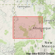
Divided in the southeast part of the San Juan basin into the Entrada Sandstone and Wanakah Formation. Upper contact of group revised in that the uppermost sandstone is named Mesita Member of Wanakah Formation. Rocks assigned to Mesita were assigned to the lower part of the sandstone at Mesita, Bluff Sandstone, Cow Springs Sandstone in earlier reports. The Beclabito and Todilto Limestone Members in sequence underlie the Mesita in the southeast part of the San Juan basin. In the south-central part of the San Juan basin, San Rafael divided into Entrada Sandstone, Wanakah Formation and its Todilto Limestone and Beclabito Members, and Cow Springs Sandstone. In the southwest part of basin, the group is represented by the Entrada and Cow Springs Sandstones. In the Gallup sag area, the Zuni Sandstone, which is equivalent to both the Entrada and Cow Springs, represents the entire group. To the northwest in the basin, the group is represented by the Entrada and the Wanakah and its Todilto Limestone, Beclabito, and Horse Mesa Members. Cross section; nomenclature chart; areal limits map for parts of Wanakah.
Source: GNU records (USGS DDS-6; Denver GNULEX).
- Usage in publication:
-
- San Rafael Group*
- Modifications:
-
- Overview
- AAPG geologic province:
-
- San Juan basin
Summary:
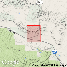
San Rafael Group represented in this report by the Beclabito Member of the Wanakah Formation and the Cow Springs Sandstone, both of Middle Jurassic age. Rocks assigned here to the Beclabito and Cow Springs were the Thoreau Formation, upper formation of the San Rafael of Smith (1954). Report area lies in the San Juan basin.
Source: GNU records (USGS DDS-6; Denver GNULEX).
For more information, please contact Nancy Stamm, Geologic Names Committee Secretary.
Asterisk (*) indicates published by U.S. Geological Survey authors.
"No current usage" (†) implies that a name has been abandoned or has fallen into disuse. Former usage and, if known, replacement name given in parentheses ( ).
Slash (/) indicates name conflicts with nomenclatural guidelines (CSN, 1933; ACSN, 1961, 1970; NACSN, 1983, 2005, 2021). May be explained within brackets ([ ]).

