- Usage in publication:
-
- Princess formation
- Modifications:
-
- Informally named
- Dominant lithology:
-
- Coal
- Shale
- Clay
- Flint
- AAPG geologic province:
-
- Appalachian basin
Summary:
Breathitt Formation is informally elevated to group rank and subdivided into the following eight informal formations: Pocahontas, Bottom Creek, Alvy Creek, Grundy, Pikeville, Hyden, Four Corners, and Princess formations. Princess includes the Stoney Fork Member (reassigned) at base, the Main Block ore, Tiptop coal, member P, Richardson coal, Flint Ridge flint (reduced to informal status), Princess Nos. 5A & 5B coals, Obryan Limestone Member, Laurel coal, Limekiln clay bed (informally named), Princess No. 6 coal, member Q, Princess No. 7 coal, member R, Princess No. 8 coal, and member S. Age of the Princess is Middle Pennsylvanian (Atokan and Desmoinesian). [Revisions made in this paper are strongly contested by C. Rice and other USGS scientists who work in this area (oral commun., 9/3/93).]
Source: GNU records (USGS DDS-6; Reston GNULEX).

- Usage in publication:
-
- Princess Formation
- Modifications:
-
- Original reference
- AAPG geologic province:
-
- Appalachian basin
Summary:
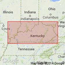
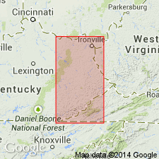
Princess Formation, uppermost unit of the Breathitt Group is formally named in this report for the Princess Coal Resource District of northeastern KY (Boyd, Carter, Greenup, Lawrence, and part of Lewis Cos). Reference sections for the lower and upper parts are designated in Perry Co. and described in the appendix. The Stoney Fork Member marks the base of the formation across most of eastern KY. Member's occurrence in other parts of the Cumberland plateau (TN, VA, and WV) is queried on the correlation chart (plate 8). Includes several named and unnamed coal beds. Reaches a maximum of <150 m. The Princess thins to the north and is difficult to distinguish from adjacent units. Unit is absent in the Cumberland overthrust sheet. Underlies Conemaugh and Monongahela Formations in the Allegheny Synclinorium. Overlies Four Corners Formation (new). A generalized Pennsylvanian age is shown for all of the Breathitt. According to the author, formal nomenclature presented in this report for units occurring in KY has been accepted by the Kentucky Stratigraphic Nomenclature Committee. Units that occur largely outside KY are considered informal. Report includes correlation charts, cross sections, and measured sections.
Source: GNU records (USGS DDS-6; Reston GNULEX).

- Usage in publication:
-
- Princess Formation
- Princess unit
- Modifications:
-
- Not used
- AAPG geologic province:
-
- Appalachian basin
Summary:
Princess Formation of Breathitt Group of Chesnut (1992); Princess unit (informal) in Breathitt Formation of Rice and others (1994, GSA Spec. Paper, p. 143, citing Chesnut, 1989). Not used. [Rocks assigned to the Princess Formation by Chesnut (1992) = top of Breathitt Formation (top of lower Princess No. 9 coal zone or Upper Freeport coal bed) down to base of Stoney Fork Member or, where absent, base of upper Broas coal zone.]
Source: Publication.

- Usage in publication:
-
- Princess Formation
- Modifications:
-
- Areal extent
- AAPG geologic province:
-
- Appalachian basin
Summary:
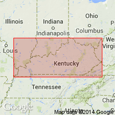
Corr. chart. Princess Formation of Breathitt Group. Mostly sandstone, siltstone, shale, and coal. Recognized in eastern Kentucky. Includes (descending): Princess No. 9 coal zone at top, Princess No. 8 (Lower Freeport) coal bed, Princess No. 7 (Middle Kittanning) coal bed, Princess No. 6 (Lower Kittanning) coal bed, Lawrence coal bed, Hitchins (Flint) clay bed, Obryan Member, Princess No. 5B (No. 4A) coal bed, Princess No. 5A (Little No. 5 Block, Laurel) coal bed, Kilgore Flint Member (Flint Ridge flint, Limekiln limestone), Princess No. 5 (Hazard No. 11, Knob) coal bed, upper Broas (Princess No. 4) coal zone, "Main Block ore," and Stoney Fork Member at base. Lies below Conemaugh Formation and above Four Corners Formation of Breathitt Group. Age is Middle Pennsylvanian (Westphalian; Atokan to Desmoinesian).
[Beds incl. in the Princess range from Westphalian C (Bolsovian) to Westphalian D based on miospores (see Peppers, 1996, GSA Memoir 188, pl.; Eble and others, 2009, Kentucky Geol. Survey, ser. XII, Spec. Pub. 10, fig. 5.2). Unpublished collections from basal Stoney Fork Member, and its equivalents, informal Lake City member of Cross Mountain Formation in Tennessee and Blunt Run (Boggs) limestone of Pottsville Group in Ohio, yielded distinctive conodonts correlative with the marine Aegir bed (=base of Westphalian C) thus shifting the Four Corners, Vowell Mountain, lower part of Cross Mountain, and upper part of Pottsville, downward into Westphalian B (R.G. Stamm, USGS, pers. commun., Oct. 17, 2013).]
[See also Chesnut, 1997 (revised Oct. 12, 1999), Stratigraphy of the coal-bearing strata of the Eastern Kentucky coal field, available online through the Kentucky Geol. Survey (http://www.uky.edu/KGS/coal/coalcorrel.htm); Greb and others, 2009, Kentucky Geol. Survey, Spec. Pub. no. 10, ser. XII, p. 32-45; and geologic descriptions of stratigraphic units in the Kentucky Geological Survey database (http://kgs.uky.edu/kgsmap/KGSLitho/lithoSearch.asp#).]
Source: Publication.
For more information, please contact Nancy Stamm, Geologic Names Committee Secretary.
Asterisk (*) indicates published by U.S. Geological Survey authors.
"No current usage" (†) implies that a name has been abandoned or has fallen into disuse. Former usage and, if known, replacement name given in parentheses ( ).
Slash (/) indicates name conflicts with nomenclatural guidelines (CSN, 1933; ACSN, 1961, 1970; NACSN, 1983, 2005, 2021). May be explained within brackets ([ ]).

