

- Usage in publication:
-
- Naese sandstone member*
- Modifications:
-
- Original reference
- Dominant lithology:
-
- Sandstone
- Conglomerate
- AAPG geologic province:
-
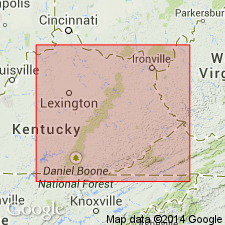
- Appalachian basin
Summary:
Pg. 31, 35, 86. Naese sandstone member of Lee formation. Massive cliff-making sandstone, probably 256 feet thick, forming top member of Lee formation in Cumberland Gap coal field, southeastern Kentucky and northeastern Tennessee. Age is Pennsylvanian.
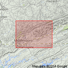
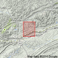
[Named from Naese Cliff, on Cumberland River, about 8 mi by road above Pineville, Bell Co., southeastern KY.]
Source: US geologic names lexicons (USGS Bull. 896, p. 1457; USGS Bull. 1200, p. 2672).
- Usage in publication:
-
- Naese Sandstone Member*
- Modifications:
-
- Areal extent
- AAPG geologic province:
-
- Appalachian basin
Summary:
Mapped as Naese Sandstone Member of Lee Formation (topmost member). Consists of very light-gray, fine- to medium-grained, thick-bedded to massive, sparsely conglomeratic sandstone; quartzose sandstone in lower part. Member thins eastward and grades into very fine to fine-grained, thin-bedded sandstone and shale of the Hance Formation. Thickness is 0-250 ft. Underlain by Bee Rock Sandstone Member of Lee Formation; overlain by Hance Formation.
Source: GNU records (USGS DDS-6; Reston GNULEX).
- Usage in publication:
-
- Naese Sandstone Member*
- Modifications:
-
- Age modified
- AAPG geologic province:
-
- Appalachian basin
Summary:
Topmost members of Lee Formation in Cumberland Mountain area are Bee Rock Sandstone Member east of Rocky Face fault and Naese Sandstone Member west of the fault. In most areas where Naese is present, it unconformably overlies Bee Rock; elsewhere, replaces Bee Rock. Bee Rock pinches out to southeast in VA. In KY, Bee Rock thickens to northwest. Where not overlain by Naese, intertongues with overlying Hance Formation. At northeast end of Pine Mountain, Bee Rock is wholly or in part equivalent to upper member of Lee Formation or to upper sandstone member of Alvord and Miller (1972). Naese grades laterally into overlying Hance; where Yellow Creek Sandstone Member of Hance directly overlies Naese, both are mapped as single unit. Boundary between Bee Rock and Naese is difficult to discern because of lithologic similarity. Englund (1968) suggests that Bee Rock is truncated by unconformity at base of Naese west of Cumberland Gap, that Bee Rock is absent in TN, and that Naese wedges out southeastward in TN. Bee Rock and Naese are partly or wholly equivalent to Rockcastle Sandstone Member of Lee in eastern KY. Also may be equivalent to Rockcastle Conglomerate of Crab Orchard Mountains Group of Tennessee Division of Geology nomenclature. Top of Bee Rock traditionally marked Lower-Middle Pennsylvanian Series boundary in KY. Englund and others (1979) place boundary above Bee Rock equivalents. Because Naese overlies Bee Rock, is Early to Middle Pennsylvanian.
Source: GNU records (USGS DDS-6; Reston GNULEX).

- Usage in publication:
-
- Naese member
- Modifications:
-
- Revised
- AAPG geologic province:
-
- Appalachian basin
Summary:
Naese assigned as informal member to Bee Rock Sandstone in KY. Bee Rock is raised to formation rank and assigned to Breathitt Group. Lee Formation is dropped. Bee Rock also includes formal Rockcastle and Livingston Members and informal "K" sandstone member of Puffett (1962: USGS GQ-179).
Source: GNU records (USGS DDS-6; Reston GNULEX).

- Usage in publication:
-
- Naese Sandstone Member
- Modifications:
-
- Areal extent
- AAPG geologic province:
-
- Appalachian basin
Summary:
Naese Sandstone Member of the Lee Formation in VA appears to be limited to western and southwestern Wise Co. and Lee Co. Lies about 15 ft above the Bee Rock Sandstone Member in drillholes SW-9 and SW-10 in northwestern Lee Co. according to Englund and others (1983). Separated from the Bee Rock by medium-gray to dark-gray siltstone. The Naese ranges from 0 to 150 ft in thickness. Consists of quartzose sandstone, which is fine to coarse grained, pebbly to conglomeratic, and has quartz pebbles as much as 0.5 in. in diameter. In some areas the Naese rests unconformably on the Bee Rock and identification of the boundary is difficult. Contact with the overlying Norton Formation is gradational and locally intertonguing. Age is Early Pennsylvanian (Morrowan).
Source: GNU records (USGS DDS-6; Reston GNULEX).

- Usage in publication:
-
- Naese Sandstone Member*
- Modifications:
-
- Revised
- AAPG geologic province:
-
- Appalachian basin
Summary:
Designated as top member of Lee Formation where present on Cumberland overthrust sheet. Locally mapped as a member of overlying Breathitt Formation. Assignment to Hance Formation discontinued as Hance is herein abandoned.
Source: GNU records (USGS DDS-6; Reston GNULEX).
For more information, please contact Nancy Stamm, Geologic Names Committee Secretary.
Asterisk (*) indicates published by U.S. Geological Survey authors.
"No current usage" (†) implies that a name has been abandoned or has fallen into disuse. Former usage and, if known, replacement name given in parentheses ( ).
Slash (/) indicates name conflicts with nomenclatural guidelines (CSN, 1933; ACSN, 1961, 1970; NACSN, 1983, 2005, 2021). May be explained within brackets ([ ]).