

- Usage in publication:
-
- Morita formation*
- Modifications:
-
- Named
- Dominant lithology:
-
- Sandstone
- Shale
- AAPG geologic province:
-
- Pedregosa basin
Summary:
Pg. 56, 63-65. Morita formation of Bisbee group. Alternating beds of dull-red arenaceous shale and red or tawny fine-grained sandstones with occasional layers of grit and lenses of impure limestone. In upper part the red shale becomes calcareous. Sandstones frequently cross-bedded. One bed of reddish-brown grit, 10 to 15 feet thick, occurs 1,200+/- feet above base of formation. Some strata are 10 to 15 feet thick, but usually are less than 4 feet thick. Thickness northeast of Bisbee, southeastern Arizona, said to be 1,800 feet. Is a shallow-water deposit. Grades into overlying Mural limestone and rests conformably on Glance conglomerate, all of which are included in Bisbee group. Age is Early Cretaceous (Comanchean), based on age (fossils) of overlying Mural. Report includes geologic map, cross sections, columnar section.
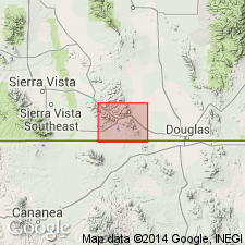
Named from Morita Hills, just south of Intl. bdry. between longitudes 100 deg. 45 min. and 100 deg. 50 min., in Sonora, Mexico. [According to GNU records (USGS DDS-6; Denver GNULEX, April 5, 1988), type locality not designated.]
Source: US geologic names lexicon (USGS Bull. 896, p. 1421-1422); supplemental information from GNU records (USGS DDS-6; Denver GNULEX).
- Usage in publication:
-
- Morita shale
- Modifications:
-
- Redescribed
- Age modified
- Biostratigraphic dating
- AAPG geologic province:
-
- Pedregosa basin
Summary:
Morita shale. Fossils indicate Trinity (Aptian) age. [No locality identified.]
Source: Modified from GNU records (USGS DDS-6; Denver GNULEX).
- Usage in publication:
-
- Morita formation
- Modifications:
-
- Areal extent
- AAPG geologic province:
-
- Pedregosa basin
Summary:
Pg. 12, 13, 36 (table 6). Morita formation. Underlies Lowell formation (new). Age is Early Cretaceous (Aptian); DESHAYESITES DESHAYESI standard ammonite zone.
Source: Publication; US geologic names lexicon (USGS Bull. 1200, p. 2593).
- Usage in publication:
-
- Morita formation
- Modifications:
-
- Not used
Summary:
Not used. Name applied by Stoyanow (1949) to the lower member of Mural limestone and upper beds of Morita formation of Ransome (1904). The base of Lowell formation found to not be readily traceable, whereas the base of Mural limestone as originally defined by Ransome (1904) can be mapped readily within narrow stratigraphic units. Rocks at Lowell type section duplicated by a fault. Several writers assumed that Lowell was a replacement name only for the lower member of the Mural. Stoyanow did not clearly state that several hundred ft of Morita were also included in Lowell.
Source: GNU records (USGS DDS-6; Denver GNULEX).

- Usage in publication:
-
- Morita Formation*
- Modifications:
-
- Areal extent
- AAPG geologic province:
-
- Pedregosa basin
Summary:
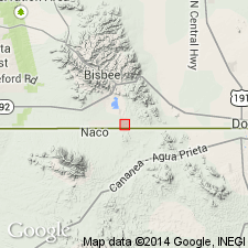
Recognized in Steele Hills, Cochise Co, AZ in Pedregosa basin and in area north of the hills where it is overlain by Cintura Formation. The two formations of Bisbee Group were undivided in mapping and not in contact with underlying Glance Conglomerate in this quad. [Rather than extending the names Morita and Cintura to the Steele Hills, it probably would have been preferable to have reduced the Bisbee to formational rank.] Is of Early Cretaceous age.
Source: GNU records (USGS DDS-6; Denver GNULEX).
- Usage in publication:
-
- Morita Formation*
- Modifications:
-
- Areal extent
- AAPG geologic province:
-
- Pedregosa basin
Summary:
Extended as a formation of Bisbee Group to the Huachuca Mountains, Cochise Co, AZ in the Pedregosa basin, where reported to be about 4,200 ft thick. Is of Early Cretaceous age.
Source: GNU records (USGS DDS-6; Denver GNULEX).

- Usage in publication:
-
- Morita Formation*
- Modifications:
-
- Overview
- AAPG geologic province:
-
- Pedregosa basin
- Basin-and-Range province
Summary:
Is formation of Bisbee Group (Lower Cretaceous) in Mule and Huachuca Mountains, southern Cochise Co, AZ in Pedregosa basin; and Little Dragoon Mountains and nearby Gunnison and Steele Hills, northern Cochise Co, AZ in Basin-and-Range province. Overlies Glance Conglomerate of Bisbee. Underlies Mural Limestone of Bisbee in Pedregosa basin. Underlies (and considered undivided with) Cintura Formation of Bisbee in Basin-and-Range province. Rocks in upper part considered equivalent to lower part of Trinity Group (Lower Cretaceous) of TX on basis of fossils. Strata in lower part correlated approximately with Carbonate Hill Limestone (Aptian, Lower Cretaceous) of Gillerman (1958) in central Peloncillo Mountains. Age is Aptian (Early Cretaceous). [See fig. 5 for regional correlations.]
Source: GNU records (USGS DDS-6; Denver GNULEX).
- Usage in publication:
-
- Morita Formation*
- Modifications:
-
- Principal reference
- AAPG geologic province:
-
- Pedregosa basin
Summary:
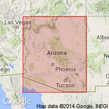
The principal reference section designated as from NW1/4 NE1/4, sec 15 to SE1/4 NE1/4, sec 10, T23S, R24E in Mule Mountains, Cochise Co, AZ. Made up almost entirely of pinkish-gray to pale-red feldspathic sandstones and grayish-red siltstones and mudstones plus minor pebble conglomerate, greenish-gray claystone, and impure limestone. Interpreted to have been deposited on a slowly subsiding, subaerial deltaic plain. Upper 600 ft or so of Morita correlated with lower part of Trinity Group, whereas most of Morita considered to be older than Trinity.
Source: GNU records (USGS DDS-6; Denver GNULEX).
- Usage in publication:
-
- Morita Formation*
- Modifications:
-
- Areal extent
- AAPG geologic province:
-
- Pedregosa basin
Summary:
Extended within Pedregosa basin to Peloncillo Mountains, Hidalgo Co., NM to replace McGhee Peak Formation of Gillerman (1958). Described as at least 200 m thick. Overlies Glance Conglomerate and overlain by Mural Limestone. [Mural Limestone here probably older than type Mural. Because of uncertainties of correlation it is doubtful that the names Morita Formation, Mural Limestone, and Cintura Formation should have been extended to the Peloncillo Mountains. The terminology of Armstrong and others (1978) should not have been rejected without reason.] Is of Early Cretaceous age.
Source: GNU records (USGS DDS-6; Denver GNULEX).
- Usage in publication:
-
- Morita Formation*
- Modifications:
-
- Areal extent
- AAPG geologic province:
-
- Pedregosa basin
Summary:
Extended as a formation of Bisbee Group into the southern Peloncillo Mountains, Hidalgo Co, NM in the Pedregosa basin. Is of Early Cretaceous age.
Source: GNU records (USGS DDS-6; Denver GNULEX).
- Usage in publication:
-
- Morita Formation*
- Modifications:
-
- Areal extent
- AAPG geologic province:
-
- Pedregosa basin
Summary:
Formation names of the Lower Cretaceous Bisbee Group used in Bisbee area (Glance Conglomerate, Morita Formation, Mural Limestone, and Cintura Formation) can be distinguished in Peloncillo Mountains (Cochise Co, AZ and Hidalgo Co, NM in Basin-and-Range province and in Pedregosa basin. Are recognized for the first time in northern Animas Mountains. Formation names of Bisbee area were defined by Ransome in 1904 and take precedence over local terminologies defined later (Gillerman, 1958, whose names McGhee Peak Formation, Johnny Bull Sandstone, Still Ridge Formation, and Carbonate Hill Limestone are not used in this report).
Source: GNU records (USGS DDS-6; Denver GNULEX).
- Usage in publication:
-
- Morita Formation*
- Modifications:
-
- Mapped 1:24k
- Dominant lithology:
-
- Shale
- Siltstone
- Graywacke
- AAPG geologic province:
-
- Pedregosa basin
Summary:
Morita Formation of Bisbee Group. Chiefly dark-gray, some reddish-gray or greenish-gray shale, siltstone, and graywacke, having interbedded sandstone, conglomerate, and limestone. Includes silicified wood. Underlies Mural Limestone of Bisbee; is inseparable from Cintura, uppermost formation of Bisbee, where Mural is absent. Age is Early Cretaceous.
Source: Publication.
For more information, please contact Nancy Stamm, Geologic Names Committee Secretary.
Asterisk (*) indicates published by U.S. Geological Survey authors.
"No current usage" (†) implies that a name has been abandoned or has fallen into disuse. Former usage and, if known, replacement name given in parentheses ( ).
Slash (/) indicates name conflicts with nomenclatural guidelines (CSN, 1933; ACSN, 1961, 1970; NACSN, 1983, 2005, 2021). May be explained within brackets ([ ]).