

- Usage in publication:
-
- Moran formation
- Modifications:
-
- Original reference
- Dominant lithology:
-
- Limestone
- Shale
- Sand
- AAPG geologic province:
-
- Bend arch
Summary:
Pg. 133-145. Moran formation in Cisco division. Light-colored shales and reddish sands, marked, in upper part, by 3 thin limestones. Top member is Moran limestone (yellow). About 160 feet below top is Dothan limestone. Thickness of formation 220+/- feet. Top formation of Cisco division in Brazos River Valley, north-central Texas. Overlies Pueblo formation. Includes at top Camp Colorado bed of Drake. Fossils. [Age is Late Pennsylvanian.]
Source: US geologic names lexicon (USGS Bull. 896, p. 1419); GNC TX Miss.-Perm. Corr. Chart, sheet 3, Oct. 1930.

- Usage in publication:
-
- Moran formation
- Modifications:
-
- Principal reference
- Revised
- Dominant lithology:
-
- Limestone
- Shale
- Sandstone
- AAPG geologic province:
-
- Bend arch
Summary:
Pg. 24, 31, 40, etc. Moran formation. Shale and limestone, with Sedwick limestone member [Moran limestone of 1919 report] at top, and, in Colorado River region, Watts Creek shale member at base. Is 150 feet thick to south and 200 or more to north. Overlies Camp Colorado limestone member of Pueblo formation and in north-central Texas is conformably overlain by Santa Anna Branch shale member of Putnam formation. Includes (descending) Sedwick limestone, Santa Anna shale, Horse Creek limestone (= ? Dothan limestone), and Watts Creek shale, or all beds down to Camp Colorado limestone.
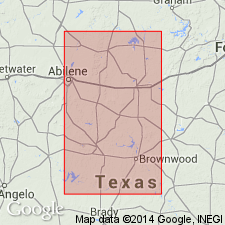
Named from town of Moran, Shackelford Co., central northern TX.
[GNC remark (ca. 1936, US geologic names lexicon, USGS Bull. 896, p. 1419): This formation was transferred to Permian Wichita group by E.H. Sellards in 1933 (Univ. Texas Bull., no. 3232), and Permian is present age designation of the USGS.]
Source: US geologic names lexicon (USGS Bull. 896, p. 1419).

- Usage in publication:
-
- Moran group
- Modifications:
-
- Revised
- AAPG geologic province:
-
- Bend arch
Summary:
Pg. 66 (fig. 1), 93. Moran group. Rank raised to group. Includes (ascending) Dothan, Horse Creek, and Sedwick formations. Underlies Putnam group; overlies Pueblo group (redefined). [Age is Early Permian (Wolfcamp).]
Source: US geologic names lexicon (USGS Bull. 1200, p. 2586).
- Usage in publication:
-
- Moran formation
- Modifications:
-
- Revised
- AAPG geologic province:
-
- Bend arch
Summary:
Sheets 3, 4. Moran formation includes (ascending) Watts Creek shale, Gouldbusk limestone (new), Santa Anna shale, and Sedwick limestone members. [Age is Early Permian (Wolfcamp).]
Source: US geologic names lexicon (USGS Bull. 1200, p. 2586).

- Usage in publication:
-
- Moran formation*
- Modifications:
-
- Revised
- AAPG geologic province:
-
- Bend arch
Summary:
Sheet 2. Moran formation. Described in Colorado River Valley where it is about 100 feet thick. Overlies Pueblo formation; underlies Putnam formation. Includes (ascending) Watts Creek shale, Gouldbusk limestone (new), Santa Anna shale, and Sedwick limestone members. Age is Early Permian (Wolfcamp).
Source: US geologic names lexicon (USGS Bull. 1200, p. 2586).
- Usage in publication:
-
- Moran formation*
- Modifications:
-
- Areal extent
- AAPG geologic province:
-
- Bend arch
Summary:
Pg. 270. Moran formation is 155 to 220 feet thick in Brazos River Valley. Overlies Pueblo formation; underlies Putnam formation. Only upper member, Sedwick limestone, recognized in area.
Source: US geologic names lexicon (USGS Bull. 1200, p. 2586).

- Usage in publication:
-
- Moran Formation
- Modifications:
-
- Revised
- Mapped 1:250k
- Dominant lithology:
-
- Mudstone
- Sandstone
- Limestone
- AAPG geologic province:
-
- Bend arch
Summary:
Moran Formation of Cisco Group. Mudstone, sandstone, and limestone. Includes several unnamed channel-fill bodies, and named limestones [unranked], in descending order: Gouldbusk Limestone, Ibex Limestone ("Dothan Limestone"), and Camp Colorado Limestone ("Noodle Creek Limestone," previously included in underlying Pueblo Formation). Also includes Santa Anna Shale [unranked], not separately described. Thickness 180 to 190 feet. Underlies Sedwick Formation (rocks previously included in Moran) and overlies Pueblo Formation, both of Cisco Group. Age is Early Permian (Wolfcamp).
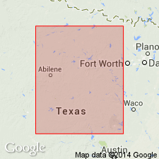
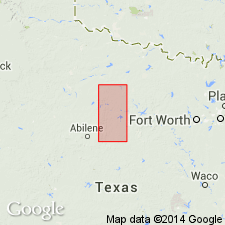
Mapped in Brown, Callahan, Coleman, Shackelford, Stephens, and Throckmorton Cos., central northern TX.
Source: Publication.
For more information, please contact Nancy Stamm, Geologic Names Committee Secretary.
Asterisk (*) indicates published by U.S. Geological Survey authors.
"No current usage" (†) implies that a name has been abandoned or has fallen into disuse. Former usage and, if known, replacement name given in parentheses ( ).
Slash (/) indicates name conflicts with nomenclatural guidelines (CSN, 1933; ACSN, 1961, 1970; NACSN, 1983, 2005, 2021). May be explained within brackets ([ ]).