

- Usage in publication:
-
- Mineral Wells sandstones
- Modifications:
-
- Overview
- Dominant lithology:
-
- Sandstone
- AAPG geologic province:
-
- Bend arch
Summary:
Pg. 138. Mineral Wells sandstones. Simply listed on a generalized chart of Pennsylvanian units. Report area in Brazos River Valley, north-central Texas. Strawn division overlies Millsap division [Millsap Lake] and is divided into (descending) Gordon, Mineral Wells sandstones, Brazos sandstone, etc. [Subdivisions not described.]
Source: US geologic names lexicon (USGS Bull. 896, p. 1380); supplemental information from GNU records (USGS DDS-6; Denver GNULEX).

- Usage in publication:
-
- Mineral Wells formation
- Modifications:
-
- Principal reference
- Dominant lithology:
-
- Sandstone
- Clay
- Marl
- Limestone
- Shale
- AAPG geologic province:
-
- Bend arch
- Strawn basin
Summary:
Pg. 24, 31, 32. Mineral Wells formation, top formation of Strawn group. Sandstones and shales, with coal No. 1 (Thurber coal) at base. Thickness 500 to 800 feet. Underlies Palo Pinto limestone of Canyon group and overlies Millsap [Millsap Lake] formation of Strawn group. Present in Palo Pinto and Erath Counties, Brazos River Valley, north-central Texas. Age is Pennsylvanian (Strawn). Report includes fossil lists, correlation chart.
Named from typical exposures [type] in vicinity of Mineral Wells, Palo Pinto Co., north-central TX.
Source: US geologic names lexicon (USGS Bull. 896, p. 1380); supplemental information from GNU records (USGS DDS-6; Denver GNULEX).

- Usage in publication:
-
- Mineral Wells formation
- Modifications:
-
- Revised
- Dominant lithology:
-
- Shale
- Sandstone
- Conglomerate
- AAPG geologic province:
-
- Bend arch
Summary:
Pg. 106, 108. Mineral Wells formation. Restricted by G. Scott and J.M. Armstrong (ms. on geol. of Parker Co., Texas) to beds above Brazos sandstone [Brazos River sandstone] and they introduce Garner formation for lower part of original Mineral Wells formation, or to include (descending) Brazos sandstone, Mingus shale, and Thurber coal members. As restricted, in Brazos River Valley, consists chiefly of shales, and sandstones and conglomerates; includes (ascending) East Mountain shale, Lake Pinto sandstone, Salesville shale, Turkey Creek sandstone, and "Keechi Creek limestone and shale" members. [Sellards (1933) included in top of Mineral Wells formation of Colorado River region the Capps limestone member. This definition is present approved definition of the USGS and is the one followed by F.B. Plummer and J. Hornberger, 1936 (Univ. Texas Bull., no. 3534).] Age is Pennsylvanian.
Source: US geologic names lexicon (USGS Bull. 896, p. 1380); supplemental information from GNU records (USGS DDS-6; Denver GNULEX).

- Usage in publication:
-
- Mineral Wells formation
- Modifications:
-
- Revised
- AAPG geologic province:
-
- Bend arch
Summary:
Pg. 91-94. Mineral Wells formation of Strawn group. Includes Ricker sandstone and Capps limestone members. Underlies Palo Pinto formation of Canyon group. [Age is Middle Pennsylvanian.]
Source: US geologic names lexicon (USGS Bull. 1200, p. 2516-2517).

- Usage in publication:
-
- Mineral Wells formation
- Modifications:
-
- Not used
- AAPG geologic province:
-
- Bend arch
- Strawn basin
Summary:
Pg. 66 (fig. 1), 87. Strawn-Canyon boundary falls within Mineral Wells formation which name is here dropped. Units formerly included in Mineral Wells are reassigned to Lone Camp group (new) or Whitt group (new). [Age is Middle Pennsylvanian.]
Source: US geologic names lexicon (USGS Bull. 1200, p. 2516-2517).
- Usage in publication:
-
- Mineral Wells formation*
- Modifications:
-
- Not used
- AAPG geologic province:
-
- Bend arch
Summary:
Pg. 60. Strawn group is used in this report for all rocks in Colorado River Valley between top of Smithwick shale of Bend group and base of Brownwood shale member of Graford formation of Canyon group. Term Mineral formation is not used in this area because of marked range in thickness and lithology that occurs in the Strawn between the Brazos and Colorado River Valleys. [Age is Middle Pennsylvanian.]
Source: US geologic names lexicon (USGS Bull. 1200, p. 2516-2517).

- Usage in publication:
-
- Mineral Wells Formation
- Modifications:
-
- Mapped 1:250k
- Dominant lithology:
-
- Shale
- Sandstone
- Conglomerate
- Limestone
- AAPG geologic province:
-
- Bend arch
- Fort Worth syncline
Summary:
Mineral Wells Formation of Strawn Group. Shale, sandstone, conglomerate, and limestone. Includes (descending) Turkey Creek Sandstone, Dog Bend Limestone, Lake Pinto Sandstone, Village Bend Limestone, Capps Limestone, and Hog Mountain Sandstone [all unranked]. Also includes (descending) Keechi Creek, Salesville, and East Mountain Shales [all unranked], not separately described. Thickness 275 to 700 feet, maximum thickness near Mineral Wells (Palo Pinto County). Overlies Brazos River Formation and underlies Palo Pinto Formation, both of Strawn. Age is Middle Pennsylvanian (Desmoinesian).
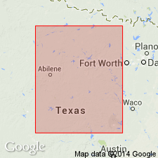
Mapped in Eastland, Palo Pinto, and Parker Cos., central northern and eastern TX.
Source: Publication.
- Usage in publication:
-
- Mineral Wells Formation
- Modifications:
-
- Mapped 1:250k
- Dominant lithology:
-
- Shale
- Sandstone
- Conglomerate
- Limestone
- AAPG geologic province:
-
- Fort Worth syncline
Summary:
Mineral Wells Formation of Strawn Group. Shale, sandstone, conglomerate, and limestone. Includes (descending) Lake Pinto Sandstone, Village Bend Limestone, and Hog Mountain Sandstone [all unranked]. Thickness of exposed part of Mineral Wells Formation 400 to 500 feet. Overlapping Cretaceous rocks cover upper third and other portions of formation including Turkey Creek Sandstone and Dog Bend Limestone [both unranked], which are exposed on the Abilene sheet immediately to the west. [Age is considered late Middle to early Late Pennsylvanian (late Desmoinesian to early Missourian). Early-Middle Pennsylvanian boundary tentatively placed between Village Bend and Lake Pinto. Boardman and others, 1994, Kansas Geol. Survey Bull., no. 232, p. 8, 14 (fig. 8) state boundary is 15 to 25 feet above Village Bend, based on fusulinids, conodonts, and ammonoids.]
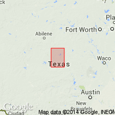
[Small, isolated outcrop along western edge of map sheet, west of Weatherford, in Parker Co., eastern TX. See also adjacent Geol. Atlas Texas, Abilene sheet, 1972.]
Source: Publication.
For more information, please contact Nancy Stamm, Geologic Names Committee Secretary.
Asterisk (*) indicates published by U.S. Geological Survey authors.
"No current usage" (†) implies that a name has been abandoned or has fallen into disuse. Former usage and, if known, replacement name given in parentheses ( ).
Slash (/) indicates name conflicts with nomenclatural guidelines (CSN, 1933; ACSN, 1961, 1970; NACSN, 1983, 2005, 2021). May be explained within brackets ([ ]).