- Usage in publication:
-
- Mesa Verde group*
- Modifications:
-
- First used
- Dominant lithology:
-
- Sandstone
- Shale
- Marl
- Lignite
- AAPG geologic province:
-
- San Juan basin
Summary:
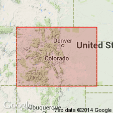
First published use of name Mesa Verde as a term applied to three units that lie between dark shales and limestones of the Colorado below and shales and clays of the "Sand Shale Group" above. The lowest unit of the Mesa Verde is the "Lower Escarpment," which consists of 120 ft of ledge- and cliff-forming massive sandstone. The middle unit is the "Middle Coal Group," a 800-900 ft thick slope-forming sandstone, shale, marl, and lignite. The upper unit is designated "Upper Escarpment," a 190 ft thick ledge- and cliff-forming sandstone. Columnar section of valley of the Rio San Juan, northwest NM in the San Juan basin. Neither source of name nor type locality stated. Of Late Cretaceous age.
Source: GNU records (USGS DDS-6; Denver GNULEX).
- Usage in publication:
-
- Mesaverde formation*
- Modifications:
-
- Revised
- AAPG geologic province:
-
- Green River basin
- Piceance basin
Summary:
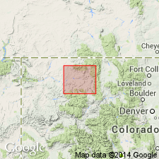
Revised in that two sandstones in Mesaverde formation named. The Trout Creek sandstone member is about 75 to 100 ft thick and lies 1,900 ft above base of formation. The Twentymile sandstone member is about 75 ft thick and it lies about 1,000 ft above the top of the Trout Creek. Mesaverde is about 3,450 ft thick in the report area where it overlies Mancos shale and underlies Lewis shale. Mesaverde mapped in parts of Moffat and Routt Cos, CO in the Greater Green River basin, Garfield and Routt Cos, CO in the Piceance basin. Several sections described Cretaceous age. Geologic map; location of coal beds in Yampa field emphasized; Trout Creek and Twentymile sandstone members not mapped.
Source: GNU records (USGS DDS-6; Denver GNULEX).
- Usage in publication:
-
- Mesaverde formation*
- Modifications:
-
- Revised
- AAPG geologic province:
-
- Piceance basin
Summary:
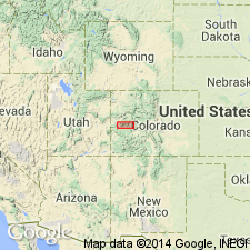
Lower part in coal field divided into (ascending order): Rollins sandstone, Bowie shale, and Paonia shale members (all new). These members total 925 +/-ft thick. The overlying upper part is undivided and is 2,000 +/-ft thick. Overlies Mancos shale; unconformably underlies Ohio Creek formation. Assigned a Montanan, Late Cretaceous age.
Source: GNU records (USGS DDS-6; Denver GNULEX).
- Usage in publication:
-
- Mesaverde formation*
- Modifications:
-
- Revised
- AAPG geologic province:
-
- San Juan basin
- Estancia basin
Summary:
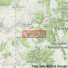
Mancos-Mesaverde contact placed at base of Punta de la Mesa sandstone member, assigned in this report for the first time to the Mesaverde. Report area is in Valencia Co, NM in the San Juan basin. Assigned to Montana group and to the Cretaceous system.
Source: GNU records (USGS DDS-6; Denver GNULEX).
- Usage in publication:
-
- Mesaverde formation*
- Modifications:
-
- Revised
- Areal extent
- AAPG geologic province:
-
- Bighorn basin
Summary:
Conformably overlies the newly named Cody shale in the Basin oil field area, Big Horn Co, WY in the Bighorn basin. Is about 1,200 ft thick and principally a sandstone with a minor amount of shale and a little coal. Washburne (1909) correlated the sandstone assigned to the Mesaverde in the Basin oil field with Eagle sandstone of MT; present author says Eagle pinches out before reaching report area. The names Gebo and Meeteetse formations were named by Hewett (1912) for rocks of this interval at Cody, but present author says thicknesses of Gebo and Meeteetse are greater than those called Mesaverde in the Basin oil field. Fossils of Montana age identified. Of Cretaceous age. History of nomenclature chart.
Source: GNU records (USGS DDS-6; Denver GNULEX).
- Usage in publication:
-
- Mesaverde group*
- Modifications:
-
- Revised
- AAPG geologic province:
-
- Paradox basin
Summary:
Rocks formerly called "Lower Escarpment," "middle coal-bearing group," and "Upper Escarpment" are named Cliff House sandstone, Menefee formation, and Point Lookout sandstone respectively. These three formations are assigned to the Cretaceous Mesaverde group (raised in stratigraphic rank from formation). The group is from 1,000 to 1,200 ft thick in vicinity of Mancos, CO.
Source: GNU records (USGS DDS-6; Denver GNULEX).
- Usage in publication:
-
- Mesaverde formation
- Modifications:
-
- Areal extent
- Revised
- AAPG geologic province:
-
- Denver basin
Summary:
This is the first report to use name Mesaverde formation east of the Front Range, CO, Denver basin. Many outcrops between Cheyenne, WY and Boulder, CO were examined. As a result of the study, name Mesaverde applied to rocks of marine origin on east side of Front Range, and to fresh water and brackish water deposits on west side of Front Range. Five unranked sandstones distinguished in Mesaverde (ascending)--Hygiene, Terry, Rocky Ridge, Larimer, and Richard--in the Denver basin. The sandstones are separated by intervals of shale. Prior to this report all of these sandstones were thought to be one sandstone and were designated Hygiene. The Terry, Rocky Ridge, Larimer, and Richard are published for the first time in this report. Cretaceous age.
Source: GNU records (USGS DDS-6; Denver GNULEX).
- Usage in publication:
-
- Mesaverde group*
- Modifications:
-
- Revised
- AAPG geologic province:
-
- Green River basin
Summary:
Name Mesaverde used as group rank in Yampa River area, northwest CO in the Greater Green River basin, where it is divided into the Iles (base) and Williams Fork (top) Formations. The two formations are named in this report. Two sandstones formerly recognized as members of the Mesaverde can be traced into Yampa River valley. The Trout Creek sandstone member of Mesaverde formation is redesignated Trout Creek sandstone member of Iles formation of Mesaverde group. The Twentymile sandstone member of the Mesaverde is redesignated Twentymile sandstone member of Williams Fork formation. Mesaverde overlies Mancos shale and underlies Lewis shale. Fossils identified in both formations listed. Cretaceous age.
Source: GNU records (USGS DDS-6; Denver GNULEX).
- Usage in publication:
-
- Mesaverde formation*
- Modifications:
-
- Revised
- AAPG geologic province:
-
- San Juan basin
Summary:
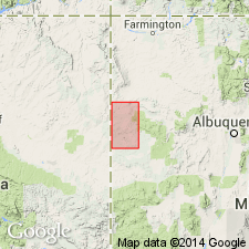
Divided in the Gallup-Zuni basin of the San Juan basin into five newly named members, Gallup sandstone (at base), Dilco coal, Bartlett barren, Gibson coal, and Allison barren members. Includes a section 1,800 ft thick of alternating gray sandstone, drab clay shale, and coal beds. The sandstone beds near the base are massive and persistent; the other lithologies are irregular and not persistent. Overlies the Mancos shale. Gallup thought to be equivalent to Point Lookout sandstone of CO; the overlying 1,600 ft thought to be equivalent to the Menefee formation of CO. Uppermost part probably removed by erosion. Was a floodplain deposit. Considered Late Cretaceous age.
Source: GNU records (USGS DDS-6; Denver GNULEX).
- Usage in publication:
-
- Mesaverde group*
- Modifications:
-
- Revised
- AAPG geologic province:
-
- Paradox basin
Summary:
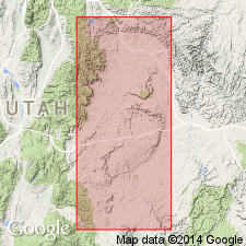
Pg. 440 (fig. 2), 441-448. Mesaverde group. In Wasatch Plateau, rocks designated as Mesaverde group are subdivided into (ascending; all new) Star Point sandstone, Blackhawk formation, and Price River formation. Upper shale member of Mancos passes by gradual transition into basal formation of Mesaverde group; underlies Wasatch formation. [Age is Late Cretaceous.]
Source: US geologic names lexicon (USGS Bull. 1200, p. 2474-2479).
- Usage in publication:
-
- Mesaverde group*
- Modifications:
-
- Revised
- AAPG geologic province:
-
- Green River basin
Summary:
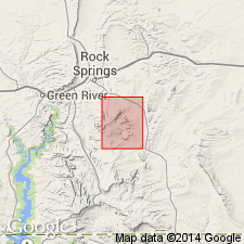
Mesaverde revised in that: 1) its basal contact placed at the Baxter shale-Blair formation contact in keeping with the shale-sandstone contact used for distinguishing Mancos shale from Mesaverde elsewhere; and 2) its divisions are the Blair and Rock Springs formations, Ericson sandstone (new), Almond formation, and the Lewis shale. Rock Springs and Almond, formerly called coal groups, are given formation status in this report. To the south, the Blair and Rock Springs tongue out into the Mancos shale, the Ericson is shown as equivalent to the Iles? formation, and the Almond shown as equivalent to the Williams Fork? formation. The Lewis is shown only at one locality. Cross section. Stratigraphic chart. Only Blair and Rock Springs formations mapped. Report area lies in the Greater Green River basin, Sweetwater Co, WY. Of Late Cretaceous age.
Source: GNU records (USGS DDS-6; Denver GNULEX).
- Usage in publication:
-
- Mesaverde group*
- Modifications:
-
- Revised
- AAPG geologic province:
-
- Uinta basin
Summary:
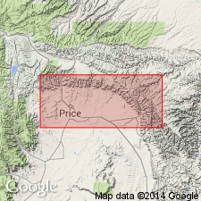
Revised in the Uinta basin, where it can be divided into (in ascending order) Star Point sandstone, Blackhawk formation, and Price River formation. Star Point includes newly named (in ascending order) Panther, Storrs, and Spring Canyon tongues, that are separated by tongues of Mancos shale. The Blackhawk is divided into the basal Aberdeen sandstone member (new), and overlying "coal-bearing beds" (Spring Canyon coal group, Castlegate coal group, Kenilworth coal, Gilson coal, Fish Creek coal, Rock Canyon coal, and Lower and Upper Sunnyside coals; in ascending order). The Price River is divided into the basal Castlegate sandstone member and overlying "non-coal-bearing member". Age is Late Cretaceous. Report includes geologic map, cross section.
Source: Modified from GNU records (USGS DDS-6; Menlo GNULEX).
- Usage in publication:
-
- Mesaverde formation*
- Modifications:
-
- Not used
Summary:
Term Pierre shale, rather than Mesaverde formation, used in northeast CO, Denver basin. Sandstones in the middle part of the Pierre--i.e., 2,400 to 3,100 ft above its base and about 5,275 ft below the top of the Pierre, are reassigned from Mesaverde, given formal stratigraphic rank, and designated (ascending order) Hygiene, Terry, Rocky Ridge, Larimer, and Richard sandstone members. These sandstones are separated by shale intervals.
Source: GNU records (USGS DDS-6; Denver GNULEX).
- Usage in publication:
-
- Mesaverde group*
- Modifications:
-
- Revised
- AAPG geologic province:
-
- Piceance basin
Summary:
Name has been applied at many localities in Rocky Mountain region to rocks not necessarily equivalent to Mesaverde group of southwest CO. Is used in Book Cliffs of CO, Piceance basin (this report), and adjacent UT for buff to yellow-brown sandstones intercalated with soft gray shale, and bituminous coal present at several horizons. Overlies and intertongues with Mancos shale. The lowest Mesaverde unit, the Castlegate sandstone, barely extends into CO. Castlegate, identified as far east as West Salt Creek just east of the UT-CO border, is mapped with Mancos shale in report area. The next younger Mesaverde unit is the Sego sandstone which is extended into CO from UT and divided into an upper and a lower part by the newly named Anchor Mine tongue of the Mancos. Two newly named coal-bearing formations are identified in the CO portion of the Book Cliffs coal field--the Mount Garfield and Hunter Canyon. These two formations have equivalence to formations already named in UT, but the exact equivalence is uncertain. Is of littoral, estuarine, and continental origin. Fossils uncommon. Late Cretaceous age. Geologic map, stratigraphic chart.
Source: GNU records (USGS DDS-6; Denver GNULEX).
- Usage in publication:
-
- Mesaverde formation*
- Modifications:
-
- Revised
- AAPG geologic province:
-
- San Juan basin
Summary:
Pg. 14-19. Mesaverde formation. In coal field from Gallup eastward to Mount Taylor, northwestern New Mexico, comprises (ascending) Gallup sandstone, Dilco coal, Dalton sandstone (new), Bartlett barren, Gibson coal, Hosta sandstone (new), and Allison barren members. Overlies Mancos shale. [Age is Late Cretaceous.]
Source: US geologic names lexicon (USGS Bull. 1200, p. 2474-2479).
- Usage in publication:
-
- Mesaverde formation*
- Modifications:
-
- Revised
- AAPG geologic province:
-
- San Juan basin
Summary:
Divided into five members: Hosta sandstone (at base), Gibson coal, Allison, Chacra sandstone (a new unit named at the top in the western part of the coal field), and Chacra (a new unit named that is at top in the eastern part of the coal field in San Juan basin, NM). Is a partly marine and partly continental Upper Cretaceous sequence.
Source: GNU records (USGS DDS-6; Denver GNULEX).
- Usage in publication:
-
- Mesaverde group*
- Modifications:
-
- Revised
- AAPG geologic province:
-
- Paradox basin
- Piceance basin
Summary:
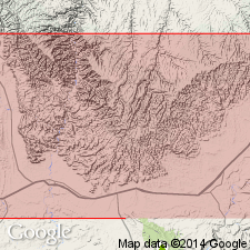
Divided into Blackhawk (base) and Price River (top) formations. Price River divided into Castlegate sandstone (base), Sego sandstone (new), Neslen coal-bearing (new), and Farrer non-coal-bearing (new) members. Two sandstone beds in Neslen named Sulphur Canyon and Thompson Canyon sandstone beds. Extends in report area from Emery Co, UT, Paradox basin east to Garfield Co, CO, Piceance basin. Measured sections. Geologic maps. Late Cretaceous age.
Source: GNU records (USGS DDS-6; Denver GNULEX).
- Usage in publication:
-
- Mesaverde group
- Modifications:
-
- Revised
- AAPG geologic province:
-
- Piceance basin
- Uinta basin
Summary:
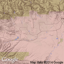
Name applied in report area which extends from Wasatch Co, UT east to Rio Blanco Co, CO across the Uinta and Piceance basins to rocks above Mancos shale and below Wasatch formation. Divided into Asphalt Ridge sandstone, a new formation in UT, Rim Rock sandstone, a new middle formation recognized in both basins, and the Williams Fork formation, the upper formation recognized in eastern UT and in CO. Measured sections of all three formations described. Fossils from Mesaverde undivided and Asphalt Ridge listed. Is a nearshore deposit of Late Cretaceous age. Geologic map.
Source: GNU records (USGS DDS-6; Denver GNULEX).
- Usage in publication:
-
- Mesaverde formation
- Modifications:
-
- Revised
- Overview
- AAPG geologic province:
-
- San Juan basin
Summary:
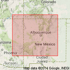
Name applied extensively and loosely to coal-bearing rocks in the middle part of the Upper Cretaceous. Overlies and intertongues with Mancos Shale. In report area, San Juan basin, formation considered to be of Montana age. Includes older beds southward. Lower part is of early Carlile age at south end of Mesa Verde-Atarque area. Probably all Mesaverde rocks below Hosta sandstone are older than the type Mesaverde. Thickness reported ranging from 422 ft on the Florida River to more than 2100 ft on the San Juan River. Mancos-Mesaverde sequence consists of (ascending order): lower part of Mancos, Atarque member (new) of Mesaverde, Horsehead tongue (new) of Mancos, lower part of Gallup sandstone member of Mesaverde, Pescado tongue (new) of Mancos, Gallup member, Dilco member and stray sandstone of Mesaverde, and upper part of Mancos. Geologic map; cross sections; block diagram; correlation chart; measured sections.
Source: GNU records (USGS DDS-6; Denver GNULEX).
- Usage in publication:
-
- Mesaverde group
- Modifications:
-
- Revised
- AAPG geologic province:
-
- San Juan basin
Summary:
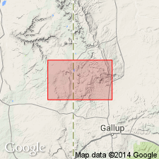
Raised in stratigraphic rank in Tohatchi quad, San Juan basin, NM where it is divided into Gallup sandstone (base), Crevasse Canyon formation (new name), Point Lookout sandstone, Menefee formation, and Tohatchi formation (top). Represents shallow-water marine, shoreline (deltas, beaches, and offshore bars), and continental (coastal plain, lagoonal flood plain and swamp) environments. Fossils indicate age range of late Carlile to Montana and early Laramie, or Late Cretaceous age.
Source: GNU records (USGS DDS-6; Denver GNULEX).
- Usage in publication:
-
- Mesaverde group
- Modifications:
-
- Revised
- AAPG geologic province:
-
- San Juan basin
Summary:
Tohatchi shale, upper formation of Upper Cretaceous Mesaverde group in this area, unconformably underlies newly named middle Tertiary Deza formation on Deza Bluffs in the Chuska Mountains of the San Juan basin in McKinley Co, NM. Rocks assigned to Deza have been mapped as Tohatchi shale by some and as lower part of Chuska sandstone by others.
Source: GNU records (USGS DDS-6; Denver GNULEX).
- Usage in publication:
-
- Mesaverde formation
- Modifications:
-
- Revised
- AAPG geologic province:
-
- Orogrande basin
Summary:
Mesaverde formation revised in north end Caballo Mountains, Sierra Co, NM in Orogrande basin, where a very thick section of Mesaverde has been preserved from erosion. The upper 100-200 ft contains a zone of coarse-grained sandstone and quartz pebble conglomerate which has been separated from the main body of the Mesaverde--this is here named Ash Canyon member of Mesaverde. It is quite distinctive and contains the coarsest material yet seen in the Mesaverde outcrops in south-central NM. This is probably due to the fact that the upper conglomerate unit has been removed by erosion at most other localities. Much silicified wood is found in Mesaverde, and it is especially conspicuous in the upper Ash Canyon beds. One log about 30 ft long and 3 ft wide has been observed in beds east of Elephant Butte Lake. Numerous fossil pelecypod fragments are present in lower beds of Mesaverde formation in the Caballo Mountains. Mesaverde and Ash Canyon are of Late Cretaceous age. Columnar sections.
Source: GNU records (USGS DDS-6; Denver GNULEX).
- Usage in publication:
-
- Mesaverde group*
- Modifications:
-
- Revised
- AAPG geologic province:
-
- San Juan basin
Summary:
Mesaverde group represented by the Point Lookout sandstone (base), Menefee formation, and Cliff House sandstone (top) in report area in San Juan Co, NM in the San Juan basin. The Menefee and Cliff House, which are intertongued with each other, are separable on the basis of recognition of sandstone tongues. The tongues are named Barker Dome, Cholla Canyon, and Beechatuda. Each tongue has very limited extent. The Cliff House intertongues with the overlying Lewis shale. A sandstone tongue at top of Cliff House in Ute Canyon named Ute Canyon tongue. Geologic map. Cross section. Of Late Cretaceous age.
Source: GNU records (USGS DDS-6; Denver GNULEX).
- Usage in publication:
-
- Mesaverde group*
- Modifications:
-
- Revised
- AAPG geologic province:
-
- San Juan basin
Summary:
Raised to group rank throughout the San Juan basin of southwest CO and northwest NM. Consists of six formations lying between Mancos and Lewis shales. Two oldest formations present near Gallup are Gallup sandstone (formerly a member of Mesaverde formation), and Crevasse Canyon formation (of Allen, Balk, 1954, adopted). Crevasse Canyon is divisible into Dilco coal (base), Dalton sandstone, Bartlett barren, and Gibson coal (restricted to what was formerly only lower part of Gibson) members. Three younger formation--Point Lookout sandstone, Menefee formation, and Cliff House sandstone--extended from CO southward into entire basin. Locally, in southern Chuska Mountains, Tohachi formation (Allen, Balk, 1954) adopted as upper formation of Mesaverde. Tohachi overlies Menefee in Chuskas and its correlation with other formations of Mesaverde uncertain. Hosta tongue of Point Lookout stratigraphically restricted to only lower part of former Hosta. Menefee divisible throughout southern part of basin into Cleary coal member (new name) that was formerly part of Gibson and overlying Allison member. Cliff House sandstone of central and southern part of basin intertongues with Lewis shale. Near La Ventana, a sandstone body is assigned to Cliff House as its La Ventana tongue, though proof of relationship to Cliff House is uncertain. Simplified geologic map. Diagrammatic cross section. Of Late Cretaceous age.
Source: GNU records (USGS DDS-6; Denver GNULEX).
- Usage in publication:
-
- Mesaverde group
- Modifications:
-
- Contact revised
- AAPG geologic province:
-
- Orogrande basin
Summary:
Upper contact revised in the Capitan coal field, Lincoln Co, NM in the Orogrande basin, where the upper sandstone unit of Mesaverde group is overlain by the newly named Upper Cretaceous? to Miocene? Cub Mountain formation. Divided into three units (geologic map, measured sections): lower sandstone, middle shale, and upper sandstone units. Mid-Carlile age oyster collected from lower unit; gastropods collected from the middle unit. Lower unit is 165 ft thick. Middle unit is 201+/-ft thick. Upper unit is 60+/-ft thick. Stratigraphic section, cross section. Of Late Cretaceous age.
Source: GNU records (USGS DDS-6; Denver GNULEX).
- Usage in publication:
-
- Mesaverde group*
- Modifications:
-
- Revised
- AAPG geologic province:
-
- Black Mesa basin
Summary:
Raised to group rank on Black Mesa, Black Mesa basin, where it is divided into three newly named formations--Toreva formation (base), Wepo formation (middle), and Yale Point sandstone. Is older at Black Mesa than in southwest CO. Overlies Mancos shale. Is the youngest Cretaceous unit (Late Cretaceous age) on Black Mesa.
Source: GNU records (USGS DDS-6; Denver GNULEX).
- Usage in publication:
-
- Mesaverde group*
- Modifications:
-
- Revised
- AAPG geologic province:
-
- Orogrande basin
Summary:
Names used in San Juan basin--Gallup sandstone and Crevasse Canyon formation of Mesaverde group--extended into Socorro Co, NM in the Orogrande basin. Rocks assigned to Gallup and Crevasse Canyon were formerly assigned to the Miguel formation and its Gallego sandstone and Bell Mountain members. The Miguel and Bell Mountain are abandoned. The Gallego is reassigned to the Gallup sandstone as its upper member. Measured sections. Geologic map. Fossil lists. Of Late Cretaceous age.
Source: GNU records (USGS DDS-6; Denver GNULEX).
- Usage in publication:
-
- Mesaverde formation
- Modifications:
-
- Revised
- AAPG geologic province:
-
- Wind River basin
Summary:
Mesaverde formation. Revised in east-central Wyoming (Wind River basin), to include regressive marine sequences and exclude transgressive marine sequences. Author assigns transgressive marine sequences to the Cody shale. The lowermost regressive unit is named Phayles Reef member of Mesaverde formation. The overlying transgressive unit, formerly called middle member of Mesaverde formation, is named the Wallace Creek tongue of Cody shale. Age is Late Cretaceous. Report includes cross sections.
Phayles Reef and Wallace Creek named on diagrammatic cross section of Mesaverde formation.
Source: Modified from GNU records (USGS DDS-6; Denver GNULEX).
- Usage in publication:
-
- Mesaverde group*
- Modifications:
-
- Revised
- AAPG geologic province:
-
- Paradox basin
Summary:
Rests on Mancos shale. Overlain by rocks of fresh-water origin. No Lewis shale equivalent present in report area. Sandstones of Mesaverde pinch out to east. Correlation chart shows relationship of formations in Mesaverde from western Book Cliffs, west of Green River to central Book Cliffs, east of Green River, UT in the Paradox basin to formations of Mesaverde in eastern Book Cliffs of western CO in the Piceance basin. West of Green River includes Blackhawk formation (base), Castlegate sandstone, and Price River formation. East of Green River includes Blackhawk formation (base), Castlegate sandstone separated from younger Sego sandstone by Buck tongue of Mancos, Neslen, Farrer, and Tuscher (top) formations. In western CO includes Sego sandstone, Mount Garfield, and Hunter Canyon formations. Fossil lists and measured sections described for formations of Mesaverde. Late Cretaceous age.
Source: GNU records (USGS DDS-6; Denver GNULEX).
- Usage in publication:
-
- Mesaverde formation
- Modifications:
-
- Revised
- AAPG geologic province:
-
- Green River basin
Summary:
Divided at base by Espy tongue (new) of Steele shale. Deep Creek sandstone member (new) and Hatfield sandstone member (new), both of Mesaverde lie below and above the Espy. Basal Mesaverde contact with Steele placed at base of lowest prominent sandstone. Shown as Campanian, Late Cretaceous age in Greater Green River basin.
Source: GNU records (USGS DDS-6; Denver GNULEX).
- Usage in publication:
-
- Mesaverde group
- Modifications:
-
- Revised
- AAPG geologic province:
-
- Powder River basin
Summary:
Raised in stratigraphic rank to Mesaverde group in the Powder River basin of northeast WY where it is divided into the Parkman sandstone (rank raised from Parkman sandstone member) and Teapot sandstone (rank raised from Teapot sandstone member); both Parkman and Teapot were formerly members of the Mesaverde formation. Parkman and Teapot separated by a 170 ft thick shale assigned as a tongue of Pierre shale. Parkman overlies Steele shale. Teapot underlies Lewis shale. Parkman divided into a lower member, the newly named Dead Horse Creek (middle), and Ferguson (top) members. Of Late Cretaceous age.
Source: GNU records (USGS DDS-6; Denver GNULEX).
- Usage in publication:
-
- Mesaverde Formation*
- Modifications:
-
- Revised
- AAPG geologic province:
-
- Piceance basin
Summary:
Upper contact with Ohio Creek Formation (formerly called Ohio Creek Conglomerate) changed in that conglomeratic sandstone with a Paleocene flora formerly assigned to Mesaverde is reassigned to Ohio Creek. Change in placement of contact modified in exposures in Garfield, Mesa, Delta, and Gunnison Co., CO in the Piceance basin; and in Pitkin Co., CO in the Eagle basin. Mesaverde retained as Late Cretaceous age.
Source: GNU records (USGS DDS-6; Denver GNULEX).
- Usage in publication:
-
- Mesaverde Formation, Group
- Modifications:
-
- Revised
- Overview
- AAPG geologic province:
-
- Piceance basin
- Eagle basin
Summary:
Sego, Corcoran, Cozzette, and Rollins Sandstone Members (ascending) assigned to Mesaverde Formation. Fig. 2 is electric log correlation across southern Piceance basin, western CO, from surface section at Hunter Canyon, Mesa Co, east to surface section at South Canyon Creek, Garfield Co. Fig. 3 is correlation of measured sections along Grand Hogback from North Thompson Creek, Pitkin Co, Eagle basin, northward to White River, Rio Blanco Co, Piceance basin. Sego thins to east from Hunter Canyon into subsurface and becomes part of Mancos Shale due to facies change. Corcoran traced to east in subsurface to South Canyon Creek; extends along Grand Hogback as far north as Rifle Gap; presence at Piceance Creek is uncertain; north to White River, Corcoran is within nonmarine part of Iles Formation of Mesaverde Group. Cozzette probably extends about 10 mi south of North Thompson Creek section; thickens northward from 21 ft at North Thompson Creek to 148 ft at Harvey Gap; north of Rifle Gap, Cozzette is difficult to distinguish from underlying Corcoran. Cozzette is correlated with part of nonmarine part of Iles at White River section. Isopach map of Cozzette. Rollins is lithogenetic equivalent of Trout Creek Sandstone Member of Iles and Cameo Member of Mesaverde; name Rollins is used as far north as New Castle and Trout Creek is used from New Castle north along Grand Hogback. Fossils indicate Campanian (Late Cretaceous) age.
Source: GNU records (USGS DDS-6; Denver GNULEX).
- Usage in publication:
-
- Mesaverde Group*
- Mesaverde Formation*
- Modifications:
-
- Revised
- AAPG geologic province:
-
- Bighorn basin
- Black Mesa basin
- Green River basin
- Paradox basin
- San Juan basin
- Wind River basin
Summary:
Incorrectly extended from southwest CO north into WY, but general use for 60 years makes areal restriction now impractical. Retained as a formation in western Powder River, Bighorn, and Wind River basins, but raised to group rank in parts of the Greater Green River basin where it is of Campanian age. In the Hanna basin, divided into Haystack Mountains Formation (new) at base, Allen Ridge Formation (of Bergstrom, 1959), Pine Ridge Sandstone (rank change), and Almond Formation (extended from Rock Springs uplift). Topers Ranch (new), O'Brien Spring (new), and Hatfield (of Hale, 1961) Sandstone Members of Haystack Mountains described. In Laramie basin, divided into Rock River Formation (new) at base and Pine Ridge Sandstone (extended from Hanna basin). In southeastern Wind River basin, Mesaverde Formation divided into Fales Sandstone Member (formerly spelled Phayles), Parkman Sandstone Member, unnamed middle member, and Teapot Sandstone Member. Overlies Baxter Shale on Rock Springs uplift, Steele Shale in Hanna and Laramie basins, and Cody Shale in Wind River basin. Overlain by Lewis Shale at all of these localities. Correlation with Pierre Shale at Red Bird, Niobrara Co., eastern Powder River basin shown on Table 1.
Source: GNU records (USGS DDS-6; Denver GNULEX).
- Usage in publication:
-
- Mesaverde Group*
- Modifications:
-
- Overview
- AAPG geologic province:
-
- Piceance basin
Summary:
East of Douglas Creek, Rio Blanco Co, CO, Piceance basin, Mesaverde is divided into, in ascending order, Sego Sandstone and Iles and Williams Fork Formations. West of Douglas Creek, Mesaverde is divided into, in ascending order, Sego Sandstone and an upper part which is divided into (ascending) minor coal, main coal, and upper units. Trout Creek Sandstone Member of Iles is used tentatively east of Douglas Creek; it cannot be mapped west of Douglas Creek with any certainty. Therefore, Douglas Creek makes a convenient boundary for the western limit of the Trout Creek and consequently the Iles and Williams Fork. In Banty Point quad (GQ-703) which adjoins Rangely quad on west, author previously used Mesaverde Formation, however, author now feels that group rank should be used because several units within Banty Point quad should be considered as formation rank.
Source: GNU records (USGS DDS-6; Denver GNULEX).
- Usage in publication:
-
- Mesaverde Group*
- Modifications:
-
- Overview
- AAPG geologic province:
-
- Green River basin
Summary:
Correlation of Upper Cretaceous Pierre Shale (and its Hygiene, Terry, Rocky Ridge, and Larimer Sandstone Members) near Boulder, CO with Pierre Shale (and its Sharon Springs, Kremmling, Muddy Buttes, Hygiene, Carter and Gunsight Pass Members) near Kremmling, CO, and with upper part of Mancos Shale (and its Morapos and Loyd Sandstone Members) and with Iles Formation (and its Tow Creek and Trout Creek Sandstone Members) and Williams Fork Formation (and its Twentymile Sandstone Member); last two are formations of Mesaverde Group of Hamilton area, Moffat Co in Greater Green River basin, shown on fig. 2.
Source: GNU records (USGS DDS-6; Denver GNULEX).
- Usage in publication:
-
- Mesaverde Group
- Modifications:
-
- Revised
- Overview
- AAPG geologic province:
-
- Piceance basin
- Eagle basin
Summary:
Cretaceous Mesaverde Group divided into the Iles Formation (at base) and Williams Fork Formation (at top). Mesaverde overlies and intertongues with the Mancos Shale, and underlies Ohio Creek Conglomerate. Correlation chart. Geologic map. The Iles is 890 to 1,600 ft thick and divisible into four named units--"Sego Sandstone," "Corcoran Sandstone," Cozzette Sandstone, and the "Rollins-Trout Creek Sandstone" --each one is separated from the other by unnamed interval. The Williams Fork is divided into the Bowie Shale Member, Paonia Shale Member, and the "upper Mesaverde undifferentiated." Bowie and Paonia were formerly assigned to the Mesaverde Formation. Term Bowie used for the lower 680 ft of the Williams Fork for a: 1) fresh to brackish water, coal channel sandstone, siltstone, shale; 2) marine siltstone and shale; 3) bar-beach-delta front sandstone; 4) brackish water coal; 5) nonmarine sandstone, siltstone, shale, local coal. Uppermost unit of Bowie is a sandstone. The Paonia is a nonmarine sandstone, siltstone, shale, and coal bed unit about 500 ft thick. The top of Paonia is gradational. Bowie and Paonia can be recognized in this study from T11S, Rs88 and 89W, Gunnison Co, CO, Piceance basin to as far as North Thompson Creek, T8S, Rs88 and 89W, Pitkin Co, CO, Eagle basin. The upper Mesaverde is a 2,000 to 4,000 ft thick series of "conglomeratic," siltstone, shale, and lenticular coal beds.
Source: GNU records (USGS DDS-6; Denver GNULEX).
- Usage in publication:
-
- Mesaverde Formation*
- Modifications:
-
- Revised
- AAPG geologic province:
-
- Piceance basin
Summary:
Ohio Creek, formerly thought to be a Paleocene unit that overlies the Mesaverde, is reduced in stratigraphic rank to a member of Mesaverde Formation near Ohio Creek, Gunnison Co, CO on southeast side of Piceance Creek basin, and to a member of Hunter Canyon Formation, a formation in Mesaverde Group near Hunter Canyon, Ts8 and 9S, R100W, Mesa Co, CO on southwest side of Piceance Creek basin. [Piceance Creek basin is part of the larger Piceance structural basin]. Ohio Creek ranges from Campanian to Maestrichtian, or Late Cretaceous age depending on locality and is separated from overlying Wasatch Formation by a major regional unconformity. The member is a distinctive white (kaolinitic) sparsely conglomeratic sandstone.
Source: GNU records (USGS DDS-6; Denver GNULEX).
- Usage in publication:
-
- Mesaverde Group*
- Modifications:
-
- Revised
- AAPG geologic province:
-
- Green River basin
Summary:
Deep Creek Sandstone Member adopted in Carbon and Sweetwater Cos, WY, Greater Green River basin, as the basal sandstone of the Haystack Mountains Formation of the Mesaverde Group. Deep Creek assigned to the Campanian, Late Cretaceous.
Source: GNU records (USGS DDS-6; Denver GNULEX).
- Usage in publication:
-
- Mesaverde Group*
- Modifications:
-
- Revised
- Age modified
- AAPG geologic province:
-
- Paradox basin
- Uinta basin
Summary:
Also called Mesaverde Formation in northwest part of Uinta basin. Is composed of Star Point Sandstone (late Santonian and early Campanian), Blackhawk Formation (early to middle Campanian), Castlegate Sandstone (late Campanian), Sego Sandstone (late Campanian), Neslen Formation (late Campanian), Price River Formation (late Campanian), Tuscher Formation (late Campanian), and Farrer Formation (late Campanian). Bluecastle removed from Neslen Formation (east of Green River) and from Price River Formation (west of Green River), and placed in the upper part of the Castlegate Sandstone, as the Bluecastle Tongue. Palynomorphs identified in all formations other than the Sego Sandstone, and in secs 30 and 33, T1S, R10W, Wasatch Co in the northwest part of the Uinta basin where the Mesaverde is of formation rank.
Source: GNU records (USGS DDS-6; Denver GNULEX).
- Usage in publication:
-
- Mesaverde Formation*
- Modifications:
-
- Not used
Summary:
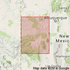
Term Upper Cretaceous Mesaverde Formation (or Group) not used in the Zuni-Salt Lake area, Cibola and Catron Cos, NM in San Juan basin. Most of the rocks in report area are of fluvial origin and are lower or older than Mesaverde. Term Atarque Sandstone applied to lower 97.9 ft and term Moreno Hill Formation (new) applied to upper 500+ to 700+ ft.
Source: GNU records (USGS DDS-6; Denver GNULEX).
- Usage in publication:
-
- Mesaverde Group*
- Modifications:
-
- Not used
Summary:
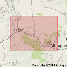
Gallup Sandstone, Crevasse Canyon Formation, and older rocks excluded from Upper Cretaceous Mesaverde Group in west-central NM in southern San Juan basin because their inclusion in Mesaverde extends the term Mesaverde to much older rocks in areas far from where the term was originally defined.
Source: GNU records (USGS DDS-6; Denver GNULEX).
- Usage in publication:
-
- Mesaverde Group*
- Modifications:
-
- Revised
- AAPG geologic province:
-
- San Juan basin
Summary:
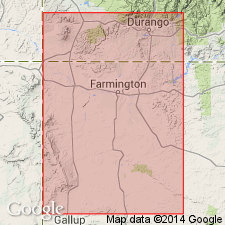
Allison Member of Menefee Formation of Upper Cretaceous Mesaverde Group divided into: lower beds, Juans Lake Beds (newly named), and La Vida Beds (newly named) in west-central San Juan basin.
Source: GNU records (USGS DDS-6; Denver GNULEX).
- Usage in publication:
-
- Mesaverde Group*
- Modifications:
-
- Revised
- AAPG geologic province:
-
- Green River basin
Summary:
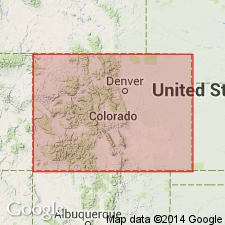
An ash bed, altered to claystone, that lies 0-250 ft above base of the Upper Cretaceous Williams Fork Formation of Mesaverde Group, named Yampa bed for occurrences along Yampa River Valley near Craig, Moffat Co, CO in the Greater Green River basin. The bed is a regionally persistent marker.
Source: GNU records (USGS DDS-6; Denver GNULEX).
- Usage in publication:
-
- Mesaverde Formation
- Modifications:
-
- Overview
- AAPG geologic province:
-
- Orogrande basin
Summary:
Assigned formation rank; divided into the main body and an overlying Ash Canyon Member. Both parts of Mesaverde mapped (geologic map) in east part of area, Sierra Co, NM in the Orogrande basin. Conformably overlies Mancos Shale. Unconformably overlain by Jose Creek Member of McRae Formation. Main body consists of 975 m of buff to brown, fine- to medium-grained, cross-bedded sandstone, gray to brown shale, mudstone, and siltstone; is dominantly sandstone; contains fossil leaves and ammonites (listed); intertongues with Ash Canyon. The Ash Canyon is 34 m thick in report area; consists of conglomerate (of subangular to subround pebbles of chert, quartz, and petrified wood) and medium- to coarse-grained sandstone; is resistant forming hogbacks where dip is steep and mesas where dip is shallow. Of Cretaceous age.
Source: GNU records (USGS DDS-6; Denver GNULEX).
- Usage in publication:
-
- Mesaverde Group*
- Modifications:
-
- Overview
- AAPG geologic province:
-
- Green River basin
Summary:
Is Upper Cretaceous group in Washakie basin, Sweetwater Co, WY and Sand Wash basin, Moffat and Routt Cos, CO (both basins part of Greater Green River basin). [Change in nomenclature of affiliated units occurs within Sand Wash basin due to facies changes from nonmarine to marginal marine strata southeastward.] Approximate geographic boundary of nomenclature change located between gas well (station 6, sec 13, T10N, R94W) and dry oil and gas drillhole (station 7, sec 13, T8N, R93W) in Moffat Co, CO. In northwest area is divided into (ascending): Blair Formation, Rock Springs Formation, Ericson Sandstone, and Almond Formation; Pine Ridge Sandstone shown locally equivalent to Canyon Creek Member (upper member) of Ericson; lower contact not studied; underlies Lewis Shale. In southeast area is divided into (ascending): Iles and Williams Fork Formations; overlies Mancos Shale; underlies Lewis Shale. Late Cretaceous age.
Source: GNU records (USGS DDS-6; Denver GNULEX).
- Usage in publication:
-
- Mesaverde Group*
- Modifications:
-
- Revised
- AAPG geologic province:
-
- Black Mesa basin
Summary:
Areal limits on Black Mesa, AZ, Black Mesa basin of Toreva and Wepo Formations of Upper Cretaceous Mesaverde Group, modified. Newly named Rough Rock Sandstone of Mesaverde Group recognized on north side of mesa. Rough Rock occurs between Wind Rock Tongue (new) of Mancos Shale beneath, and upper carbonaceous member of Wepo Formation, above.
Source: GNU records (USGS DDS-6; Denver GNULEX).
- Usage in publication:
-
- Mesaverde Group, Formation
- Modifications:
-
- Areal extent
- AAPG geologic province:
-
- Piceance basin
GNU Staff, 1988, GNU Staff remark by T.W. Judkins. Use of Mesaverde Group or Formation in southern Piceance basin (oral communication with R.C. Johnson, U.S. Geological Survey, 8-24-88).: U.S. Geological Survey Digital Data Series, DDS-6, 1 CD-ROM., release 3
Summary:
Within subsurface in area of Multiwell Experiment (MWX) located in sec 34, T6S, R94W, Garfield Co, CO, Piceance basin, Mesaverde Group is divided into Iles and Williams Fork Formations. Here Corcoran, Cozzette and Rollins are members of Iles. Mount Garfield and Hunter Canyon Formations of Mesaverde are generally thought to be restricted to area of Book Cliffs of western CO. Part of Erdmann's (1934) definition of Hunter Canyon was that it is a cliff-forming unit and, therefore, may not be a good term in subsurface. There is no consensus on where Mesaverde changes rank from group to formation.
Source: GNU records (USGS DDS-6; Denver GNULEX).
- Usage in publication:
-
- Mesaverde Group*, Formation*
- Modifications:
-
- Overview
- AAPG geologic province:
-
- Piceance basin
Summary:
Nomenclature varies within Piceance basin of western CO. In northern part of basin, fluvial part of Mesaverde Group is divided into (ascending) Iles and Williams Fork Formations. Iles extends from top of underlying Mancos Shale to top of Trout Creek Sandstone Member of Iles; Williams Fork extends from top of Trout Creek to Cretaceous-Tertiary unconformity. Where Trout Creek is absent, base of Cameo-Fairfield coal zone (or equivalent) defines Iles-Williams Fork boundary. In southwestern part of basin, along Book Cliffs, Mesaverde Group is divided into (ascending) Mount Garfield and Hunter Canyon Formations. Mount Garfield extends from top of underlying Sego Sandstone to several hundred feet above Cameo-Fairfield coal zone, where fluvial sandstones of Mesaverde begin to form cliffs; Hunter Canyon extends from base of cliffs to Cretaceous-Tertiary unconformity. In eastern part of basin, along Grand Hogback, Mesaverde is referred to either as a group consisting of Iles and Williams Fork Formations or just as Mesaverde Formation. Measured sections; cross sections. Campanian and Maestrichtian (Late Cretaceous) age.
Source: GNU records (USGS DDS-6; Denver GNULEX).
- Usage in publication:
-
- Mesaverde Group*
- Modifications:
-
- Overview
- AAPG geologic province:
-
- Piceance basin
Summary:
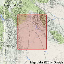
Includes, in ascending order, Corcoran Sandstone, Cozzette Sandstone, and Rollins Sandstone Members of Iles Formation and Williams Fork Formation. Multiwell Experiment (MWX) site is in sec 34, T6S, R94W, Garfield Co, CO, within Rulison gas field in Piceance basin. Mesaverde is about 4200 ft thick. Iles, of late Campanian age, consists of several marine transgressions (represented by tongues of Mancos Shale) and regressions (represented by Corcoran, Cozzette, and Rollins). Corcoran and Cozzette prograded from northwest to southeast across MWX area and undergo facies change into Mancos about 25-30 mi southeast of MWX site. Maximum regression of Rollins (or equivalent Trout Creek Member of Iles) is east of Grand Hogback; Rollins probably prograded from west to east across MWX area. Williams Fork is about 3500 ft thick in MWX area and consists of nonmarine rocks of Campanian and Maestrichtian age. Lower 800 ft of Williams Fork is mostly carbonaceous shale and coal deposited in coastal-plain or delta-plain (paludal) environment. Cameo-Fairfield coal zone, a 450-ft thick interval in lowermost part of Williams Fork, is present in all but northwesternmost part of basin; at MWX site, it contains 80 ft of coal. About 2700 ft of mostly fluvial point-bar and overbank deposits overlie paludal sequence of Williams Fork. Conformably overlies Mancos; unconformably underlies Wasatch Formation. Correlation chart; cross section.
Source: GNU records (USGS DDS-6; Denver GNULEX).
- Usage in publication:
-
- Mesaverde Formation*
- Modifications:
-
- Revised
- AAPG geologic province:
-
- Yellowstone province
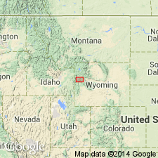
Summary:
Overlies newly named Sohare Formation in Teton Co, WY in Yellowstone province. Is of Late Cretaceous age.
Source: GNU records (USGS DDS-6; Denver GNULEX).
- Usage in publication:
-
- Mesaverde Group*, Formation*
- Modifications:
-
- Areal extent
- AAPG geologic province:
-
- San Juan basin
Summary:
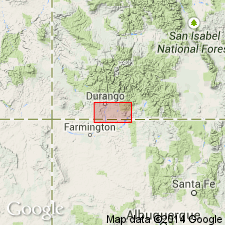
Mapped as Mesaverde Group on five cross sections in the subsurface of southern La Plata Co, CO and northern San Juan Co, NM in the San Juan basin. Is divided into the Point Lookout Sandstone (base), Menefee Formation, and locally the Cliff House Sandstone (top). Lower contact with Upper Cretaceous Mancos Shale is intertonguing. Upper contact with Upper Cretaceous Lewis Shale is intertonguing. The Cliff House intertongues with the Menefee and the Lewis, and at some localities, Cliff House is missing. Where Menefee is missing, Mesaverde cannot be subdivided. At those localities, the term Mesaverde Formation is used. Of Late Cretaceous age.
Source: GNU records (USGS DDS-6; Denver GNULEX).
- Usage in publication:
-
- Mesaverde Group*
- Modifications:
-
- Revised
- AAPG geologic province:
-
- Piceance basin
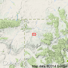
Summary:
Unit previously mapped by author as Ohio Creek? Formation in lower Yellow Creek area, Moffat and Rio Blanco Cos, CO is not used in this report. Most of rocks occupying interval previously assigned to Ohio Creek? are tentatively included as part of Upper Cretaceous Williams Fork Formation of Mesaverde Group.
Source: GNU records (USGS DDS-6; Denver GNULEX).
- Usage in publication:
-
- Mesaverde Group*
- Modifications:
-
- Biostratigraphic dating
- AAPG geologic province:
-
- Piceance basin
Summary:
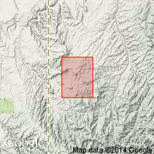
Pollen (genera TRICOLPITES, INTERANGULUS, and LORANTHACITES) recovered near Cretaceous-Tertiary unconformity in NW sec 13, T3S, R103W (USGS paleobotany location D5237-B) indicates Campanian age for Mesaverde (D.J. Nichols, written communication, 1987).
Source: GNU records (USGS DDS-6; Denver GNULEX).
- Usage in publication:
-
- Mesaverde Group*
- Modifications:
-
- Areal extent
- AAPG geologic province:
-
- Uinta basin
Summary:
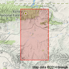
Mesaverde Group in report area, Uinta basin of UT includes (ascending): Star Point Sandstone, Blackhawk Formation, Castlegate Sandstone, and Price River Formation, and the eastward equivalents of the Castlegate and Price River --the Sego Sandstone, Neslen Formation, and the Farrer and Tuscher Formations undivided. All of these units are of Campanian Age, except for the uppermost part of the Farrer and Tuscher undivided which is early Maastrichtian. Cross sections. Stratigraphic chart. Isopach map of Mesaverde Group in the basin shows it increasing in thickness to more than 3,000 ft in western Uintah and eastern Grand Co.
Source: GNU records (USGS DDS-6; Denver GNULEX).
- Usage in publication:
-
- Mesaverde Formation*
- Modifications:
-
- Areal extent
- AAPG geologic province:
-
- Powder River basin
Summary:
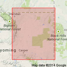
Mesaverde Formation identified in the subsurface of the western and southern Powder River basin (Converse, Niobrara, Johnson, Sheridan, western Campbell Cos, WY and Big Horn Co, MT) where it overlies Steele Shale and underlies Lewis Shale. Is divided into the Parkman Sandstone Member at base, unnamed middle part, and Teapot Sandstone Member at top. Eastward in the basin, the Steele, Mesaverde, and Lewis are replaced by Pierre Shale. The Parkman is the equivalent of the Red Bird Silty Member of the Pierre. Late Cretaceous age. [Shown on many cross sections in this OC series.]
Source: GNU records (USGS DDS-6; Denver GNULEX).
- Usage in publication:
-
- Mesaverde Formation*
- Modifications:
-
- Overview
- AAPG geologic province:
-
- Piceance basin
Summary:
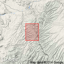
Formation rank used within quad in Rio Blanco Co, CO, Piceance basin. Within northern and eastern parts of basin, the top of Rollins and Trout Creek Sandstone Members is used to define contact between Iles and Williams Fork Formations of Mesaverde Group. However, because Rollins and Trout Creek could not be recognized in quad, Mesaverde is considered to be of formation rank. Thickness is 2,800-3,200 ft.
Source: GNU records (USGS DDS-6; Denver GNULEX).
For more information, please contact Nancy Stamm, Geologic Names Committee Secretary.
Asterisk (*) indicates published by U.S. Geological Survey authors.
"No current usage" (†) implies that a name has been abandoned or has fallen into disuse. Former usage and, if known, replacement name given in parentheses ( ).
Slash (/) indicates name conflicts with nomenclatural guidelines (CSN, 1933; ACSN, 1961, 1970; NACSN, 1983, 2005, 2021). May be explained within brackets ([ ]).

