- Usage in publication:
-
- Home Creek bed
- Modifications:
-
- Original reference
- Dominant lithology:
-
- Limestone
- Clay
- Sandstone
- AAPG geologic province:
-
- Bend arch
- Llano uplift
Summary:
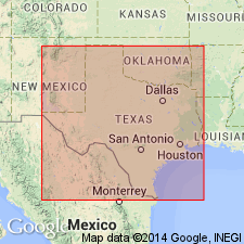
Pg. 387, 398. Home Creek bed in Canyon division. Limestone, 25 to 50 feet thick, friable in upper part, massive blue beds in lower part, and some clay and sandstone; one clay bed 10 to 30 feet thick to north. Is member of Canyon division [Canyon is 3rd from top of 5 Carboniferous divisions of Cummins, 1891]. Overlies Hog Creek bed and underlies Bluff Creek bed. Fossils. Age is Pennsylvanian.
[Named from Home Creek, Coleman Co., Colorado River region, central TX.]
Source: Publication; US geologic names lexicon (USGS Bull. 896, p. 973).
- Usage in publication:
-
- Home Creek limestone member*
- Modifications:
-
- Revised
- AAPG geologic province:
-
- Bend arch
Summary:
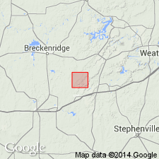
Pg. 30G. Home Creek limestone member of Canyon formation. Is 40 feet thick in Lacasa area. Consists of 3 limestones separated by shales. Is top member of Canyon formation. Replaces Plummer's "Eastland" limestone, which name is preoccupied. Town of Caddo, Stephens Co., central northern Texas, is built on this. [Age is Pennsylvanian.]
Source: US geologic names lexicon (USGS Bull. 896, p. 973).
- Usage in publication:
-
- Home Creek limestone member
- Modifications:
-
- Revised
- AAPG geologic province:
-
- Bend arch
- Fort Worth syncline
Summary:
Pg. 118+; Jour. Geol., v. 30, p. 24, 31, 36. Home Creek limestone, a series of thin limestones 10 to 50 feet thick, forming top member of Caddo Creek formation from Llano Mountains northeast into Young County, Texas; but to northeast of Finis, Jack County, Texas, it can not be traced with certainty, because it changes laterally into calcareous sands. Overlies Hog Creek shale member in both Colorado River and Brazos River valleys. [Age is Pennsylvanian.]
Source: US geologic names lexicon (USGS Bull. 896, p. 973).
- Usage in publication:
-
- Home Creek limestone
- Modifications:
-
- Revised
- AAPG geologic province:
-
- Bend arch
Summary:
Pg. 66 (fig. 1), 88. Home Creek limestone. Rank raised to formation in Caddo Creek group. Redefined to include shales found locally above highest limestone member of Home Creek formation and below disconformity at base of the Cisco. Overlies Hog Creek shale; underlies Gonzales formation. [Age is Late Pennsylvanian.]
Source: US geologic names lexicon (USGS Bull. 1200, p. 1791-1792).
- Usage in publication:
-
- Home Creek limestone
- Modifications:
-
- Areal extent
- AAPG geologic province:
-
- Bend arch
Summary:
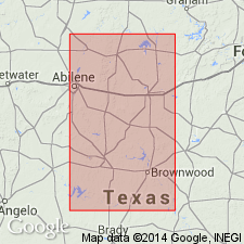
Pg. 20. Home Creek limestone overlies Colony Creek shale (new) which replaces Hog Creek shale. [Age is Late Pennsylvanian.]
Source: US geologic names lexicon (USGS Bull. 1200, p. 1791-1792).
- Usage in publication:
-
- Home Creek limestone member*
- Modifications:
-
- Areal extent
- AAPG geologic province:
-
- Bend arch
Summary:
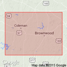
Pg. 51. Home Creek limestone member of Caddo Creek formation. Consists of limestone, light-gray to nearly white, nodular to slabby to thick-bedded, fine-grained, locally cherty; middle part generally marly, contains "seaweed" structures and a few fusulinids. Contains reefs in vicinity of Colorado River. Thickness about 30 feet. Overlies Colony Creek shale member; underlies Bluff Creek shale member of Graham formation. [Age is Late Pennsylvanian.]
Source: US geologic names lexicon (USGS Bull. 1200, p. 1791-1792).
- Usage in publication:
-
- Home Creek limestone member*
- Modifications:
-
- Areal extent
- AAPG geologic province:
-
- Bend arch
Summary:
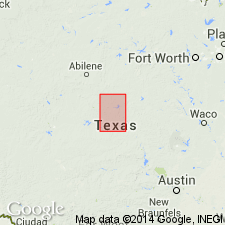
Pg. 67-68, pl. 27. Home Creek limestone member of Caddo Creek formation. Unusual thickening of limestone units in uppermost part of Canyon group near junction of Home Creek and Colorado River has resulted in confusion in correlation with limestone units in Caddo Creek and Brad formations as mapped elsewhere. Drake originally applied term "Home Creek bed" to upper noncherty limestone in walls of creek and name "Cherty bed" to lower massive limestone, which contains abundant nodules of rounded nodules of chert. The chert bearing limestone is now included in Brad formation. Plummer and Moore ([1922], Univ. Texas Bull. 2132) applied name "Home Creek" to prominent limestone at top of Canyon group in Brazos and Colorado River valleys. By tracing this member across northern McCulloch County to the type locality, and by studying stratigraphy of northern Brown County, Nickell (1938, Texas Univ. Bur. Econ. Geol. Pub., no. 3801) found that limestone called Home Creek limestone by most geologists correlated with one higher on the slope than the one to which Drake had originally applied term "Home Creek" at type locality. Drake's Home Creek limestone, he found, was the one that Plummer and Moore had subsequently named Ranger. Other miscorrelations to north have been made in the past. Beds mapped as Home Creek across southern Brown County to outlier of Cretaceous rocks on which town of Bangs is located were mapped as Ranger limestone member of Brad formation (Plummer and Moore, [1922]) north of outlier. Thus, Hog Creek shale of Drake (1893), named for creek north of outlier --in which Bluff Creek shale as used by Cheney (1948, Abilene Geol. Soc. Gdbk., Spring Field Trip, June 11-12) is exposed-- was believed to lie below Plummer and Moore's Home Creek limestone. Actually, Hog Creek shale of Drake lies above the Home Creek. Because of this confusion, Cheney proposed name Colony Creek to replace term Hog Creek. [Age is Pennsylvanian.]
Source: US geologic names lexicon (USGS Bull. 1200, p. 1791-1792).
- Usage in publication:
-
- Home Creek Limestone
- Modifications:
-
- Mapped
- AAPG geologic province:
-
- Bend arch
- Fort Worth syncline
Summary:
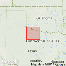
Home Creek Limestone of Canyon Group. Limestone, sandstone, shale, and conglomerate. Thickness 2 to 145 feet. Includes (descending) Salem School Limestone [unranked] and Kisinger Sandstone [unranked]. Fossils. Age is Late Pennsylvanian (Missouri).
Exposed in extreme southeastern Young Co., and in adjacent Jack Co., where it pinches out. [See also adjacent Geol. Atlas Texas sheet Abilene (Barnes, 1972).]
Source: Publication.
For more information, please contact Nancy Stamm, Geologic Names Committee Secretary.
Asterisk (*) indicates published by U.S. Geological Survey authors.
"No current usage" (†) implies that a name has been abandoned or has fallen into disuse. Former usage and, if known, replacement name given in parentheses ( ).
Slash (/) indicates name conflicts with nomenclatural guidelines (CSN, 1933; ACSN, 1961, 1970; NACSN, 1983, 2005, 2021). May be explained within brackets ([ ]).

