


- Usage in publication:
-
- Harpersville formation*
- Modifications:
-
- Original reference
- Dominant lithology:
-
- Shale
- Limestone
- Coal
- AAPG geologic province:
-
- Bend arch
- Llano uplift
Summary:
Pg. 24, 31, 39. Harpersville formation of Cisco group. Chiefly shale, but in Brazos River Valley includes Saddle Creek limestone member at top, Belknap limestone member in middle and Crystal Falls limestone member near base. Thickness 200 to 275 feet. Overlies Breckenridge limestone member of Thrifty formation and underlies Camp Creek shale member of Pueblo formation. Chiefly characterized by presence of coal No. 6, one of most important coals in northern Texas.
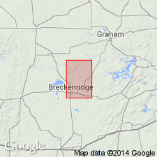
Named from town of Harpersville, 10 mi south of Breckenridge, Stephens Co., central northern TX.
Source: US geologic names lexicon (USGS Bull. 896, p. 913).

- Usage in publication:
-
- Harpersville formation*
- Modifications:
-
- Original reference
- Dominant lithology:
-
- Sandstone
- Limestone
- Shale
- Conglomerate
- Coal
- AAPG geologic province:
-
- Bend arch
- Llano uplift
Summary:
Pg. 160-168 and charts. Harpersville formation of Cisco group. In Colorado River Valley includes all strata between top of Saddle Creek limestone member and base of Waldrip bed of Drake. It consists of basal beds of coarse thick sandstones which grade in places to conglomerates; of middle beds composed of an alternation of fossiliferous buff and yellow-brown limestones, irregularly bedded calcareous sandstones, carbonaceous and ferruginous shales, and thin beds of coal; and of upper beds of a thick, massive coarse persistent sandstone in many places capped by a hard gray limestone (Saddle Creek limestone member). Includes Crystal Falls limestone lentil 40 to 80 feet above base, and Belknap limestone lentil 60 to 80 feet above Crystal Falls limestone. [Age is Pennsylvanian.]
Source: US geologic names lexicon (USGS Bull. 896, p. 913).
- Usage in publication:
-
- Harpersville formation
- Modifications:
-
- Areal extent
- AAPG geologic province:
-
- Bend arch
- Llano uplift
Summary:
Pg. 61-74, 128-132. Harpersville formation of Cisco group. In Brazos River Valley, extends from top of Breckenridge limestone member of Thrifty formation to base of Pueblo formation, and interval of 233 feet. It is part of a chaotic series of thin limestones, relatively thin lenticular sandstone, variegated sandy and clay shales, and thin coals. This complex series of beds, interrupted by unconformities expresses in large and small channels, extends with progressive changes upward beyond limits of Harpersville to middle of Moran formation. Formation comprises (ascending) unnamed limestone and shale interval, Crystal Falls limestone, unnamed shale interval. "Upper Crystal Falls limestone," unnamed shale and limestone interval, Belknap limestone, unnamed interval, and Saddle Creek limestone. In Colorado River Valley, includes Waldrip bed of Drake and Saddle Creek limestone member. Thickness 238 feet. Overlies Thrifty formation; underlies Pueblo formation. [Age is Late Pennsylvanian.]
Source: US geologic names lexicon (USGS Bull. 1200, p. 1682-1683).

- Usage in publication:
-
- Harpersville formation†
- Modifications:
-
- Abandoned
- AAPG geologic province:
-
- Bend arch
Summary:
Pg. 66 (fig. 1), 91. †Harpersville formation. Term abandoned. Pennsylvanian-Permian boundary is placed at disconformity in Harpersville formation. This boundary is 40 to 150 feet below Saddle Creek limestone. Harpersville beds below boundary are assigned to Obregon (new) and Chaffin formation of Thrifty group; those above the systemic boundary to Saddle Creek formation of expanded Pueblo group.
Source: US geologic names lexicon (USGS Bull. 1200, p. 1682-1683).
- Usage in publication:
-
- Harpersville formation
- Modifications:
-
- Revised
- AAPG geologic province:
-
- Bend arch
Summary:
Pg. 5-23. Harpersville formation. Three clays, Quinn, Curry, and Craddock, named in this report. The Quinn is described as next to lowest clay in the Harpersville as defined in report and map by Plummer and Moore [1922]. Curry clay occurs between upper and lower layers of Crystal Falls limestone. [Age is Pennsylvanian.]
Source: US geologic names lexicon (USGS Bull. 1200, p. 1682-1683).
- Usage in publication:
-
- Harpersville formation
- Modifications:
-
- Areal extent
- AAPG geologic province:
-
- Bend arch
Summary:
Pg. 21-26, pl. 1. Discussion of lower part of Harpersville formation in Stephens County, central northern Texas. Here includes (ascending) Quinn clay, Crystal Falls limestone, and Curry clay members. [Age is Pennsylvanian.]
Source: US geologic names lexicon (USGS Bull. 1200, p. 1682-1683).

- Usage in publication:
-
- Harpersville Formation
- Modifications:
-
- Mapped 1:250k
- Dominant lithology:
-
- Mudstone
- Coal
- Limestone
- Sandstone
- AAPG geologic province:
-
- Bend arch
Summary:
Harpersville Formation of Cisco Group. Mudstone, coal, limestone, sandstone. Includes (descending) Waldrip Shale, Crystal Falls Limestone and equivalent Chaffin Limestone, Curry Clay, Quinn Clay, and Breckenridge Limestone [all unranked]. Thickness 175 to 210 feet, thickens northward. Underlies Pueblo Formation and overlies Thrifty and Graham Formations [undifferentiated], all of Cisco Group. Age is Late Pennsylvanian to Early Permian (Virgilian to Wolfcampian). [Earlier workers placed Breckenridge at top of Thrifty Formation.]
Source: Publication.

- Usage in publication:
-
- Harpersville Formation
- Modifications:
-
- Revised
- Mapped 1:250k
- Dominant lithology:
-
- Mudstone
- Sandstone
- Siltstone
- Limestone
- AAPG geologic province:
-
- Bend arch
Summary:
Harpersville Formation of Cisco Group. [Mostly] mudstone, sandstone, and siltstone. Mudstone, gray, tan, maroon, greenish-gray, locally silty and gypsiferous; thin, very fine sandstone and siltstone beds throughout, tan to white, calcareous, ripple-marked. Includes Breckenridge Limestone [unranked], 1 to 3.5 feet thick, at base. Terminated by stratigraphic cutoff immediately north of southern border of area shown on Wichita Falls-Lawton sheet; best exposed in area depicted on adjacent Abilene sheet. Thickness of Harpersville Formation (revised) 150 to 160 feet. Underlies Pueblo Formation and overlies Thrifty and Graham Formations [undifferentiated], all of Cisco Group. Equivalent to part of Markley Formation of Bowie Group. Age is Late Pennsylvanian to Early Permian (Virgilian to Wolfcampian).
Source: Publication.
For more information, please contact Nancy Stamm, Geologic Names Committee Secretary.
Asterisk (*) indicates published by U.S. Geological Survey authors.
"No current usage" (†) implies that a name has been abandoned or has fallen into disuse. Former usage and, if known, replacement name given in parentheses ( ).
Slash (/) indicates name conflicts with nomenclatural guidelines (CSN, 1933; ACSN, 1961, 1970; NACSN, 1983, 2005, 2021). May be explained within brackets ([ ]).