The National Geologic Map Database is migrating to a new infrastructure. We apologize for any service disruptions during this process.
|
|---|


- Usage in publication:
-
- Greenhorn limestone*
- Modifications:
-
- Original reference
- Dominant lithology:
-
- Limestone
- Shale
- AAPG geologic province:
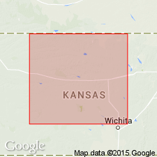
-
- Denver basin
Summary:
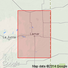
Pg. 564. Greenhorn limestone. Limestone beds, 3 to 12 inches thick, separated by somewhat thicker shale beds. Thickness of formation 25 to 40 feet. Middle formation of Benton group in Arkansas Valley region, Colorado. Underlies Carlile shale and overlies Graneros shale.
Named from Greenhorn Station, 14 mi south of Pueblo, CO, and for Greenhorn Creek [Pueblo Co., Pueblo and Walsenburg quadrangles].
Source: US geologic names lexicon (USGS Bull. 896, p. 870).
- Usage in publication:
-
- Greenhorn limestone*
- Modifications:
-
- Revised
- AAPG geologic province:
-
- Central Kansas uplift
Summary:
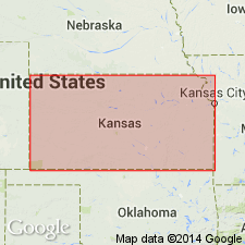
Pg. 45-50. Greenhorn limestone. In western Kansas, subdivided into four members (ascending): Lincoln limestone, unnamed member, Jetmore chalk (new), and unnamed member. Thickness about 100 feet. Overlies Graneros shale; underlies Fairport chalky shale member (new) of Carlile shale. Fossiliferous (many INOCERAMUS LABIATUS). Age is Late Cretaceous.
Source: US geologic names lexicon (USGS Bull. 1200, p. 1601-1602); supplemental information from GNU records (USGS DDS-6; Denver GNULEX).
- Usage in publication:
-
- Greenhorn limestone*
- Modifications:
-
- Revised
- AAPG geologic province:
-
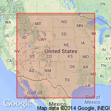
- Anadarko basin
- Central Kansas uplift
Summary:
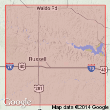
Pg. 31-35, 66-71. Greenhorn limestone. In Ellis County comprises (ascending) Lincoln limestone, Hartland shale (new), Jetmore chalk, and Pfeifer shale (new) members; total thickness about 100 feet. In Hamilton County, comprises (ascending) Lincoln limestone, Hartland shale, and Bridge Creek limestone (new) members; total thickness 130 feet. Overlies Graneros shale; underlies Fairport chalky shale member of Carlile shale. Age is Late Cretaceous.
Source: US geologic names lexicon (USGS Bull. 1200, p. 1601-1602); supplemental information from GNU records (USGS DDS-6; Denver GNULEX).

- Usage in publication:
-
- Greenhorn limestone*
- Modifications:
-
- Overview
Summary:
Greenhorn limestone of Colorado group. Recognized in eastern Colorado and Wyoming, southeastern Montana, Nebraska, South Dakota, Kansas, and northeastern New Mexico. Age is Late Cretaceous.
The Niobrara and Benton are not now [ca. 1938] treated as groups, the broader term Colorado group, which includes them both, being considered the more useful group name. Where the Niobrara deposits and Benton deposits are not subdivided, they are called Niobrara limestone and Benton shale, respectively.
Source: US geologic names lexicon (USGS Bull. 896, p. 870).
- Usage in publication:
-
- Greenhorn formation*
- Modifications:
-
- Areal extent
- Biostratigraphic dating
- AAPG geologic province:
-
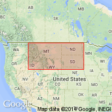
- Powder River basin
- Williston basin
Summary:
Pg. 2183-2187, 2197 (fig. 2). Greenhorn formation. Formations in Black Hills that are equivalent to Colorado shale of central and northwestern Montana are (ascending) Fall River sandstone, Skull Creek shale, Newcastle sandstone, Mowry shale, Belle Fourche shale, Greenhorn formation, Carlile shale, and Niobrara formation. Greenhorn formation is largely a light-gray calcareous mudstone with interbedded calcareous marl. Attains maximum known thickness of 360 feet on east flank of Colony-Albion anticline in E/2 sec. 9, T. 57 N., R. 61 W., Crook County, Wyoming. In Carter County, Montana, formation thins sharply to 180 feet or less and, in addition, becomes less calcareous. At some localities base is a buff shaly limonitic limestone, averaging a foot in thickness (= Middle Creek limestone of Wing, 1940; Orman Lake limestone of Petsch, 1949; Bull Creek sandy limestone of Moore, 1949). Overlies Belle Fourche shale; underlies Carlile shale. Age is Late Cretaceous [mid-Cenomanian to early Turonian]; DUNVEGANOCERAS PONDI-METOICOCERAS PRAECOX zone to WATINOCERAS REESIDEI-INOCERAMUS LABIATUS zone. Report includes faunal lists.
Source: Publication; US geologic names lexicon (USGS Bull. 1200, p. 1601-1602).
- Usage in publication:
-
- Greenhorn calcareous member*
- Modifications:
-
- Revised
- Areal extent
- Dominant lithology:
-
- Shale
- AAPG geologic province:
-
- Powder River basin
Summary:
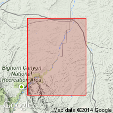
(W.A. Cobban.) Greenhorn calcareous member of Cody shale of Colorado group. In Bighorn River Canyon-Hardin area, Big Horn and Yellowstone Counties, Montana, the Greenhorn is classed as calcareous member of Cody shale. Cconsists of calcareous shale with limestone concretions; includes gray limonite bentonite bed at base. Thickness 97 feet. Overlain by Carlile shale member of Cody. Age is Late Cretaceous.
Measured section: on east flank of Soap Creek dome, in SW/4 sec. 36, T. 6 S., R. 32 E., Crow Indian Reservation, Big Horn Co., MT.
Source: Publication; US geologic names lexicon (USGS Bull. 1200, p. 1601-1602).
- Usage in publication:
-
- Greenhorn formation
- Modifications:
-
- Revised
- Areal extent
- AAPG geologic province:
-
- Williston basin
Summary:
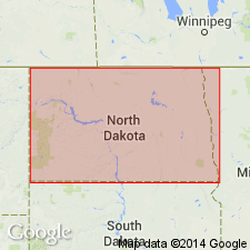
Pg. 14-15 (table 2), 28-29, pl. Greenhorn formation of Colorado group. In subsurface of North Dakota consists of dark-gray, calcareous, soft shale with thin beds of very shaly limestone. Thickness 120 to 150 feet. Overlies Belle Fourche formation of Colorado group. Fossiliferous (GLOBIGERINA, INOCERAMUS). Age is Late Cretaceous.
Described from Stanolind Oil and Gas Company McLean County well No. 1, depth-interval 2780 to 2920 feet, in sec. 28, T. 150 N., R. 80 W. (No. 46); [approx. Lat. 47 deg. 46 min. 57 sec. N., Long. 100 deg. 54 min. 54 sec., Ruso 7.5-min quadrangle, McLean Co., central ND (from Montana State Univ. Graphical Locator, accessed January 13, 2011)].
Source: Publication.
- Usage in publication:
-
- Greenhorn formation*
- Modifications:
-
- Revised
- AAPG geologic province:
-
- Powder River basin
- Williston basin
Summary:
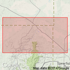
Shows outcrop in northern Black Hills, Butte Co, SD, Crook CO, WY, and Carter Co, MT in Williston and Powder River basins. Contains a bentonite bed, referred to as bed G, 55 to 60 ft above base in areas east of the Little Missouri River in Carter Co, MT; eastern Crook Co, WY; and western Butte Co, SD. Contact with the underlying Belle Fourche shale rises stratigraphically eastward, and east of the Little Missouri River, bed G passes into the Belle Fourche shale. Thickness 3-6 ft. Gives results of tests of the bentonite for use as sand bonding clay and drilling mud. Underlain conformably by Belle Fourche shale; overlain by Carlile formation. Late Cretaceous in age.
Source: GNU records (USGS DDS-6; Denver GNULEX).

- Usage in publication:
-
- Greenhorn limestone*
- Greenhorn formation*
- Greenhorn limestone member*
- Greenhorn calcareous member
- Modifications:
-
- Areal extent
- AAPG geologic province:
-
- Anadarko basin
- Central Kansas uplift
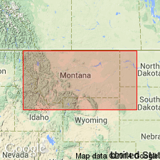
- Central Montana uplift
- Las Vegas-Raton basin
- Powder River basin
- San Juan basin
- Sioux uplift
Summary:
ADDITIONAL REFERENCES FOR THE GREENHORN (1936-1960):
Source: US geologic names lexicon (USGS Bull. 1200, p. 1601-1602).
- Usage in publication:
-
- Greenhorn Limestone*
- Modifications:
-
- Areal extent
- AAPG geologic province:
-
- Central Montana uplift
Summary:
The USGS currently [ca. 1966] classifies the Greenhorn Limestone as a member of the Colorado Shale in the Cleveland quadrangle, Blaine County, Montana, on the basis of a study now in progress.
Source: US geologic names lexicon (USGS Bull. 1200, p. 1601-1602).
- Usage in publication:
-
- Greenhorn Limestone*
- Modifications:
-
- Principal reference
- Dominant lithology:
-
- Shale
- Limestone
- Bentonite
- AAPG geologic province:
-
- Denver basin
Summary:
Pg. 5 (table 1), 14-25. Greenhorn Limestone. Thickness 153 feet. Includes (ascending) Lincoln Limestone, Hartland Shale, and Bridge Creek Limestone Members. At type locality, Gilbert's (1896) Greenhorn applied only to 57-foot-thick Bridge Creek Limestone Member. Underlies Fairport Chalky Shale Member of Carlile Shale and overlies Graneros Shale. Age is Late Cretaceous (Cenomanian and Turonian).
Principal reference section: at Rock Canyon anticline, a few mi west of Pueblo, in SW/4 sec. 30, T. 20 S., R. 65 W., and in NW/4 NE/4 sec. 36, T. 20 S., R. 66 W., Pueblo Co., CO.
Source: Publication.
- Usage in publication:
-
- Greenhorn Limestone*
- Modifications:
-
- Overview
- AAPG geologic province:
-
- Anadarko basin
- Central Kansas uplift
- Salina basin
Summary:
Greenhorn Limestone. In Kansas, includes (descending) Bridge Creek Limestone Member (Pfeifer Shale and Jetmore Chalk Members in northeast exposures), Hartland Shale Member, and Lincoln Limestone Member. Exposed in a northeast-trending belt from Ford County, north of Arkansas River, into Republic and Washington Counties, at Nebraska line. Consists mostly of dark colored, impure shaly chalk. Thickness 68.5 to 135.9 feet, averaging 94.8 feet for 11 measured sections. Age is Late Cretaceous (late Cenomanian to early Turonian), based on fossils (ammonites, bivalves, gastropods, brachiopods, cirripeds, foraminifers).
Publication provides thorough synthesis of stratigraphic, lithologic, and paleontologic data gathered from all areas of Kansas outcrop.
Source: Publication.
- Usage in publication:
-
- Greenhorn Limestone*
- Modifications:
-
- Biostratigraphic dating
- Geochronologic dating
- AAPG geologic province:
-
- Powder River basin
Summary:
Greenhorn Limestone. Sample collected from marker bentonite bed within the ACANTHOCERAS AMPHIBOLUM ammonite zone, at base of Greenhorn Limestone [=basal Lincoln Limestone Member of CO,KS,NM,OK], in SE/4 NW/4 sec. 14, T. 36 N., R. 62 W., Niobrara Co., WY, yielded a K-Ar age on biotite of 92.1 +/-0.9 Ma (Late Cretaceous; Cenomanian).
Source: Modified from GNU records (USGS DDS-6; Denver GNULEX).
- Usage in publication:
-
- Greenhorn Formation*
- Modifications:
-
- Revised
- AAPG geologic province:
-
- Williston basin
Summary:
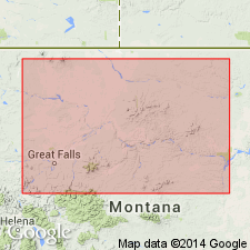
Greenhorn Formation. Extended into north-central and central Montana, where it includes the basal Mosby Sandstone Member (formerly part of †Warm Creek Shale; herein abandoned) and an upper unnamed calcareous shale member. The Mosby Sandstone Member correlates with the "Phillips sand" (economic term) of subsurface usage.
Source: Changes in stratigraphic nomenclature, 1975 (USGS Bull. 1422-A, p. A16-A17, A66-A67).
- Usage in publication:
-
- Greenhorn Formation*
- Modifications:
-
- Revised
- AAPG geologic province:
-
- Williston basin
- Sweetgrass arch
- Central Montana uplift
Summary:
Pg. H99. Greenhorn Formation. Restricted in central Montana. Mosby Sandstone Member transferred to underlying Belle Fourche Shale. Greenhorn Formation as now restricted consists primarily of calcareous shale and limestone, whereas the Belle Fourche is mainly noncalcareous shale with minor siltstone and sandstone, particularly in the upper part. Age is Late Cretaceous.
Source: Stratigraphic notes, 1980-1982 (USGS Bull. 1529-H).
- Usage in publication:
-
- Greenhorn Formation*
- Modifications:
-
- Biostratigraphic dating
- AAPG geologic province:
-
- Powder River basin
Summary:
Pg. 2-3, 5-8. Greenhorn Formation, depth-interval 163 to 250 m, USGS borehole in Osage oil field on west flank of Black Hills uplift, in SW/4 NW/4 sec. 30, T. 46 N., R. 63 W., Weston Co., eastern WY. Mostly calcareous shale with thin limestone beds. Lies below Pool Creek Member of Carlile Shale and above Belle Fourche Shale. Includes ACANTHOCERAS AMPHIBOLUM zone to MYTILOIDES MYTILOIDES zone. Age is Late Cretaceous (Cenomanian and Turonian). Boundary between middle and upper Cenomanian probably near 240 m; between Cenomanian and Turonian seems best placed at about 180 m; between lower and middle Turonian lies near top of Greenhorn, probably at about 168 m.
Source: Publication.
- Usage in publication:
-
- Greenhorn Formation*
- Modifications:
-
- Biostratigraphic dating
- AAPG geologic province:
-
- Williston basin
- Powder River basin
Summary:
Greenhorn Limestone (Colorado, New Mexico), Greenhorn Formation (Montana, New Mexico, South Dakota, Wyoming), and Greenhorn Limestone Member of Cody Shale (Montana). [Describes middle and late Cenomanian ammonites EUCALYCOCERAS PENTAGONUM (Jukes-Browne), E. TEMPLETONENSE Cobban, n. sp., PSEUDOCALYCOCERAS ANGOLAENSE (Spath), SUMITOMOCERAS CONLINI Wright and Kennedy, S. BENTONIANUM (Cragin), NEOCARDIOCERAS JUDDII (Barrois and de Guerne), N. DENSICOSTATUM Cobban, n. sp., N. UPTONENSE Cobban, n. sp., N. MINUTUM Cobban, n. sp., collected from the Greenhorn at principal reference section and several other localites in Western Interior region.]
Source: Publication.
- Usage in publication:
-
- Greenhorn Limestone*
- Greenhorn Limestone Member*
- Modifications:
-
- Age modified
- Biostratigraphic dating
- AAPG geologic province:
-
- Anadarko basin
- Central Kansas uplift
- Denver basin
- Las Animas arch
- Salina basin
- Sierra Grande uplift
Summary:
Greenhorn Limestone (Colorado, Kansas, Minnesota, New Mexico) and Greenhorn Limestone Member of Cody Shale (Montana). [Describes early Turonian ammonites WATINOCERAS REESIDEI Warren, W. COLORADOENSE (Henderson), W. THOMPSONENSE Cobban, n. sp., W. DEVONENSE FLEXUOSUM Cobban, n. subsp., and W. HATTINI Cobban, n. sp., collected from the Greenhorn at principal reference section and several other localites in Western Interior region.]
Source: Publication.
For more information, please contact Nancy Stamm, Geologic Names Committee Secretary.
Asterisk (*) indicates published by U.S. Geological Survey authors.
"No current usage" (†) implies that a name has been abandoned or has fallen into disuse. Former usage and, if known, replacement name given in parentheses ( ).
Slash (/) indicates name conflicts with nomenclatural guidelines (CSN, 1933; ACSN, 1961, 1970; NACSN, 1983, 2005, 2021). May be explained within brackets ([ ]).