

- Usage in publication:
-
- Glen Canyon group*
- Modifications:
-
- Overview
- AAPG geologic province:
-
- Paradox basin
Summary:
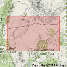
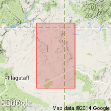
In San Rafael Swell, Emery County, Utah (Paradox basin), Glen Canyon group is divided into three units. Massive sandstone at base called Wingate sandstone. Middle thin-bedded red shale, lenticular sandstone, and limestone assigned to Todilto(?) formation, though correlation from San Rafael Swell to northwest New Mexico uncertain. Massive sandstone at top called Navajo sandstone. Age is Jurassic(?).
Source: GNU records (USGS DDS-6; Denver GNULEX).
- Usage in publication:
-
- Glen Canyon group*
- Modifications:
-
- Named
- Dominant lithology:
-
- Sandstone
- Shale
- Limestone
- AAPG geologic province:
-
- Plateau sedimentary province
- Paradox basin
- Black Mesa basin
- Great Basin province
Summary:
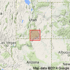
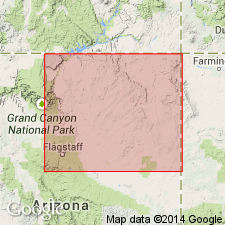
Glen Canyon group. Rocks previously thought to occupy same stratigraphic position as the La Plata group, but recognized now as only partly equivalent to the La Plata. Name Glen Canyon introduced to avoid confusion. Separated into (ascending) Wingate sandstone, a massive cross-bedded, cliff-making sandstone at base; Todilto(?) formation, a thin-bedded calcareous sandstone, shale, and thin, dense limestone; and Navajo sandstone, a massive cross-bedded, cliff-making sandstone at top. Rocks assigned to Glen Canyon extend across southern Utah, and east to La Plata Mountains of Colorado (Paradox basin), Navajo County, Arizona (Plateau sedimentary province and Black Mesa basin), and Muddy and Spring Valley Mountains of Nevada (Great Basin province). Ranges from less than 600 feet to more than 2,000 feet thick. Eroded to spectacular canyons, ridges, and other topographic forms. Unconformably overlies Chinle formation. Underlies Carmel formation. Age is Jurassic(?). Report includes geologic map, stratigraphic charts, cross sections.
Type locality not specifically designated. Named from exposures in the walls that form the Glen Canyon of the Colorado River, a canyon that stretches from north of Lees Ferry, Coconino Co., AZ, to north of the intersection of the Colorado with the San Juan River in San Juan Co., UT.
Source: Modified from GNU records (USGS DDS-6; Denver GNULEX).
- Usage in publication:
-
- Glen Canyon group*
- Modifications:
-
- Revised
- AAPG geologic province:
-
- San Juan basin
- Black Mesa basin
- Plateau sedimentary province
Summary:
Glen Canyon group revised to include (ascending) the Wingate sandstone (at base), Kayenta formation (new), and Navajo sandstone (at top). Name Kayenta replaces earlier uses of Todilto limestone. Group mapped in west half of geologic map: in San Juan County, Utah (San Juan basin); Navajo County, Arizona (Black Mesa basin); and in Coconino County, Arizona (Plateau sedimentary province). Overlies Chinle formation; underlies Carmel formation. Age is Jurassic(?). Report includes cross section, stratigraphic column.
Source: GNU records (USGS DDS-6; Denver GNULEX).
- Usage in publication:
-
- Glen Canyon group*
- Modifications:
-
- Revised
- AAPG geologic province:
-
- Great Basin province
- Plateau sedimentary province
Summary:
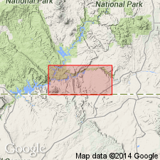
The Kayenta formation and the Navajo sandstone of the Glen Canyon group intertongue in southern Utah and northern Arizona. In the Cedar City area, Kane County, Utah, in Great Basin province, the sequence described consists of (ascending): lower part of the Kayenta, Shurtz sandstone tongue (named) of the Navajo, Cedar City tongue (named) of the Kayenta, and the main body of the Navajo. In the Kanab area, Kane County, Utah, and Coconino County, Arizona, in Plateau sedimentary province, the sequence described consists of the Lamb Point tongue (first used) of the Navajo, Tenney Canyon tongue (first used) of the Kayenta, and the main body of the Navajo. Age of Kayenta is Jurassic(?). Age of Navajo is Jurassic and Jurassic(?). [No stratigraphic figures.]
Source: GNU records (USGS DDS-6; Denver GNULEX).
- Usage in publication:
-
- Glen Canyon group*
- Modifications:
-
- Areal extent
- AAPG geologic province:
-
- Black Mesa basin
- Paradox basin
- Plateau sedimentary province
- San Juan basin
Summary:
Pg. 3 (fig. 2), 5-53, pls. 1, 2. Glen Canyon group. Described in Navajo country. Overlies Chinle formation; contact lies between Gregory's (USGS Prof. Paper 93, 1917) "A" and "B" divisions of the Chinle. This reassignment of the Chinle "A" is based upon intertonguing between Wingate sandstone and Chinle "A" in several areas. Underlies various units of San Rafael group-Entrada sandstone, Carmel formation, or Entrada and Carmel undifferentiated. In Kachina Point and Navajo Creek areas, Coconino County, northeastern Arizona, includes (ascending) Wingate sandstone, Moenave formation, Kayenta formation, and Navajo sandstone; in Fort Wingate area, San Juan County, northwestern New Mexico, includes only Wingate sandstone (Lukachukai member). Age is Late Triassic to Early Jurassic.
Source: Publication; US geologic names lexicon (USGS Bull. 1200, p. 1519-1520).
- Usage in publication:
-
- Glen Canyon group*
- Modifications:
-
- Age modified
- Biostratigraphic dating
Summary:
Reappraisal of paleontologic and stratigraphic evidence warrants a change in age assignment of two of the formations of the Glen Canyon group. Age of Kayenta is changed from Early Jurassic(?) to Late Triassic(?). Age of Navajo sandstone is changed from Jurassic and Jurassic(?) to Late Triassic(?) and Jurassic. Fossils identified from: (1) Moenave formation (Late Triassic holostean fish, crocodile); (2) Kayenta formation (carnivorous dinosaur, fresh-water pelecypods, tritylodont reptile); and (3) Navajo sandstone (fern leaves, wood, crustaceans, and carnivorous dinosaur fossils).
Source: GNU records (USGS DDS-6; Denver GNULEX).
- Usage in publication:
-
- Glen Canyon group*
- Modifications:
-
- Revised
- AAPG geologic province:
-
- Plateau sedimentary province
Summary:
Contact between the Glen Canyon and San Rafael groups modified in report area, which extends from Kane County, Utah, south into Coconino County, Arizona (Plateau sedimentary province). The red-brown sandstone and siltstone tongue above the main body of the Navajo sandstone is newly named Judd Hollow tongue of Carmel formation of San Rafael group. This is overlain by a gray to white to red-brown, fine-grained to very fine-grained, quartzose, silty, tangentially cross-bedded sandstone newly named Thousand Pockets tongue of the Navajo sandstone of the Glen Canyon group. Glen Canyon group also includes Moenave (and its Dinosaur Canyon and Springdale sandstone members) and Kayenta formation. Age of the Moenave, at base, is classified as Triassic(?), the Kayenta as Jurassic(?), and the Navajo as Jurassic(?) and Jurassic. Report includes measured sections, geologic map, columnar section.
Source: Modified from GNU records (USGS DDS-6; Denver GNULEX).
- Usage in publication:
-
- Glen Canyon Sandstone*
- Modifications:
-
- Areal extent
- AAPG geologic province:
-
- Green River basin
- Uinta uplift
Summary:
Name Glen Canyon Sandstone applied to the thick sandstones overlying Chinle Formation in Uinta Mountains, northeastern Utah, and Dinosaur National Monument area, northwestern Colorado. Previously called Nugget or Navajo.
Source: Publication.
- Usage in publication:
-
- Glen Canyon Group*
- Modifications:
-
- Areal extent
- AAPG geologic province:
-
- Great Basin province
Summary:
The part of the stratigraphic section in southwestern Utah, and southern Nevada (Great Basin province), formerly considered to be part of the Chinle Formation is correlated with and reassigned to the Moenave and Kayenta Formations of the Glen Canyon Group. The Chinle-Glen Canyon contact is an erosional surface that marks a hiatus in southwestern Utah, and southern Nevada, that is occupied to the east by the Owl Rock and Church Rock Members of the Chinle. Age is Triassic and Jurassic.
Source: GNU records (USGS DDS-6; Denver GNULEX).
- Usage in publication:
-
- Glen Canyon Group*
- Modifications:
-
- Areal extent
- Overview
- AAPG geologic province:
-
- San Juan basin
Summary:
Upper contact of Glen Canyon Group revised in the Gallup-Grants area, McKinley County, New Mexico (San Juan basin). The eolian sandstone previously assigned to the Lukachukai Member of the Wingate Sandstone is reassigned to the overlying Iyanbito Member (new) of the Entrada Sandstone of the San Rafael Group. Rocks were erroneously considered to be Wingate, the basal formation of the Glen [Canyon] Group to the west.
Source: Modified from GNU records (USGS DDS-6; Denver GNULEX).
- Usage in publication:
-
- Glen Canyon Group*
- Modifications:
-
- Revised
- Overview
- AAPG geologic province:
-
- Plateau sedimentary province
- Black Mesa basin
- Great Basin province
Summary:
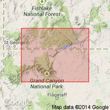
In southwest Utah and northwest Arizona (Plateau sedimentary and Great Basin provinces), the Glen Canyon Group is divided into (ascending): Moenave Formation, Kayenta Formation, and Navajo Sandstone. In northeast Arizona (Black Mesa basin), the Glen Canyon is divided into (ascending): Wingate Sandstone, Kayenta Formation, and Navajo Sandstone. Upper two formations do not extend far into the San Juan basin of northwest New Mexico. Navajo Sandstone stratigraphically restricted in this report. Part is reallocated to Page Sandstone (new) of San Rafael Group. Near Page, Arizona, the Page Sandstone is divisible into Harris Wash Tongue (new) and Thousand Pockets Tongue (formerly a member of Navajo). Temple Cap Sandstone removed from Navajo, raised to formation rank, and assigned to San Rafael Group. Age of Glen Canyon Group is tentatively Early Jurassic (Sinemurian, Pliensbachian, and Toarcian), based on Early Jurassic palynomorphs identified from Whitmore Point Member, middle member of Moenave. [Late Triassic and Jurassic age is retained by USGS]. Report includes correlation chart, cross sections.
Source: Modified from GNU records (USGS DDS-6; Denver GNULEX).
- Usage in publication:
-
- Glen Canyon Sandstone*
- Modifications:
-
- Mapped 1:24k (Moffat Co, CO)
- Dominant lithology:
-
- Sandstone
- AAPG geologic province:
-
- Green River basin
Summary:
Glen Canyon Sandstone mapped in southwest Moffat County, Colorado (Greater Green River basin). Unconformably overlies Chinle Formation (Upper Triassic); unconformably underlies Carmel Formation (Middle Jurassic). Described as pink, light-gray, and buff, moderately resistant, prominently cross-bedded, medium- to thick-bedded, fine- to medium-grained sandstone. In this and nearby quadrangles, the formation has been called the Navajo Sandstone, but as it may not be entirely correlative with the Navajo, the name Glen Canyon now is used (Mac Lachlan, 1957; Poole and Stewart, 1964). The Glen Canyon also is correlated with the Nugget Sandstone of Wyoming (Pipiringos and O'Sullivan, 1975; Picard, 1975). Most workers consider the Glen Canyon and its correlatives to be of Early Jurassic age. The Glen Canyon appears to be conformable with the underlying Chinle Formation but regionally is unconformable according to Pipiringos and O'Sullivan (1977). Thickness estimated at about 200 m (650 feet). The formation thins eastward and pinches out in the subsurface along the eastern boundary of Moffat County, Colorado, due to erosional beveling beneath the chert pebble unconformity (Pipiringos and O'Sullivan, 1975, 1977). The unit thickens west of the mapped area (Kinney, 1955). Age is Late Triassic and Early Jurassic.
Source: GNU records (USGS DDS-6; Denver GNULEX).
- Usage in publication:
-
- Glen Canyon Group*
- Modifications:
-
- Age modified
- Revised
- AAPG geologic province:
-
- Black Mesa basin
- San Juan basin
Summary:
Lower boundary of Glen Canyon Group modified in area south of Laguna Creek around the Defiance uplift in northeast Arizona (Black Mesa basin), and in northwest New Mexico (San Juan basin). South of Laguna Creek, the Rock Point Member, formerly the basal member of the Wingate Sandstone of the Glen Canyon Group, is reassigned to the Chinle Formation as the upper member. Rock Point's geographic distribution, depositional environment, lithology, bedding, and sedimentary characteristics is similar to Chinle, but not to the cliff-forming, eolian sandstone of the Wingate, as restricted in this report. Term Lukachukai, previously applied to the eolian sandstone, is abandoned in favor of Wingate (restricted). Age of Wingate is Early Jurassic, following age assigned by majority of current workers to rocks of the Glen Canyon Group. Report includes cross section.
Source: Modified from GNU records (USGS DDS-6; Denver GNULEX).
- Usage in publication:
-
- Glen Canyon Group
- Modifications:
-
- Age modified
- AAPG geologic province:
-
- Plateau sedimentary province
Summary:
Horn-like scutes have been found in the Kayenta Formation at several localities in the Rock Head quadrangle, Coconino County, Arizona, in the Plateau sedimentary province, that match an obscure ornithisician dinosaur from the Early Jurassic of southwest England. These scutes [pictured] belonged to SCELIDOSAURUS. Possible late Hettangian or Sinemurian age suggested for lower part of the Kayenta. Along with palynomorphs in the Moenave Formation and magnetostratigraphic studies, the Early Jurassic age assignment for several parts of the group, is assigned to the entire Glen Canyon Group. Age of formations of the Glen Canyon are thought to be as follows: Wingate is Hettangian; Moenave is Hettangian and Sinemurian; Kayenta is Sinemurian and Pliensbachian; Navajo is Pliensbachian or Toarcian --all are part of Early Jurassic. [Members of formations in Glen Canyon Group not discussed.]
Source: GNU records (USGS DDS-6; Denver GNULEX).
For more information, please contact Nancy Stamm, Geologic Names Committee Secretary.
Asterisk (*) indicates published by U.S. Geological Survey authors.
"No current usage" (†) implies that a name has been abandoned or has fallen into disuse. Former usage and, if known, replacement name given in parentheses ( ).
Slash (/) indicates name conflicts with nomenclatural guidelines (CSN, 1933; ACSN, 1961, 1970; NACSN, 1983, 2005, 2021). May be explained within brackets ([ ]).