The National Geologic Map Database is migrating to a new infrastructure. We apologize for any service disruptions during this process.
|
|---|


- Usage in publication:
-
- Glance conglomerate*
- Modifications:
-
- Named
- Dominant lithology:
-
- Conglomerate
- AAPG geologic province:
-
- Pedregosa basin
Summary:
Pg. 56, 57+. Glance conglomerate, basal formation of Bisbee group. Distinctly bedded red-brown conglomerate, 50 to 75 feet thick. Age is Early Cretaceous (Comanchean) in Bisbee quadrangle. Rests unconformably on pre-Cambrian Pinal schist. Overlain conformably by Morita formation. Report includes geologic map, cross sections, columnar section.
Named from Glance Station on El Paso & Southwestern RR [no longer exists] near Glance Mine, Bisbee quadrangle, Cochise Co., southeastern AZ. [According to GNU records (USGS DDS-6; Denver GNULEX, April 5, 1988), type locality not designated.]
Source: US geologic names lexicon (USGS Bull. 896, p. 824); supplemental information from GNU records (USGS DDS-6; Denver GNULEX).
- Usage in publication:
-
- Glance conglomerate*
- Modifications:
-
- Age modified
- AAPG geologic province:
-
- Pedregosa basin
Summary:
Correlated with Trinity group of Texas and with the Aptian Series of Europe. Is in the Pedregosa basin. Is of Early Cretaceous (Trinity) age.
Source: GNU records (USGS DDS-6; Denver GNULEX).
- Usage in publication:
-
- Glance conglomerate
- Modifications:
-
- Areal extent
- AAPG geologic province:
-
- Pedregosa basin
Summary:
Glance conglomerate, at base of Bisbee group. Limestone boulders. Present in Chiricahua National Monument, Cochise County, southeastern Arizona. Age is Early Cretaceous.
Source: Modified from GNU records (USGS DDS-6; Denver GNULEX).
- Usage in publication:
-
- Glance conglomerate*
- Modifications:
-
- Areal extent
- AAPG geologic province:
-
- Pedregosa basin
Summary:
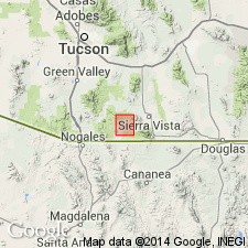
Pg. 71, pl. 5. Glance conglomerate, at base of Bisbee group. Described in central Cochise County; notably Tombstone Hills and Dragoon Mountains. Thickness varies rapidly in short distances owing to irregularities in surface of unconformity beneath. Thickness of several thousand feet reported at Bisbee. Unconformable above older rocks; locally overlies Pinal schist; underlies Morita formation. Age is Early Cretaceous. Report includes geologic map.
Source: US geologic names lexicon (USGS Bull. 1200, p. 1515); supplemental information from GNU records (USGS DDS-6; Denver GNULEX).
- Usage in publication:
-
- Glance conglomerate
- Modifications:
-
- Overview
- AAPG geologic province:
-
- Pedregosa basin
Summary:
Glance conglomerate of Bisbee group. Present in northern Chiricahua Mountains, Cochise County, Arizona. Consists of quartzite conglomerate facies, 20 to 40 feet thick; limestone conglomerate facies, 50 to 1,000 feet thick; and volcanic conglomerate facies, up to 100 feet thick. Age is Early Cretaceous.
Source: Modified from GNU records (USGS DDS-6; Denver GNULEX).

- Usage in publication:
-
- Glance Conglomerate*
- Modifications:
-
- Areal extent
- Overview
- AAPG geologic province:
-
- Pedregosa basin
Summary:
Described in Gunnison Hills, Cochise Co, AZ in Pedregosa basin. Geologic map. On basis of lithology and great variation in thickness, authors suggest that Glance represents a terrestrial deposits series of partly confluent fanglomerates. Is of Early Cretaceous age.
Source: GNU records (USGS DDS-6; Denver GNULEX).
- Usage in publication:
-
- Glance Conglomerate*
- Modifications:
-
- Areal extent
- AAPG geologic province:
-
- Pedregosa basin
Summary:
Extended as a formation of Bisbee Group west from type area to Huachuca Mountains, Cochise Co, AZ in the Pedregosa basin. Locally includes a mapped andesitic volcanic unit in middle part. Ranges from less than 100 to as much as 5,000 ft thick. Is of Early Cretaceous age.
Source: GNU records (USGS DDS-6; Denver GNULEX).
- Usage in publication:
-
- Glance Conglomerate*
- Modifications:
-
- Overview
- Revised
- AAPG geologic province:
-
- Basin-and-Range province
Summary:
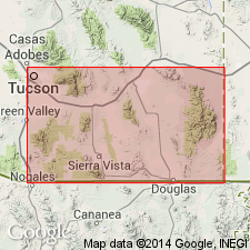
Is the basal formation of the Bisbee Group, Pima Co, AZ, Basin-and-Range province, in the Empire Mountains. Consists of two types of conglomerate. One is mainly limestone and dolomite fragments and is present on the south, east, and north flanks of the Empire Mountains; the other is composed mainly of quartzite and granitoid fragments and is only present in the northern part of the range where it overlies the limestone conglomerate. Limestone conglomerate is 1-400 ft thick and consists of closely packed subangular to subround fragments of limestone and dolomite as much as 3 ft across. The quartzite-granitoid conglomerate is as much as 5,200 ft thick, and consists of angular to subangular fragments of quartzite and gneissic quartz diorite as much as 3 ft across in a matrix of brown to gray sandstone and silty sandstone. Overlies older rocks with erosional unconformity. Underlies Willow Canyon Formation (adopted). Is of Early Cretaceous age.
Source: GNU records (USGS DDS-6; Denver GNULEX).

- Usage in publication:
-
- Glance Conglomerate*
- Modifications:
-
- Age modified
- Overview
- AAPG geologic province:
-
- Pedregosa basin
- Basin-and-Range province
Summary:
Is basal formation of Bisbee Group in Huachuca, eastern Whetstone, Mule, southern Chiricahua, and Pedregosa Mountains in southern Cochise Co, AZ in Pedregosa basin; Santa Rita Mountains (Pima and Santa Cruz Cos., AZ) western Whetstone and Empire Mountains (Pima Co, AZ), Canelo Hills (Santa Cruz Co, AZ), and in Dos Cabezas, northern Chiricahua, Winchester, and Little Dragoon Mountains in northern Cochise Co, AZ in Basin-and-Range province; and Cabullona basin, Sonora, MX. Regional overview with summary descriptions and correlations [See fig. 5 for regional correlations.] Age refined from Early Cretaceous to late Neocomian and early Aptian (Early Cretaceous).
Source: GNU records (USGS DDS-6; Denver GNULEX).
- Usage in publication:
-
- Glance Conglomerate*
- Modifications:
-
- Principal reference
- AAPG geologic province:
-
- Pedregosa basin
Summary:
The principal reference section designated in NW1/4 NW1/4 sec 15, T23S, R24E. Described as less than 300 to more than 3,600 ft thick in Huachuca Mountains. Is in the Pedregosa basin. Is of Early Cretaceous age.
Source: GNU records (USGS DDS-6; Denver GNULEX).
- Usage in publication:
-
- Glance Conglomerate*
- Modifications:
-
- Areal extent
- AAPG geologic province:
-
- Pedregosa basin
Summary:
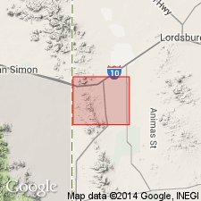
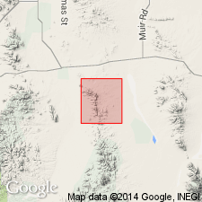
Extended eastward to Peloncillo Mountains in Hidalgo Co, NM, in the Pedregosa basin. Described as about 1-100 m thick. Is of Early Cretaceous age.
Source: GNU records (USGS DDS-6; Denver GNULEX).
- Usage in publication:
-
- Glance Conglomerate Member*
- Modifications:
-
- Areal extent
- Revised
- AAPG geologic province:
-
- Basin-and-Range province
- Pedregosa basin
Summary:
Accepted as member of Bisbee Formation in Chiricahua and Dos Cabezas Mountains of Pedregosa basin, and in Rincon Mountains of Basin-and-Range province. Correlation chart. Is of Early Cretaceous age.
Source: GNU records (USGS DDS-6; Denver GNULEX).
- Usage in publication:
-
- Glance Conglomerate
- Modifications:
-
- Overview
- AAPG geologic province:
-
- Pedregosa basin
- Basin-and-Range province
Summary:
Interpreted as a syntectonic deposit related to differential vertical uplift of nearby, elevated source terranes on basis of variations in thickness and lithology, paleocurrent directions. [Although the general interpretation as it appears above is probably valid, the author's conclusions as to positions of faults is largely unsupported.] Is of Early Cretaceous age.
Source: GNU records (USGS DDS-6; Denver GNULEX).
- Usage in publication:
-
- Glance Conglomerate*
- Modifications:
-
- Areal extent
- AAPG geologic province:
-
- Pedregosa basin
Summary:
Formation names of the Lower Cretaceous Bisbee Group used in Bisbee area (Glance Conglomerate, Morita Formation, Mural Limestone, and Cintura Formation) can be distinguished in Peloncillo Mountains (Cochise Co, AZ and Hidalgo Co, NM in Basin-and-Range province and in Pedregosa basin. Are recognized for the first time in northern Animas Mountains. Formation names of Bisbee area were defined by Ransome in 1904 and take precedence over local terminologies defined later (Gillerman, 1958, whose names McGhee Peak Formation, Johnny Bull Sandstone, Still Ridge Formation, and Carbonate Hill Limestone are not used in this report).
Source: GNU records (USGS DDS-6; Denver GNULEX).
- Usage in publication:
-
- Glance Conglomerate
- Modifications:
-
- Age modified
- Revised
- AAPG geologic province:
-
- Basin-and-Range province
- Pedregosa basin
Summary:
Is a syntectonic deposit in southeast AZ in Pedregosa basin and Basin-and-Range province. Is poorly sorted boulder to cobble conglomerate 0-2000+ m thick deposited on alluvial fans along margins of west-northwest striking fault-bounded graben or half-graben basins. Debris-flow deposits commonly interbedded with clast-supported braided-stream deposits. Interfingers with Morita Formation of Bisbee Group and Willow Canyon Formation. In Huachuca and Santa Rita Mountains, and Canelo Hills, volcanic flows and tuffs are intercalated with the conglomerate. Following unpublished mapping in Lone Mountain area by Kluth (1982, Ph.D. dissert., U. AZ) and Vedder (1984, M.S. thesis, U. AZ), rocks comprising lower member of Canelo Hills of Hayes and Raup (1968) are reassigned to Glance. Geologic maps; chart comparing nomenclature. Assign Late Jurassic age to lower Glance based on Marvin and others (1978, NM Geol. Soc. 29th Conf., p.234-252) dates of 147 +/-6 Ma (K-Ar) and 149 +/-11 Ma (Rb/Sr) for lower part of revised Glance in Lone Mountain area and a date of 151 +/-2 Ma (Rb/Sr) in northern Canelo Hills. Age of upper part uncertain. Fossils of Aptian-Albian age described by Stoyanow (1949, GSA Mem. 38) and Scott (1979, AAPG Bull. v. 63, p.1108-1127) in Mural Limestone of Bisbee. Upper Glance could be as old as Late Jurassic or as young as late Early Cretaceous.
Source: GNU records (USGS DDS-6; Denver GNULEX).
- Usage in publication:
-
- Glance Conglomerate*
- Modifications:
-
- Mapped 1:24k
- Dominant lithology:
-
- Conglomerate
- AAPG geologic province:
-
- Pedregosa basin
Summary:
Glance Conglomerate, basal formation of Bisbee Group. Light-gray, thick-bedded to massive, limestone cobble and pebble conglomerate. Clasts mainly from Paleozoic limestones. Where sequence is thick, east of Jordan Canyon, in sec. 3, T. 17 S., R. 23 E., also includes exotic breccia, a boulder fanglomerate of intercalated megabreccia lenses of landslide origin; blocks as much as 3 m across. Thickness from a few meters to hundreds of meters. Age is Early Cretaceous.
Source: Publication.

- Usage in publication:
-
- Glance Conglomerate*
- Modifications:
-
- Areal extent
- Mapped 1:24k
- Dominant lithology:
-
- Conglomerate
- AAPG geologic province:
-
- Pedregosa basin
Summary:
Glance Conglomerate, basal formation of Bisbee Group. Mapped in Big Hatchet Mountains, Hidalgo County, southwestern New Mexico. Medium-gray cobble-pebble conglomerate; = Zeller's (1965) basal conglomerate in Hell-to-Finish Formation. Thickness 3 to 175 feet (1 to 50 m). Underlies with fault-contact Hell-to-Finish Formation (restricted); unconformably overlies Concha Limestone (Lower Permian). Age is Early Cretaceous.
Source: Publication.
- Usage in publication:
-
- Glance Conglomerate*
- Modifications:
-
- Overview
- AAPG geologic province:
-
- Basin-and-Range province
Summary:
Study area in vicinity of Tucson, Pima Co, AZ, Basin-and-Range province. Follows published mapping of Hayes and Raup (1968) for Glance and Canelo Hills Volcanics rather than unpublished mapping of Kluth (1982, Ph.D. dissert., U. AZ) and Vedder (1984, M.S. thesis, U. AZ) and considers Glance to be Early Cretaceous age. Jurassic ages determined by radiometric dates of Marvin and others (1978, New Mexico Geol. Soc. 29th Field Conf. Gdbk., p.234-252) considered to be from lower member of Canelo Hills and not from Glance as revised by Bilodeau and others (1987).
Source: GNU records (USGS DDS-6; Denver GNULEX).
For more information, please contact Nancy Stamm, Geologic Names Committee Secretary.
Asterisk (*) indicates published by U.S. Geological Survey authors.
"No current usage" (†) implies that a name has been abandoned or has fallen into disuse. Former usage and, if known, replacement name given in parentheses ( ).
Slash (/) indicates name conflicts with nomenclatural guidelines (CSN, 1933; ACSN, 1961, 1970; NACSN, 1983, 2005, 2021). May be explained within brackets ([ ]).