

- Usage in publication:
-
- Gammon ferruginous member*
- Modifications:
-
- Named
- Dominant lithology:
-
- Sandstone
- Shale
- AAPG geologic province:
-
- Powder River basin
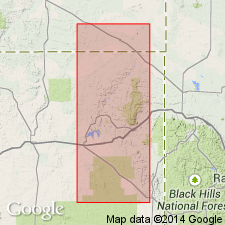
Summary:
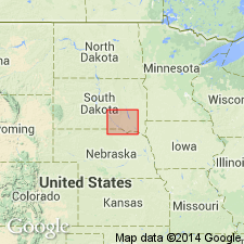
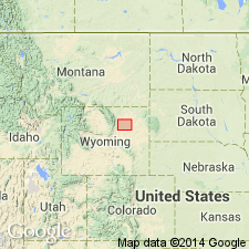
Named as basal member of Pierre shale for exposures along Gammon Creek, T57N, Rs67 and 68W, Crook Co, WY in the Powder River basin. Consists of light-gray mudstone and shale containing abundant iron-stained concretions and thin beds of siderite. Contains the Groat sandstone bed (new) near the top of the member, consisting of ferruginous and glauconitic sandstone and siltstone, 150 ft thick in the northern part of the area [northeastern WY and southeastern MT]. Pedro bentonite bed (new), locally 20 ft thick, at base of the member. Thickness 800-1,000 ft. Type section not given. Overlies Beaver Creek chalky member (new) of the Niobrara formation; underlies Mitten black shale member (new) of Pierre shale. Possible unconformity at or near the base. Samples of Upper Cretaceous shale, mudstone, and marl, including a sample from the lower part of the Gammon ferruginous member, compared for their mineralogy, chemical composition, grain size, density, porosity, fissility, and bedding laminations. Late Cretaceous in age.
Source: GNU records (USGS DDS-6; Denver GNULEX).
- Usage in publication:
-
- Gammon ferruginous member*
- Modifications:
-
- Overview
- Age modified
- AAPG geologic province:
-
- Powder River basin
- Williston basin
- Chadron arch
Summary:
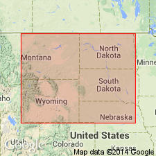
Member of Pierre shale. Name used on the western, northern, and eastern rim of the Black Hills, WY and SD, and in the areas of Cedar Creek anticline, southeastern MT in Powder River and Williston basins. Overlain conformably by Mitten black shale or Sharon Springs member in the Black Hills region, WY and SD, and by "Judith River sand" of drillers on Cedar Creek anticline, MT. Overlies Niobrara formation conformably on the western rim of the Black Hills, WY, and on Cedar Creek anticline, MT, and unconformably on the northern and eastern rim of the Black Hills, SD. Late Cretaceous in age. Age refined to Santonian and Campanian.
Source: GNU records (USGS DDS-6; Denver GNULEX).
- Usage in publication:
-
- Gammon ferruginous member*
- Modifications:
-
- Overview
- AAPG geologic province:
-
- Powder River basin
- Williston basin
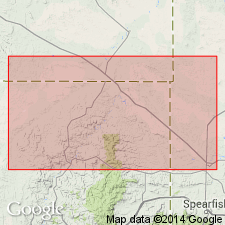
Summary:
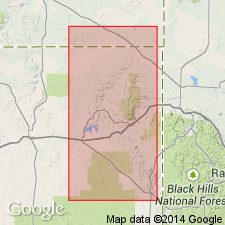
Member of the Pierre shale. Map shows distribution on north side of the Black Hills in parts of Crook Co, WY and Butte Co, SD in Powder River and Williston basins. Bentonite bed H identified and described as a persistent bed 1 1/2 ft thick, 70-75 ft below top of member. Overlain by Mitten black shale member; underlain by Niobrara formation. Late Cretaceous in age.
Source: GNU records (USGS DDS-6; Denver GNULEX).
- Usage in publication:
-
- Gammon ferruginous member*
- Modifications:
-
- Biostratigraphic dating
- Overview
- AAPG geologic province:
-
- Powder River basin
- Williston basin
Summary:
Member of the Pierre shale in northeastern part of the Powder River basin. Lists index fossils and discusses their stratigraphic and geographic distribution in the Powder River basin and southernmost part of the Williston basin. Shows faunal zonation. Late Cretaceous (Campanian) in age.
Source: GNU records (USGS DDS-6; Denver GNULEX).
- Usage in publication:
-
- Gammon member*
- Modifications:
-
- Redescribed
- Areal extent
- AAPG geologic province:
-
- Chadron arch
- Williston basin
Summary:
Name extended to include a formerly undifferentiated lower part of the Sharon Springs member. Is the basal member of Pierre shale in southern and eastern parts of the Black Hills in an area extending from Fall River Co, SD northward to Meade Co, SD on Chadron arch and in Williston basin. Redescribed--name abbreviated from Gammon ferruginous member to Gammon member because it lacks the abundant ferruginous concretions found in the type area, Crook Co, WY in Powder River basin. Thickness is 15 ft at Ardmore, NW1/4 sec 8, T12S, R4E, Fall River Co, and 67 ft southeast of Hot Springs, NW1/4 sec 31, T7S, R7E, Fall River Co, SD. Pinches out between the Black Hills and the Missouri River in southern SD. Overlain conformably by Sharon Springs formation; underlain conformably by Niobrara formation. Late Cretaceous in age.
Source: GNU records (USGS DDS-6; Denver GNULEX).
- Usage in publication:
-
- Gammon ferruginous member*
- Modifications:
-
- Overview
- AAPG geologic province:
-
- Powder River basin
- Williston basin
Summary:
Member of Pierre shale on the western and northern sides of the Black Hills, WY and MT, in Powder River and Williston basins. Lists fossils found in the member and gives stratigraphic sections in Carter Co, MT. Overlain by Mitten black shale member; underlain by Niobrara formation. Late Cretaceous in age.
Source: GNU records (USGS DDS-6; Denver GNULEX).
- Usage in publication:
-
- Gammon ferruginous member*
- Modifications:
-
- Overview
- AAPG geologic province:
-
- Powder River basin
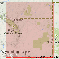
Summary:
Member of the Pierre shale. Constitutes a wedge of shale that appears between the Sharon Springs member of Pierre and the underlying Niobrara rocks a few mi north of Newcastle, Weston Co, WY and thickens northward in the Powder River basin. Overlain by the Mitten black shale member [which passes southward into Sharon Springs member]. Late Cretaceous in age.
Source: GNU records (USGS DDS-6; Denver GNULEX).
- Usage in publication:
-
- Gammon Ferruginous Member*
- Modifications:
-
- Overview
- AAPG geologic province:
-
- Powder River basin
- Chadron arch
Summary:
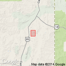
Member of the Pierre Shale. Gives detailed reference locality [section] of the Pierre Shale at Red Bird, sec 13, T38N, R62W and sec 18, T38N, R61W, Niobrara Co, WY in the Powder River basin. Consists of hard, platy-weathering gray shale that contains a few layers of red-weathering siderite concretions and several thin beds of nonswelling bentonite. Thickness 30 ft at Red Bird; about 110 ft along Cheyenne River near hot Springs, Fall River Co, SD on Chadron arch. Conformably overlies Niobrara Formation; conformably overlain by Sharon Springs Member. Late Cretaceous (early Campanian) in age.
Source: GNU records (USGS DDS-6; Denver GNULEX).

- Usage in publication:
-
- Gammon Ferruginous Member*
- Modifications:
-
- Overview
- AAPG geologic province:
-
- Powder River basin
Summary:
Is the basal member of Pierre Shale at Red Bird, Niobrara Co, WY in the Powder River basin. Overlies Niobrara Formation. Underlies Sharon Springs Member of Pierre. Is of early Campanian, Late Cretaceous age. Correlates with: 1) Sussex Sandstone Member, Shannon Sandstone Member, and an intervening shale, and the upper part of an underlying shale that all are part of Steele Shale; 2) upper part of Cody Shale; 3) lower unnamed member and Tapers Ranch Sandstone Member of Haystack Mountains Formation (new); and 4) middle part of Rock Springs Formation. Correlation chart.
Source: GNU records (USGS DDS-6; Denver GNULEX).
- Usage in publication:
-
- Gammon member
- Modifications:
-
- Overview
- AAPG geologic province:
-
- Powder River basin
Summary:
A member of the Cody shale in the Powder River basin, WY and southeastern MT. Underlain by Niobrara formation; overlain by Shannon member. Shows isopach map and correlation of sandstone beds in the upper part of the member in electric-log correlation diagrams. Varies in thickness from 850 to 1,200 ft in the central Powder River basin. It contains the "Fishtooth" sandstone in southwest part of the basin, and the lower sandstone of the so-called "Ash Creek" sandstone in the northwest part of the basin. There are several unnamed sandstones in the member along the western margin of the basin. Sandstones occur near top of member in all of 20 widely scattered wells in the northwest part of the central Powder River basin area, Johnson Co, WY. These sandstones, which are 6-18 ft thick, occur consistently in the same approximate stratigraphic position, 60 or 80 ft below top of member, and are collectively called the Gammon sandstone. Late Cretaceous in age.
Source: GNU records (USGS DDS-6; Denver GNULEX).
- Usage in publication:
-
- Gammon Ferruginous Member*
- Modifications:
-
- Areal extent
- AAPG geologic province:
-
- Denver basin
Summary:
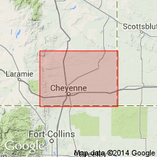
Nomenclature applied to divisions of the Pierre Shale in exposures at Francis Ranch, secs 7-10 and 15-16, T14N, R69W and in subsurface in Apache Corp. 1 Polo Ranch, sec 14, T14N, R68W, Laramie Co, WY, Denver basin modified. Term: 1) Gammon Ferruginous Member replaces use of lower transition zone; 2) Mitten Black Shale Member replaces use of rusty zone; 3) Hygiene replaces use of the subsurface Sussex; 4) Rocky Ridge, Larimer, and Richard Sandstone Members replace use of the subsurface Parkman. Terry Sandstone Member of Pierre in the Fort Collins, CO area is equivalent to the subsurface Sussex and is not present at Francis Ranch or in the Apache Corp. well. Use of Shannon, Sussex, and Parkman is discontinued in the Denver basin because the sandstones of the Denver basin are not time-equivalents or time-transgressive facies of the Shannon, Sussex, or Parkman of the Powder River basin. As modified, divisions of Pierre are (ascending): Gammon, Sharon Springs, Mitten, Hygiene Members, unnamed interval, Rocky Ridge Sandstone Member, unnamed interval, Larimer Sandstone Member, unnamed interval, Richard Sandstone Member, unnamed interval, units A, B, C, unnamed interval. Pierre overlies Niobrara Formation and underlies Fox Hills Sandstone. Of Campanian age. Measured section; nomenclature chart.
Source: GNU records (USGS DDS-6; Denver GNULEX).
- Usage in publication:
-
- Gammon Shale*
- Modifications:
-
- Revised
- AAPG geologic province:
-
- Williston basin
Summary:
Gammon Ferruginous Member of the Pierre Shale is raised to the rank of formation and called the Gammon Shale in the subsurface of east-central MT and northwestern SD (Williston basin) where the Shannon Sandstone Member (areally extended from WY) is recognized as a member of the Gammon. Term Shannon is applied to sandstone equivalent to the Groat Sandstone Bed (restricted to outcrop) in the subsurface. Age is Late Cretaceous [Campanian].
Source: GNU records (USGS DDS-6; Denver GNULEX).

- Usage in publication:
-
- Gammon Ferruginous Member*
- Modifications:
-
- Areal extent
- Revised
- AAPG geologic province:
-
- Powder River basin
Summary:
Pierre Shale identified in subsurface of eastern Powder River basin in WY in Niobrara, Weston, eastern Campbell, and Crook Cos, and in MT in Powder River and eastern Big Horn Cos. Pierre divided (ascending) into Gammon Ferruginous, Mitten and Red Bird Silty Members, and an unnamed upper part. Pierre overlies Niobrara Formation and underlies Fox Hills Sandstone. To west, name Pierre replaced by (ascending) Steele Shale (and its Ardmore Bentonite-newly assigned--in lower part, Sussex and Shannon Sandstone Members which are separated by, overlain and underlain by unnamed parts of Steele), Mesaverde Formation (and its Parkman Sandstone Member, at base, unnamed middle part, Teapot Sandstone Member, at top), and Lewis Shale (and its unnamed upper and lower parts separated by Teckla Sandstone Member). Sussex and Shannon Members of Steele continue eastward under basin, and they become (new assignment) Sussex and Shannon Sandstone Beds of Gammon Member. Ardmore also continues eastward where it becomes (new assignment) a bed at or near base of Mitten. Red Bird is equivalent to Parkman, basal member of Mesaverde to west. Of Late Cretaceous age. [This nomenclature shown on 22 cross sections in this OC series.]
Source: GNU records (USGS DDS-6; Denver GNULEX).
- Usage in publication:
-
- Gammon Member*
- Modifications:
-
- Revised
- AAPG geologic province:
-
- Powder River basin
Summary:
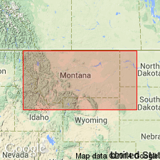
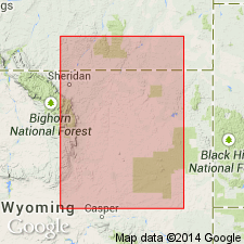
In northwest part of Powder River basin in MT and WY, Gammon is divided into Telegraph Creek Beds (rank reduced) at base and an unnamed shale at top. Here Gammon is third member from base of four members of Cody Shale and Gammon conformably overlies Niobrara Member and conformably underlies Claggett Member. Gammon in northwest part of basin is 1040-1242 ft thick. In east part of basin, Gammon is assigned as lowest member of eight named and unnamed members of Pierre Shale. At local outcrops along eastern flank of basin Gammon encloses Groat Sandstone Bed (equivalent to Shannon Sandstone Member in subsurface) in its upper part. Here Gammon interfingers with underlying Niobrara Formation and disconformably underlies Sharon Springs Member of Pierre. Gammon and laterally equivalent rocks thin eastward from more than 1000 ft thick in eastern Campbell and Converse Cos to less than 50 ft thick in eastern Weston and Niobrara Cos. Outcrop section and well log (shows part of Gammon) in Big Horn Co, MT (figs. 12, 12a); cross sections (figs. 5, 6). In eastern part of basin mollusks indicate an early Campanian age, though lower part not dated. In northwest part of basin ammonites of middle Santonian age found by W. A. Cobban in upper part of underlying Niobrara Member and is shown on nomenclature chart to be within fossil zones 34-42 suggesting a middle Santonian to early Campanian (Late Cretaceous) age.
Source: GNU records (USGS DDS-6; Denver GNULEX).
For more information, please contact Nancy Stamm, Geologic Names Committee Secretary.
Asterisk (*) indicates published by U.S. Geological Survey authors.
"No current usage" (†) implies that a name has been abandoned or has fallen into disuse. Former usage and, if known, replacement name given in parentheses ( ).
Slash (/) indicates name conflicts with nomenclatural guidelines (CSN, 1933; ACSN, 1961, 1970; NACSN, 1983, 2005, 2021). May be explained within brackets ([ ]).