The National Geologic Map Database is migrating to a new infrastructure. We apologize for any service disruptions during this process.
|
|---|


- Usage in publication:
-
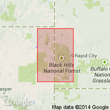
- Fall River formation
- Modifications:
-
- Original reference
Summary:
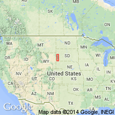
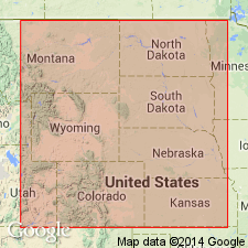
Pg. 402. Fall River formation. It has been shown by writer elsewhere (South Dakota State Geol. and Nat. Hist. Survey Bull., no. 14, 1927, in press) that so-called Dakota sandstone of Black Hills region is in reality older than true Dakota, and it will be called Fall River formation in this paper. Overlies Fuson formation and underlies Graneros shale. Age is Early Cretaceous. [Type locality not stated.]
Source: US geologic names lexicon (USGS Bull. 896, p. 718).
- Usage in publication:
-
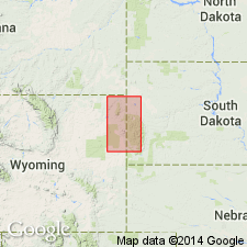
- Fall River formation
- Modifications:
-
- Biostratigraphic dating
- AAPG geologic province:
-
- Chadron arch
Russell, W.L., 1928, The origin of artesian pressure: Economic Geology, v. 23, no. 2, p. 132-157.
Summary:
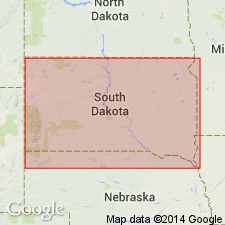
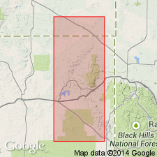
Consists of 75 ft of sandstones and interbedded shales of post-Fuson age (Early Cretaceous) lying below Graneros shale in the Black Hills region. Type locality is Evans quarry on Fall River below Hot Springs, Fall River Co, SD. According to fossil plants from overlying rocks, identified by E. W. Berry, is much older than typical Dakota sandstone of eastern NE. Type section not given.
Source: GNU records (USGS DDS-6; Denver GNULEX).
- Usage in publication:
-
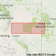
- Fall River sandstone*
- Modifications:
-
- Areal extent
- Overview
- AAPG geologic province:
-
- Chadron arch
Summary:
Is the top formation of newly proposed Inyan Kara group. Is so-called Dakota sandstone of previous reports in the Black Hills. Conformably underlies Graneros shale and overlies Fuson formation. Is of Early Cretaceous age.
Source: GNU records (USGS DDS-6; Denver GNULEX).
- Usage in publication:
-
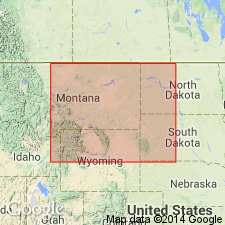
- Fall River sandstone*
- Modifications:
-
- Areal extent
- AAPG geologic province:
-
- Williston basin
Summary:
Extended into southeast MT and adjacent parts of southwestern ND in the subsurface. Underlies Colorado group; overlies Fuson formation. Assigned to the Early Cretaceous in the Williston basin.
Source: GNU records (USGS DDS-6; Denver GNULEX).
- Usage in publication:
-
- Fall River sandstone*
- Modifications:
-
- Overview
- AAPG geologic province:
-
- Sweetgrass arch
Summary:
Correlated Fall River sandstone with First Cat Creek sandstone in central MT, and a thin-bedded, fine-grained quartz sandstone 15-50 ft thick at base of Colorado shale on the Sweetgrass arch, northwestern MT. Assigned an Early Cretaceous, (Albian) age.
Source: GNU records (USGS DDS-6; Denver GNULEX).
- Usage in publication:
-
- Fall River sandstone*
- Modifications:
-
- Areal extent
- AAPG geologic province:
-
- Powder River basin
- Central Kansas uplift
- Salina basin
Summary:
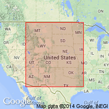
Used name in Lance Creek region, WY, southeast Powder River basin, Black Hills, WY and SD; south-central NE (Webster Co, Salina basin); southeast MT (Cedar Creek anticline); and northwest KS (Decatur Co, Central Kansas uplift). Underlies Skull Creek shale member of Graneros shale; disconformably overlies Fuson shale. Assigned a middle Albian, or Early Cretaceous age.
Source: GNU records (USGS DDS-6; Denver GNULEX).
- Usage in publication:
-
- Fall River sandstone*
- Modifications:
-
- Overview
- AAPG geologic province:
-
- Denver basin
Summary:
Area of report is Front Range of the Rocky Mountains, in Denver basin. Correlation with other Cretaceous units in Powder River basin in northeast WY, Wind River basin in central WY, and Denver basin of southeast WY, northeast and south-central CO shown on fig 19.
Source: GNU records (USGS DDS-6; Denver GNULEX).
- Usage in publication:
-
- Fall River formation*
- Modifications:
-
- Revised
- AAPG geologic province:
-
- Powder River basin
Summary:
In northwestern part of the Black Hills consists of an upper unit of siltstone, silty shale, and mostly thin-bedded sandstone; Keyhole sandstone member (new), consisting of massive, cliff-forming, very fine to fine-grained sandstone; and a lower unit or units of siltstone, silty shale, and thin-bedded sandstone. Is of Early Cretaceous age.
Source: GNU records (USGS DDS-6; Denver GNULEX).
- Usage in publication:
-
- Fall River formation*
- Modifications:
-
- Redescribed
- Revised
Summary:
Restricted to the dominantly sandy marginal marine rocks above a regional transgressive unconformity. Becomes part of two-fold division of Inyan Kara group, consisting of Fall River formation and the unconformably underlying Fuson-Lakota sequence. Criteria given for recognizing the unconformity that divides Fall River from underlying rocks, including distinctive color-banding of outcrops of weathered rocks above and below the unconformity. In southern and eastern Black Hills contains a tongue of continental beds, similar to those in Lakota, in the middle part. Is of Early Cretaceous age.
Source: GNU records (USGS DDS-6; Denver GNULEX).
- Usage in publication:
-
- Fall River formation*
- Modifications:
-
- Overview
Summary:
Shows informal subdivisions, including a basal carbonaceous unit and an overlying unit containing several widespread sandstone bodies. Illustrates truncation of units in underlying Lakota formation beneath an unconformity at base of Fall River formation. Assigned to the Early Cretaceous.
Source: GNU records (USGS DDS-6; Denver GNULEX).

- Usage in publication:
-
- Fall River formation*
- Modifications:
-
- Overview
- AAPG geologic province:
-
- Chadron arch
Summary:
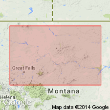
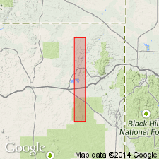
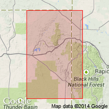
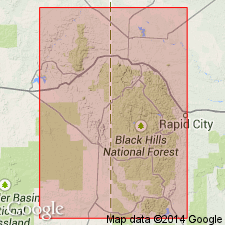
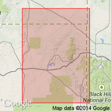
Measured type section in the N1/2 sec 33, T7S, R6E, Hot Springs quad, Fall River Co, SD in the bluffs of Fall River in the area of the falls and of the two Evans quarries which are on opposite sides of the river just above the falls (p. 79-81). Is 158 ft thick at type; unconformably overlain by Skull Creek shale; unconformably underlain by a redefined Lakota formation. Assigned to the Early Cretaceous.
Source: GNU records (USGS DDS-6; Denver GNULEX).
- Usage in publication:
-
- Fall River sandstone
- Modifications:
-
- Overview
Summary:
Deposited during a continuous westward regression of the shoreline of the interior Early Cretaceous sea that left behind a near-parallel series of south-trending, westward-dipping mudstone and sandstone facies that tie in with deltaic sources to the north and south in the east-central Powder River basin. Includes a lagoonal-channel facies, a lagoonal facies, a barrier-bar facies, an inlet-channel facies, and, at top of formation, a soil zone.
Source: GNU records (USGS DDS-6; Denver GNULEX).
- Usage in publication:
-
- Fall River unit
- Modifications:
-
- Overview
- AAPG geologic province:
-
- Williston basin
Summary:
Used the name in eastern Bighorn Mountain, MT and the Williston basin of eastern MT, ND, and SD (fig. 4, p. 1377) for rocks between conformably overlying Skull Creek shale and disconformably underlying Lakota formation. Includes Fall River sandstone and an overlying siltstone sequence in the basal part of Skull Creek Shale in a Fall River unit. Is of Early Cretaceous age.
Source: GNU records (USGS DDS-6; Denver GNULEX).
- Usage in publication:
-
- Fall River Formation
- Modifications:
-
- Overview
Summary:
Three suites of heavy minerals characterize Fall River sandstones: a staurolite suite, a chloritoid suite, and a zircon-tourmaline suite. Staurolite sandstones occur on the eastern side of the basin of deposition and their source was the Piedmont area of the Appalachians. Chloritoid sandstones are in a north-south belt about parallel to the shoreline; they were derived from a Canadian low-grade metamorphic terrane. Transport was mostly by south-flowing longshore currents. The marine basin of deposition was bordered by fluviatile and delta deposits of the Colorado Front Range consisting of zircon-tourmaline sandstones derived from pre-existing sediments. Assigned to the Early Cretaceous.
Source: GNU records (USGS DDS-6; Denver GNULEX).
- Usage in publication:
-
- Fall River Formation
- Modifications:
-
- Overview
Summary:
Divided into two principal sedimentary assemblages of deltaic and marine origin, respectively. Within the deltaic assemblage identified channel sandstone, interchannel and foreset sandstone and mudstone, and destructive-phase blanket sandstone. Within the marine assemblage identified off-shore and lagoon mudstone and shale, and bar and spit sandstone Staurolite-chloritoid content of the sandstone used as an indicator of source. Traced the growth of early and late northern and southern deltas in the Black Hills region. Assigned to the Early Cretaceous.
Source: GNU records (USGS DDS-6; Denver GNULEX).
- Usage in publication:
-
- Fall River Formation*
- Modifications:
-
- Overview
Summary:
Compares petrology of sandstone from the Fall River, Lakota, and Morrison Formations and the Unkpapa Sandstone. Sandstone from Fall River Formation characteristically well sorted, mostly fine- to very fine grained; mostly quartz grains with feldspar muscovite and schist fragments in small amounts; predominantly angular zircon and tourmaline, locally abundant chloritoid hornblende and apatite, small amounts of garnet in 0.062-0.125 mm size fraction. Nonopaque heavy mineral suite is similar to that in the younger Newcastle Sandstone, but differ from that in the underlying Lakota Formation at most places and from the older Morrison Formation. Discusses source and origin. Assigned to the Early Cretaceous.
Source: GNU records (USGS DDS-6; Denver GNULEX).
- Usage in publication:
-
- Fall River Formation*
- Modifications:
-
- Overview
Summary:
Summarizes detailed and reconnaissance mapping of Fall River Formation and associated rocks begun in 1922 and continuing intermittently to 1958. Lithologic variations shown for 36 partial or complete stratigraphic sections, (pl. 3). Lists trace fossils, nonmarine pelecypods, marine vertebrates and plants collected from the formation in the Black Hills. Assigned to the Early Cretaceous.
Source: GNU records (USGS DDS-6; Denver GNULEX).
- Usage in publication:
-
- Fall River Formation
- Modifications:
-
- Revised
- AAPG geologic province:
-
- Williston basin
- Powder River basin
Summary:
As the upper formation of the Inyan Kara Group, is divided into Liscom Creek, Morton, and Coyote Creek Members, (all newly named) in subsurface of Custer Co, SD in the Williston basin. Each of these members has the characteristic of roof shingles. Fall River consists of deltaic and marginal marine deposits, littoral to neutic sandstone and offshore shale. Overlies Lakota Formation of Inyan Kara Group. Underlies "Dakota silt" [of drillers] or Thermopolis Shale. Cross sections. Ranges from less than 10 ft to about 200 ft thick in the Williston and Powder River basins over SD(w), MT(e), and WY(e) on isopach map. Characterized by southward transgression of the sea and recession of delta fonts from southeast MT to southwest SD. Early Cretaceous age. E-logs. Cross sections.
Source: GNU records (USGS DDS-6; Denver GNULEX).
- Usage in publication:
-
- Fall River Formation*
- Modifications:
-
- Overview
- AAPG geologic province:
-
- Chadron arch
- Powder River basin
Summary:
Discusses lithologic variation, minerology, and fossil content and shows distribution of the member in the southern Black Hills, Fall River and Custer Cos, SD on Chadron arch, and Weston Co, WY in Powder River basin. Divides formation into upper, middle, and lower units; further subdivides the upper unit into 3 lithologically separate subunits, and the middle unit into two lithologically separate subunits. Formation contains a mineral assemblage distinguishable from other major fluvial units in the Inyan Kara Group. Source areas probably southeast and southwest of the Black Hills. Assigned to the Early Cretaceous.
Source: GNU records (USGS DDS-6; Denver GNULEX).
For more information, please contact Nancy Stamm, Geologic Names Committee Secretary.
Asterisk (*) indicates published by U.S. Geological Survey authors.
"No current usage" (†) implies that a name has been abandoned or has fallen into disuse. Former usage and, if known, replacement name given in parentheses ( ).
Slash (/) indicates name conflicts with nomenclatural guidelines (CSN, 1933; ACSN, 1961, 1970; NACSN, 1983, 2005, 2021). May be explained within brackets ([ ]).