The National Geologic Map Database is migrating to a new infrastructure. We apologize for any service disruptions during this process.
|
|---|


- Usage in publication:
-
- Entrada sandstone*
- Modifications:
-
- Named
- Dominant lithology:
-
- Sandstone
- AAPG geologic province:
-
- Paradox basin
Summary:
Named as one of four formations of San Rafael group (new name) for exposures at Entrada Point, northern San Rafael Swell, Emery Co., UT in the Paradox basin where type section measured. Is present around the Swell, in the Waterpocket fold, in the Henry Mountains, and along the San Juan River, and east into CO. Consists of two types of sandstone. The first is clean and well sorted, and forms steep cliffs. The second is earthy, less well cemented, and weathers like a shale. Is 312 ft thick at Entrada Point, 844 ft thick at Muddy Point, and 1430 ft thick at Circle Cliffs. Overlies Carmel formation (newly assigned to San Rafael Group); underlies Curtis formation (new). Is a waterlaid deposit, probably of marine origin. Cross-bedded deposits in eastern exposures suggest eolian origin. Age of Late Jurassic determined by position between two dated units.
Source: GNU records (USGS DDS-6; Denver GNULEX).
- Usage in publication:
-
- Entrada sandstone*
- Modifications:
-
- Areal extent
- AAPG geologic province:
-
- Plateau sedimentary province
- Paradox basin
Summary:
Extended south to the Kaiparowits region, Plateau sedimentary province from its original area in the San Rafael Swell, Paradox basin mapped in Kane and Garfield Cos. Is one of four formations--Carmel formation (first use), Entrada sandstone, Curtis and Summerville formations (listed in ascending order)--of the San Rafael group. Assigned to the Upper Jurassic.
Source: GNU records (USGS DDS-6; Denver GNULEX).
- Usage in publication:
-
- Entrada sandstone*
- Modifications:
-
- Revised
- AAPG geologic province:
-
- San Juan basin
- Paradox basin
Summary:
Underlies Pony Express limestone member (assigned formerly as basal beds of Wanakah shale member of Morrison formation). Was called lower sandstone of La Plata sandstone in earlier reports. Assigned to the Upper Jurassic.
Source: GNU records (USGS DDS-6; Denver GNULEX).
- Usage in publication:
-
- "Entrada" formation
- Modifications:
-
- Areal extent
- Contact revised
- AAPG geologic province:
-
- Great Basin province
Summary:
Name applied to a maroon and gray shale that grades upward into shale and siltstone interlensed with medium to coarse arkosic channel sandstone. Varies between 50 and 220 ft thick. Overlies the ripple marked argillaceous limestone of the Homestake formation. Upper contact revised; unconformably underlies conglomerate of the newly named Iron Springs formation (Formerly Pinto sandstone). Name questionably applied. Term Entrada used because of its stratigraphic position. Assigned to the Jurassic. Geologic maps. Cross sections.
Source: GNU records (USGS DDS-6; Denver GNULEX).
- Usage in publication:
-
- Entrada sandstone*
- Modifications:
-
- Contact revised
- AAPG geologic province:
-
- San Juan basin
- Paradox basin
Summary:
Is an easily recognized, massive, white, even-grained, cross-bedded sandstone. Forms sheer cliffs. Distinguished by its well-rounded coarse quartz sandstone. Ranges from 150 to 265 ft thick in the report area. Upper contact revised in that Entrada sandstone underlies Pony Express limestone member which formerly was assigned to the basal Morrison formation but is removed from the Morrison and reassigned to the Wanakah formation as its basal member. Nomenclature chart. Mapped (geologic map) on east side of area, and in southwest and west part of area in La Plata Co, CO in the San Juan basin and in Montezuma Co, CO in the Paradox basin. This name replaces use of "lower La Plata sandstone" in the La Plata district. Of Late Jurassic age.
Source: GNU records (USGS DDS-6; Denver GNULEX).
- Usage in publication:
-
- Entrada sandstone*
- Modifications:
-
- Revised
- AAPG geologic province:
-
- Black Mesa basin
Summary:
Overlain by Cow Springs sandstone (new) along Black Mesa, Navajo Co, AZ in the Black Mesa basin. Of Jurassic age.
Source: GNU records (USGS DDS-6; Denver GNULEX).
- Usage in publication:
-
- Entrada sandstone*
- Modifications:
-
- Areal extent
- AAPG geologic province:
-
- Great Basin province
Summary:
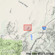
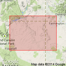
Name extended geographically into Iron Co, UT in the Great Basin province, where it is mapped as a formation above the Homestake limestone member (reduced in stratigraphic rank), newly assigned to the Carmel formation of Jurassic age, and unconformably beneath the Iron Springs formation of Late? Cretaceous age. Mapped (geologic map) adjacent to Three Peaks intrusion at northeast edge of quad, at northeast side of Granite Mountain in central part of quad, and at south side of Desert Mound arch in southwest corner of quad. Rocks assigned to the Entrada in this report were part of the Pinto sandstone of Leith and Harder (1908). Pinto is abandoned in this report. Lower contact described as gradational. Entrada consists of a basal 40 ft thick mud-cracked and ripple-marked limey mudstone that grades upward into a gray and maroon shale. The remainder of the Entrada consists of shale, siltstone, and coarse-grained sandstone. Has an overall thickness of a featheredge to 220 ft. At several localities in the quad, the maroon color of the Entrada has been reduced to gray by solutions from nearby intrusions. Assigned to the Jurassic.
Source: GNU records (USGS DDS-6; Denver GNULEX).
- Usage in publication:
-
- Entrada sandstone*
- Modifications:
-
- Areal extent
- AAPG geologic province:
-
- Anadarko basin
Summary:
Name applied to massive sandstone in Baca Co, CO in the Anadarko basin above the Dockum group, or locally the Taloga formation. History of use (1896 to 1954) of Exeter and Entrada sandstones given. Crops out as a prominent white ledge along Carrizo Creek and its tributaries and along Two Butte Creek. Eastern limit map for Entrada in Baca Co. Pinches out south of Two Buttes and east of Edler; not thought to be continuous across county between Two Buttes and Edler. Missing in a well southeast of Prichett between these two areas. Is 30-40 ft thick. Pinches out between overlying Morrison Formation and underlying Dockum locally. Is 380 ft thick along Two Butte Creek. Entrada in Baca Co is white in southwest part of county and gray near Two Butte Creek, very fine to medium grained, friable, cross-bedded, quartz sandstone. Weathers to smooth, steep cliffs. Considered Late Jurassic on basis of correlation. Cross section. Geologic map.
Source: GNU records (USGS DDS-6; Denver GNULEX).
- Usage in publication:
-
- Entrada sandstone*
- Modifications:
-
- Areal extent
- AAPG geologic province:
-
- Black Mesa basin
- Paradox basin
- Plateau sedimentary province
- San Juan basin
Summary:
Pg. 3 (fig. 2), 35-38, strat. sections, pls. 1, 3. Entrada sandstone of San Rafael group. In most of Navajo country comprises three members which represent two distinct depositional facies. Lower sandy member is a sandy cross-bedded facies, in part eolian, present only in northwestern part of area; medial silty member approximates lithology of type section and is present in central and eastern parts of area; upper sandy member, a cross-bedded facies, is present in eastern part of area. A thin (50-foot) eastward extension of medial silty member and a thick (253-foot) sequence of upper sandy member constitute upper half of original type section of Wingate sandstone. In southwestern area, it is difficult to differentiate from underlying Carmel formation. In some areas, underlies Cow Springs sandstone, in others Summerville formation or Todilto limestone. Thickness as much as 303 feet. [Age is Late Jurassic.]
Source: US geologic names lexicon (USGS Bull. 1200, p. 1268-1271).
- Usage in publication:
-
- Entrada sandstone*
- Modifications:
-
- Areal extent
- AAPG geologic province:
-
- Palo Duro basin
- Sierra Grande uplift
Summary:
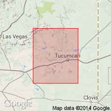
Ranks previously assigned to Wingate sandstone near Tucumcari, NM in the Palo Duro basin and on the Sierra Grande uplift reassigned to Entrada sandstone and included in San Rafael group as the lower formation. Is a 50-60 ft, cliff-forming white to pale-red massive sandstone. Overlies Redonda formation (formerly a member of Chinle); underlies Morrison formation. Assigned to the Late Jurassic.
Source: GNU records (USGS DDS-6; Denver GNULEX).
- Usage in publication:
-
- Entrada sandstone*
- Modifications:
-
- Areal extent
- AAPG geologic province:
-
- Las Vegas-Raton basin
Summary:
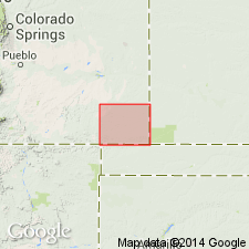
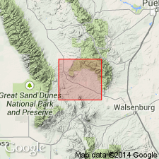
Sandstone called Entrada in this report east of the Rocky Mountains in Huerfano and Custer Cos, CO, Las Vegas-Raton basin, believed to be equivalent to the Entrada to the west. Is also identical to rocks to south in Mora Co, NM called Ocate sandstone and to southeast along the Dry Cimarron, Union Co, NM, called Exeter sandstone. Names Ocate and Exeter abandoned. Name Entrada used throughout area. Briefly described (columnar section) as a 70 to 100 ft thick gray to buff sandstone. Geologic map. Overlies Sangre de Cristo formation disconformably. Underlies Morrison formation. Of Jurassic age.
Source: GNU records (USGS DDS-6; Denver GNULEX).
- Usage in publication:
-
- Entrada sandstone*
- Modifications:
-
- Revised
- AAPG geologic province:
-
- Las Vegas-Raton basin
Summary:
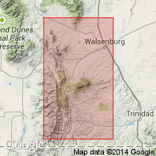
Overlies unconformably Johnson Gap formation, a new name applied to Triassic? rocks in Las Animas Co., CO in the Las Vegas-Raton basin. Unconformably overlies Lykins? formation, a Permian? and Triassic? unit in Huerfano Co., CO in Denver basin. Is of Jurassic age.
Source: GNU records (USGS DDS-6; Denver GNULEX).
- Usage in publication:
-
- Entrada Sandstone*
- Modifications:
-
- Revised
- AAPG geologic province:
-
- Paradox basin
Summary:
Upper Jurassic Entrada Sandstone divided into: Dewey Bridge Member, a new unit at base, Slick Rock Member, a new unit in the middle, and Moab Member (or Tongue) extended into the Grand Junction area, at the top. Measured sections included for Dewey Bridge, Slick Rock, and Moab Members. Rocks assigned to Dewey Bridge are found east of the Green River in UT and west-central CO in Paradox and Piceance basins, and were formerly assigned to Carmel Formation.
Source: GNU records (USGS DDS-6; Denver GNULEX).
- Usage in publication:
-
- Entrada Sandstone
- Modifications:
-
- Revised
- AAPG geologic province:
-
- Paradox basin
- Plateau sedimentary province
Summary:
Divided into Gunsight Butte Member, new at base, Cannonville Member, new in middle, and Escalante Member, first published description at top. Areal extent of outcrops of Entrada shown on figure 1; formation shown in Waterpocket Fold, and completely around Kaiparowits Plateau from Pine Creek through Paria amphitheater, Garfield (Paradox basin) and Kane Cos (Plateau sedimentary province), UT. Age is Late Jurassic. Measured sections. Cross sections. Block diagram.
Source: GNU records (USGS DDS-6; Denver GNULEX).
- Usage in publication:
-
- Entrada Sandstone*
- Modifications:
-
- Areal extent
- Revised
- AAPG geologic province:
-
- San Juan basin
Summary:
A new member added to Upper Jurassic Entrada Sandstone of San Rafael Group in Gallup-Grants area, McKinley Co, NM, San Juan basin and named Iyanbito Member. This revises lower contact of Entrada, the areal limits of Entrada and the Wingate Sandstone, and discontinues use of Lukachukai Member of Wingate Sandstone of Glen Canyon Group in this area, the name formerly assigned to these rocks.
Source: GNU records (USGS DDS-6; Denver GNULEX).
- Usage in publication:
-
- Entrada Sandstone*
- Modifications:
-
- Mapped 1:24k (Moffat Co, CO)
- Dominant lithology:
-
- Sandstone
- AAPG geologic province:
-
- Green River basin
Summary:
Is Middle Jurassic formation mapped in southwest Moffat Co, CO (Greater Green River basin). Overlies Carmel Formation (Middle Jurassic); unconformably underlies Curtis Member (Middle Jurassic) of Stump Formation (Middle and Upper Jurassic). Map unit described as moderately resistant gray, buff, and less commonly pink, prominently cross-bedded medium- to thick-bedded fine- to medium-grained sandstone. Resembles Glen Canyon Sandstone (Upper Triassic and Lower Jurassic) except generally is softer and not as markedly cross-bedded. About 45 m (150 ft) thick near well in NW1/4 sec. 7, T3N, R103W, and about 37 m (120 ft) thick on the southern side of Plug Hat Rock. Thickens west of the mapped area and thins east of it (Hansen, 1965; Otto and Picard, 1975, 1976).
Source: GNU records (USGS DDS-6; Denver GNULEX).
- Usage in publication:
-
- Entrada Formation
- Modifications:
-
- Not used
Summary:
Exeter Sandstone (Upper Jurassic) is mapped in Harding Co, NM (Sierra Grande uplift) and in eastern San Miguel and northwest Quay Cos, NM (Palo Duro basin). Exeter is noted to be equivalent to Entrada Formation on New Mexico State Geologic Map, but not used on this map sheet.
Source: GNU records (USGS DDS-6; Denver GNULEX).
- Usage in publication:
-
- Entrada Sandstone*
- Modifications:
-
- Areal extent
- AAPG geologic province:
-
- Paradox basin
- Piceance basin
Summary:
Recognized above J-2 unconformity above Navajo Sandstone or Kayenta Formation, and underlies the J-5 unconformity at base of Morrison in west and underlies Wanakah Formation to east in CO. Report area is in the Paradox basin of UT-CO, and southern Piceance basin of CO. Thins southeastward from Dewey Bridge to Uravan. Divisible into Dewey Bridge and Slick Rock Members. Reworked zone of sandstone and sparse to common chert pebbles present at base of Entrada in Dewey Bridge or in Slick Rock. Moab Tongue not recognized in report area. Moab can be traced as far east as Auger Spring, UT (10 km west of Dewey Bridge, UT). Eastward it joins main body of Entrada Sandstone and cannot be separately distinguished from it. Of Middle Jurassic age.
Source: GNU records (USGS DDS-6; Denver GNULEX).

- Usage in publication:
-
- Entrada Sandstone
- Modifications:
-
- Revised
- Areal extent
- AAPG geologic province:
-
- Sierra Grande uplift
Summary:
Name Entrada Sandstone extended to northeast NM on Sierra Grande uplift and applied to rocks beneath the Morrison Formation formerly called Exeter Sandstone. Exeter was defined as having a lower pink sandstone, a thin fine-grained interval, and an upper white sandstone that are 23 m thick. Exeter restricted to the upper sandstone 17.7 m thick. The underlying 6.7 m is the main body of the Entrada. The middle thin fine-grained interval forms a notch, or an erosional unconformity that is homotaxial with the notch described in the Zuni Sandstone. Lithology of Entrada in east-central NM is massive, friable, poorly to moderately cemented, well-sorted, fine-grained, white to pale reddish-brown (unweathered), white to yellow gray (weathered) sandstone. Is a cliff-forming unit. Rests on Redonda Member (orange-brown, poorly sorted, planar bedded unit) of Chinle Formation. Contact is unconformable and locally angular. Where Redonda absent, Entrada rests on upper member of Chinle. Middle Jurassic, probably early to middle Callovian. Exeter intertongues with Todilto and Bell Ranch Formations. Correlation chart. Isopach map.
Source: GNU records (USGS DDS-6; Denver GNULEX).
- Usage in publication:
-
- Entrada Sandstone
- Modifications:
-
- Not used
Summary:
Not used in map area (Las Vegas-Raton basin and Sierra Grande uplift). Rocks between Dockum Formation below and Bell Ranch Formation (in preference to Wanakah Formation) above assigned to Exeter Sandstone.
Source: GNU records (USGS DDS-6; Denver GNULEX).
- Usage in publication:
-
- Entrada Sandstone
- Modifications:
-
- Overview
- AAPG geologic province:
-
- Sierra Grande uplift
Summary:
Section measured in SW1/4 SW1/4 SE1/4 sec 28, T32N, R35E, Union Co, NM on the Sierra Grande uplift, designated type section of the Exeter Member, upper member of Entrada. At this locality, Entrada: unconformably overlies Travesser Formation; disconformably underlies Bell Ranch Formation; is 16.8 m thick; divided into a lower main body 11.2 m thick, the "notch" 0.4 m thick, and the Exeter Member 5.2 m thick. The main body is pale-orange to yellow-gray, fine- to medium-grained, very poorly to poorly sorted, well-rounded, friable, calcareous, massive, quartzose sandstone. The "notch" is white, very fine grained, well-rounded, well-sorted, resistant to less resistant quartzose sandstone. The Exeter is white, yellow-gray to pale-orange, medium to very fine grained, very poorly to well sorted, well-rounded, very calcareous, friable, massive, ledge-forming quartzose sandstone. Was deposited near east edge of Entrada. Callovian age. Cross sections.
Source: GNU records (USGS DDS-6; Denver GNULEX).
- Usage in publication:
-
- Entrada Sandstone*
- Modifications:
-
- Revised
- AAPG geologic province:
-
- San Juan basin
Summary:
Underlies the Middle Jurassic Todilto Limestone Member (reduced stratigraphic rank) of the Wanakah Formation between Beclabito dome and Navajo, McKinley Co, NM in the San Juan basin. Underlies the Beclabito Member of Wanakah between Beclabito Dome, NM in the San Juan basin, and west to Toh Atin Mesa, AZ in Black Mesa basin. Of Middle Jurassic age.
Source: GNU records (USGS DDS-6; Denver GNULEX).
- Usage in publication:
-
- Entrada Sandstone*
- Modifications:
-
- Principal reference
- Revised
- Dominant lithology:
-
- Sandstone
- AAPG geologic province:
-
- Plateau sedimentary province
- Paradox basin
- Black Mesa basin
- San Juan basin
Summary:
Lies conformably above Carmel Formation and below J-3 unconformity, or Romana Sandstone (new) in Kaiparowits basin, Plateau sedimentary province, Curtis Formation in Paradox basin. Underlies Tidwell Member (new) of Morrison in Black Mesa basin. Principal reference section measured at Pine Creek, Garfield Co, UT in SW1/4 sec 29, SE1/4 sec 30, T34S, R3E where Entrada is 3/4 m thick, is divisible into three informal members, and consists of sandstone that ranges from light gray, gray green, yellow brown to red brown, very fine to fine grained, very thin to thin-bedded to low angle cross-bedded, and a very minor amount of red-brown to purple, thin-bedded mudstone. Divided into lower sandy member and Cow Springs Member (new stratigraphic rank and affiliation) at Cow Springs, AZ, and into Black Mesa basin. Bleaching across bedding from white to gray is common beneath the J-3. Cow Springs represents a bleached upper part of Entrada. Of eolian and sabkha origin to possibly tidal-flat or shallow-water hypersaline marine origin. Cross sections. Of late Middle Jurassic or early to middle Callovian age.
Source: GNU records (USGS DDS-6; Denver GNULEX).
- Usage in publication:
-
- Entrada Sandstone*
- Modifications:
-
- Areal extent
- AAPG geologic province:
-
- Black Mesa basin
- Paradox basin
- San Juan basin
Summary:
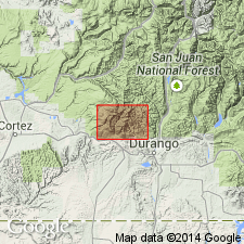
Unconformably overlies Dolores Formation on east side of Reservation and Glen Canyon Group on west side of Reservation. Divisible into (ascending): Dewey Bridge and Slick Rock Members. Isopach map; Ranges between 100 and 200 ft thick in report area --northern San Juan basin of NM and CO, northeasternmost part of Black Mesa basin in northeast AZ, and southeasternmost UT and adjacent Montezuma Co., CO in the Paradox basin. Dewey Bridge is 25-35 ft thick on west side of Reservation; if pinches out eastward; is not present in Durango or Piedra River areas; it was a sabkha deposit, Slick Rock averages 70-100 ft thick . Thickens to 250 ft north of Piedra River; it is of eolian origin. Middle Jurassic age.
Source: GNU records (USGS DDS-6; Denver GNULEX).
For more information, please contact Nancy Stamm, Geologic Names Committee Secretary.
Asterisk (*) indicates published by U.S. Geological Survey authors.
"No current usage" (†) implies that a name has been abandoned or has fallen into disuse. Former usage and, if known, replacement name given in parentheses ( ).
Slash (/) indicates name conflicts with nomenclatural guidelines (CSN, 1933; ACSN, 1961, 1970; NACSN, 1983, 2005, 2021). May be explained within brackets ([ ]).