


- Usage in publication:
-
- Elm Creek bed
- Modifications:
-
- Original reference
- Dominant lithology:
-
- Limestone
- Clay
- AAPG geologic province:
-
- Bend arch
Summary:
Pg. 421, 424. Elm Creek bed in Albany division. Mostly bluish-gray limestone, with some yellowish, friable, dark shaly, and highly fossiliferous (corals, brachiopods, gastropods, pelecypods) limestone, and some marly clay. Thickness 25 to 100 feet. Member of Albany division [Albany is uppermost of 5 Carboniferous divisions of Cummins, 1891]. Overlies Coleman bed and underlies Bed No. 8 (50 to 75 feet of clay). Age is possibly Permian.
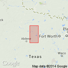
Forms prominent escarpment in western Coleman Co., Colorado River region, central TX. [Named from Elm Creek, Brown Co., Colorado River region, central TX.]
Source: Publication; US geologic names lexicon (USGS Bull. 896, p. 677).

- Usage in publication:
-
- Elm Creek limestone member*
- Modifications:
-
- Revised
- AAPG geologic province:
-
- Bend arch
Summary:
Pg. 192-198 and charts. Elm Creek limestone, 20 to 50 feet thick, is top member of Admiral formation (basal formation of Wichita group). Overlies Coleman clay and underlies Belle Plains formation, the basal bed of which is bed No. 8 of Drake. [Age is Permian.]
Source: US geologic names lexicon (USGS Bull. 896, p. 677).

- Usage in publication:
-
- Elm Creek limestone member*
- Modifications:
-
- Overview
- AAPG geologic province:
-
- Bend arch
Summary:
Pg. 170, 172, 173. Elm Creek limestone, 20 to 50 feet thick, is top member of Admiral formation, and a prominent escarpment-forming limestone. [Age is Permian.]
Source: US geologic names lexicon (USGS Bull. 896, p. 677).

- Usage in publication:
-
- Elm Creek limestone
- Modifications:
-
- Revised
- AAPG geologic province:
-
- Bend arch
Summary:
Pg. 66 (fig. 1), 96. Elm Creek limestone. Rank raised to formation in Belle Plains group. Overlies Jim Ned shale (new); underlies Jagger Bend limestone. Age is Early Permian (Leonard).
Source: US geologic names lexicon (USGS Bull. 1200, p. 1244).

- Usage in publication:
-
- Elm Creek limestone member*
- Modifications:
-
- Revised
- Areal extent
- AAPG geologic province:
-
- Bend arch
Summary:
Sheet 2. Elm Creek limestone member of Belle Plains formation. Described in Colorado River valley where it is classified as member of Belle Plains formation. Overlies Jim Ned shale member; underlies Voss shale member (new). Consists of closely spaced beds of gray medium-grained partly foraminiferal limestone, that weather light brown. Beds range in thickness from 1 to 5 feet, and except locally, are noncherty. Thickness about 45 feet at Colorado River. Age is Early Permian (Leonard?). Note on type exposure.
Type exposures: on lower Elm Creek near its confluence with Colorado River, south of Leaday, Coleman Co., TX.
Source: Publication; US geologic names lexicon (USGS Bull. 1200, p. 1244).
- Usage in publication:
-
- Elm Creek limestone member*
- Modifications:
-
- Areal extent
- AAPG geologic province:
-
- Bend arch
Summary:
Pl. 11. Elm Creek limestone member of Belle Plains formation. Thickness 55 to 95 feet in Brazos River Valley. Overlies Jim Ned shale member; underlies Voss shale member. [Age is Early Permian (Leonard).]
Source: US geologic names lexicon (USGS Bull. 1200, p. 1244).

- Usage in publication:
-
- Elm Creek Formation
- Modifications:
-
- Mapped
- AAPG geologic province:
-
- Bend arch
Summary:
Elm Creek Formation of Albany Group. Shale, mudstone, and limestone, 130 to 150 feet thick. Underlies Jagger Bend and Valera Formations (undivided) and overlies Admiral Formation, all of Albany Group. Equivalent to lower part of Petrolia Formation of Wichita Group. Earlier workers included these rocks in Belle Plains and Admiral Formations. Sparsely fossiliferous. Age is Early Permian (Leonard).
[Geographic extent arbitrarily placed. In general, recognized south of Salt Fork of Brazos River in Throckmorton Co.]
Source: Publication.
For more information, please contact Nancy Stamm, Geologic Names Committee Secretary.
Asterisk (*) indicates published by U.S. Geological Survey authors.
"No current usage" (†) implies that a name has been abandoned or has fallen into disuse. Former usage and, if known, replacement name given in parentheses ( ).
Slash (/) indicates name conflicts with nomenclatural guidelines (CSN, 1933; ACSN, 1961, 1970; NACSN, 1983, 2005, 2021). May be explained within brackets ([ ]).