The National Geologic Map Database is migrating to a new infrastructure. We apologize for any service disruptions during this process.
|
|---|


- Usage in publication:
-
- Cintura formation*
- Modifications:
-
- Original reference
- Dominant lithology:
-
- Shale
- Sandstone
- Limestone
- AAPG geologic province:
-
- Pedregosa basin
Summary:
Pg. 56, 68. Cintura formation of Bisbee group. Strongly resembles underlying Morita formation, from which it is separated by Mural limestone. Consists of (descending): (1) 600 feet of reddish nodular shale interbedded with flaggy cross-bedded sandstones, one of latter (about 200 feet below present top of formation) being of pale cream color; (2) 300 feet of flaggy cross-bedded gray and buff sandstones with occassional layers of red shale; (3) 700 to 800 feet of red nodular shale with occassional beds (some 6 feet thick) of buff sandstone, and very subordinate beds or lenses of impure, greenish nodular limestone; (4) 100 to 150 feet of red shale, thin-bedded sandstones, and arenaceous gray or greenish limestones, some of latter fossiliferous; and (5) 10 to 15 feet of buff quartzite. Total thickness at least 1,800 feet. Rests conformably on Mural limestone. Unconformably overlain by Quaternary deposits. Is top formation of Bisbee group. Age is Early Cretaceous (Comanche).
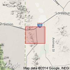
Named from Cintura Hill, [in T. 22 S., R. 24 E.], near north edge of Bisbee 15-min quadrangle, Bisbee region, Cochise Co., southeastern AZ.
Source: US geologic names lexicon (USGS Bull. 896, p. 446).
- Usage in publication:
-
- Cintura formation*
- Modifications:
-
- Age modified
- AAPG geologic province:
-
- Pedregosa basin
Summary:
In the Pedregosa basin, correlated with Fredericksburg group of Texas. Is of Early Cretaceous age.
Source: GNU records (USGS DDS-6; Denver GNULEX).

- Usage in publication:
-
- Cintura formation*
- Modifications:
-
- Areal extent
- AAPG geologic province:
-
- Pedregosa basin
Summary:
Recognized in the Steele Hills, Cochise Co, Pedregosa basin, where it overlies Morita Formation. The two formations of Bisbee Group were undivided in mapping and not in contact with underlying Glance in this quad. See geologic map. Overlain unconformably by Tertiary or Quaternary deposits. [Rather than extending the names Morita and Cintura to the Steele Hills, it probably would have been preferable to have reduced Bisbee to formational rank here.] Is of Early Cretaceous age.
Source: GNU records (USGS DDS-6; Denver GNULEX).
- Usage in publication:
-
- Cintura Formation*
- Modifications:
-
- Areal extent
- AAPG geologic province:
-
- Pedregosa basin
Summary:
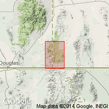
Extended as a formation of Bisbee Group to Huachuca Mountains, Cochise Co, AZ in the Pedregosa basin, where reported to be 600-1,200 ft thick. Unconformably overlain by Fort Crittenden Formation. Is of Early Cretaceous age.
Source: GNU records (USGS DDS-6; Denver GNULEX).
- Usage in publication:
-
- Cintura Formation*
- Modifications:
-
- Principal reference
- AAPG geologic province:
-
- Pedregosa basin
Summary:
Principal reference section (composite): in SE/4 sec. 12, T. 23 S., R. 24 E., and in NW/4 sec. 7, T. 23 S., R. 25 E., Mule Mountains, Cochise Co., southeastern AZ. Age is Early Cretaceous.
Source: Modified from GNU records (USGS DDS-6; Denver GNULEX).

- Usage in publication:
-
- Cintura Formation*
- Modifications:
-
- Age modified
- Overview
- AAPG geologic province:
-
- Pedregosa basin
- Basin-and-Range province
Summary:
Is top formation of Bisbee Group (Lower Cretaceous) in Mule and Huachuca Mountains, southern Cochise Co, AZ in Pedregosa basin; in Little Dragoon Mountains and nearby Gunnison and Steele Hills, northern Cochise Co, AZ in Basin-and-Range province; and in Canelo Hills, eastern Santa Cruz Co, AZ in Basin-and-Range province. Overlies Mural Limestone of Bisbee in Mule and Huachuca Mountains and Canelo Hills. Overlies (and considered undivided with) Morita Formation of Bisbee in Little Dragoon Mountains and vicinity. May correlate with Fredericksburg Group and, in part, with Washita Group of TX. Is also considered roughly correlative with Mojado Formation of Zeller (1965) in Big Hatchet Mountains area; with Corbett Sandstone in Little Hatchet Mountains; with Shellenberger Canyon Formation and possibly in part with overlying Turney Ranch Formation in or near Whetstone, Empire, and Santa Rita Mountains; and with upper parts of the arkose of Angelica Wash in Sierrita Mountains vicinity, and the Amole Arkose of Brown (1939) in Tucson Mountains. [See fig. 5 for regional correlations.] Is interpreted to have been deposited on the subaerial part of a prograding delta. Age is considered to be middle Albian (Early Cretaceous) on basis of correlation with Fredericksburg.
Source: GNU records (USGS DDS-6; Denver GNULEX).
- Usage in publication:
-
- Cintura Formation*
- Modifications:
-
- Areal extent
- AAPG geologic province:
-
- Pedregosa basin
Summary:
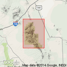
Extended within Pedregosa basin to Peloncillo Mountains, Hidalgo Co, NM [apparently to replace the combined Still Ridge Formation and Johnny Bull Sandstone of Gillerman (1958)]. Reported to be at least 700 ft thick. [This extension of the Cintura Formation into NM may be ill advised due to uncertainties of correlation of parts of Bisbee Group from range to range. It would have been wiser to have used the terminology of Armstrong and others (1978).] Is of Early Cretaceous age.
Source: GNU records (USGS DDS-6; Denver GNULEX).
- Usage in publication:
-
- Cintura Formation*
- Modifications:
-
- Areal extent
- AAPG geologic province:
-
- Pedregosa basin
Summary:
Extended as a formation of the Bisbee Group into the southern Peloncillo Mountains, Hidalgo Co, NM in the Pedregosa basin. Is of Early Cretaceous age.
Source: GNU records (USGS DDS-6; Denver GNULEX).
- Usage in publication:
-
- Cintura Formation*
- Modifications:
-
- Areal extent
- AAPG geologic province:
-
- Pedregosa basin
Summary:
Formation names of the Lower Cretaceous Bisbee Group used in Bisbee area (Glance Conglomerate, Morita Formation, Mural Limestone, and Cintura Formation) can be distinguished in Peloncillo Mountains, Cochise Co, AZ and Hidalgo Co, NM in Basin-and-Range province and in Pedregosa basin. Are recognized for the first time in northern Animas Mountains. Formation names of Bisbee area were defined by Ransome in 1904 and take precedence over local terminologies defined later (Guillerman, 1958, whose names McGhee Peak Formation, and Johnny Bull Sandstone, Still Ridge Formation, and Carbonate Hill Limestone are not used in this report).
Source: GNU records (USGS DDS-6; Denver GNULEX).
- Usage in publication:
-
- Cintura Formation*
- Modifications:
-
- Mapped 1:24k
- Dominant lithology:
-
- Shale
- Siltstone
- Graywacke
- AAPG geologic province:
-
- Pedregosa basin
Summary:
Cintura Formation, uppermost formation of Bisbee Group. Mostly dark-gray, some reddish-gray or greenish-gray shale, siltstone, and graywacke, having interbedded sandstone and sparse, thin beds of conglomerate. Overlies Mural Limestone of Bisbee; is inseparable from Morita Formation, also of Bisbee, where Mural is absent. Age is Early Cretaceous.
Source: Publication.
For more information, please contact Nancy Stamm, Geologic Names Committee Secretary.
Asterisk (*) indicates published by U.S. Geological Survey authors.
"No current usage" (†) implies that a name has been abandoned or has fallen into disuse. Former usage and, if known, replacement name given in parentheses ( ).
Slash (/) indicates name conflicts with nomenclatural guidelines (CSN, 1933; ACSN, 1961, 1970; NACSN, 1983, 2005, 2021). May be explained within brackets ([ ]).