- Usage in publication:
-
- Chattanooga black shale
- Modifications:
-
- Named
- Dominant lithology:
-
- Shale
- AAPG geologic province:
-
- Appalachian basin
Summary:
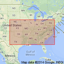
Named Chattanooga black shale. Thickness is 0 to 35 ft. In northwestern GA, underlain by the Rockwood formation and overlain by the Fort Payne chert.
Source: GNU records (USGS DDS-6; Reston GNULEX).
- Usage in publication:
-
- Chattanooga Shale
- Modifications:
-
- Areal extent
- AAPG geologic province:
-
- Cincinnati arch
Summary:
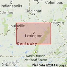
Authors follow de Witt (1981) in restricting the New Albany Shale to the Illinois basin and the Ohio Shale to the Appalachian basin. Ohio Shale terminology used wherever Three Lick Bed is recognizable in cores. Unlike de Witt (1981), authors do not use Chattanooga Shale in Knobs outcrop area of south-central KY.
Source: GNU records (USGS DDS-6; Reston GNULEX).
- Usage in publication:
-
- Chattanooga Shale
- Modifications:
-
- Revised
- Overview
- AAPG geologic province:
-
- Appalachian basin
Summary:
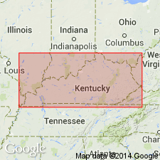
In this study, the Chattanooga Shale is divided into (ascending) Rhinestreet Shale, Upper Olentangy Shale, Ohio Shale, Bedford Shale, Berea Sandstone, and Sunbury Shale Members. Throughout most of the region, the dominant lithology is black, organic-rich shale. Black shale members are separated by gray shales and sandstone. Chattanooga is very thin in the extreme western part of the study area, but thickens to the east where the members are easily recognized. Geophysical logs indicate that in the western region, unit consists of only the Sunbury, Berea-Bedford, and Ohio Members. Largely Late Devonian in age, although the Sunbury and part of the Berea Sandstone and Bedford Shale are Early Mississippian. According to the author, formal nomenclature presented in this report for units within KY has been accepted by the Kentucky Stratigraphic Nomenclature Committee. Report includes correlation charts, cross-sections, and measured sections.
Source: GNU records (USGS DDS-6; Reston GNULEX).
- Usage in publication:
-
- Chattanooga Shale*
- Modifications:
-
- Overview
- AAPG geologic province:
-
- Appalachian basin
Summary:
Chattanooga Shale in TN and northern AL is the distal fringe of the black gas shales in the southwestern Appalachian basin. In central TN, where the unit ranges in thickness from a featheredge to more than 35 ft it is divided into the Dowelltown Member below and the Gassaway Member above. The Dowelltown consists of a lower black shale, the Rhinestreet Shale Bed (6 ft) and an upper unit of interbedded medium- and dark-gray shale, the undivided Angola and Hanover Shales (9 ft) at Sligo Bridge, DeKalb Co. The Center Hill Ash Bed occurs in the upper part of the Dowelltown. In central TN, the Gassaway consists of a basal black shale (the Huron Bed) (7.5 ft), a middle unit of intercalated black and medium-gray shale (2 ft), and an upper black shale (7 ft). In north-central TN, it also includes the Cleveland Bed at the top. The Chattanooga underlies the Maury Formation (Early Mississippian) or to the southeast, the Fort Payne Chert. In south-central KY, the Dowelltown is absent and the Gassaway consists of the Huron, Three Lick, and Cleveland Beds and a thin layer of Sunbury Shale at the top. In east-central KY, the Chattanooga Shale grades northward into the Ohio Shale, the Bedford Shale, the Berea Sandstone, and the Sunbury Shale. The Chattanooga thickens northeastward and reaches more than 1,000 ft in northeast TN and southwest VA, but there the Gassaway and Dowelltown are not recognized as separate lithostratigraphic units. In Wise Co., VA, the Chattanooga includes the Big Stone Gap Member (243 ft), which consists mostly of brownish-black and black shale. Figures showing areal extent of Chattanooga feature it in KY, TN, AL, GA, and VA only.
Source: GNU records (USGS DDS-6; Reston GNULEX).
- Usage in publication:
-
- Chattanooga Shale
- Modifications:
-
- Overview
- AAPG geologic province:
-
- Appalachian basin
Summary:
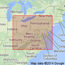
Chattanooga Shale mapped in Roane Co., eastern TN. Consists of 25 ft of very dark-gray to black, carbonaceous shale, commonly chevron-folded. Unconformably overlies Lower and Middle Silurian Rockwood Formation and underlies Lower Mississippian Fort Payne Formation. Age is Late Devonian and Early Mississippian.
Source: GNU records (USGS DDS-6; Reston GNULEX).
- Usage in publication:
-
- Chattanooga Shale Formation
- Modifications:
-
- Revised
- AAPG geologic province:
-
- Appalachian basin
Summary:
Cross section between Norton and Asberrys, VA, in the Clinch Mountain outcrop belt shows more detailed divisions of Chattanooga Shale than previously indicated. Base of Chattanooga marked by Belpre Ash. Ascending, members are Rhinestreet Shale, Angola Shale, Java Shale (including the Center Hill Ash), Dunkirk Shale Tongue of Huron Shale Member and remaining upper part of Huron, Three Lick Bed, Cleveland Shale Member, and Sunbury Shale Member. According to authors, divisions are based on careful outcrop description and outcrop gamma-ray log. Divisions can be traced by borehole gamma-ray logs to their type areas in OH and NY.
Source: GNU records (USGS DDS-6; Reston GNULEX).
- Usage in publication:
-
- Chattanooga Shale
- Modifications:
-
- Overview
- AAPG geologic province:
-
- Appalachian basin
Summary:
Chattanooga Shale in this report consists of the lower black shale member, the middle gray siltstone member, and the Big Stone Gap Member. All three crop out in Powell Valley and can be traced throughout southwestern VA. Conodonts found at the base of the Chattanooga suggest a Middle Devonian age, but the major portion of the member is Late Devonian (Senecan). The middle gray siltstone reaches a thickness of 1190 ft. Age of the middle member is Late Devonian (Chatauquan). The Big Stone Gap Member reaches a maximum thickness of 480 ft and includes the 100-ft-thick Berea sand bed. The lower 10 to 20 ft of the Big Stone Gap contains Late Devonian conodont fauna but the member for the most part is Early Mississippian (Kinderhookian). The Chattanooga disconformably overlies the Wildcat Valley Sandstone and gradationally underlies the Price Formation.
Source: GNU records (USGS DDS-6; Reston GNULEX).
For more information, please contact Nancy Stamm, Geologic Names Committee Secretary.
Asterisk (*) indicates published by U.S. Geological Survey authors.
"No current usage" (†) implies that a name has been abandoned or has fallen into disuse. Former usage and, if known, replacement name given in parentheses ( ).
Slash (/) indicates name conflicts with nomenclatural guidelines (CSN, 1933; ACSN, 1961, 1970; NACSN, 1983, 2005, 2021). May be explained within brackets ([ ]).

