

- Usage in publication:
-
- Canyon division
- Modifications:
-
- Original reference
- Dominant lithology:
-
- Limestone
- AAPG geologic province:
-
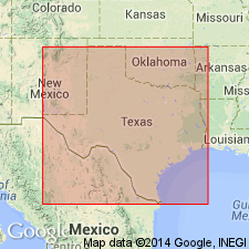
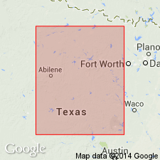
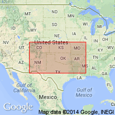
- Bend arch
- Fort Worth syncline
Summary:
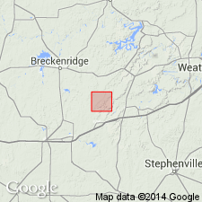
Pg. 361-374. Canyon division, 3rd from top of 6 divisions of Carboniferous "Coal Measures." Largely massive, heavy-bedded limestones, 930 feet thick. Underlies Cisco division and overlies Strawn division. Age is Carboniferous (Coal Measures). Carboniferous area of Texas stretches from below Colorado River northward to Red River, average width about 75 miles; comprises Brazos coal field (north) and Colorado coal field (south), separated by Cretaceous rocks. Report includes measured sections, fossils.
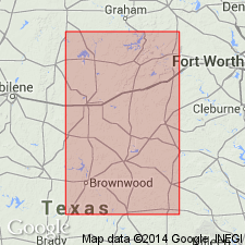
Named from town of Canyon, on Texas and Pacific RR, western Palo Pinto Co., TX, where prominently exposed. Other notable exposures: Brazos coal field, at Rock Creek (western Jack Co.), and at and near Palo Pinto and Canyon Creek (Palo Pinto Co.); Colorado coal field, on Jim Ned Creek (Brown Co.).
Source: US geologic names lexicon (USGS Bull. 896, p. 338); supplemental information from GNU records (USGS DDS-6; Denver GNULEX).

- Usage in publication:
-
- Canyon division
- Modifications:
-
- Revised
- AAPG geologic province:
-
- Bend arch
- Llano uplift
Summary:
Pg. 371-372, 387+, geol. map [reprinted 1917 as Univ. Texas. Bull., no. 1755]. Canyon division [3rd from top of 5 Carboniferous divisions of Cummins, 1891]. Consists of alternating beds of rather rough, evenly textured bluish limestone, blue clay, some sandstone, and conglomerate. Divided into (descending) CAMPOPHYLLUM, Bluff Creek, Home Creek, Hog Creek, cherty limestone, Bed No. 7, Clear Creek, Cedarton, Adams Branch limestone, Brownwood, Rochelle conglomerate, and Coral limestone beds. Overlies Strawn division, with Ricker bed at top; underlies Cisco division, with Trickham bed at base. Age is Pennsylvanian.
Source: Publication; US geologic names lexicon (USGS Bull. 1200, p. 615-617).
- Usage in publication:
-
- Canyon division
- Modifications:
-
- Revised
- AAPG geologic province:
-
- Bend arch
Summary:
Canyon division. Revised to include 4 formations (ascending): Palo Pinto limestone, Graford formation, Ranger formation, and Eastland formation. Outcrops in belt about 30 miles wide across in central part of the Pennsylvanian outliers. Overlies Strawn division and underlies Cisco division. Age is Late Pennsylvanian. Report area in Brazos River Valley, north-central Texas.
Source: Modified from GNU records (USGS DDS-6; Denver GNULEX).
- Usage in publication:
-
- Canyon formation*
- Modifications:
-
- Revised
- AAPG geologic province:
-
- Bend arch
Summary:
Canyon formation. Exposed in Lacasa area, Stephens County, Texas. Includes Ranger limestone member, above, and Home Creek limestone member, below. Age is Pennsylvanian.
Source: Modified from GNU records (USGS DDS-6; Denver GNULEX).

- Usage in publication:
-
- Canyon group
- Modifications:
-
- Revised
- AAPG geologic province:
-
- Bend arch
- Fort Worth syncline
- Llano uplift
Summary:
Pg. 87-120; Jour. Geol., v. 30. Canyon group comprises (ascending) Graford formation (with Rochelle conglomerate, at base, Capps limestone lentil, Brownwood shale, and Adams Branch limestone); Brad formation (with Cedarton shale at base, Clear Creek limestone, Placid shale, and Ranger limestone); and Caddo Creek (with Hog Creek shale, below, and Home Creek limestone, above). Overlies Strawn group (Ricker bed at top), underlies Cisco group. Present in Brazos River Valley, Wise, Jack, Palo Pinto, Stephens, Eastland, and Comanche Counties (north area), and Colorado River Valley, Brown and McCulloch Counties (south area); two areas separated by Cretaceous overlap [Callahan Divide]. Age is Pennsylvanian. Report includes measured sections, correlation chart, fossil lists.
Source: US geologic names lexicon (USGS Bull. 1200, p. 615-617); supplemental information from GNU records (USGS DDS-6; Denver GNULEX).

- Usage in publication:
-
- Canyon group*
- Modifications:
-
- Overview
- AAPG geologic province:
-
- Bend arch
Summary:
In Palo Pinto County, type region, consists of 750 feet of massive limestones, sandstones, and gray shales, with a heavy limestone at base. Canyon group is now divided into (descending) Caddo Creek, Brad, Graford, and Palo Pinto formations. Present in central northern and central Texas.
Source: US geologic names lexicon (USGS Bull. 896, p. 338).

- Usage in publication:
-
- Canyon group
- Modifications:
-
- Revised
Summary:
Pg. 94-118. Canyon group. Group includes (ascending) Palo Pinto, Graford, Brad, and Caddo Creek formations.
Source: US geologic names lexicon (USGS Bull. 1200, p. 615-617).

- Usage in publication:
-
- Canyon series
- Modifications:
-
- Revised
- AAPG geologic province:
-
- Bend arch
Summary:
Pg. 66 (fig. 1), 87-90. Canyon series. Rank raised to series. Comprises (ascending) Whitt (new), Graford, Brad, and Caddo Creek groups. Includes sediments above disconformity (unconformity in more positive areas) at top of Strawn series (base of Lake Pinto sandstone at Mineral Wells) and below disconformity marked by Kisinger channel (base of Cisco series) of southeast Young County, Texas. Village Bend limestone is top member of East Mountain shale of Lone Camp group (new) in Strawn series. Subdivision is thought to be approximately equivalent to Missouri series of Kansas.
Source: US geologic names lexicon (USGS Bull. 1200, p. 615-617).
- Usage in publication:
-
- Canyon group
- Modifications:
-
- Revised
Summary:
Pg. 288 (fig. 1), 299. Rocks of Kawvian series (new) are widespread in North America. In north-central Texas, include the Canyon and Cisco. Age is Late Pennsylvanian.
Source: Publication; US geologic names lexicon (USGS Bull. 1200, p. 615-617).
- Usage in publication:
-
- Canyon group
- Modifications:
-
- Revised
- AAPG geologic province:
-
- Bend arch
Summary:
Pg. 46 (fig. 38), 47-49. Canyon group. In Palo Pinto County, north-central Texas, Canyon-Strawn contact has for several years been placed at base of Lake Pinto sandstone (top of East Mountain shale). Position and correlation of Village Bend limestone (within East Mountain shale) has been used as evidence for unconformity at base of Lake Pinto sandstone. In general area of its type locality, the Village Bend occurs at variable intervals below beds identified as Lake Pinto. This variability of interval provided some postulation of erosional surface at top of East Mountain shale. Also inferring from statements by Cheney and Goss (1952, AAPG Bull., v. 36, no. 12) typical Strawn fossils, such as FUSULINA, PRISMOPORA, and MESOLOBUS, were not known above base of Lake Pinto at time of their publication. Believed from data available that logical Canyon-Strawn contact should be at base of Turkey Creek sandstone in Palo Pinto County. Turkey Creek sandstone is immediately overlain by Keechi Creek shale near top of which TRITICITES (post-Strawn age) has been found. Also concluded that lower Brownwood of Brown County is probably late Strawn age and that the upper Brownwood is early Canyon. Hence, base of conglomerate separating these two parts of Brownwood shale should be regarded as Canyon-Strawn contact. This would increase Strawn interval in Brown County about 125 feet, at expense of Canyon.
Source: US geologic names lexicon (USGS Bull. 1200, p. 615-617).
- Usage in publication:
-
- Canyon series
- Modifications:
-
- Biostratigraphic dating
- AAPG geologic province:
-
- Bend arch
Summary:
Pg. 1515, 1524, pl. 1. Canyon series. Strawn-Canyon boundary in north-central Texas is evaluated from surface studies in Colorado River and Brazos River Valleys. Zonation based on fusulinids is best criterion for defining boundary, Strawn series is characterized by genus FUSULINA, Canyon series by TRITICITES. Brachiopod MESOLOBUS and bryozoan PRISMOPORA are not persistent in outcrop area; boundary is placed at three different stratigraphic positions so that locally prominent surfaces, which agree with paleontological evidence, may be used as the contact. In Colorado River Valley, boundary is considered to be top of Capps limestone, which is continuous to north through Comanche County and most of Eastland County. In southern part of Brazos River Valley, boundary is placed at top of "boulder" bed (of other investigators). This bed, which is present in northeastern Eastland County and southwestern Palo Pinto County, lies about 20 feet above Capps limestone. It is correlated with, and designated as Village Bend limestone of central Palo Pinto County. In eastern Palo Pinto County, boundary is placed at base of Lake Pinto sandstone, which overlies Village Bend limestone. Age is Late Pennsylvanian.
Source: US geologic names lexicon (USGS Bull. 1200, p. 615-617).
- Usage in publication:
-
- Canyon group*
- Modifications:
-
- Revised
- AAPG geologic province:
-
- Bend arch
Summary:
Pg. 58 (table 1), 62-68, pl. 27. Canyon group. Sequence of rocks now assigned to Canyon group includes most of the rocks assigned to Milburn shales and Brownwood division by Tarr (1890, Texas Geol. Survey 1st Ann. Rept.) and to Brownwood-Ranger series by Dumble (1890, Texas Geol. Survey 1st Ann. Rept.). Tarr's Brownwood division and Dumble's Brownwood-Ranger series were described as overlying their Milburn shales (later called Brownwood shale) and as including rocks that are barren of coal and that consist chiefly of limestone. Upper limit of this sequence was not definitely identified but appears to have been top of Gunsight limestone member of Graham formation, Cisco group, of presesnt classification. Drake (1893), adopting Cummins' (1891) divisions of rocks in Brazos River Valley, applied term Canyon to prominent beds of limestone and intervening beds of shale of Colorado River Valley, to which he gave local names and which he classified as beds. He considered base of Canyon to be top of his Coral limestone bed (Capps limestone lentil of Plummer and Moore) and top of Canyon to be his CAMPOPHYLLUM bed (Gunsight limestone member of present usage). Plummer and Moore [1922] raised Canyon to group rank, divided it into formations named for Brazos River Valley localities, and further divided these into members bearing nomenclature of Drake's beds. This terminology is still widely used, though some renaming, reorganization, and redefining of units has been accomplished. Following nomenclature is recommended for formations and members (ascending): Graford formation, with Brownwood shale, Adams Branch limestone, and Cedarton shale members; Winchell limestone with lower and upper unnamed limestone members; Brad formation with Placid shale and Ranger limestone members; and Caddo Creek formation with Colony Creek shale and Homewood limestone members. Thickness about 600 feet in area of this report [Brown and Coleman Counties]. Age is Late Pennsylvanian.
Source: US geologic names lexicon (USGS Bull. 1200, p. 615-617).

- Usage in publication:
-
- Canyon Group
- Modifications:
-
- Areal extent
- AAPG geologic province:
-
- Bend arch
- Fort Worth syncline
Summary:
Canyon Group mapped in north-central TX, on Bend arch and Fort Worth syncline. In southeastern part of mapped area, divided into (ascending): Palo Pinto Formation, Wolf Mountain Shale, Winchell Limestone, Placid Shale, Ranger Limestone, Colony Creek Shale, and Home Creek Limestone. Farther east, Canyon is divided into (ascending): Willow Point Formation, Jasper Creek Formation and its Chico Ridge Limestone [unranked], Ventioner Formation, Ranger Limestone, and Colony Creek Shale. Age is Missouri (Late Pennsylvanian). Geologic map.
Source: GNU records (USGS DDS-6; Denver GNULEX).
For more information, please contact Nancy Stamm, Geologic Names Committee Secretary.
Asterisk (*) indicates published by U.S. Geological Survey authors.
"No current usage" (†) implies that a name has been abandoned or has fallen into disuse. Former usage and, if known, replacement name given in parentheses ( ).
Slash (/) indicates name conflicts with nomenclatural guidelines (CSN, 1933; ACSN, 1961, 1970; NACSN, 1983, 2005, 2021). May be explained within brackets ([ ]).