


- Usage in publication:
-
- Camp Colorado bed
- Modifications:
-
- Original reference
- Dominant lithology:
-
- Limestone
- Chert
- AAPG geologic province:
-
- Bend arch
- Llano uplift
Summary:
Pg. 387, 418. Camp Colorado bed in Cisco division. Chiefly hard, rather brittle, bluish gray limestone, rough weathering, and often much fractured. Contains many black or nearly black chert nodules. Fossiliferous (corals, brachiopods). Thickness 10 to 25 feet. Member of Cisco division [Cisco is 2nd from top of 5 Carboniferous divisions of Cummins, 1891]. Overlies Bed No. 13 (reddish clay) and underlies Watts Creek bed. Age is Pennsylvanian.
[Named from Camp Colorado, northeast of Coleman, Coleman Co., Colorado River region, central TX.]
Source: Publication; US geologic names lexicon (USGS Bull. 896, p. 326; USGS Bull. 1200, p. 595).

- Usage in publication:
-
- Camp Colorado limestone member
- Modifications:
-
- Revised
- Areal extent
- AAPG geologic province:
-
- Bend arch
Summary:
Pg. 24, 31, 40; Univ. Texas Bull., no. 2132, p. 172-182 and charts. Camp Colorado limestone is top member of Pueblo formation of Cisco group in Colorado River and Brazos River Valleys. Remarkably uniform and persistent. Underlies Watt's Creek shale member of Moran formation of Cisco group (in Colorado River Valley) and is separated from underlying Stockwether limestone by 65 to 98 feet of shale, sandstone, and limestone. [Age is Pennsylvanian.]
Source: US geologic names lexicon (USGS Bull. 896, p. 326).

- Usage in publication:
-
- Camp Colorado formation
- Modifications:
-
- Revised
- AAPG geologic province:
-
- Bend arch
Summary:
Pg. 66 (fig. 1). Camp Colorado formation of Pueblo group. Rank raised to formation in the Pueblo here given group status. Overlies Stockwether formation; underlies "Dothan" formation of Moran group. [Age is Permian.]
Source: US geologic names lexicon (USGS Bull. 1200, p. 595).

- Usage in publication:
-
- Camp Colorado limestone member*
- Modifications:
-
- Revised
- AAPG geologic province:
-
- Bend arch
Summary:
Sheet 2. Camp Colorado limestone member of Pueblo formation. Described in Colorado River Valley as limestone member of Pueblo formation. Consists of irregularly bedded fine- to medium-grained gay limestone, which commonly weathers brownish, and intervening thin beds of shale; at type locality and farther south, basal beds consist of fossiliferous shale interbedded with earthy discontinuous limestone layers; dark-blue to nearly black chert occurs commonly as nodules in upper limestone beds. Thickness 5 to 25 feet. Overlies Salt Creek Bend shale member; underlies Watts Creek shale member of Moran formation. Age is Early Permian (Wolfcamp).
Mapped with Watts Creek (Sheet 1).
Source: US geologic names lexicon (USGS Bull. 1200, p. 595).
- Usage in publication:
-
- Camp Colorado limestone member*
- Modifications:
-
- Areal extent
- AAPG geologic province:
-
- Bend arch
Summary:
Pg. 269-270, pl. 11. Camp Colorado limestone member of Pueblo formation. Extended into Brazos River Valley. Thicknes 10 to 25 feet. Overlies Salt Creek Bend shale member; top of member not easily distinguished from overlying Watts Creek shale member of Moran formation. [Age is Permian.]
Source: US geologic names lexicon (USGS Bull. 1200, p. 595).

- Usage in publication:
-
- Camp Colorado Limestone [unranked]
- Modifications:
-
- Mapped 1:250k
- Dominant lithology:
-
- Limestone
- Shale
- AAPG geologic province:
-
- Bend arch
Summary:
Camp Colorado Limestone ("Noodle Creek Limestone") [unranked] in Moran Formation of Cisco Group. Basal unit of Moran. [Previously top member of Pueblo Formation.] Consists of two limestone units separated by shale. Thickness 3 to 25 feet. Lies above Pueblo Formation of Cisco Group and below Ibex Limestone ("Dothan Limestone") [unranked] in Moran Formation. Fossils. Age is Early Permian (Wolfcamp).
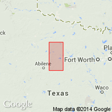
Mapped in Brown, Callahan, Coleman, Shackelford, Stephens, and Throckmorton Cos., central northern TX.
Source: Publication.

- Usage in publication:
-
- Camp Colorado Limestone [unranked]
- Modifications:
-
- Areal extent
- AAPG geologic province:
-
- Bend arch
Summary:
Camp Colorado Limestone [unranked] in Moran Formation of Cisco Group. Gray to light-brown, coarse-grained, massive limestone with thin lentils bearing MYALINA. Thickness 1 foot. Overlies Pueblo Formation of Cisco. Defines base of Moran; [earlier workers included the Camp Colorado at top of Pueblo]. Age is Early Permian (Wolfcamp).
Recognized along southern border of quadrangle in southeastern Throckmorton Co., central northern TX.
Source: Publication.
For more information, please contact Nancy Stamm, Geologic Names Committee Secretary.
Asterisk (*) indicates published by U.S. Geological Survey authors.
"No current usage" (†) implies that a name has been abandoned or has fallen into disuse. Former usage and, if known, replacement name given in parentheses ( ).
Slash (/) indicates name conflicts with nomenclatural guidelines (CSN, 1933; ACSN, 1961, 1970; NACSN, 1983, 2005, 2021). May be explained within brackets ([ ]).