- Usage in publication:
-
- Bunger limestone member
- Modifications:
-
- Original reference
- Dominant lithology:
-
- Limestone
- AAPG geologic province:
-
- Bend arch
Summary:
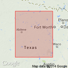
Pg. 133-145. Bunger limestone member of Bunger formation of Cisco [group]. Top member of †Bunger formation [later abandoned; is part of Graham formation]. It is a persistent limestone, 2 to 4 [8] feet thick; in places dark yellowish-brown, dense, and heavy, in other places light-gray and coarsely crystalline. [Age is Pennsylvanian.]
[Named from Bunger, Young Co., Brazos River region, central northern TX.]
Source: US geologic names lexicon (USGS Bull. 896, p. 293-294).
- Usage in publication:
-
- Bunger limestone lentil
- [Bunger limestone member]
- Modifications:
-
- Principal reference
- Revised
- Dominant lithology:
-
- Limestone
- AAPG geologic province:
-
- Bend arch
Summary:
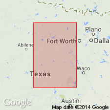
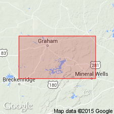
Pg. 24, 31; Univ. Texas Bull., no. 2132, p. 129, 130, and charts. Bunger limestone lentil. A limestone member of Graham formation of Cisco group in Brazos River Valley. Underlies South Bend shale and sandstone member and overlies Gonzales Creek shale member; all members of Graham formation. Thickness 2 to 8 feet. In places is dark yellowish brown, quite dense and heavy; in other places is light gray, impure, and massively bedded. Lies 60 [50 to 110] feet below Gunsight limestone member. [Age is Pennsylvanian.]
Best exposed around north and west sides of big curve of Brazos River 5 mi south of Graham, Young Co., Brazos River region, central northern TX.
Source: US geologic names lexicon (USGS Bull. 896, p. 293).
- Usage in publication:
-
- Bunger limestone member
- Modifications:
-
- Areal extent
- AAPG geologic province:
-
- Llano uplift
Summary:
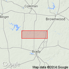
Pg. 197, 221-223. Used Bunger limestone in McCulloch County, Colorado River Valley, and stated: The limestone called Bunger in Colorado River Valley occupies same stratigraphic position as typical Bunger of Brazos River Valley, and agrees in lithology and fossils. But fact that it is a lentil in northern area would make it unlikely that the Bunger of Colorado River area is continuous with the Bunger of Brazos River area. It seems less confusing, however, to use same name for these beds (20 to 25 feet thick in McCulloch County), which lie 50 to 70 feet below top of Bluff Creek shale member of Graham formation and 52 to 68+/- feet above base of the Bluff Creek member.
Source: US geologic names lexicon (USGS Bull. 896, p. 293).
- Usage in publication:
-
- Bunger formation
- Modifications:
-
- Revised
Summary:
Pg. 66 (fig. 1). Bunger formation of Graham group. Rank raised. Overlies North Leon formation; underlies post-Bunger cycles 1 to 7.
Source: US geologic names lexicon (USGS Bull. 1200, p. 533)
- Usage in publication:
-
- Bunger limestone
- Modifications:
-
- Areal extent
Summary:
Pg. 14-15, chart. Chart shows Bunger limestone in Graham group above Gonzales limestone and below Gunsight limestone in Brazos River outcrop section; thins toward Colorado River section.
Source: US geologic names lexicon (USGS Bull. 1200, p. 533)
- Usage in publication:
-
- Bunger limestone
- Modifications:
-
- Areal extent
- AAPG geologic province:
-
- Bend arch
Summary:
Fig. 4. Generalized columnar section shows Bunger limestone in Graham group stratigraphically above Salem School limestone and below unit termed "Number 3" limestone.
Source: US geologic names lexicon (USGS Bull. 1200, p. 533)
- Usage in publication:
-
- Bunger Limestone [unranked]
- Modifications:
-
- Mapped 1:250k
- AAPG geologic province:
-
- Bend arch
- Fort Worth syncline
Summary:
Bunger Limestone [unranked] in Cisco Group. Gray to brown, thin and irregular bedded limestone, sandy and argillaceous in places. Thickness 0 to 4 feet. Lies below Wayland Shale and above Finis Shale, both of Cisco Group. Earlier workers included these rocks in Graham Formation of Cisco Group. Fossils. Age is Late Pennsylvanian (Virgil).
Recognized in Young and Jack Cos., central northern TX. (Exposures are few and widely separated, thus correlation is imprecise, being based solely on relative stratigraphic position.)
Source: Publication.

- Usage in publication:
-
- Bunger Limestone [unranked]
- Modifications:
-
- Mapped 1:250k
- Dominant lithology:
-
- Limestone
- AAPG geologic province:
-
- Fort Worth syncline
Summary:
Pamphlet [p. 10-11]. Bunger Limestone [unranked] inThrifty and Graham Formations, [undifferentiated], of Cisco Group. Light-gray, coarse-grained, thin-bedded, bioclastic, fossils mostly crinoid fragments and fusulinids, thickness 2 to 4 feet. Lies in lower part of Thrifty and Graham Formations, [undifferentiated], below Lower Gunsight Limestone [unranked].
[Mapped in Jack Co., central northern TX; western edge of map sheet. Rocks previously (1967 ed. of map) included in "Graham and Caddo Creek Formations, undivided." See also Hentz, 1988, and adjacent Wichita Falls-Lawton sheet, Texas Geol. Atlas, 1987.]
Source: Publication.
For more information, please contact Nancy Stamm, Geologic Names Committee Secretary.
Asterisk (*) indicates published by U.S. Geological Survey authors.
"No current usage" (†) implies that a name has been abandoned or has fallen into disuse. Former usage and, if known, replacement name given in parentheses ( ).
Slash (/) indicates name conflicts with nomenclatural guidelines (CSN, 1933; ACSN, 1961, 1970; NACSN, 1983, 2005, 2021). May be explained within brackets ([ ]).

